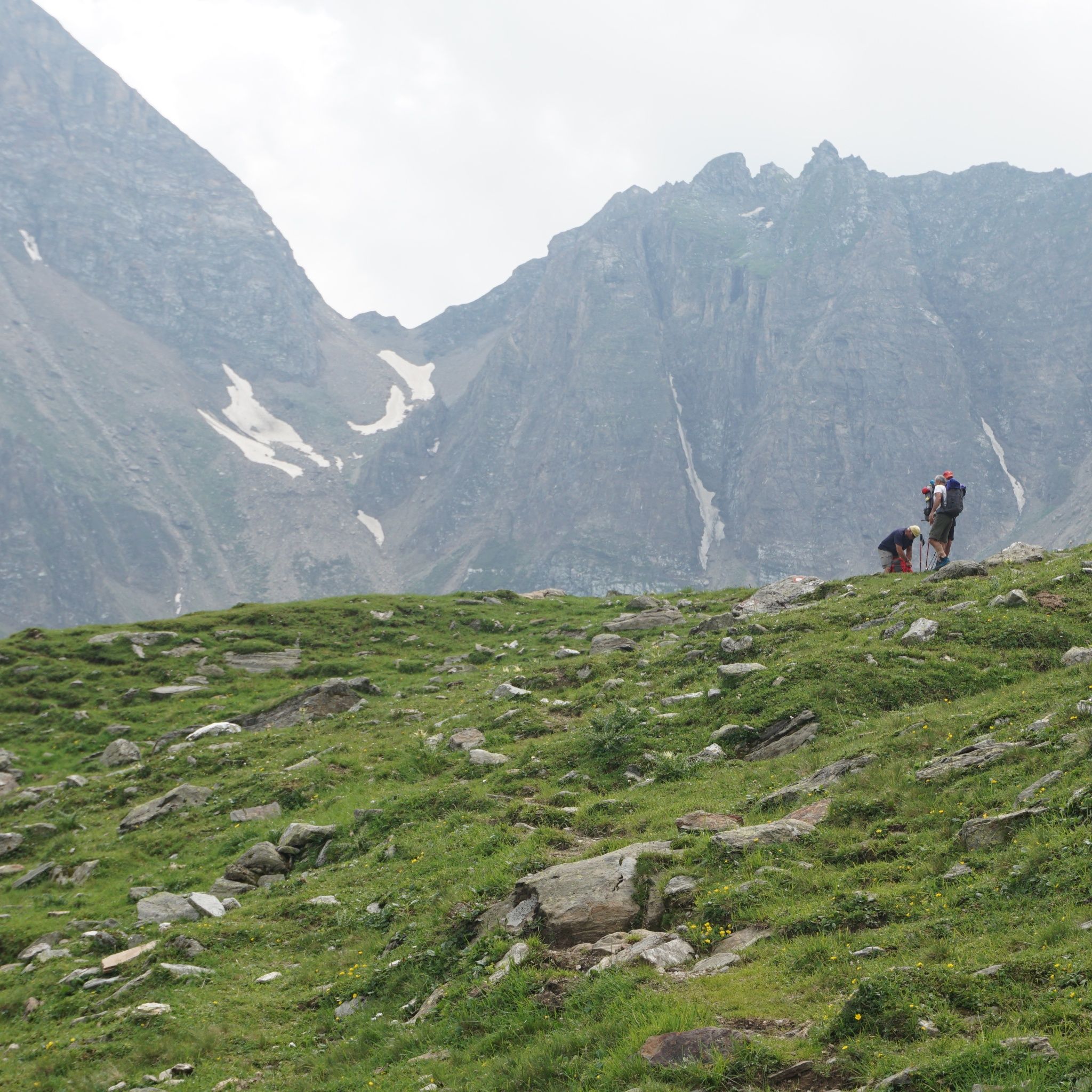
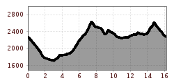
Open interactive mapOpen this POI on the interactive mapElevation profileSenselerweg: Vom Pfitscherjochhaus zur Brixnerhütte.gpx
The sunny plateau circuitDifficulty: easy Length: 33.0 km Duration: 8:00 h Elevation uphill: 740 m See trailSee trail: The sunny plateau circuit
Along the Goetheweg trail to thePfeishütte mountain hutDifficulty: difficult Length: 5.2 km Duration: 5:00 h Elevation uphill: 344 m See trailSee trail: Along the Goetheweg trail to thePfeishütte mountain hut
Suspension bridge to Maria Locherboden pilgrimage churchDifficulty: medium Length: 8.5 km Duration: 3:00 h Elevation uphill: 370 m See trailSee trail: Suspension bridge to Maria Locherboden pilgrimage church
St. Sigmund - Pforzheimer Hütte mountain hut (145)Difficulty: medium Length: 14.1 km Duration: 5:00 h Elevation uphill: 781 m See trailSee trail: St. Sigmund - Pforzheimer Hütte mountain hut (145)
Carnic altitude trail. Stage 1: Arnbach - Sillianer HütteDifficulty: easy Length: 9.5 km Elevation uphill: 1,350 m See trailSee trail: Carnic altitude trail. Stage 1: Arnbach - Sillianer Hütte
Carnic altitude trail. Stage 3: Obstansersee Hütte – PorzehütteDifficulty: medium Length: 11.3 km Duration: 6:00 h Elevation uphill: 650 m See trailSee trail: Carnic altitude trail. Stage 3: Obstansersee Hütte – Porzehütte
Winterwanderung Markbachjoch - NiederauDifficulty: medium Length: 10.5 km Elevation uphill: 56 m See trailSee trail: Winterwanderung Markbachjoch - Niederau
Summit Hike to Lodron from Gasthof JägerhäuslDifficulty: medium Length: 20.0 km Duration: 8:30 h Elevation uphill: 1,125 m See trailSee trail: Summit Hike to Lodron from Gasthof Jägerhäusl
Talwanderweg KaunertalDifficulty: easy Duration: 2:30 h Elevation uphill: 295 m See trailSee trail: Talwanderweg Kaunertal
Alpine Outdoor GalleryDifficulty: easy Length: 3.4 km Duration: 1:00 h Elevation uphill: 117 m See trailSee trail: Alpine Outdoor Gallery
Schnackler Adventure TrailDifficulty: easy Length: 2.0 km Duration: 0:45 h Elevation uphill: 130 m See trailSee trail: Schnackler Adventure Trail
Circular hiking trail Horlachtal - NiederthaiOpening hours: open Difficulty: easy Length: 6.9 km Duration: 2:00 h Elevation uphill: 233 m See trailSee trail: Circular hiking trail Horlachtal - Niederthai
Ramolhaus - ObergurglDifficulty: difficult Length: 7.8 km Duration: 4:00 h Elevation uphill: 1,095 m See trailSee trail: Ramolhaus - Obergurgl
KitzTrail Streif-liveDifficulty: medium Length: 7.7 km Duration: 3:00 h Elevation uphill: 76 m See trailSee trail: KitzTrail Streif-live
7-BrunnenwegDifficulty: easy Length: 10.3 km Duration: 2:30 h Elevation uphill: 200 m See trailSee trail: 7-Brunnenweg
Gampe ThayaDifficulty: medium Length: 2.6 km Duration: 1:45 h Elevation uphill: 623 m See trailSee trail: Gampe Thaya
Fundusfeiler - UmhausenDifficulty: difficult Length: 4.5 km Duration: 3:00 h Elevation uphill: 1,109 m See trailSee trail: Fundusfeiler - Umhausen
Seenplatte - Lake Nedersee - ObergurglDifficulty: medium Length: 9.6 km Duration: 5:00 h Elevation uphill: 740 m See trailSee trail: Seenplatte - Lake Nedersee - Obergurgl
Around the Thierbach HilltopDifficulty: medium Length: 5.5 km Duration: 2:00 h Elevation uphill: 162 m See trailSee trail: Around the Thierbach Hilltop
Solsteinhaus mountain hut (Alpenverein route 213)Difficulty: medium Length: 13.6 km Duration: 6:22 h Elevation uphill: 876 m See trailSee trail: Solsteinhaus mountain hut (Alpenverein route 213)
Winter hiking Fieberbrunn - Zillstatt - StreubödenDifficulty: medium Length: 13.0 km Duration: 4:30 h Elevation uphill: 550 m See trailSee trail: Winter hiking Fieberbrunn - Zillstatt - Streuböden
Mountain peak RosskopfDifficulty: medium Length: 2.0 km Duration: 2:00 h Elevation uphill: 379 m See trailSee trail: Mountain peak Rosskopf
Narrenkogel - NiederthaiDifficulty: medium Length: 2.9 km Duration: 2:00 h Elevation uphill: 764 m See trailSee trail: Narrenkogel - Niederthai
Stage 6: Through the VerwallDifficulty: medium Length: 15.0 km Duration: 8:00 h Elevation uphill: 1,481 m See trailSee trail: Stage 6: Through the Verwall
Panorama Restaurant and WIDIVERSUM HochoetzDifficulty: easy Length: 2.8 km Duration: 0:04 h Elevation uphill: 1,216 m See trailSee trail: Panorama Restaurant and WIDIVERSUM Hochoetz
Give feedback for a chance to win a special holiday experience!Click here for the surveyClick here for the survey

")


 Sportalpen (21).jpg")


.jpg")


.jpg")

