
Opening hours:Today closed
Place:Sölden
:Alpine pasture / hut / mountain restaurant
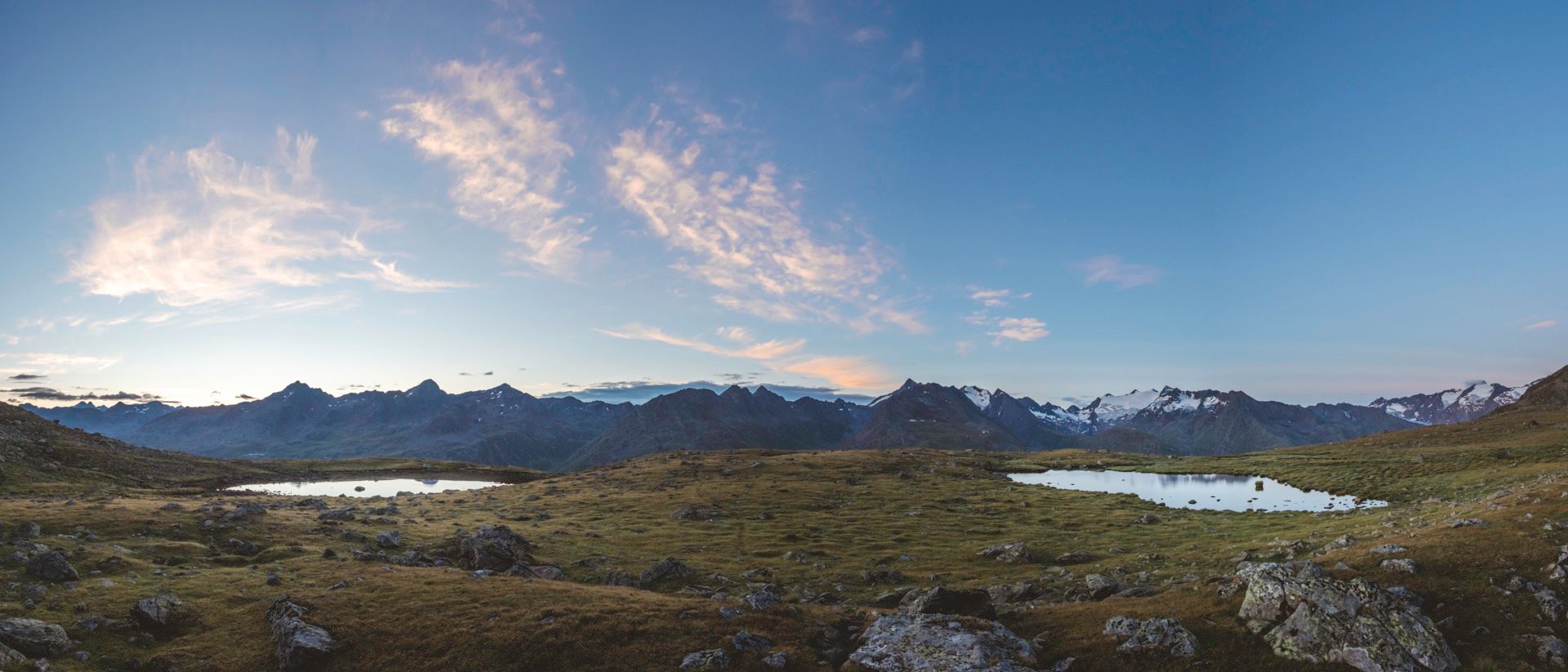
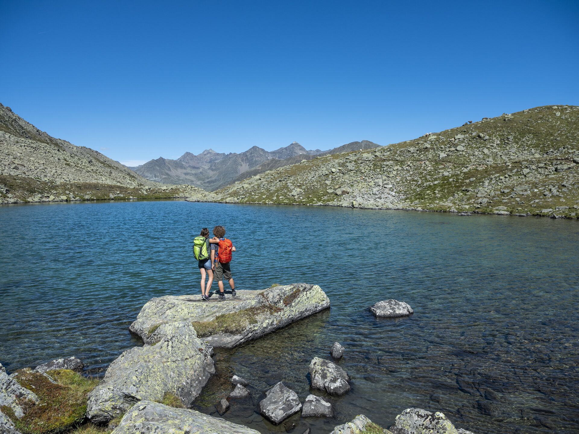
Obergurgl, Hochgurgl... Übergurgl? Just leave the superlatives in the valley. One thing's for sure, here you'll be hiking above it all - almost at eye level with the glaciers.
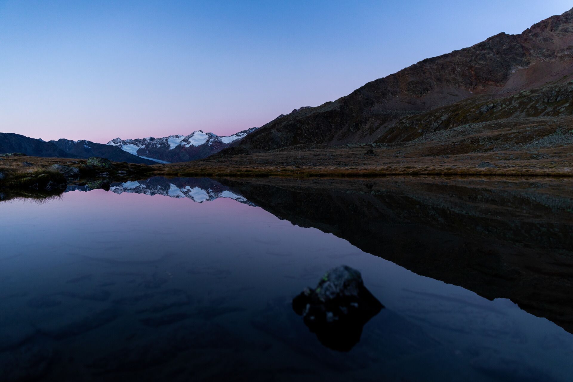
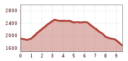
Medium-difficulty mountain hike on a panoramic trail above the Gurgler Valley in the rear Ötztal. From an altitude of up to 2,500 meters above sea level, there is a wide view of the three-thousand-metre peaks of the main Alpine ridge and glaciers such as the Gurgler Ferner. Steep ascent from Obergurgl, but without any major technical hurdles. Almost entirely treeless terrain with a sunny south-westerly exposure, making it hot at times, especially in summer. You can cool off at Nedersee lake and beforehand - if you have enough energy reserves for the detour - at the Gurgler Seenplatte. The descent to the Lenzenalm is steep again, a difficult section with boulders where you may need to use your hands. Stop off at the Lenzenalm at the end of the tour, the only restaurant on the entire route. Take the hiking bus or public bus (line 320) back to Obergurgl or out of the valley towards Sölden and Haiming (runs daily every 30 minutes).

Moderate mountain trail; suitable for sure-footed and experienced mountain hikers.
Good physical condition, mountain experience, and mountain equipment (see equipment section) are necessary. Please check the current weather report at: www.oetztal.com/de/sommer.html
Appropriate equipment such as breathable and weather-appropriate outdoor clothing, ankle-high hiking boots, wind, rain, and sun protection, hat, and possibly gloves is required for all hikes and routes. Carrying a first aid kit, a mobile phone, and possibly a hiking map, as well as sufficient provisions for hikes without the option to restock, is necessary.
From the center of Obergurgl northwards to the Pirchhütter Ach bridge. Over the Gurgler Ache, the hiking trail continues steeply uphill on the western side of the valley to the lake area. Below the Soomsee, at the junction, continue down-valley towards Nedersee. From the north shore of the lake, descend to Lenzenalm and continue to the federal road. (Return by bus to Obergurgl - runs every 30 minutes).
Travel comfortably and safely by train to the Ötztal station. The final station or exit point is the ÖTZTAL station. Then, travel conveniently and quickly with public transportation or local taxi services through the whole valley to your desired destination! The current bus schedule is available at: http://fahrplan.vvt.at
The following parking options are available in Gurgl:


")


