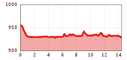
DescriptionThe Fitness Run route is 14,5km and 54m in elevation on flat gravel and asphalt paths from Pertisau to Achenkirch.
The Wildschönau High TrailDifficulty:mediumLength:14.8 kmDuration:6:30 hElevation uphill:760 mSee trailSee trail: The Wildschönau High Trail
BichlachrundeDifficulty:easyLength:10.5 kmDuration:3:30 hElevation uphill:295 mSee trailSee trail: Bichlachrunde
Langlauf und Biathlon in St. Johann © Mirja Geh Lärchenhof TrailOpening hours:closedDifficulty:easyLength:1.7 kmElevation uphill:11 m:Style: Skating, ClassicGo to Cross-country skiing trailGo to Cross-country skiing trail: Lärchenhof Trail
Langlaufen Itter 2022 @Magdalena Laiminger (17).jpg © Magdalena Laiminger Cross-country ski trail ItterOpening hours:closedDifficulty:mediumLength:3.6 kmElevation uphill:10 m:Style: Skating, ClassicGo to Cross-country skiing trailGo to Cross-country skiing trail: Cross-country ski trail Itter
Region-Hohe-Salve-Gravel-Bike-07-2025-Fotograf-Stefan-Ringler-Web-09.jpg © Stefan Ringler SalvenaradrundeDifficulty:mediumLength:62.7 kmDuration:3:30 hElevation uphill:648 mGo to biketourGo to biketour: Salvenaradrunde
Ellmau_Biedringer Platte_Winterwanderung_Wilder Kaiser © TVB Wilder Kaiser/Maria Luise Handl Winter walking Biedringer PlatteOpening hours:closedLength:12.7 kmDuration:5:30 hElevation uphill:470 mGo to winter hikeGo to winter hike: Winter walking Biedringer Platte
Eternity meadow trail - No. 3Opening hours:closedDifficulty:mediumLength:11.5 kmDuration:1:30 hElevation uphill:160 m:Style: Skating, ClassicGo to Cross-country skiing trailGo to Cross-country skiing trail: Eternity meadow trail - No. 3
Söll_Hexenwasser_Hohe Salve_Wilder Kaiser © TVB Wilder Kaiser/Martin Raffeiner MTB Tour Söll - HochsöllDifficulty:mediumLength:5.1 kmElevation uphill:480 mGo to biketourGo to biketour: MTB Tour Söll - Hochsöll
koasamarsch_light_ebbs_2021_copyright_max_draeger (20).jpg © Max Draeger Two day tour - Höhenweg Zahmer KaiserOpening hours:openDifficulty:mediumLength:30.0 kmDuration:13:15 hElevation uphill:2,100 mSee trailSee trail: Two day tour - Höhenweg Zahmer Kaiser
St_Johann23©MirjaGeh_2817.jpg © Mirja Geh Flusserlebnisweg GroßacheDifficulty:easyLength:3.2 kmDuration:0:30 hElevation uphill:20 mGo to biketourGo to biketour: Flusserlebnisweg Großache
Käse FG Verena Rechte TVB Wildschönau (11).jpg © wildschönau Tourismus On the cheese trailDifficulty:mediumLength:13.0 kmDuration:5:00 hElevation uphill:338 mSee trailSee trail: On the cheese trail
Dorfloipe Walchsee (3).JPG © TVB Kaiserwinkl Village trail Walchsee - No. 17Opening hours:closedDifficulty:easyLength:3.0 kmDuration:0:20 hElevation uphill:45 m:Style: Skating, ClassicGo to Cross-country skiing trailGo to Cross-country skiing trail: Village trail Walchsee - No. 17
St. Johann, Angerer Alm_Tirol Werbung_Bauer Frank_Sankt Johann in Tirol (1) © Tirol Werbung | Frank Bauer Angereralm - HarschbichlDifficulty:mediumLength:18.2 kmDuration:2:00 hElevation uphill:942 mGo to biketourGo to biketour: Angereralm - Harschbichl
Summit hike: Ginzling Schlegeis reservoir - Schönbichler HornDifficulty:difficultLength:20.7 kmDuration:9:30 hElevation uphill:1,350 mSee trailSee trail: Summit hike: Ginzling Schlegeis reservoir - Schönbichler Horn
Leutasch Farm Shop Circular HikeDifficulty:easyLength:11.5 kmDuration:3:10 hElevation uphill:111 mSee trailSee trail: Leutasch Farm Shop Circular Hike
Easy cross-country skiing circuit in KranebittauOpening hours:closedDifficulty:easyLength:2.0 kmDuration:0:20 hElevation uphill:40 m:Style: Skating, ClassicGo to Cross-country skiing trailGo to Cross-country skiing trail: Easy cross-country skiing circuit in Kranebittau
TaubenseeDifficulty:mediumLength:13.0 kmDuration:5:00 hElevation uphill:620 mSee trailSee trail: Taubensee
Schmugglerweg KlobensteinOpening hours:openDifficulty:mediumLength:8.2 kmDuration:3:00 hElevation uphill:250 mSee trailSee trail: Schmugglerweg Klobenstein
Schneerosentalloipe am Angerberg © Astner Stefan Cross-country ski trail Schneerosental AngerbergOpening hours:closedDifficulty:easyLength:7.6 kmElevation uphill:30 m:Style: Skating, ClassicGo to Cross-country skiing trailGo to Cross-country skiing trail: Cross-country ski trail Schneerosental Angerberg
Langlaufen Hopfgarten Penningberg 2022 @Magdalena Laiminger (18).jpg © Magdalena Laiminger Cross-country ski trail Penningberg, HopfgartenOpening hours:closedDifficulty:mediumLength:5.3 kmElevation uphill:67 m:Style: Skating, ClassicGo to Cross-country skiing trailGo to Cross-country skiing trail: Cross-country ski trail Penningberg, Hopfgarten
Region-Hohe-Salve-Gravel-Bike-07-2025-Fotograf-Stefan-Ringler.jpg © Region Hohe Salve - Stefan Ringler Brixental cycling tour Nr. 21Difficulty:easyLength:46.7 kmDuration:3:30 hElevation uphill:450 mGo to biketourGo to biketour: Brixental cycling tour Nr. 21
Käsealm Straubing © Ferienregion Hohe Salve Käsealm Straubing past WindauDifficulty:mediumLength:19.8 kmDuration:2:30 hElevation uphill:270 mGo to biketourGo to biketour: Käsealm Straubing past Windau
Scheffau_Kaiser-Hochalm_Wilder Kaiser © TVB Wilder Kaiser/Stefan Leitner Hochalm hikeDifficulty:mediumLength:19.6 kmDuration:7:00 hElevation uphill:1,140 mSee trailSee trail: Hochalm hike
web-wilder-kaiser-mountain-tours-summit-photos-behind-goinger-halt-herbst2022-stefan-leitner-6©stefanleitner © Stefan Leitner Hintere Goinger Halt summit tourDifficulty:difficultLength:9.3 kmDuration:6:30 hElevation uphill:1,090 mSee trailSee trail: Hintere Goinger Halt summit tour
Scheffau_Brandstadl_Tanzboden_Panoramaweg_Wilder Kaiser © TVB Wilder Kaiser/Stefan Leitner Panoramic circuit Brandstadl–HartkaiserDifficulty:easyLength:6.0 kmDuration:1:50 hElevation uphill:170 mSee trailSee trail: Panoramic circuit Brandstadl–Hartkaiser
Give feedback for a chance to win a special holiday experience!Click here for the surveyClick here for the survey
.jpg")


.jpg")


.jpg")

.jpg")
.JPG")
")


.JPG")

.jpg")

.jpg")


