Mountain hikes Alpbachtal water hiking trail

Reith im Alpbachtal / Kitzbüheler Alpen
Difficulty ratings: easy
Route length: 8.6 km
Duration: 2:45 h

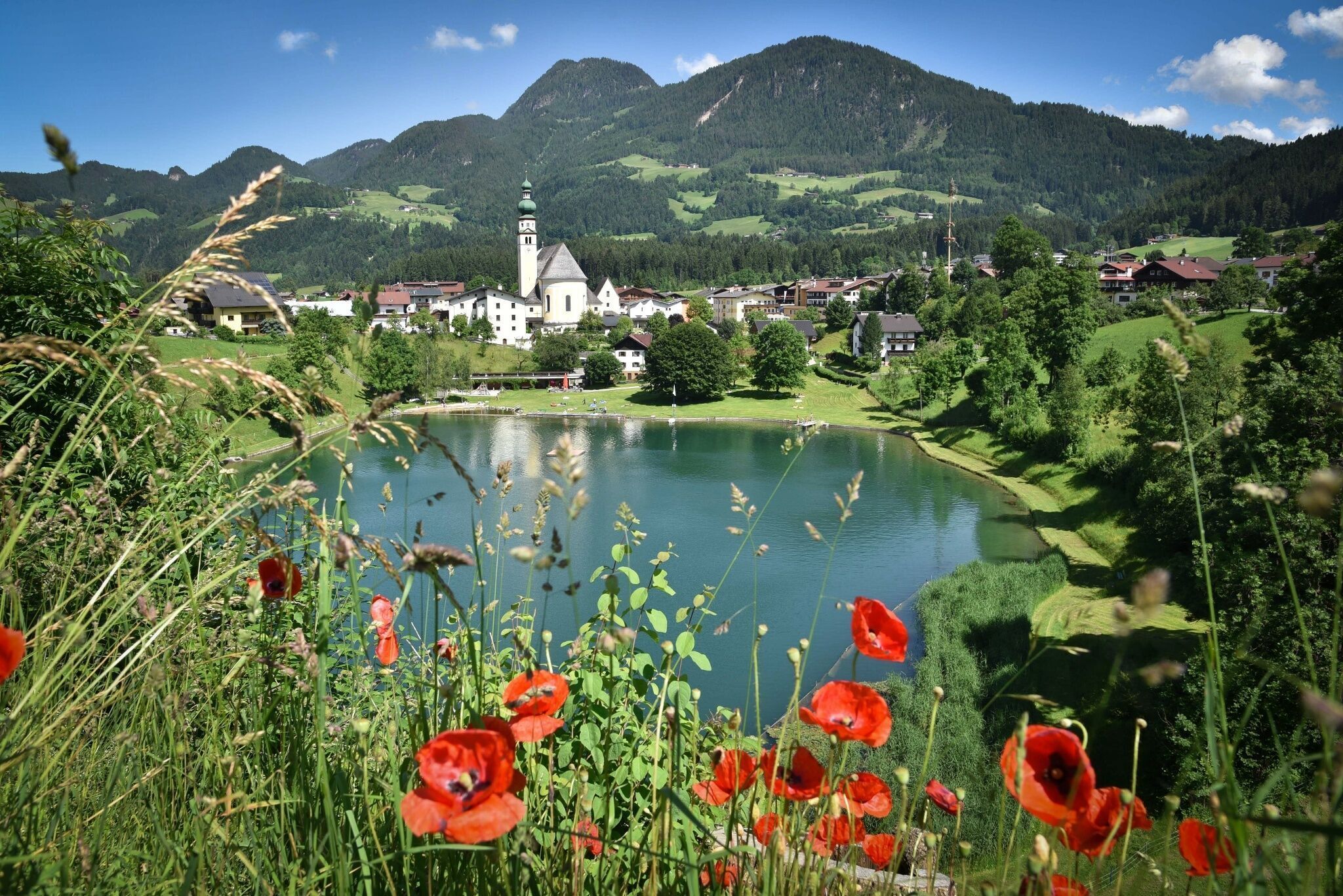
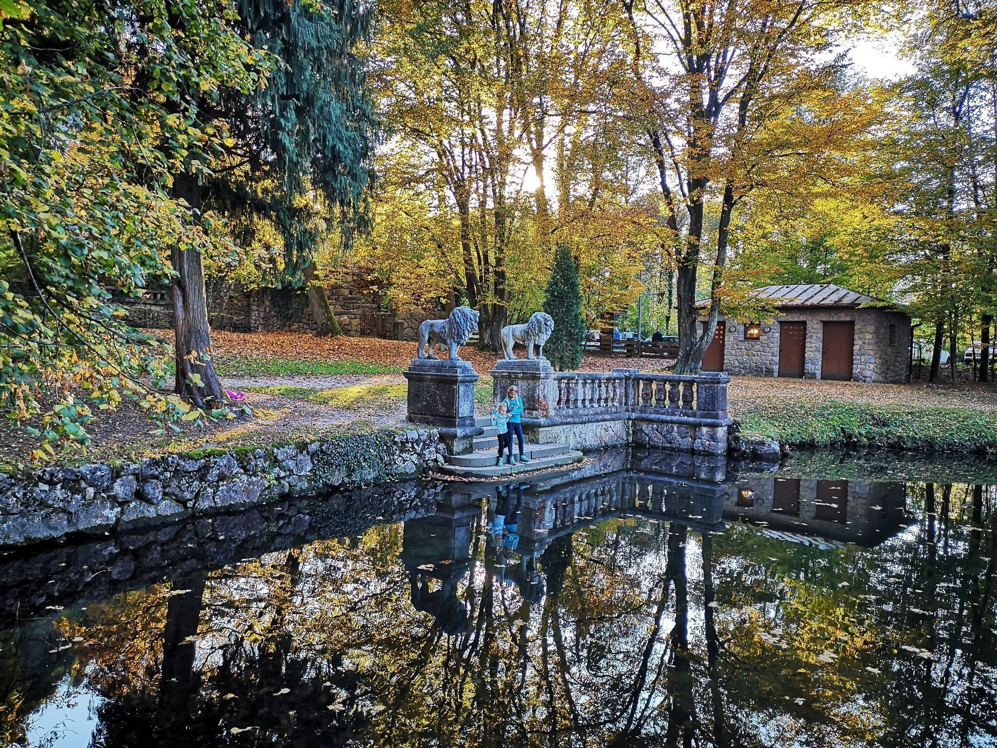
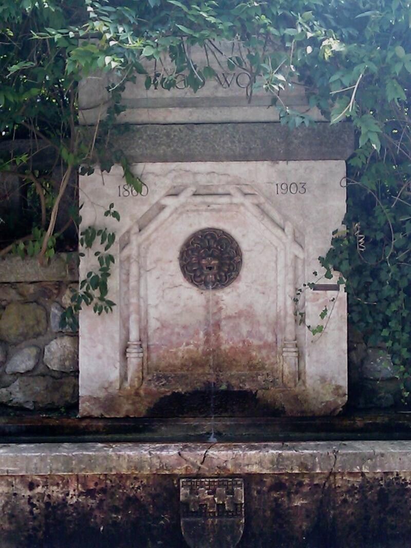
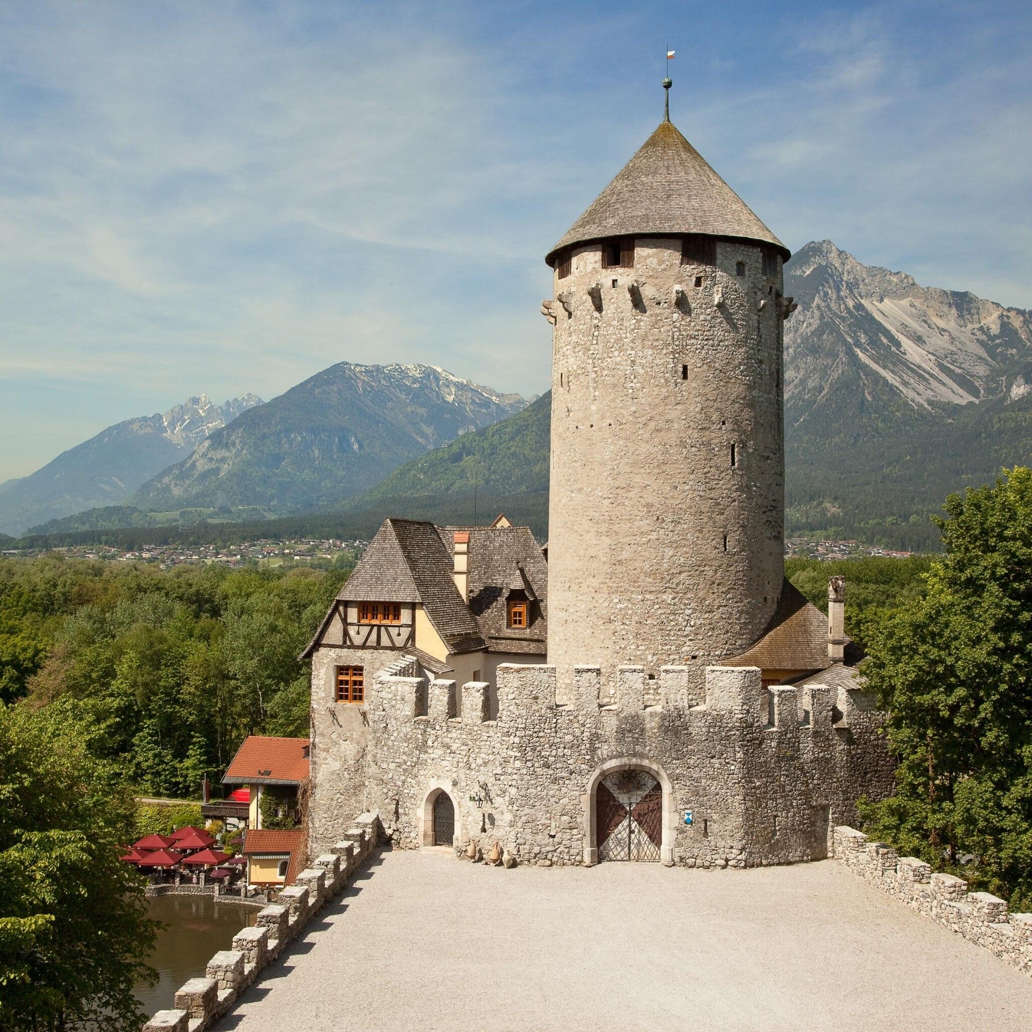
Beautiful circular hike with lakes, fountains, castles, and lots of impressions on the theme of water

Tour information

  • Requirement: easy
  • Length: 8.6 km
  • Duration: 2:45 h
  • Elevation uphill:222 hm
  • Elevation downhill:222 hm
Highest point688 m

Starting point

Village center, Reith im Alpbachtal

Finishing point

Village center Reith im Alpbachtal
  • Fitness level 2 / 6

Best time of year

  • January
  • February
  • March
  • April
  • May
  • June
  • July
  • August
  • September
  • October
  • November
  • December

Equipment

sturdy shoes and weather-appropriate clothing

Source: Alpbachtal

Description

Dive into the history of Tirol and discover impressive places with interesting pasts along the water hiking trail. Along the circular hiking trail, you'll find 33 station boards with interesting information about the historic sites of the region. There are also some places to eat and playgrounds along the route.

Basically, the water hiking trail is designed so you can "join" anywhere. Each station has its own "story," independent from the others, and yet the trail forms a whole.

The old mountain house at the so-called Kramstollen, for example, reminds you of the millennia-long mining activities on the Große and Kleine Kogel. Copper was mined here even in prehistoric times. Or let your imagination run free at Schloss Lichtwerth and envision how the castle once was an island. Surrounded by Schloss Matzen as well as Schloss Neumatzen (Lipperheide), Schloss Lichtwerth and the Kropfsberg ruin, the picturesque Matzen Park is one of the most beautiful and valuable cultural landscapes in Tirol. But these are only some of the highlights along the route!


Nearby huts and mountain restaurants

Getting here

  • Arrival by public transport

    www.vvt.at

    Bus line 620, stop Dorfmitte Reith in Alpbachtal

  • Parking

    valley station Reitherkogelbahn

More tours in the surrounding area

  • 3-peak-tour Kienberg-Plessenberg-Heuberg

    Difficulty: medium
    Length: 8.6 km Duration: 4:30 h Elevation uphill: 779 m
  • Day 3: 4 days - 4 summits tour

    Difficulty: medium
    Length: 19.3 km Duration: 8:00 h Elevation uphill: 1,371 m
  • 4 days - 4 summits tour

    Difficulty: medium
    Length: 54.4 km Duration: 23:00 h Elevation uphill: 3,408 m
  • Day 1: 4 days - 4 summits tour

    Difficulty: medium
    Length: 9.8 km Duration: 5:00 h Elevation uphill: 984 m
  • Loop tour Juppi Zauberwald

    Difficulty: easy
    Length: 2.5 km Duration: 1:00 h Elevation uphill: 93 m
  • Kaiser Gorge - loop trail

    Opening hours: closed
    Difficulty: easy
    Length: 4.2 km Duration: 1:00 h Elevation uphill: 198 m
  • Voldöpper Spitze Loop Hike

    Difficulty: medium
    Length: 12.9 km Duration: 5:00 h Elevation uphill: 988 m
  • Kundler Klamm

    Opening hours: closed
    Difficulty: easy
    Length: 6.4 km Duration: 2:00 h Elevation uphill: 116 m
  • Discovering the Tiefenbach Gorge Hike

    Opening hours: closed
    Difficulty: medium
    Length: 5.7 km Duration: 3:30 h Elevation uphill: 669 m
  • 3-day Family Tour Alpbachtal

    Difficulty: easy
    Length: 18.3 km Duration: 7:00 h Elevation uphill: 998 m
  • Farmkehralm 1.521 m

    Difficulty: medium
    Length: 9.3 km Duration: 3:30 h Elevation uphill: 506 m
  • Wiedersberger Horn Panorama Path

    Difficulty: easy
    Length: 4.1 km Duration: 1:30 h Elevation uphill: 195 m
  • Barrier-free path Lake Reintal

    Difficulty: easy
    Length: 6.5 km Duration: 1:45 h Elevation uphill: 15 m
Newsletter

The mountain is calling? So does our newsletter!

In our monthly newsletter we reveal the best holiday tips for Tyrol.