
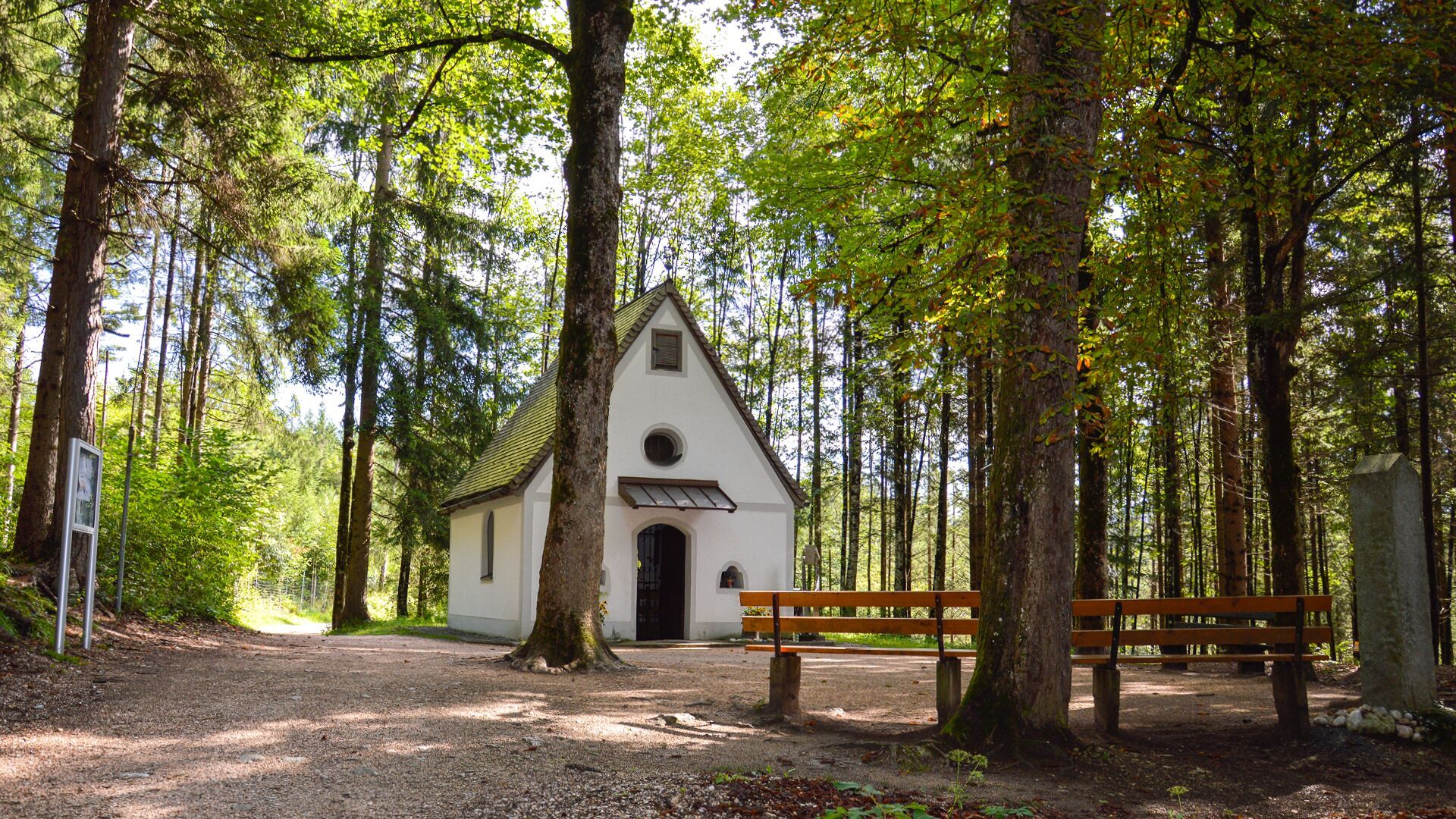
Themed hikes Church and chapel path - trail option 3: parish church Wiesing - Grünangerl chapel

Wiesing / Brandenberg Alps (Rofan)
Difficulty ratings: easy
Route length: 4.4 km
Duration: 1:45 h

A forest trail leads to the Grünangerl chapel in Wiesing. Open all year round, the chapel can be reached easily in every season, as the path is maintained in winter.
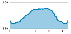
Tour information

  • Requirement: easy
  • Length: 4.4 km
  • Duration: 1:45 h
  • Elevation uphill:25 hm
  • Elevation downhill:25 hm
Highest point590 m

Starting point

Wiesing, parish church

Finishing point

Wiesing, parish church
  • Fitness level 2 / 6
  • Technique 1 / 6

Features

  • suitable for pushchairs

Best time of year

  • January
  • February
  • March
  • April
  • May
  • June
  • July
  • August
  • September
  • October
  • November
  • December

Trail condition

asphalt, forest road, forest path

Equipment

Sturdy boots (ankle-high hiking boots), weather appropriate clothing. Telescopic hiking poles are recommended.
Source: Achensee Tourismus

Description

From the parish church Wiesing, walk to the underpass of the Achensee main road in the direction of the campsite. At the junction, turn right at house number 400 and walk straight on until you reach the forest path to the Grünangerl chapel. 

Getting here

  • Arrival by public transport

    Take the regional bus (line 4080 or 8332) to the village centre of Wiesing and get off at the "Wiesing Dorf" stop.

  • Parking

    Turn off the Achensee main road (B181) towards the centre of Wiesing. Continue along the road; after the left-hand bend, you’ll find the entrance to the underground car park on the right, next to the bakery. The starting point of the tour, the parish church, is located a few metres uphill from the bend.
    Underground car park in the centre of Wiesing (paid parking)

Weather

Today

partly Cloudy
13°C/3°C
0%0l5 km/h

Fri

mainly clear
12°C/2°C
0%0l5 km/h

Sat

clear sky
11°C/1°C
40%0.6l5 km/h
Go to weather forecast

More tours in the surrounding area

  • Dalfaz Alm

    Difficulty:medium
    Length:10.5 kmDuration:4:30 hElevation uphill:840 m
  • Gramai Alm - Gramai Hochleger - Sonnjoch - Gramai Alm

    Difficulty:difficult
    Length:10.8 kmDuration:6:30 hElevation uphill:1,200 m
  • Rofan tour - stage 4

    Difficulty:medium
    Length:4.1 kmDuration:1:45 h
  • Rofan tour - stage 2 - alternative summit route

    Difficulty:difficult
    Length:8.7 kmDuration:5:00 hElevation uphill:670 m
  • Rofan tour - stage 1

    Difficulty:medium
    Length:5.0 kmDuration:2:00 hElevation uphill:840 m
  • Rofan tour- stage 2 - scenic tour

    Difficulty:medium
    Length:9.3 kmDuration:3:30 hElevation uphill:370 m
  • Rofan tour

    Difficulty:medium
    Length:30.5 kmDuration:4 daysElevation uphill:1,450 m
  • Bärenwald circuit

    Difficulty:easy
    Length:4.9 kmDuration:1:30 hElevation uphill:170 m
  • Eagle Walk Stage 07: Jausenstation Waldhäusl - Erfurter Hütte

    Difficulty:difficult
    Length:18.0 kmDuration:8:00 hElevation uphill:1,590 m
  • Eben - Astenau Alpe - Ebner Joch - Eben

    Difficulty:medium
    Length:7.6 kmDuration:4:30 hElevation uphill:970 m
  • Guffert

    Difficulty:difficult
    Length:10.3 kmDuration:6:30 hElevation uphill:1,195 m
  • Bärenkopf

    Difficulty:medium
    Length:16.3 kmDuration:6:15 hElevation uphill:1,065 m
  • Maurach - Pertisau - Maurach

    Difficulty:easy
    Length:9.6 kmDuration:3:00 hElevation uphill:40 m
  • Eben - Astenau Alpe - Eben

    Difficulty:medium
    Length:4.5 kmDuration:2:15 hElevation uphill:505 m
  • Steinberg - Panoramarunde

    Difficulty:easy
    Length:6.1 kmDuration:2:00 hElevation uphill:200 m
Newsletter

The mountain is calling? So does our newsletter!

In our monthly newsletter we reveal the best holiday tips for Tyrol.
