Hut hike From Hochpillberg via Naunz to the Kellerjoch Hut

Pill / Tuxer Alpen
Difficulty ratings: medium
Route length: 5.2 km
Duration: 5:50 h

Hut hike with panoramic views over the Inn Valley.

Tour information

  • Requirement: medium
  • Length: 5.2 km
  • Duration: 5:50 h
  • Elevation uphill:855 hm
  • Elevation downhill:855 hm
Highest point2,222 m

Starting point

Car park at the Loas junction

Finishing point

Kellerjochhütte
  • Fitness level 3 / 6
  • Technique 3 / 6

Best time of year

  • January
  • February
  • March
  • April
  • May
  • June
  • July
  • August
  • September
  • October
  • November
  • December

Equipment

  • Sturdy footwear
  • Rain protection/sun protection
  • Sufficient drinking water/snacks
Source: TVB Silberregion Karwendel

Description

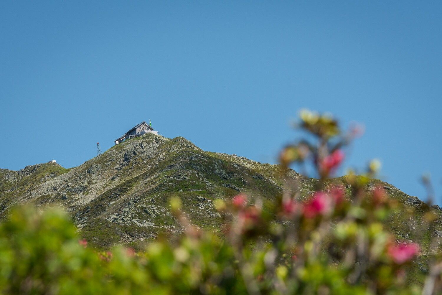
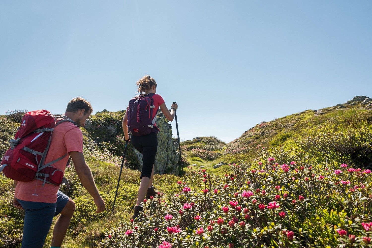
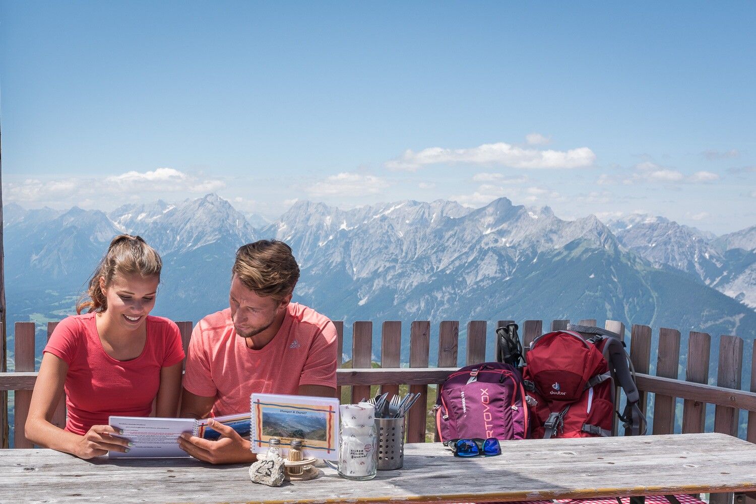
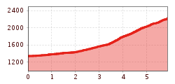
Step by step, you climb through the peaceful mountain landscape to Naunzstand and on to the destination of the hike – the Kellerjochhütte. Once at the top, you can enjoy magnificent views and regional delicacies – before returning to the valley via the same route.

Nearby huts and mountain restaurants

Getting here

  • Arrival by public transport

    Train to Schwaz station - regional bus 8 to the bus stop Parkplatz Abzw. Loas

    You can find the bus timetables at www.smartride.vvt.at

  • Parking

    Paid parking lot at the Loas junction

More tours in the surrounding area

Newsletter

The mountain is calling? So does our newsletter!

In our monthly newsletter we reveal the best holiday tips for Tyrol.