
Place:Gschnitz
:Alpine pasture / hut / mountain restaurant
Breathtaking mountain tour through beautiful alpine terrain to the striking and mighty rock pyramid of the Gschnitzer Tribulaun.
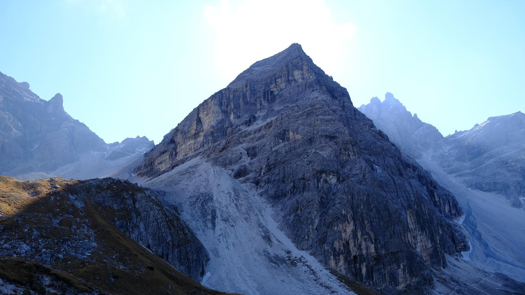
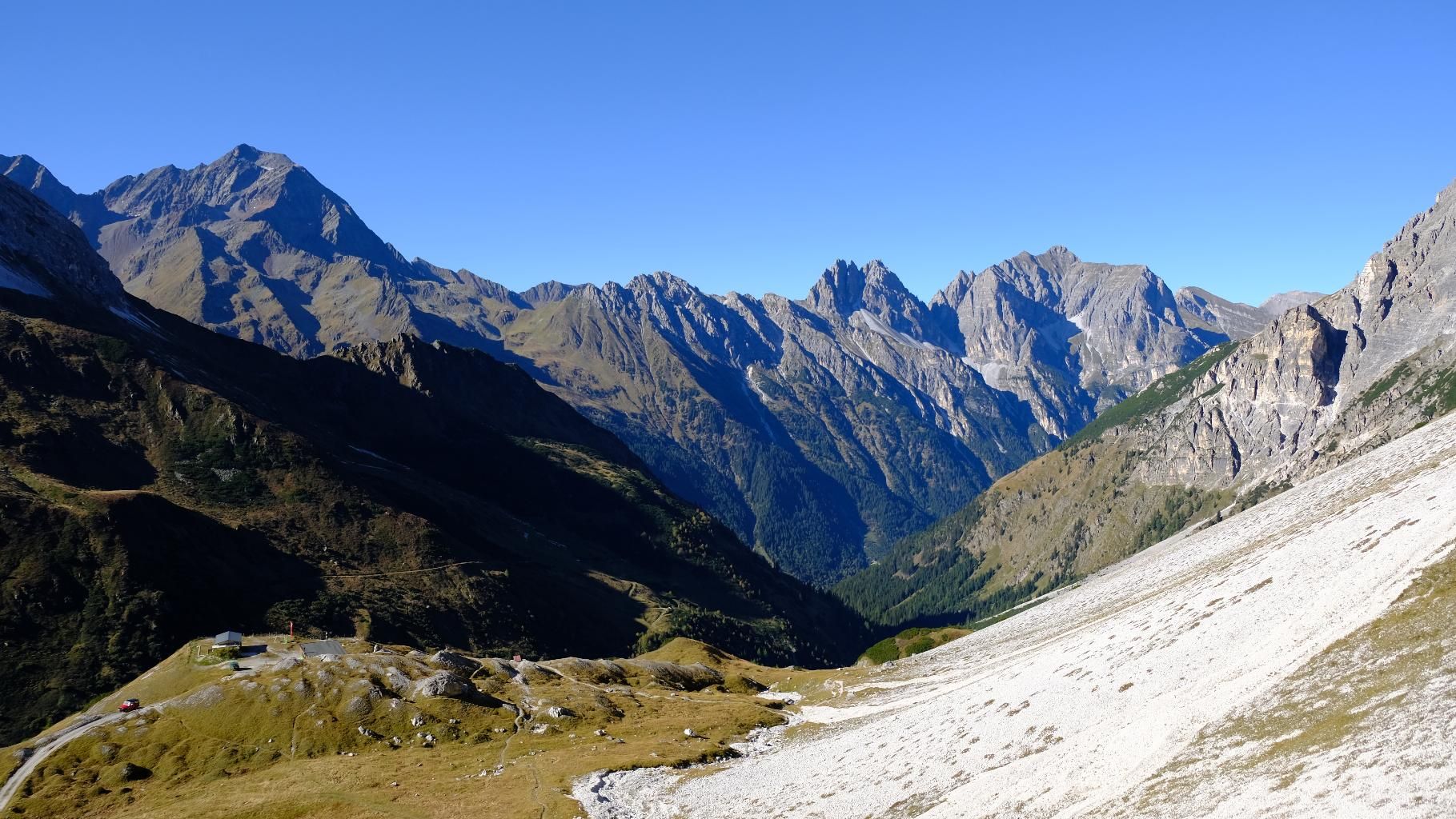
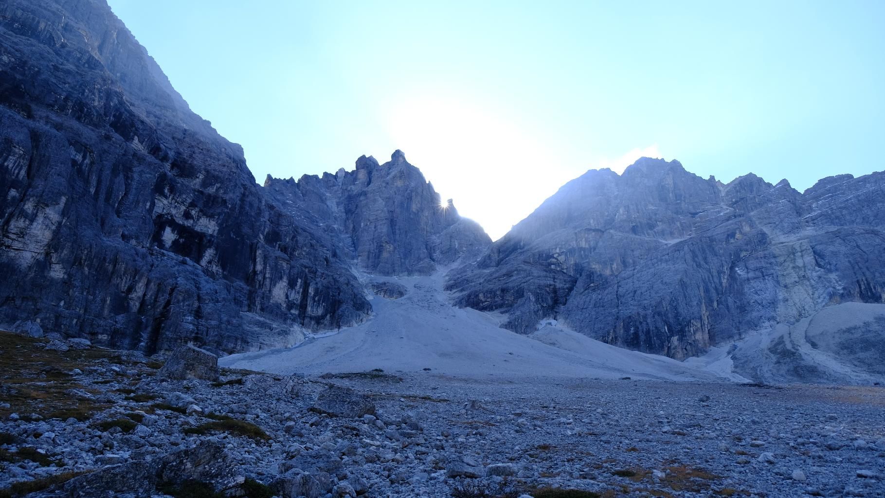
From the starting point, the tour first leads past the mill village to the beginning of the valley incision, which leads back to the tribulaunas. Over a great bridge construction, you can also admire the rushing masses of water that flow out of the valley. We then continue on a beautifully laid out, not too steep path first to Vordersandes and from there up in serpentines to the Tribulaun hut, which lies impressively in front of the majestic massif. We save the stop for the way back and instead choose the path that winds its way up through wide scree fields past snowfields to the Schneetalscharte. This, embedded in the stony flanks of Schwarzer Wand and Tribulaun, also forms the border between Austria and Italy. Now there is only one last climb up the wide eastern ridge of the rock formation with one or two exposed sections to overcome before the summit cross and a great view, starting with the shapely Pflerscher "namesake" and extending to the glaciers of Wilder Freiger and Zuckerhüttl, await the climber with joy.
ROUTE DESCRIPTION
From the car park, the trail first leads briefly out of the valley, past the Feuerstein inn and over the bridge to the entrance of the mill village. Passing the historic buildings, the trail first leads back to the waterfall and then to the left, uphill in serpentines through a beautiful spruce forest in the direction of Vordertaufers. After some time of somewhat steeper ascent, the trail with the No. 137 (Max Dellantoni) becomes somewhat flatter and leads further and further into the valley, where the silhouette of the mighty Tribulaune enchants the eye. Shortly before the hut, the ascent becomes more intense in serpentines before reaching the hut, which is situated on a small hilltop. The next section of the tour is the ascent to the Schneetalscharte, which lies below the Gschnitzer Tribulaun on its left. Especially in the upper section, the trail, now with the No. 32, runs through scree fields and is therefore somewhat more strenuous. Shortly before reaching the saddle, keep to the right and head for the cut on the tribulaun side. Once this is reached, the route first leads over one or two more exposed sections, and later through easier terrain along the eastern flank up to the summit.
TIP OF THE AUTHOR
For those who want to explore something new on the ascent as well as on the descent, it is worthwhile to take the beautifully angled wide forest path from the Tribulaun hut downwards, which leads in a curve via Hintersanders back to Gschnitz.
With the regional bus 4146 "Trins/Gschnitz" from Steinach a. Br. station to Gh. Feuerstein (terminal stop) [exact journey times at www.vvt.at].
Gasthaus Feuerstein (fee required)


.JPG")


.jpg")
")


 (1).jpg")


