Mountain hikes Stallwiesalm

Sölden / Stubaier Alpen
Difficulty ratings: medium
Route length: 3.0 km
Duration: 1:45 h

SÖLDEN -> STALLWIESALM -> SÖLDEN

Tour information

  • Requirement: medium
  • Length: 3.0 km
  • Duration: 1:45 h
  • Elevation uphill:465 hm
  • Elevation downhill:2 hm
Highest point1,842 m

Starting point

Sölden

Finishing point

Stallwiesalm
  • Fitness level 3 / 6

Best time of year

  • January
  • February
  • March
  • April
  • May
  • June
  • July
  • August
  • September
  • October
  • November
  • December

Equipment

Moderate mountain trail; for sure-footed and experienced hikers. Good physical condition, mountain experience & mountain equipment (see notice equipment) necessary. Please pay attention to the current weather report: Appropriate equipment such as breathable suitable outdoor clothes for the weather, ankle-high walking boots, wind-, rain- & sun protection, hat, possibly gloves, is for all hikes and tours necessary. Please bring a first-aidbox, a mobile phone, a walking map and if there is no hut on the way a snack and enough to drink.
Source: Ötztal

Description

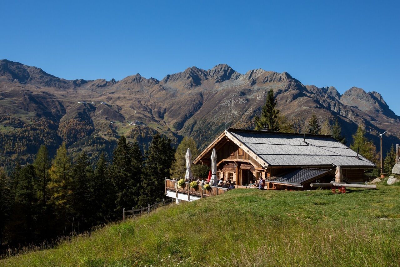
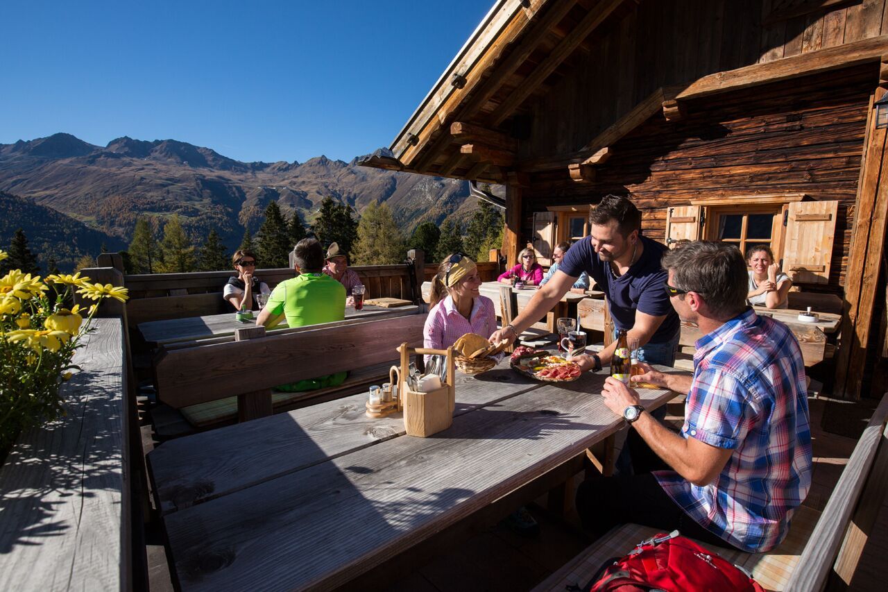
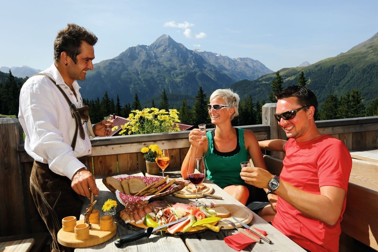
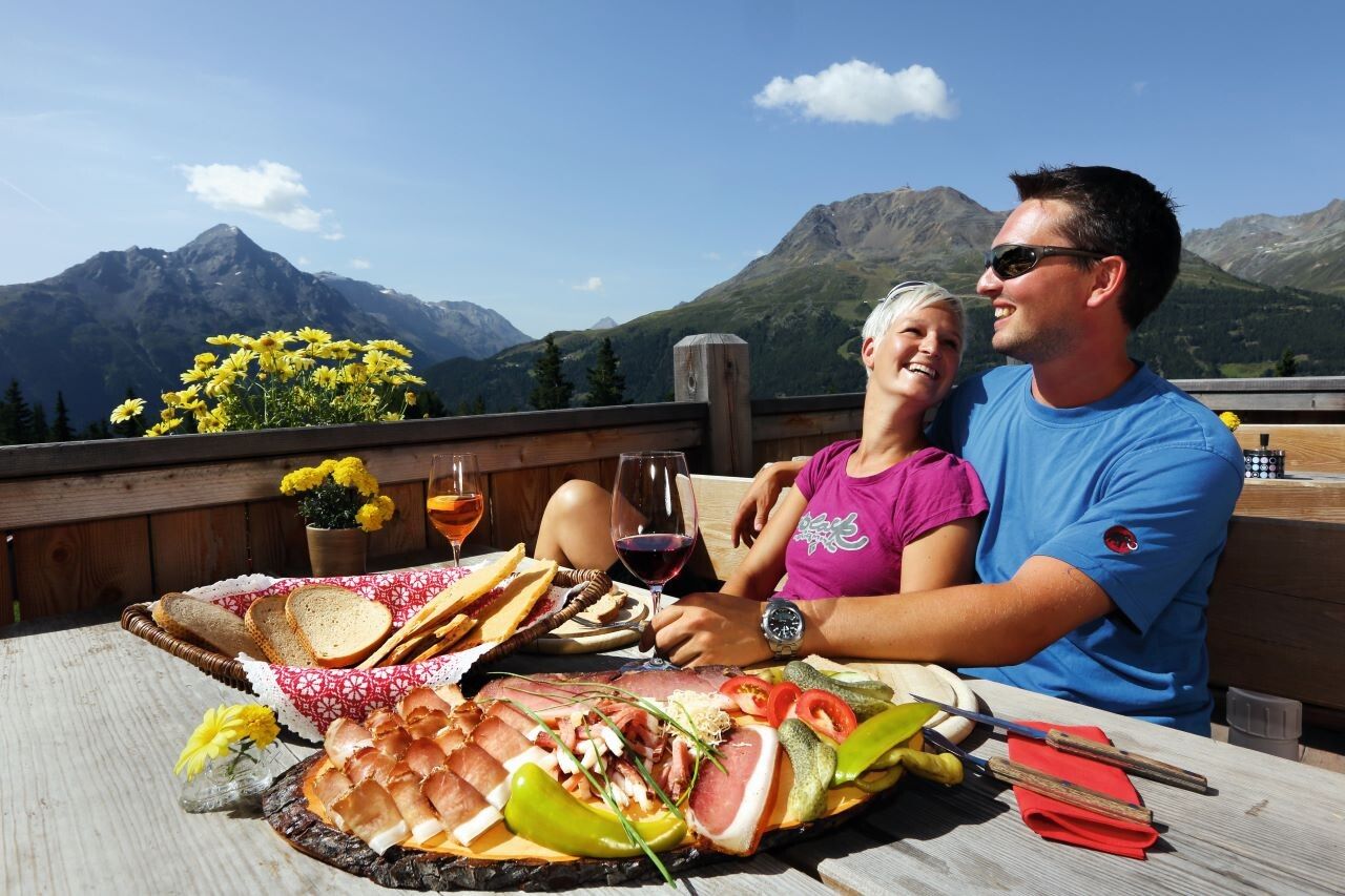
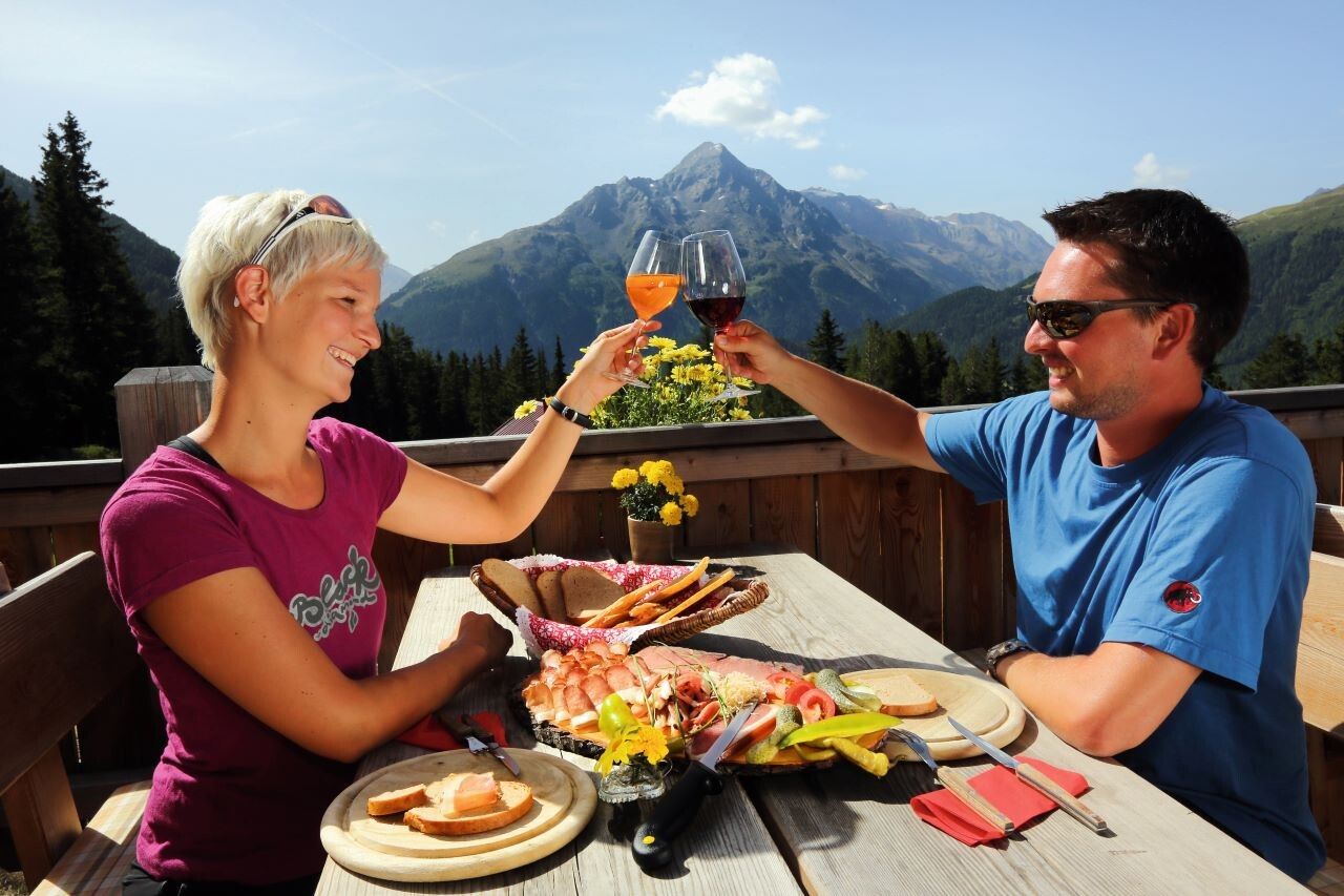
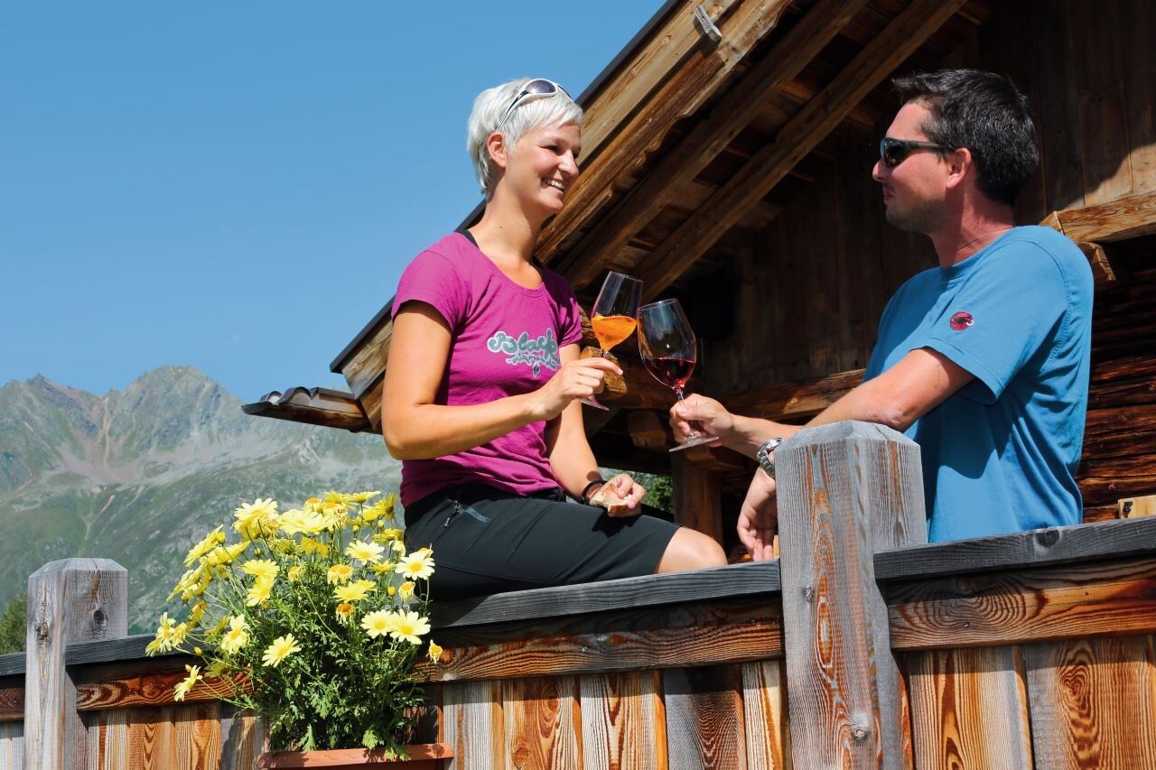
The Stallwiesalm is a popular alpine hut above Sölden, offering traditional Tyrolean cuisine, a sunny terrace, and a peaceful location. It can be reached by two different routes: a wide forest road or a shorter, steeper woodland trail.

Option 1: Via the Forest Road (easy & family-friendly)

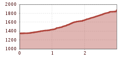
The hike begins at the Freizeit Arena in the center of Sölden. From there, follow the Granbichlstraße uphill to the barrier near the edge of the forest. Here, a well-maintained forest road winds gently through a quiet wooded area. Along the way, you’ll enjoy beautiful views of the Ötztal valley. After about 1.5 hours, you reach the Stallwiesalm at 1,842 m, a cozy alpine hut perfect for a break.

Option 2: Via the Woodland Trail (shorter & steeper)

Also starting from the Freizeit Arena, a marked hiking trail branches off from the forest road shortly after the barrier. This steep forest path leads more directly up the mountain. It’s a shorter option – around 1 hour of walking time – but requires sturdy footwear and good footing, especially if the ground is wet.

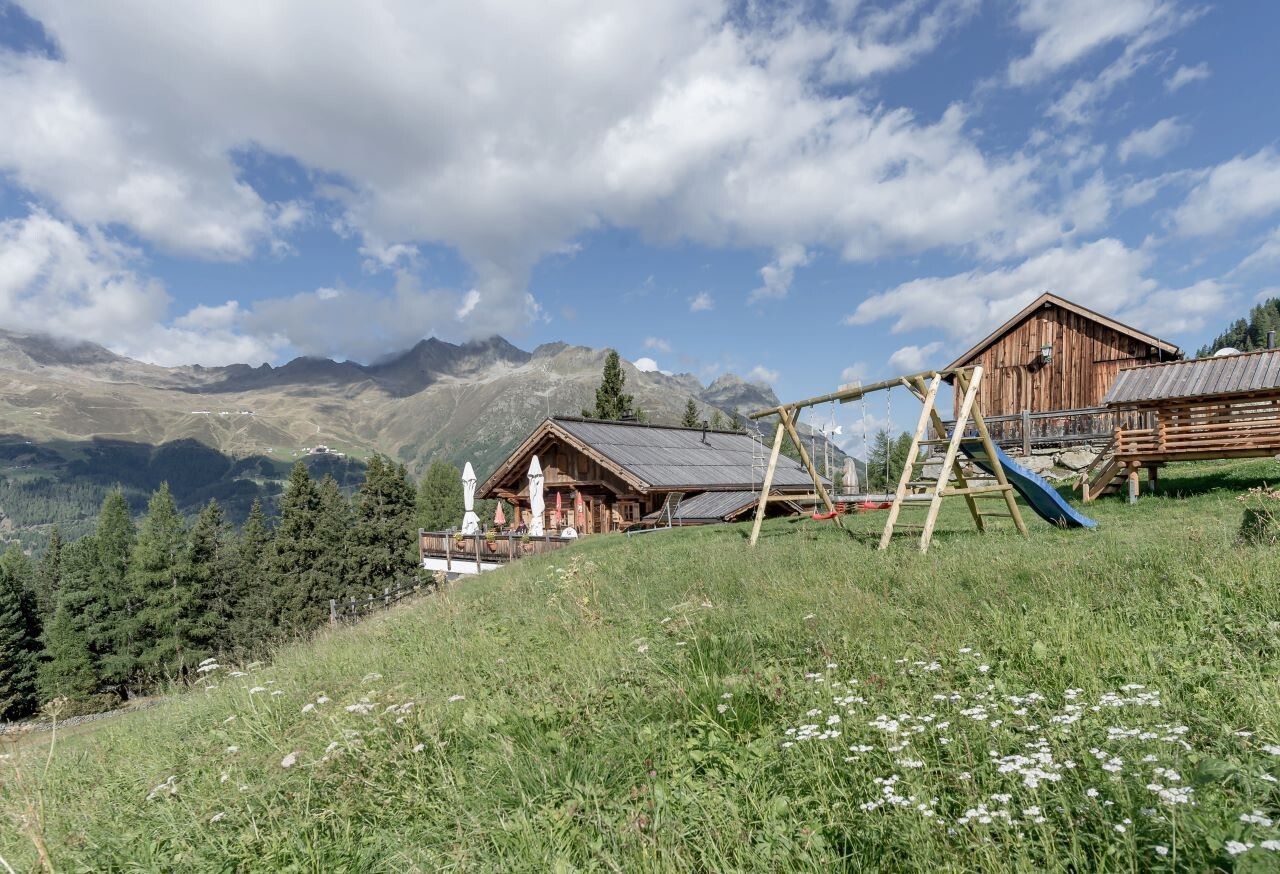
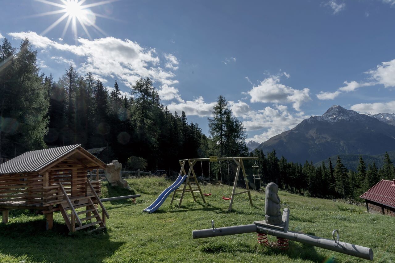
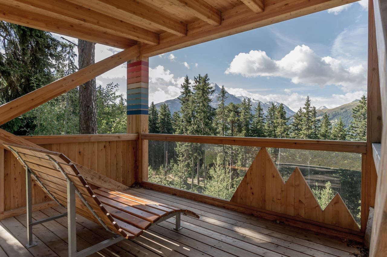
At 1,842 m, Stallwiesalm offers hearty local dishes, homemade desserts, and a relaxed mountain atmosphere. The hut is family-friendly, with outdoor seating and a small play area for children.


Nearby huts and mountain restaurants

Getting here

  • Arrival by public transport

    Travel safe and comfortable with the train to the Ötztal Bahnhof train station. Last stop and exit point is the train station Ötztal Bahnhof. Afterwards you can travel smoothly and quick with the public transport or our local taxi companies through the valley to your desired destination. Please find the current bus timetable here:http://fahrplan.vvt.at

  • Parking

    The following parking facilities are available in Sölden:

    • Parking lot Postplatz
    • parking lot Stiegele
    • stair parking
    • Giggijochbahn + underground garage
    • Gaislachkoglbahn + underground garage
    • Parking Hochsölden
    • parking garage Hochsölden 1. parking lot

    All parking is free during the day.

    Parking for several days (eg hike tour):

    • Parkgarage Gaislachkoglbahn, Parkticket either online or directly at the cash desk of the Gaislachkoglbahn

More tours in the surrounding area

  • Mutsbühl

    Difficulty: medium
    Length: 4.5 km Duration: 1:30 h Elevation uphill: 470 m
  • Via Ferrate Stuibenfall | Umhausen

    Opening hours: closed
    Difficulty: medium
    Length: 1.5 km Duration: 4:00 h Elevation uphill: 162 m
  • Wilder Mann

    Difficulty: medium
    Length: 2.4 km Duration: 2:30 h Elevation uphill: 665 m
  • Fundusfeiler - Umhausen

    Difficulty: difficult
    Length: 4.5 km Duration: 3:00 h Elevation uphill: 1,109 m
  • Gampe Alm

    Difficulty: medium
    Length: 2.7 km Duration: 2:00 h Elevation uphill: 623 m
  • Siegerlandhütte - Sölden

    Difficulty: medium
    Length: 8.0 km Duration: 3:30 h Elevation uphill: 780 m
  • Ötztal Trek Stage 4

    Difficulty: difficult
    Length: 8.9 km Duration: 4:00 h Elevation uphill: 802 m
  • Ötztal Trek Stage 3

    Difficulty: difficult
    Length: 10.4 km Duration: 4:00 h Elevation uphill: 842 m
  • Ötztal Trek Stage 10

    Difficulty: difficult
    Length: 11.1 km Duration: 4:30 h Elevation uphill: 1,476 m
  • Ötztal Trek Stage 8

    Difficulty: difficult
    Length: 9.3 km Duration: 3:30 h Elevation uphill: 274 m
  • Ötztal Trek Stage 14

    Difficulty: difficult
    Length: 6.3 km Duration: 3:00 h Elevation uphill: 1,004 m
  • Ötztal Trek Stage 20

    Opening hours: closed
    Difficulty: medium
    Length: 6.4 km Duration: 3:00 h Elevation uphill: 610 m
  • Ötztal Trek Stage 11

    Difficulty: difficult
    Length: 12.0 km Duration: 5:00 h Elevation uphill: 705 m
  • Ötztal Trek Stage 5

    Difficulty: difficult
    Length: 8.1 km Duration: 3:30 h Elevation uphill: 1,125 m
  • Ötztal Trek Stage 1

    Difficulty: medium
    Length: 18.6 km Duration: 6:30 h Elevation uphill: 1,561 m
  • Ötztal Trek Stage 17

    Difficulty: difficult
    Length: 16.4 km Duration: 6:00 h Elevation uphill: 1,080 m
  • Ötztal Trek Stage 21

    Difficulty: difficult
    Length: 9.4 km Duration: 4:30 h Elevation uphill: 1,270 m
Newsletter

The mountain is calling? So does our newsletter!

In our monthly newsletter we reveal the best holiday tips for Tyrol.