Arrival by public transport
Take the regional bus (line 4080 to Achenkirch, change to line 7801 to Steinberg) to Steinberg am Rofan to the car park Waldfrieden. Get off at the stop: Steinberg a. R. Waldfrieden.
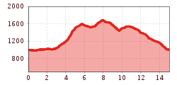
Strenuous circular route via the Schneidjoch, the Rhaetian rock inscriptions, and the Stubachalm: 15.1 km, nearly 1,000 metres of elevation gain, ca. 7 hrs 45 mins walking time.
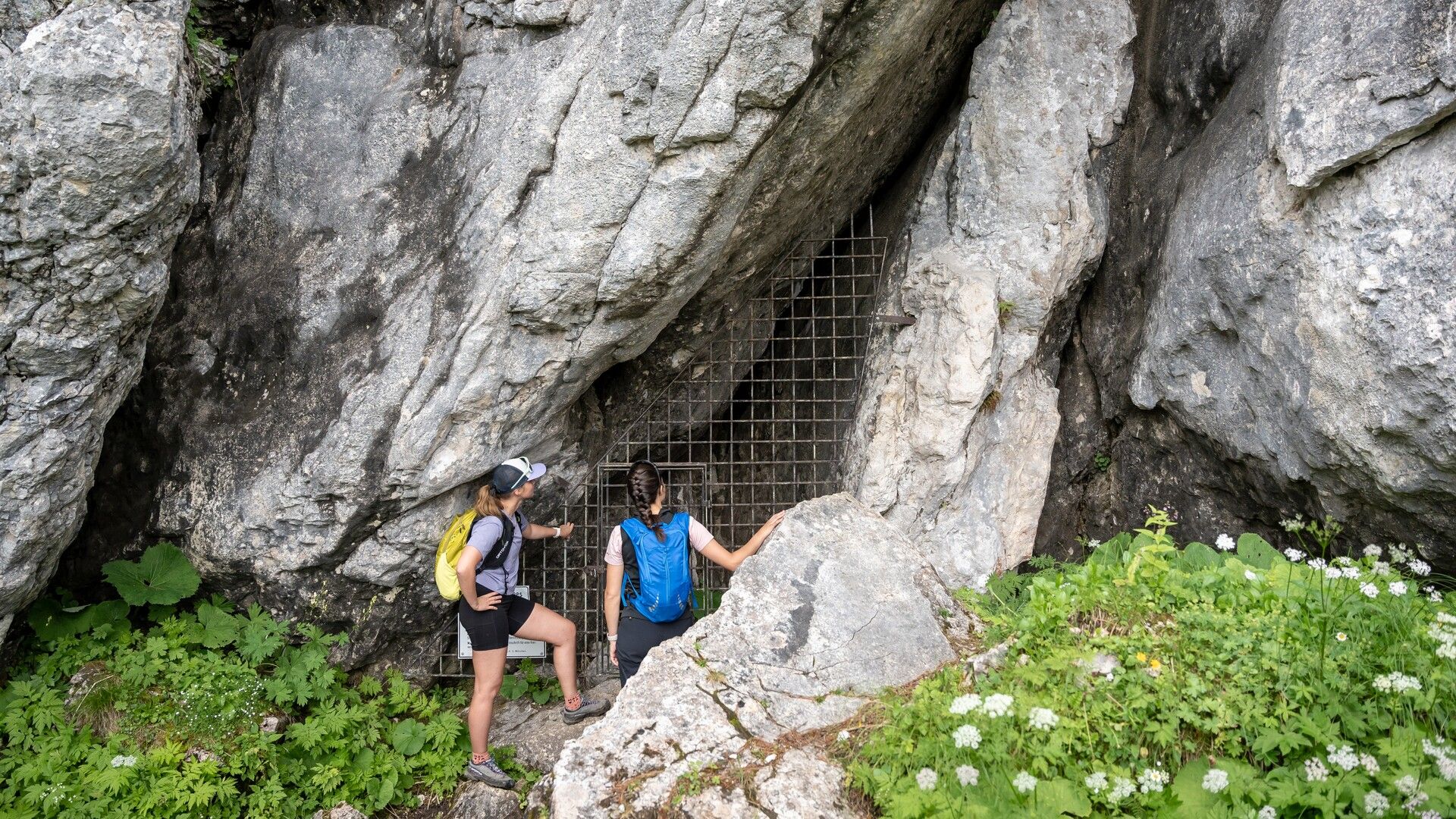
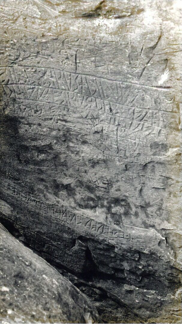

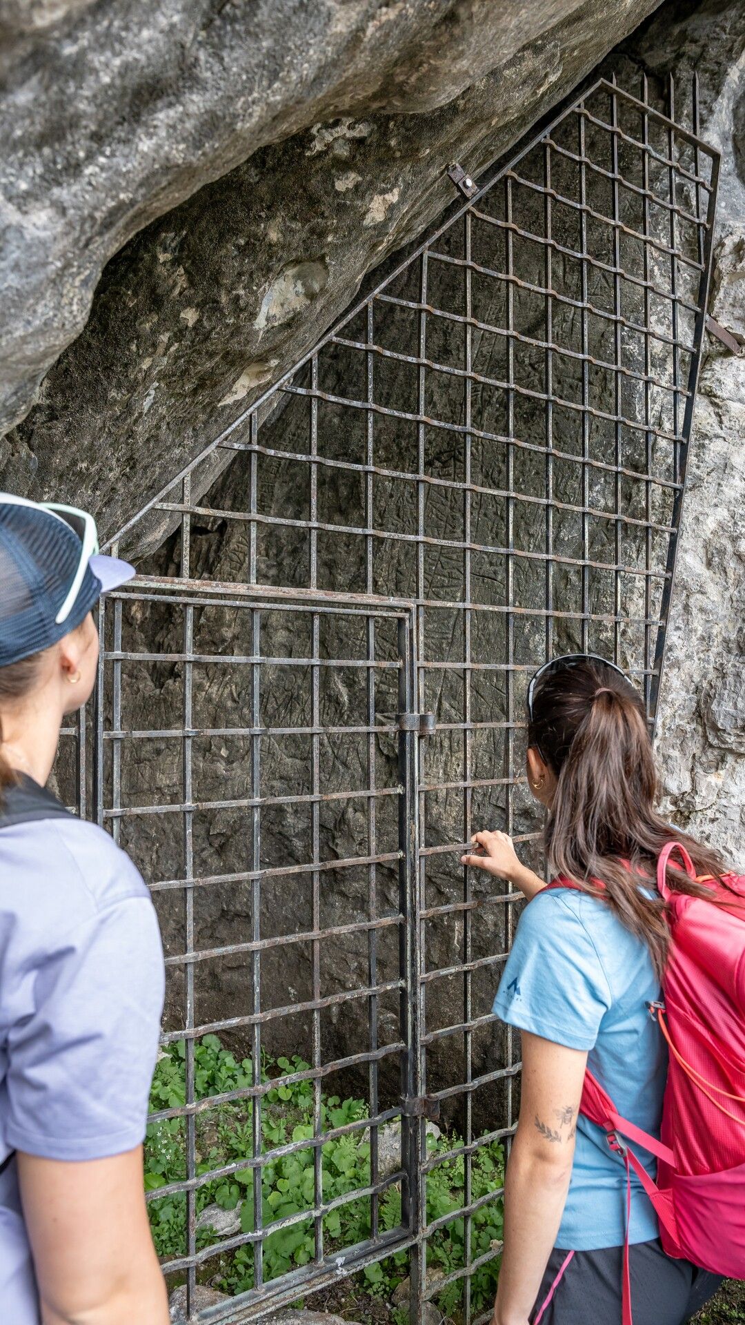

From the car park “Waldfrieden”, follow the main road for ca. 500 metres in the direction of Achenkirch until you reach the forest road to the right. From here, walk along the Weißenbach in the direction of the Weißbachl Alm (not serviced). A beautiful trail takes you to the Schneidalm (not serviced) and the Rhaetian inscriptions (1,520 metres). Turn right and follow the trail in the direction of the Angernalm. Keep right and climb to the Schneidjoch (see signpost). Walk over the Schneidjoch saddle facing the Guffert and descend in the direction of the Issalmen (not serviced). Walk past the Issalmen and continue in a westerly direction via the Stubachalm (decrepit) until you reach the federal road. Walk back to the starting point.
Take the regional bus (line 4080 to Achenkirch, change to line 7801 to Steinberg) to Steinberg am Rofan to the car park Waldfrieden. Get off at the stop: Steinberg a. R. Waldfrieden.
Car park Waldfrieden in Steinberg am Rofan (paid parking).


.jpg")


.jpg")


.jpg")


