Mountain hikes Summit route Blosse

Sautens / Ötztaler Alpen
Difficulty ratings: medium
Route length: 5.2 km
Duration: 6:00 h

SAUTENS -> Haderlehn -> Knappensteig -> Bachfalle -> Karalm -> Bloße -> SAUTENS

Tour information

  • Requirement: medium
  • Length: 5.2 km
  • Duration: 6:00 h
  • Elevation uphill:1,600 hm
  • Elevation downhill:24 hm
Highest point2,504 m

Starting point

Sautens

Finishing point

Sautens
  • Fitness level 4 / 6

Best time of year

  • January
  • February
  • March
  • April
  • May
  • June
  • July
  • August
  • September
  • October
  • November
  • December

Equipment

Moderate mountain trail; suitable for sure-footed and experienced mountain hikers; good physical condition, mountain experience, and mountain equipment (see equipment section) required. Please note the current weather report at: www.oetztal.com/de/sommer.html Appropriate equipment such as breathable and weather-appropriate outdoor clothing, ankle-high hiking boots, wind, rain, and sun protection, a hat, and possibly gloves is required for all hikes and routes. It is necessary to carry a first aid kit, a mobile phone, and possibly a hiking map, as well as sufficient provisions on hikes without a place to rest or eat.
Source: Ötztal

Description

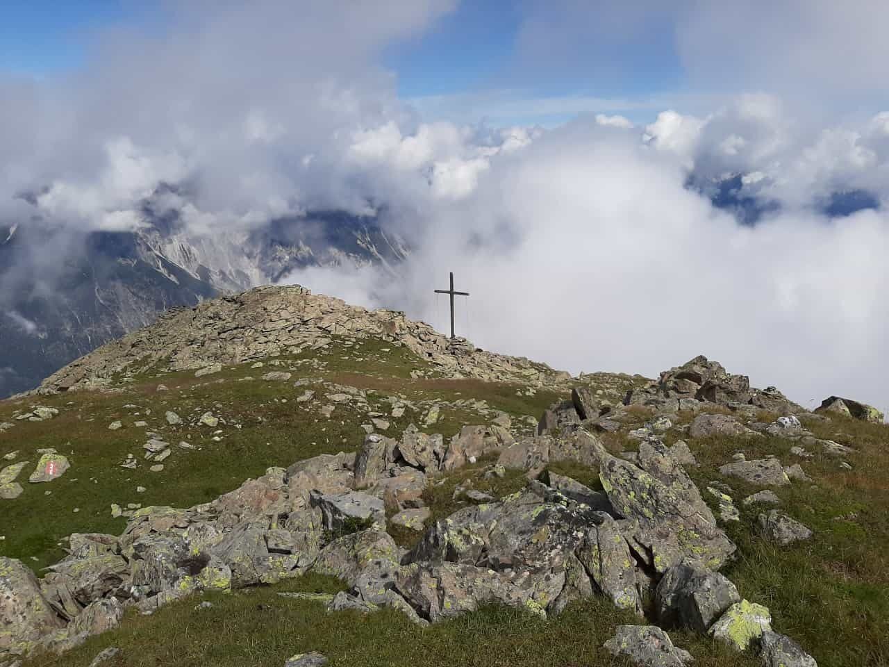
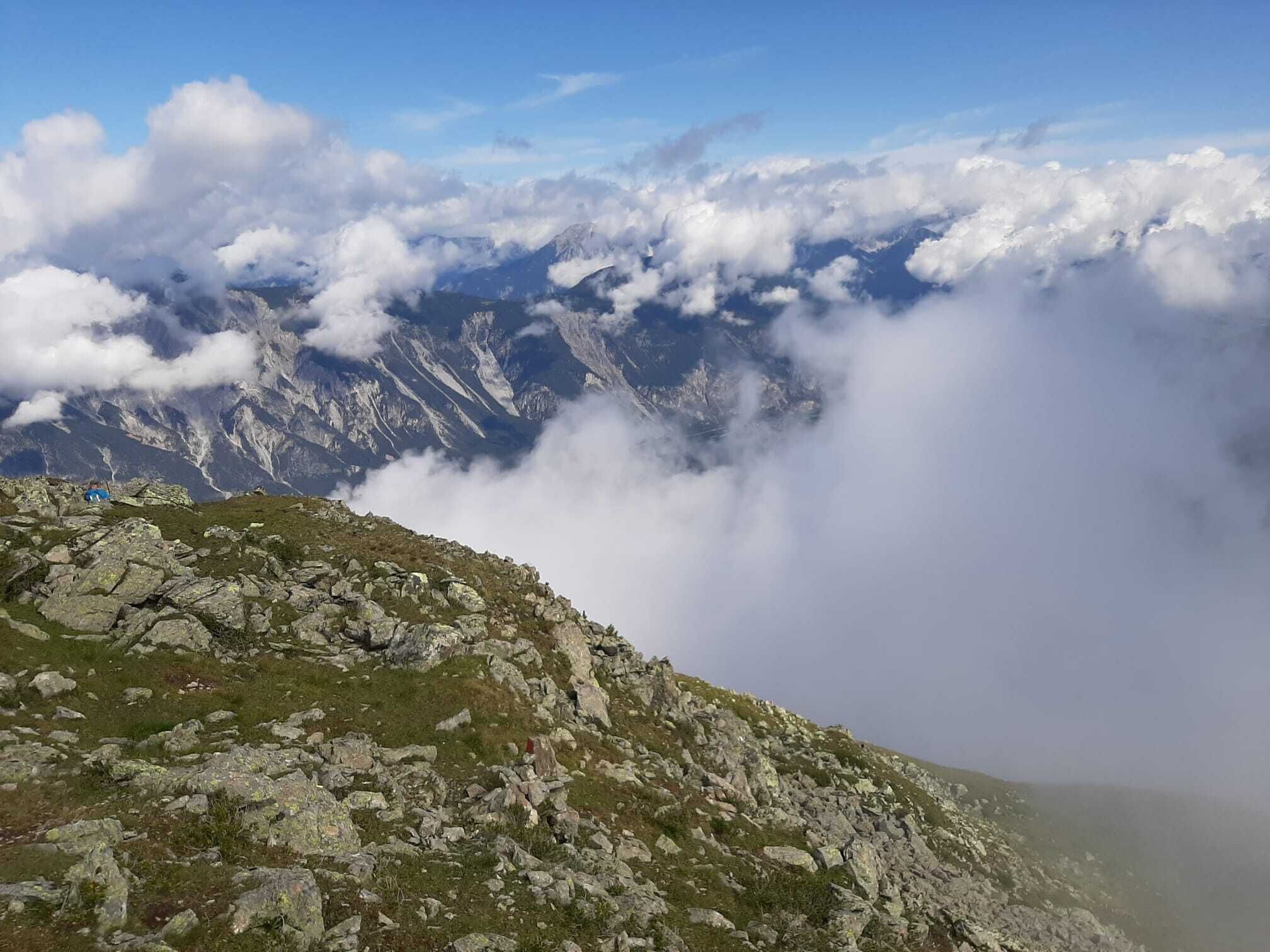
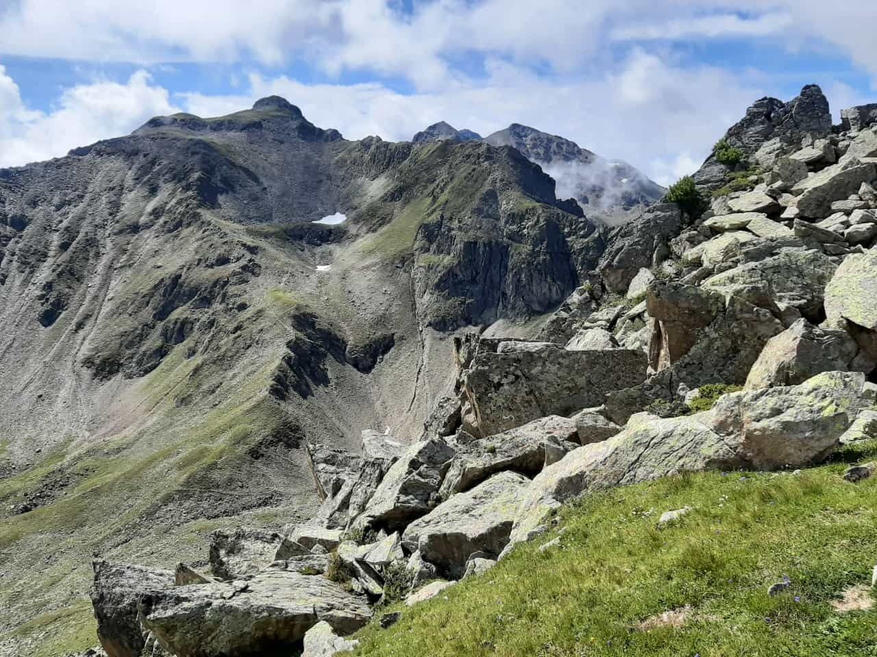
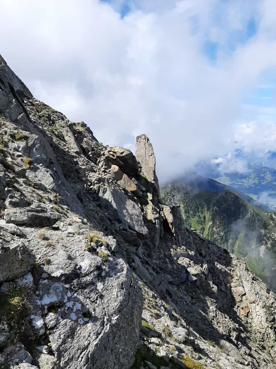
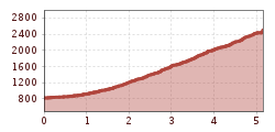
The starting point of this route is the district of Haderlehn above Sautens. From here, you walk moderately uphill through the forest via the Knappensteig, past the Opferstein and the cold holes to the forest road junction. At the turning area, continue up the steep forest path, cross the Bachfalle, and continue on to the Karalm at 2,122 m (not managed). The fountain at the hut is the last water source. From there, continue to the summit of the Bloße at 2,536 m. A wonderful view of the towns of Sautens, Oetz with Hochoetz, the middle Inn Valley, and Imst rewards the arduous ascent. The return follows the same path to the starting point – not a circular hike.


Nearby huts and mountain restaurants

Getting here

  • Arrival by public transport

    Travel comfortably and safely by train to the Ötztal station. The final stop or exit point is the ÖTZTAL station. Afterwards, you can travel conveniently and quickly with public transport or local taxis through the whole valley to your desired destination! The current bus timetable can be found at: http://fahrplan.vvt.at

  • Parking

    The following parking options are available in Sautens:

    • directly in front of the town hall - free of charge
    • right after the large bridge (turnoff from B186) on the large gravel parking lot - free of charge
    • at the sports field/cross chapel/Kalkofen adventure facility - free of charge
    • in front of the primary school/kindergarten, 3-Kirchblickweg – free of charge

More tours in the surrounding area

Newsletter

The mountain is calling? So does our newsletter!

In our monthly newsletter we reveal the best holiday tips for Tyrol.