Mountain hikes Sunnseithütte Round Tour

closed
Difficulty ratings: medium
Route length: 4.9 km
Duration: 1:35 h

Leisurely hike to the Sunnseit hut - return via the quiet toboggan run route.

Tour information

  • Requirement: medium
  • Length: 4.9 km
  • Duration: 1:35 h
  • Elevation uphill:250 hm
  • Elevation downhill:250 hm
Highest point906 m

Starting point

Tourist information Hopfgarten, 610m

Finishing point

Tourist information Hopfgarten, 610m
  • Fitness level 2 / 6
  • Technique 2 / 6

Features

  • Circular route

Best time of year

  • January
  • February
  • March
  • April
  • May
  • June
  • July
  • August
  • September
  • October
  • November
  • December

Trail condition

Asphalt, forest trail

Equipment

Outdoor clothing, sturdy shoes
Sufficient food and drink
First aid kit
Mobile phone with full battery & charger Hiking map & guide literature possibly GPS device or GPS data to be loaded onto the mobile phone
Sun protection (sunglasses, sun cream & cap)
Rain protection
Cash
Source: Kitzbüheler Alpen Management GmbH

Description

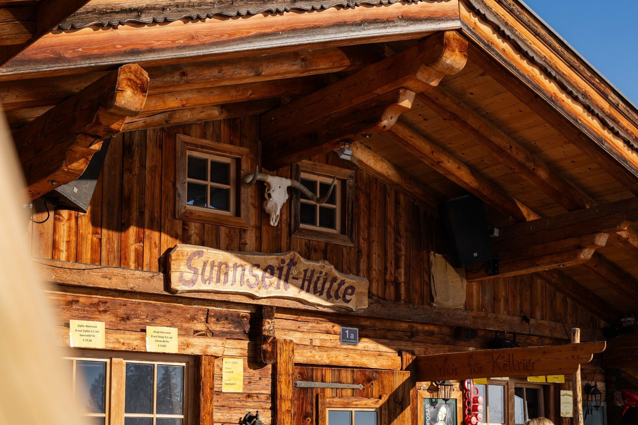
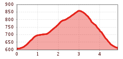
The starting point of this hike is the information office in Hopfgarten. From there you hike in the direction of the Salvenbahn valley station. Shortly before the valley station, turn right and follow trail no. 65 to the Sunnseit hut. 

From the Sunnseit hut you take the same way back. After a few meters you will find the entrance to the toboggan run on the right side. There you follow the signs 65a back to the starting point.

Nearby huts and mountain restaurants

  • Sunnseit Hütte

    Opening hours:Open today
    Place: Hopfgarten im Brixental
    : Restaurant, Alpine pasture / hut / mountain restaurant

Getting here

  • Arrival by public transport

    bus: Hopfgarten Berglift
    train: Hopfgarten Berglift

    Guest card of the region = train ticket from Kirchbichl to Hochfilzen + bus ticket from Mariastein to Kitzbühel included

    More detailed information: www.hohe-salve.com/mobility


  • Parking

    Free parking at the P3 Wasserfeld car park
    Lift parking - free of charge when using the gondola

More tours in the surrounding area

  • Lechtaler Höhenweg

    Difficulty: difficult
    Length: 84.5 km Duration: 45:00 h Elevation uphill: 6,773 m
  • Bärenkopf

    Difficulty: medium
    Length: 16.3 km Duration: 6:15 h Elevation uphill: 1,065 m
  • Guffert

    Difficulty: difficult
    Length: 10.3 km Duration: 6:30 h Elevation uphill: 1,195 m
  • Pertisau - Falzthurnalm - Gramai Alm - Pertisau

    Difficulty: easy
    Length: 14.1 km Duration: 4:30 h Elevation uphill: 280 m
  • Steinberg - Panoramarunde

    Difficulty: easy
    Length: 6.1 km Duration: 2:00 h Elevation uphill: 200 m
  • Bärenwald circuit

    Difficulty: easy
    Length: 4.8 km Duration: 1:30 h Elevation uphill: 180 m
  • Carnic altitude trail

    Difficulty: medium
    Length: 150.0 km Duration: 26:50 h Elevation uphill: 9,100 m
  • Dalfazer Falls

    Difficulty: medium
    Length: 9.2 km Duration: 4:00 h Elevation uphill: 760 m
  • Rosengartenschlucht

    Opening hours: closed
    Difficulty: easy
    Length: 4.4 km Duration: 2:30 h Elevation uphill: 282 m
  • Arzl - Benni-Raich-Bridge - Wald

    Difficulty: easy
    Length: 1.8 km Duration: 0:40 h Elevation uphill: 120 m
  • Breitegg tour

    Difficulty: medium
    Length: 11.0 km Duration: 5:00 h Elevation uphill: 680 m
Newsletter

The mountain is calling? So does our newsletter!

In our monthly newsletter we reveal the best holiday tips for Tyrol.