
Multi-day hikes Two day tour - Höhenweg Zahmer Kaiser - day 2

open
Kirchdorf in Tirol / Kaiser Mountains
Difficulty ratings: medium
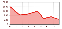
Route length: 12.3 km
Duration: 6:51 h

Two day tour - Höhenweg Zahmer Kaiser - day 2

Tour information

  • Requirement: medium
  • Length: 12.3 km
  • Duration: 6:51 h
  • Elevation uphill:546 hm
  • Elevation downhill:1,644 hm
Highest point1,578 m

Starting point

Ebbs

Finishing point

Ebbs
  • Fitness level 4 / 6
  • Technique 5 / 6

Features

  • Circular route

Best time of year

  • January
  • February
  • March
  • April
  • May
  • June
  • July
  • August
  • September
  • October
  • November
  • December

Trail condition

270 steps, forest path, steep path

Equipment

Outdoor clothing appropriate to the weather (good footwear, rain protection, breathable clothing...) Snacks (e.g. fruit, muesli bars, wholemeal breads) and drinks (allow for sufficient liquid) First aid equipment Mobile phone with full battery Hiking map and guide literature Sun protection (sunscreen and glasses, cap) Bivouac bag
Source: TVB Kufsteinerland

Description


Day 2: Stripsenjochhaus - Ebbs
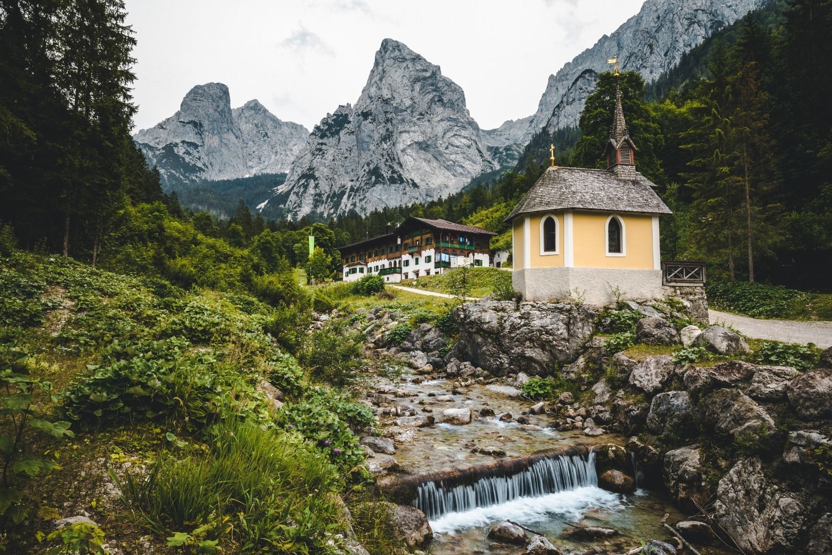
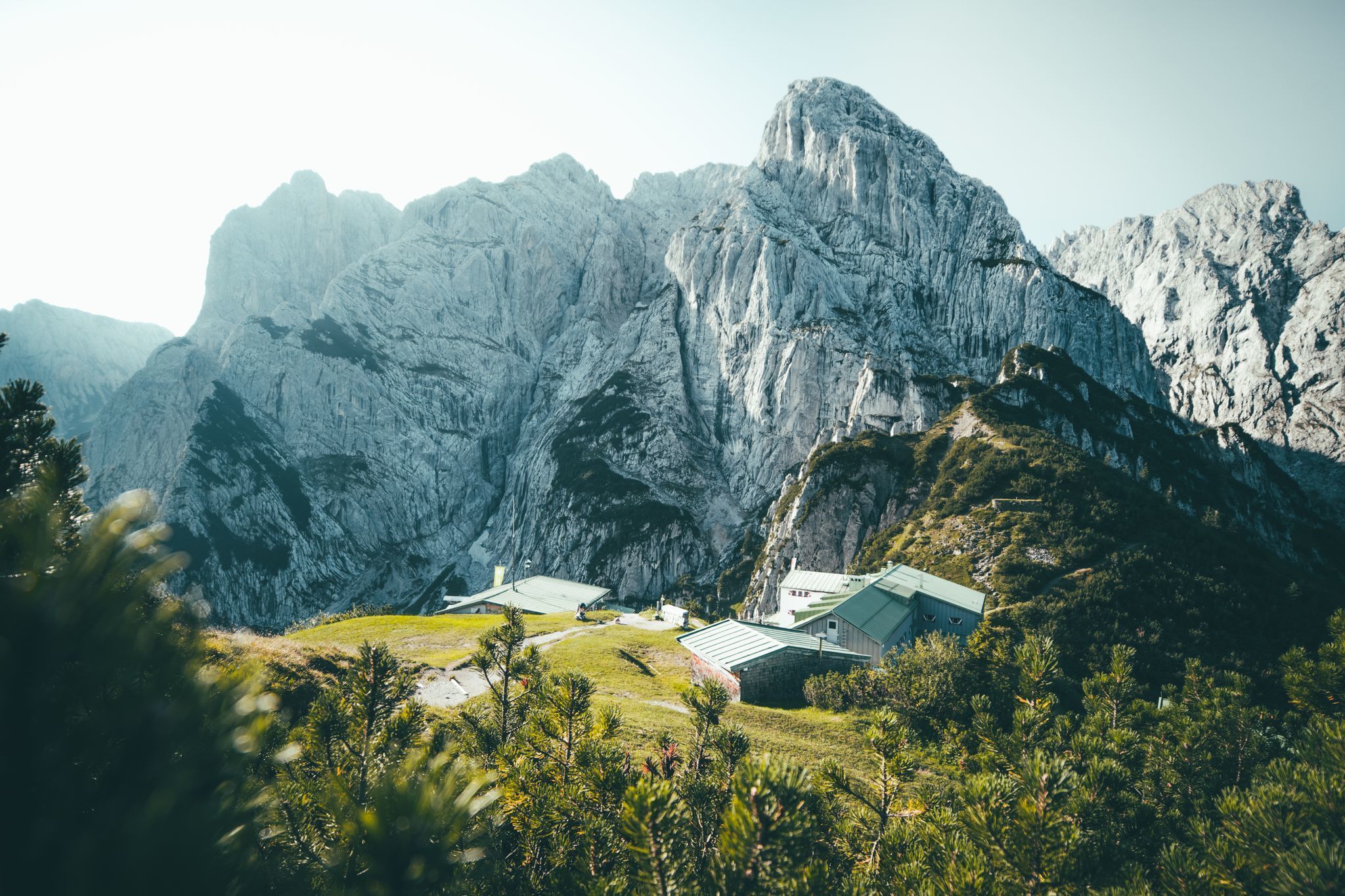
From the Stripsenjochhaus you follow a narrow path to Hans-Berger-Haus. Both of the huts invite you to stop by and have a bite to eat or to stay overnight (for those who want to split the tour on two days).
Further in the direction of Hinterbärenbad and at Hinterbärenbad-Anton Karg Haus you take the path to your right leading uphill. Follow the path until you arrive at the Ritzau Alm (1159m), where you can have a snack and regain power for the descent. Further along a steep path, which is secured with a wire rope (sure-footed, not scared of heights) and following the forest path back to the starting point. (Option: Descent past Vorderkaiserfeldenhütte and approach).
 

Nearby huts and mountain restaurants

  • Ritzau Alm

    Opening hours:Open today
    Place:Ebbs
    :Alpine pasture / hut / mountain restaurant
  • Hans Berger house

    Opening hours:Open today
    Place:Ebbs
    :Alpine pasture / hut / mountain restaurant

Getting here

  • Arrival by public transport

    From Kufstein, take bus line 4030 in the direction of Ebbs and get off at the Ebbs Schulzentrum stop.
    With the KufsteinerlandCard within the region bus free of charge.

  • Parking

    Community office or church square, free of charge.

Weather

Today

moderate rain
19°C/11°C
90%19.9l5 km/h

Thu

light rain
17°C/10°C
70%6.4l5 km/h

Fri

light rain showers
17°C/9°C
75%2l5 km/h
Go to weather forecast

More tours in the surrounding area

  • Angerer Alm

    Difficulty:medium
    Length:5.7 kmDuration:2:45 hElevation uphill:652 m
  • Kleine Salve & Hohe Salve summit tour

    Difficulty:medium
    Length:7.4 kmDuration:2:45 hElevation uphill:350 m
  • 1st stage KAT Walk Family

    Difficulty:medium
    Length:10.0 kmDuration:5:30 hElevation uphill:700 m
  • 3rd stage KAT Walk Family

    Difficulty:medium
    Length:21.0 kmDuration:8:00 hElevation uphill:1,250 m
  • 2nd stage KAT Walk Family

    Difficulty:medium
    Length:13.5 kmDuration:7:00 hElevation uphill:961 m
  • The Wiegalm

    Difficulty:medium
    Length:10.5 kmDuration:4:45 hElevation uphill:680 m
  • Koasa Trail Stage 2

    Difficulty:medium
    Length:11.8 kmDuration:7:15 hElevation uphill:1,078 m
  • Eifersbacher Wasserfall

    Difficulty:medium
    Length:5.9 kmDuration:2:30 hElevation uphill:241 m
  • Bichlachrunde

    Difficulty:easy
    Length:10.5 kmDuration:3:30 hElevation uphill:295 m
  • Kaiserbachtal - Feldberg - Stripsenjoch

    Difficulty:medium
    Length:21.0 kmDuration:9:00 hElevation uphill:1,170 m
  • KAT Walk Alpine stage 6

    Difficulty:medium
    Length:19.0 kmDuration:7:30 hElevation uphill:1,000 m
  • KAT WALK ALPINE

    Difficulty:medium
    Length:113.0 kmDuration:45:00 hElevation uphill:6,300 m
  • 2nd stage KAT Walk Alpine

    Difficulty:medium
    Length:18.0 kmDuration:8:00 hElevation uphill:1,140 m
  • 1st stage KAT Walk Alpine

    Difficulty:medium
    Length:20.0 kmDuration:6:00 hElevation uphill:800 m
  • Brechhorn

    Difficulty:medium
    Length:11.8 kmDuration:5:00 hElevation uphill:600 m
  • Möslalmkogel via Wörgl

    Difficulty:medium
    Length:10.3 kmDuration:3:30 hElevation uphill:580 m
  • Schafsiedel

    Difficulty:medium
    Length:15.6 kmDuration:7:00 hElevation uphill:1,280 m
Newsletter

The mountain is calling? So does our newsletter!

In our monthly newsletter we reveal the best holiday tips for Tyrol.
