viewpoint Lutzen Öfele

Ried im Oberinntal / Ötztal Alps
Difficulty ratings: easy
Route length: 5.8 km
Duration: 2:00 h

The vantage point Lutzen Öfele offers a magnificent view of Ried and its surroundings.

Tour information

  • Requirement: easy
  • Length: 5.8 km
  • Duration: 2:00 h
  • Elevation uphill:185 hm
  • Elevation downhill:183 hm
Highest point1,065 m

Starting point

Infobüro TVB | Ried im Oberinntal

Finishing point

Infobüro TVB | Ried im Oberinntal
  • Fitness level 1 / 6
  • Technique 1 / 6

Best time of year

  • January
  • February
  • March
  • April
  • May
  • June
  • July
  • August
  • September
  • October
  • November
  • December

Trail condition

Trail, Forest road, asphalt

Equipment

We recommend equipment suitable for the tour and weather conditions, including sturdy shoes, weatherproof clothing, food, and appropriate maps.
Source: TVB Tiroler Oberland

Description

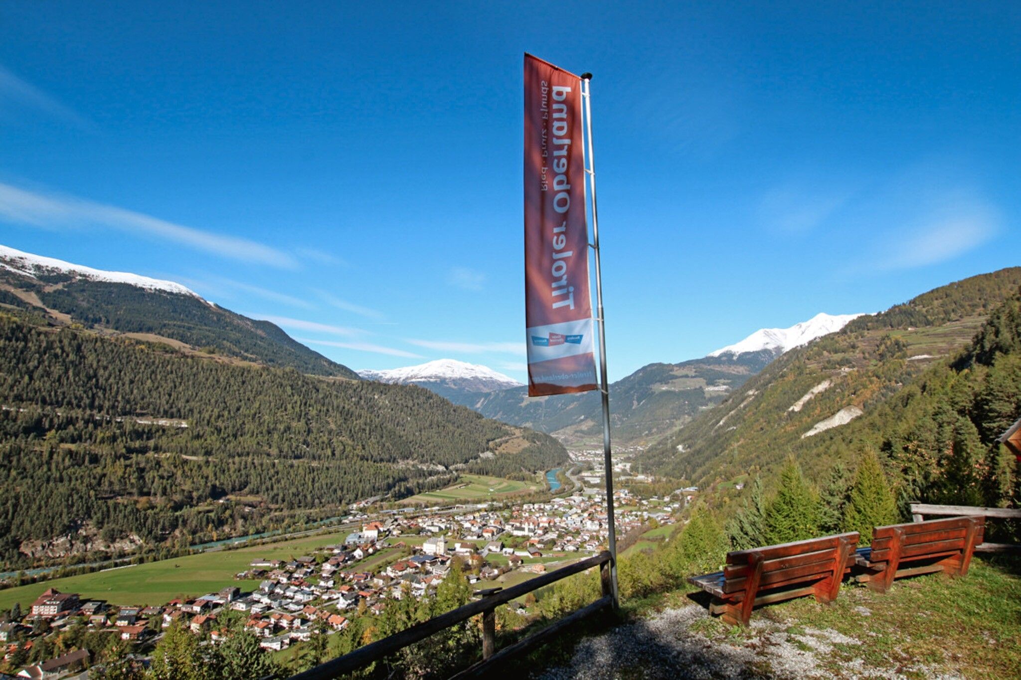
The trail starts at the Ried information office and follows the village road in the direction of Tösens to the southern edge of Ried. There the path branches off to the left into the long meadow and leads over a relaxing footpath, past meadows and along the edge of the forest. After approx. 100 metres a forest path (sharp left) leads to the Lutzen Öfele lookout point - same way back.

Getting here

  • Arrival by public transport

    Line 210, 220, Bus stop: Ried i. O. Gemeindeamt, walking distance to the tourist information office: 200 m

  • Parking

    Parking area at the lake, free of charge

More tours in the surrounding area

Newsletter

The mountain is calling? So does our newsletter!

In our monthly newsletter we reveal the best holiday tips for Tyrol.