Mountain hikes Walk "Sonnenseite Klaunzerberg"

Matrei in Osttirol / Granatspitzgruppe
Difficulty ratings: easy
Route length: 7.5 km
Duration: 3:00 h

Panorama walk high above Matrei in Osttirol
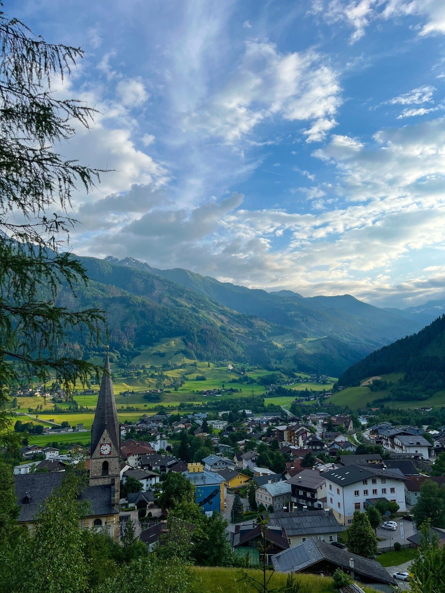
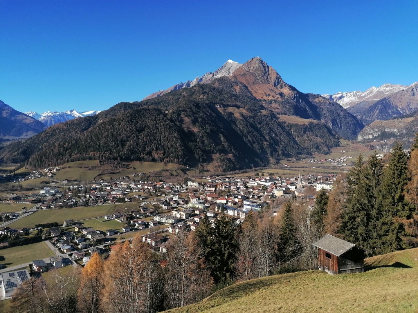
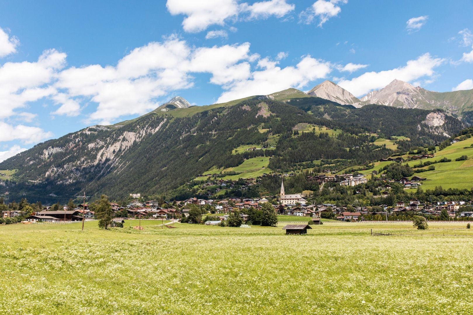
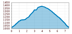
Tour information

  • Requirement: easy
  • Length: 7.5 km
  • Duration: 3:00 h
  • Elevation uphill:400 hm
  • Elevation downhill:400 hm
Highest point1,400 m

Starting point

Parkplatz Goldriedstraße

Finishing point

Parkplatz Goldriedstraße
  • Fitness level 3 / 6
  • Technique 1 / 6

Features

  • Circular route
  • Suitable for families

Best time of year

  • January
  • February
  • March
  • April
  • May
  • June
  • July
  • August
  • September
  • October
  • November
  • December
Source: Nationalparkregion Hohe Tauern Osttirol

Description

From the parking place Goldriedstraße, the trail first passes the Muh-Bar, the PanoramA-Bar and the Hotel Goldried. Between the hotel complex, a forest path leads up to the hill Klaunzbühel and the chapel Klaunzkapelle. The Klaunzkapelle or Klaunz Kirchle was built in the 18th century and consecrated in honour of the Mother of God. Then walk along the road leading away to the right until reaching the house Klaunz nr. 27, where you turn left and follow the path to the next junction. At this junction, keep left and follow the street Innerer Klaunzerberg for a while. In front of the farmhouse "Kölln", a forest path branches off, which subsequently leads to the street Äußere Klaunzer Güterweg. Take this path, past the farmhouse Huberhof, back to the starting point.

More tours in the surrounding area

  • Rotenkogel

    Difficulty: difficult
    Length: 3.9 km Duration: 3:00 h Elevation uphill: 383 m
  • Lasörling 3.098m

    Difficulty: difficult
    Length: 21.9 km Duration: 12:00 h Elevation uphill: 1,940 m
  • Hike to the Venedigerhaus Innergschlöß

    Difficulty: easy
    Length: 8.5 km Duration: 2:30 h Elevation uphill: 180 m
  • Hiking tour to Lasörlinghütte 2.350m

    Difficulty: medium
    Length: 14.6 km Duration: 7:10 h Elevation uphill: 1,080 m
  • Hike to Kalser Tauernhaus

    Difficulty: medium
    Length: 12.2 km Duration: 4:00 h Elevation uphill: 244 m
  • Badener Hütte

    Difficulty: difficult
    Length: 23.2 km Duration: 11:30 h Elevation uphill: 1,750 m
  • Venediger altitude trail

    Difficulty: difficult
    Length: 55.5 km Duration: 27:00 h Elevation uphill: 3,915 m
  • Lasörling altitude trail

    Difficulty: medium
    Length: 57.0 km Duration: 25:00 h Elevation uphill: 3,740 m
  • Figerhorn

    Difficulty: difficult
    Length: 6.5 km Duration: 6:00 h Elevation uphill: 807 m
  • Umbal waterfalls nature force trail

    Difficulty: easy
    Length: 5.8 km Duration: 2:30 h Elevation uphill: 250 m
  • Muhs panorama trail

    Difficulty: medium
    Length: 15.2 km Duration: 6:00 h Elevation uphill: 1,090 m
  • Hike to Neuen Reichenberger Hütte

    Difficulty: medium
    Length: 9.1 km Duration: 9:00 h Elevation uphill: 1,210 m
  • Hiking tour to Neue Sajathütte 2.600m

    Difficulty: medium
    Length: 10.3 km Duration: 6:50 h Elevation uphill: 1,080 m
  • Lucknerhaus - Stüdlhütte

    Difficulty: medium
    Length: 9.3 km Duration: 5:30 h Elevation uphill: 862 m
  • Böses Weibl

    Difficulty: difficult
    Length: 14.1 km Duration: 8:00 h Elevation uphill: 1,193 m
Newsletter

The mountain is calling? So does our newsletter!

In our monthly newsletter we reveal the best holiday tips for Tyrol.