Mountain hikes Westendorf past Hopfgarten

Difficulty ratings: easy
Route length: 13.7 km
Duration: 3:15 h

Westendorf past Hopfgarten

Tour information

  • Requirement: easy
  • Length: 13.7 km
  • Duration: 3:15 h
  • Elevation uphill:260 hm
  • Elevation downhill:260 hm
Highest point784 m

Starting point

Hopfgarten tourist information

Finishing point

Westendorf centre
  • Fitness level 2 / 6
  • Technique 2 / 6

Features

  • Circular route
  • Suitable for families
  • suitable for pushchairs

Best time of year

  • January
  • February
  • March
  • April
  • May
  • June
  • July
  • August
  • September
  • October
  • November
  • December

Trail condition

Asphalt, footpath

Equipment

outdoor clothing Sturdy shoes 

Description

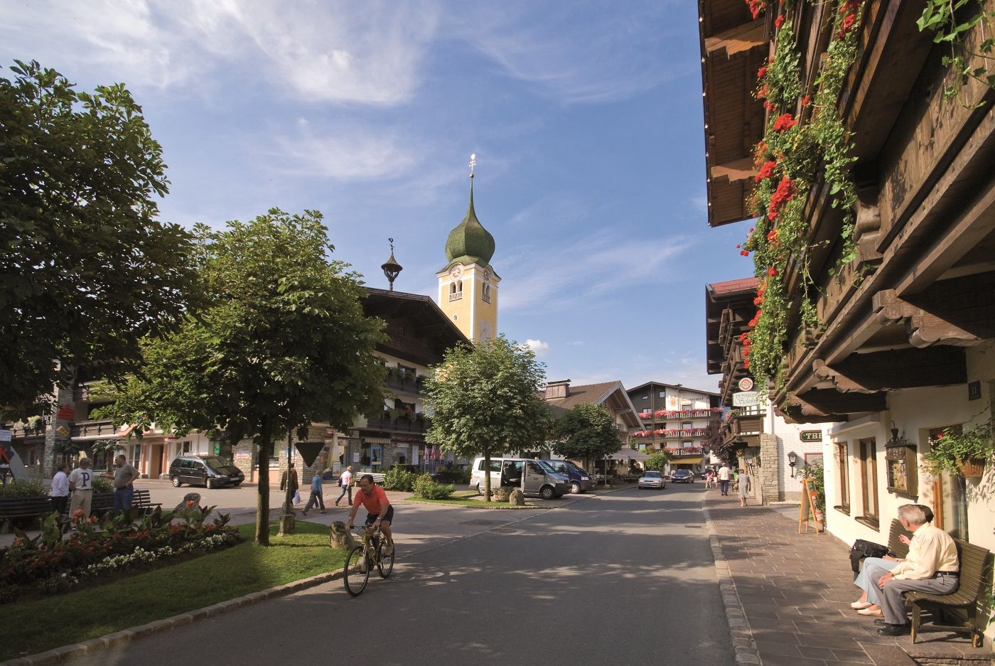
The starting point of this hike is the information office in Hopfgarten. From there you hike in the direction of the Salvenbahn valley station. Shortly before the valley station, turn right and follow trail no. 2 to Westendorf.
From the center of Westendorf you now follow the road to Straßhäusl and on to the district of Feichten. Once you reach the end of the settlement, cross the main road and continue hiking back to Hopfgarten (no.2).
Alternatively, you can take public transport from Westendorf back to Hopfgarten.

Getting here

  • Arrival by public transport

    bus: Hopfgarten Berglift
    train: Hopfgarten Berglift

    Guest card = travel ticket - bus & train included! 
    Online timetables:

    www.vvt.at
    www.oebb.at

  • Parking

    Gondola lift car park: free with valid lift ticket
    Free parking at the P3 Wasserfeld car park

More tours in the surrounding area

  • Wilder-Kaiser-Steig - Detour

    Difficulty: difficult
    Length: 33.0 km Duration: 16:49 h Elevation uphill: 2,311 m
  • 3-day Family Tour Alpbachtal

    Difficulty: easy
    Length: 18.3 km Duration: 7:00 h Elevation uphill: 998 m
  • Kundler Klamm

    Opening hours: closed
    Difficulty: easy
    Length: 6.4 km Duration: 2:00 h Elevation uphill: 116 m
  • 3-peak-tour Kienberg-Plessenberg-Heuberg

    Difficulty: medium
    Length: 8.6 km Duration: 4:30 h Elevation uphill: 779 m
  • Kaiser Gorge - loop trail

    Opening hours: closed
    Difficulty: easy
    Length: 4.2 km Duration: 1:00 h Elevation uphill: 198 m
  • Voldöpper Spitze Loop Hike

    Difficulty: medium
    Length: 12.9 km Duration: 5:00 h Elevation uphill: 988 m
  • Loop tour Juppi Zauberwald

    Difficulty: easy
    Length: 2.5 km Duration: 1:00 h Elevation uphill: 93 m
  • Farmkehralm 1.521 m

    Difficulty: medium
    Length: 9.3 km Duration: 3:30 h Elevation uphill: 506 m
  • Barrier-free path Lake Reintal

    Difficulty: easy
    Length: 6.5 km Duration: 1:45 h Elevation uphill: 15 m
  • Day 1: 4 days - 4 summits tour

    Difficulty: medium
    Length: 9.8 km Duration: 5:00 h Elevation uphill: 984 m
  • Day 3: 4 days - 4 summits tour

    Difficulty: medium
    Length: 19.3 km Duration: 8:00 h Elevation uphill: 1,371 m
  • Wiedersberger Horn Panorama Path

    Difficulty: easy
    Length: 4.1 km Duration: 1:30 h Elevation uphill: 195 m
  • 4 days - 4 summits tour

    Difficulty: medium
    Length: 54.4 km Duration: 23:00 h Elevation uphill: 3,408 m
  • Discovering the Tiefenbach Gorge Hike

    Opening hours: closed
    Difficulty: medium
    Length: 5.7 km Duration: 3:30 h Elevation uphill: 669 m
Newsletter

The mountain is calling? So does our newsletter!

In our monthly newsletter we reveal the best holiday tips for Tyrol.