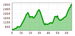
Open interactive mapOpen this POI on the interactive mapElevation profileDownloadSUT K68 NEU TEST.gpx
Wandern am Penken © Christian Lorenz Themed hike: Mayrhofen "PanoramaRundWeg" at Mount PenkenDifficulty:easyLength:4.4 kmDuration:1:45 hElevation uphill:195 mSee trailSee trail: Themed hike: Mayrhofen "PanoramaRundWeg" at Mount Penken
Benni-Raich-Brücke_0518_001.jpg © TVB Pitztal/Chris Walch Arzl - Benni-Raich-Bridge - WaldDifficulty:easyLength:1.8 kmDuration:0:40 hElevation uphill:120 mSee trailSee trail: Arzl - Benni-Raich-Bridge - Wald
Going_Ausblick vom Baumgartenköpfl_Wilder Kaiser © TVB Wilder Kaiser/Thomas Hennerbichler Tauernblick panorama circular hiking routeDifficulty:mediumLength:13.6 kmDuration:6:00 hElevation uphill:980 mSee trailSee trail: Tauernblick panorama circular hiking route
©-TVB-Tiroler-Oberland-Kaunertal-Die-West-Barrierefrei-Langlaufen-1 (3).jpg © Die West GmbH Adaptive cross country skiing circuit Anger at Kaunertal ValleyOpening hours:closedDifficulty:easyLength:1.0 kmElevation uphill:5 m:Style: Skating, ClassicGo to Cross-country skiing trailGo to Cross-country skiing trail: Adaptive cross country skiing circuit Anger at Kaunertal Valley
Winterwandern in der Naturparkregion Reutte © Peter Neusser Hike to the Ehrenberg castle ruinsDifficulty:mediumLength:5.1 kmDuration:1:45 hElevation uphill:237 mGo to winter hikeGo to winter hike: Hike to the Ehrenberg castle ruins
Langlaufloipe © Dominik Somweber, Naturparkregion Reutte Höfener Wiesen circuitOpening hours:closedDifficulty:easyLength:2.2 kmDuration:0:45 hElevation uphill:33 m:Style: Skating, ClassicGo to Cross-country skiing trailGo to Cross-country skiing trail: Höfener Wiesen circuit
Aussicht vom Panormaweg © Tim Salow Winter walk at Hüttegg am WeerbergDifficulty:easyLength:8.0 kmDuration:2:50 hElevation uphill:315 mSee trailSee trail: Winter walk at Hüttegg am Weerberg
Innsbruck to KühtaiDifficulty:difficultLength:110.0 kmDuration:4:30 hElevation uphill:1,600 mGo to biketourGo to biketour: Innsbruck to Kühtai
Vilser Alm im Winter © Robert Eder Winter walk to the Vilser Alm hutDifficulty:mediumLength:6.6 kmDuration:2:30 hElevation uphill:348 mGo to winter hikeGo to winter hike: Winter walk to the Vilser Alm hut
The Arzler Alm Trail (5007)Difficulty:mediumLength:3.8 kmDuration:0:15 hGo to biketourGo to biketour: The Arzler Alm Trail (5007)
Hike to the Small AhornbodenDifficulty:mediumLength:26.8 kmDuration:10:40 hElevation uphill:1,395 mSee trailSee trail: Hike to the Small Ahornboden
The Hungerburg Trail (596)Difficulty:difficultLength:550 mDuration:0:15 hGo to biketourGo to biketour: The Hungerburg Trail (596)
Breitegg tourDifficulty:mediumLength:11.0 kmDuration:5:00 hElevation uphill:680 mSee trailSee trail: Breitegg tour
Kaiserlift Tour tip 1: Berghaus Aschenbrenner und Duxer AlmDifficulty:easyLength:4.9 kmElevation uphill:35 mSee trailSee trail: Kaiserlift Tour tip 1: Berghaus Aschenbrenner und Duxer Alm
©-TVB-Tiroler-Oberland-Kaunertal-Daniel-Zangerl-2016-Gepatschhaus-(3).jpg © Daniel Zangerl Rolli-Wanderung GepatschhausLength:8.5 kmDuration:1:45 hElevation uphill:156 mSee trailSee trail: Rolli-Wanderung Gepatschhaus
©-TVB-Tiroler-Oberland-Kaunertal-Daniel-Zangerl-Falkaunsalm-2016-(6).jpg © Daniel Zangerl Rolli-Wanderung FalkaunsalmDifficulty:mediumLength:4.5 kmDuration:1:45 hElevation uphill:392 mSee trailSee trail: Rolli-Wanderung Falkaunsalm
©-TVB-Tiroler-Oberland-Kaunertal-Daniel-Zangerl-Piller-Moor-Familie-2014-(28).jpg © Daniel Zangerl Rolli-Wanderung Piller MoorDifficulty:easyLength:2.0 kmSee trailSee trail: Rolli-Wanderung Piller Moor
The Chainless OneDifficulty:easyLength:7.6 kmDuration:0:10 hGo to biketourGo to biketour: The Chainless One
Pfad zur Dürrenberg Alm © Rene Paulweber Koflerjoch summit hikeDifficulty:difficultLength:9.3 kmDuration:4:45 hElevation uphill:933 mSee trailSee trail: Koflerjoch summit hike
The First OneDifficulty:mediumLength:2.4 kmDuration:0:15 hGo to biketourGo to biketour: The First One
©-TVB-Tiroler-Oberland-Kaunertal-Michaela-Gasser-Mark-Handbikebattle-2017-8863.jpg © Michaela Gasser-Mark Handbike Route Kaunertaler GletscherDifficulty:difficultLength:27.5 kmDuration:4:00 hElevation uphill:1,500 mGo to biketourGo to biketour: Handbike Route Kaunertaler Gletscher
The Rough OneDifficulty:difficultLength:2.0 kmDuration:0:10 hGo to biketourGo to biketour: The Rough One
Ehenbichler Alm © Robert Eder, Naturparkregion Reutte Winter walk to the Ehenbichler Alm hutDifficulty:difficultLength:6.5 kmDuration:4:00 hElevation uphill:640 mGo to winter hikeGo to winter hike: Winter walk to the Ehenbichler Alm hut
Frauenseestube aerial view © Robert Eder Winter Hike to Lake Frauensee from LechaschauDifficulty:easyLength:7.2 kmDuration:2:30 hElevation uphill:122 mGo to winter hikeGo to winter hike: Winter Hike to Lake Frauensee from Lechaschau
Wanderung zur Binsalm © ichmachefotos.com Uo to the die Binsalm Alp in the KarwendelDifficulty:easyLength:6.2 kmDuration:2:15 hElevation uphill:289 mSee trailSee trail: Uo to the die Binsalm Alp in the Karwendel
Give feedback for a chance to win a special holiday experience!Click here for the surveyClick here for the survey


.jpg")


")

.jpg")
")
.jpg")
.jpg")
.jpg")


