Mountain hikes Adlerweg Stage 06: Pinegg – Steinberg am Rofan

Brandenberg / Brandenberger Alpen (Rofan)
Difficulty ratings: medium
Route length: 17.9 km
Duration: 7:00 h

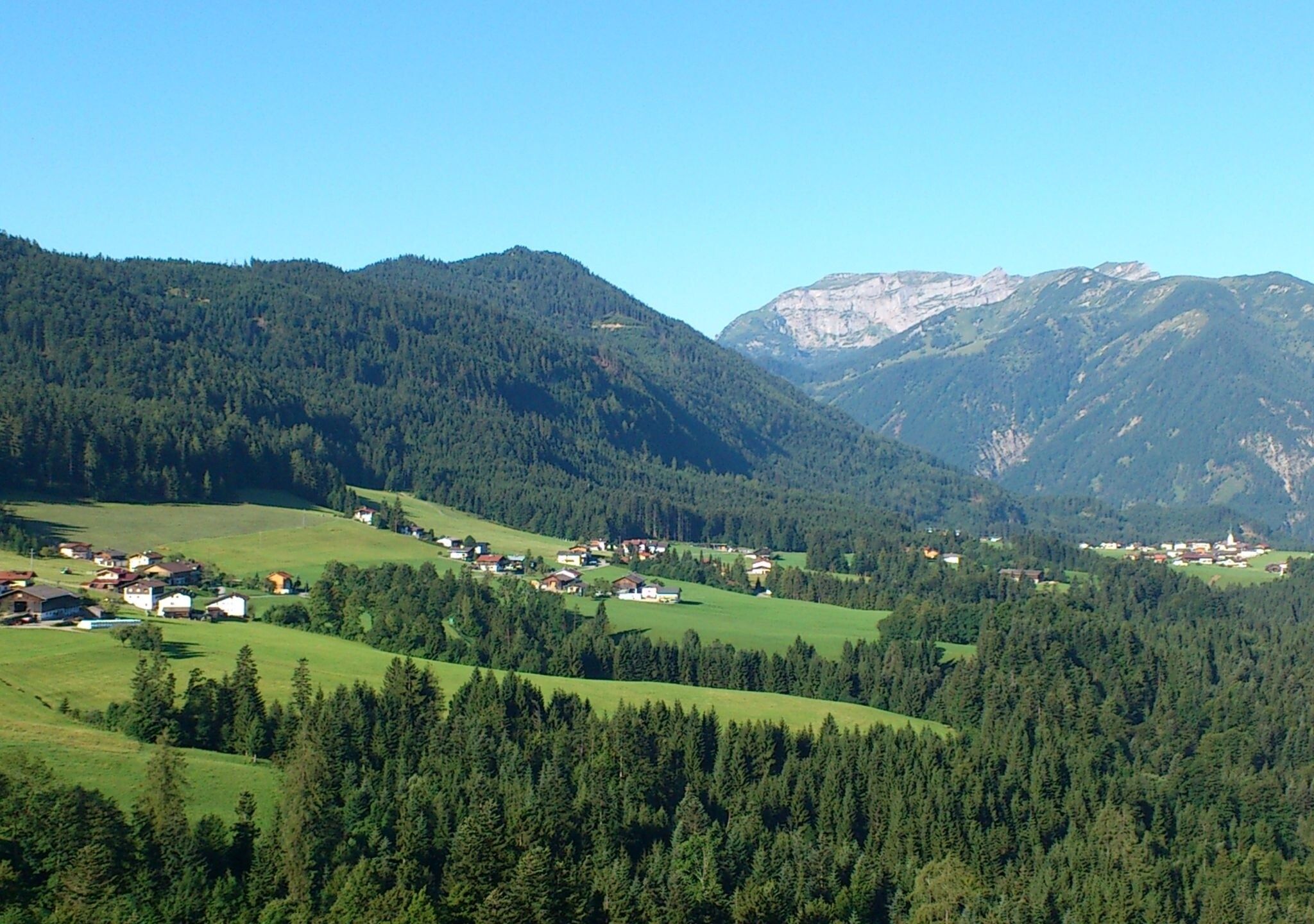
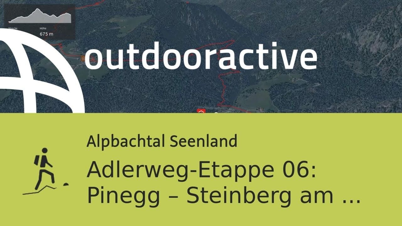
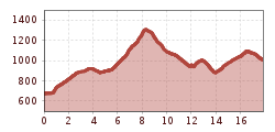
Relaxed yet rewarding is the easy hike on this Adlerweg stage from Gasthof Gwercherwirt to Gasthof Waldhäusl in Steinberg am Rofan.

Tour information

  • Requirement: medium
  • Length: 17.9 km
  • Duration: 7:00 h
  • Elevation uphill:1,007 hm
  • Elevation downhill:683 hm
Highest point1,323 m

Starting point

Gasthof Gwercherwirt, Pinegg

Finishing point

Gasthof Waldhäusl, Steinberg
  • Fitness level 3 / 6

Best time of year

  • January
  • February
  • March
  • April
  • May
  • June
  • July
  • August
  • September
  • October
  • November
  • December

Equipment

You always have to expect oncoming traffic on the forest roads!

Hiking boots and weatherproof clothing, as well as sufficient provisions

Source: Alpbachtal

Description

In the high alpine mountain world, close under the sky, the Adlerweg runs from east to west through all of Tyrol. The route resembles the silhouette of an eagle soaring in the air with wings widely spread.

The Adlerweg extends over 33 stages across all of Tyrol. Along the route, a total of 413 kilometers and 31,000 meters of elevation gain must be mastered. The long-distance hiking trail is divided into two routes: 24 day stages run across the mountains of North Tyrol, the second route crosses the Glockner and Venediger groups in East Tyrol in nine day stages.

Those who take on the long-distance hiking adventure will be enthusiastic about the diversity of the Adlerweg. The course through various mountain ranges guarantees variety: those who want to discover the country with extensive hikes will be just as thrilled as experienced mountaineers and alpinists striving for summit successes. Alpine experience, surefootedness, and a head for heights are prerequisites on many stages.


Nearby huts and mountain restaurants

Getting here

  • Parking

    Gasthof Gwercher, Brandenberg/Pinegg

More tours in the surrounding area

  • Voldöpper Spitze Loop Hike

    Difficulty: medium
    Length: 12.9 km Duration: 5:00 h Elevation uphill: 988 m
  • Farmkehralm 1.521 m

    Difficulty: medium
    Length: 9.3 km Duration: 3:30 h Elevation uphill: 506 m
  • Wiedersberger Horn Panorama Path

    Difficulty: easy
    Length: 4.1 km Duration: 1:30 h Elevation uphill: 195 m
  • Barrier-free path Lake Reintal

    Difficulty: easy
    Length: 6.5 km Duration: 1:45 h Elevation uphill: 15 m
  • Discovering the Tiefenbach Gorge Hike

    Opening hours: closed
    Difficulty: medium
    Length: 5.7 km Duration: 3:30 h Elevation uphill: 669 m
  • 3-day Family Tour Alpbachtal

    Difficulty: easy
    Length: 18.3 km Duration: 7:00 h Elevation uphill: 998 m
  • Loop tour Juppi Zauberwald

    Difficulty: easy
    Length: 2.5 km Duration: 1:00 h Elevation uphill: 93 m
  • Kaiser Gorge - loop trail

    Opening hours: closed
    Difficulty: easy
    Length: 4.2 km Duration: 1:00 h Elevation uphill: 198 m
  • Kundler Klamm

    Opening hours: closed
    Difficulty: easy
    Length: 6.4 km Duration: 2:00 h Elevation uphill: 116 m
  • Day 3: 4 days - 4 summits tour

    Difficulty: medium
    Length: 19.3 km Duration: 8:00 h Elevation uphill: 1,371 m
  • 4 days - 4 summits tour

    Difficulty: medium
    Length: 54.4 km Duration: 23:00 h Elevation uphill: 3,408 m
  • Day 1: 4 days - 4 summits tour

    Difficulty: medium
    Length: 9.8 km Duration: 5:00 h Elevation uphill: 984 m
  • 3-peak-tour Kienberg-Plessenberg-Heuberg

    Difficulty: medium
    Length: 8.6 km Duration: 4:30 h Elevation uphill: 779 m
Newsletter

The mountain is calling? So does our newsletter!

In our monthly newsletter we reveal the best holiday tips for Tyrol.