Mountain hikes Circular hike suspension bridge Isel Canyon via "Hohe Bank"

Virgen in Osttirol / Venediger Group
Difficulty ratings: medium
Route length: 8.1 km
Duration: 2:50 h

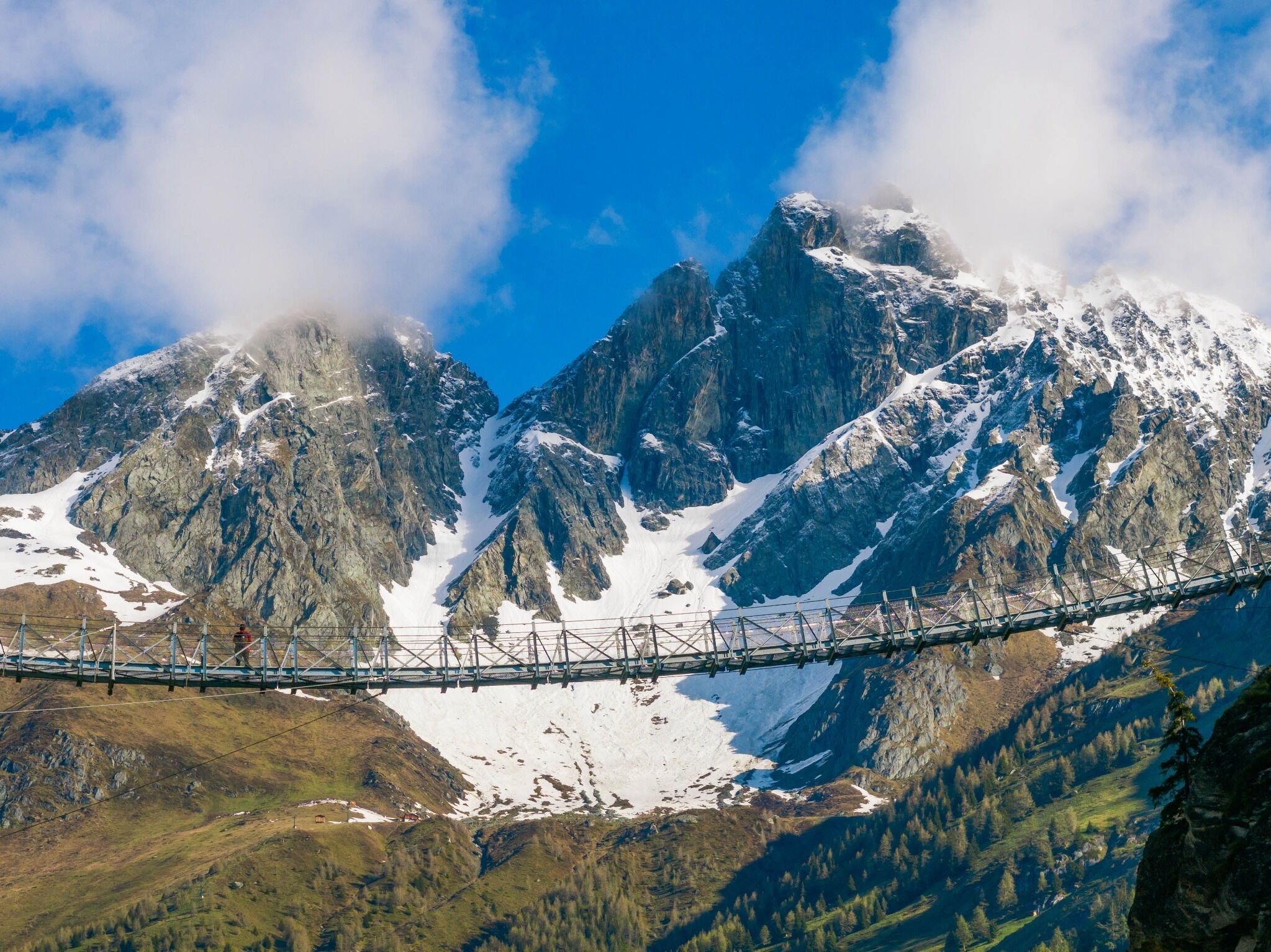
On this circular hike, you can look into the deep gorge of the Isel Gorge several times. Our favorite opportunities are the suspension bridge and the 25-meter-long viewing platform made of Corten steel.

Tour character

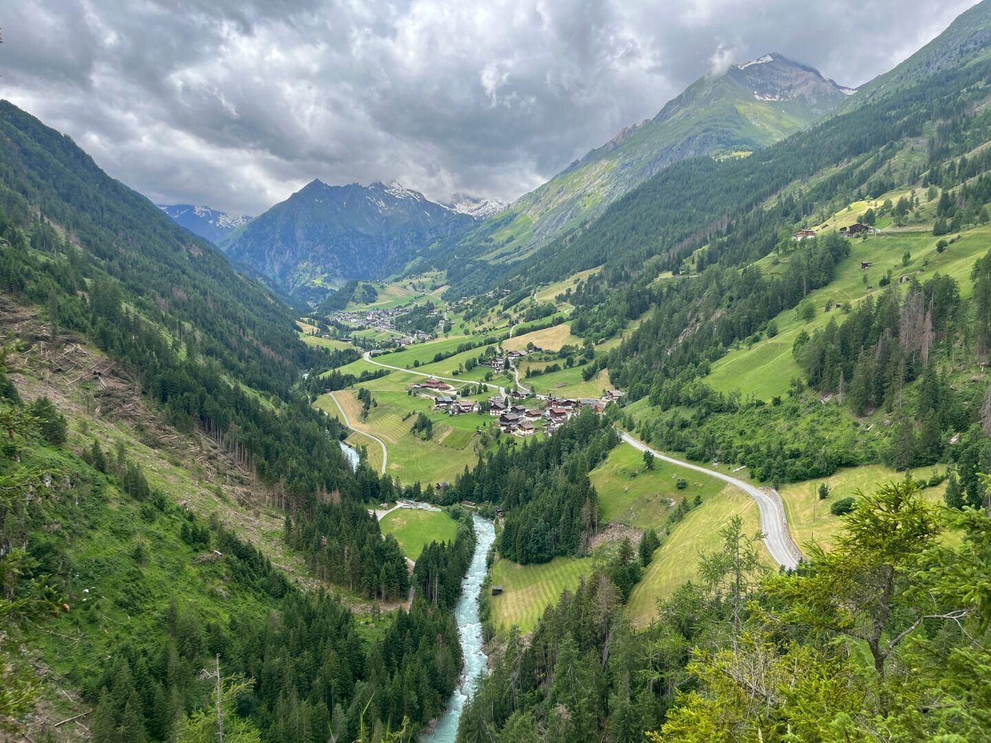
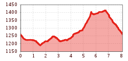
Varied and easy circular hike through the impressive Isel Gorge near Obermauern, over a suspension bridge and further along the Isel Trail to Bobojach. A highlight is the 25-metre-long viewing platform made of Corten steel with a spectacular view of the gorge. The way back is via the "Hohe Bank" back to Obermauern, where the pilgrimage church of Maria Schnee with its frescoes is well worth a visit.
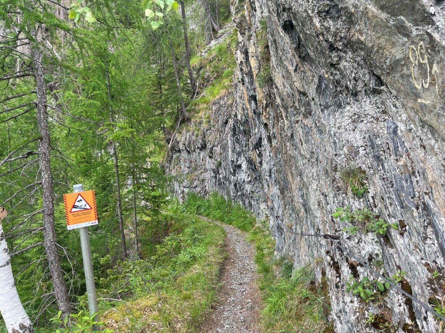
Tour information

  • Requirement: medium
  • Length: 8.1 km
  • Duration: 2:50 h
  • Elevation uphill:300 hm
  • Elevation downhill:300 hm
Highest point1,424 m

Starting point

Obermauern bus stop

Finishing point

Obermauern bus stop
  • Fitness level 3 / 6
  • Technique 3 / 6

Features

  • Circular route

Best time of year

  • January
  • February
  • March
  • April
  • May
  • June
  • July
  • August
  • September
  • October
  • November
  • December

Trail condition

Asphalt, gravel, path
Source: TVB Osttirol

Description

The starting point is the bus stop in Obermauern. From there, follow the signs via trail no. 46 to the suspension bridge. After crossing the suspension bridge, you hike along the Iseltrail - continuing through the Isel gorge - to Bobojach. Shortly before the Bobojach district, another highlight awaits hikers: a 25-metre-long viewing platform made of Corten steel with fascinating views of the roaring gorge. The way back is via the "Hohe Bank" (trail no. 31) to the district of Obermauern. The Maria Schnee pilgrimage church with its impressive frescoes can be visited free of charge throughout the day.

Weather

Sun

clear sky
21°C/6°C
0%0.2l5 km/h

Mon

clear sky
20°C/6°C
5%1.4l5 km/h

Tue

light rain
16°C/7°C
75%11.6l5 km/h
Go to weather forecast

More tours in the surrounding area

  • Figerhorn

    Difficulty:difficult
    Length:6.5 kmDuration:6:00 hElevation uphill:807 m
  • Lasörling altitude trail

    Difficulty:medium
    Length:57.0 kmDuration:25:00 hElevation uphill:3,740 m
  • Venediger altitude trail

    Difficulty:difficult
    Length:55.5 kmDuration:27:00 hElevation uphill:3,915 m
  • Theme path "Virgen crossroads"

    Difficulty:easy
    Length:3.2 kmDuration:1:00 hElevation uphill:104 m
  • Muhs panorama trail

    Difficulty:medium
    Length:15.2 kmDuration:6:00 hElevation uphill:1,090 m
  • Hiking tour to Lasörlinghütte 2.350m

    Difficulty:medium
    Length:14.6 kmDuration:7:50 hElevation uphill:1,135 m
  • Hiking tour to St. Pöltner Hütte and 3 lakes

    Difficulty:difficult
    Length:14.8 kmDuration:7:40 hElevation uphill:1,119 m
  • Hike to Neuen Reichenberger Hütte

    Difficulty:medium
    Length:18.2 kmDuration:9:00 hElevation uphill:1,252 m
  • Hike to Kalser Tauernhaus

    Difficulty:medium
    Length:12.2 kmDuration:4:00 hElevation uphill:244 m
  • Hiking tour to Neue Sajathütte 2.600m

    Difficulty:medium
    Length:10.3 kmDuration:6:50 hElevation uphill:1,086 m
  • Badener Hütte

    Difficulty:difficult
    Length:23.2 kmDuration:12:00 hElevation uphill:1,754 m
  • Hiking tour to Zupalsee Hütte 2.350m

    Difficulty:medium
    Length:14.9 kmDuration:8:30 hElevation uphill:1,261 m
  • Lucknerhaus - Stüdlhütte

    Difficulty:medium
    Length:9.3 kmDuration:4:30 hElevation uphill:862 m
  • Böses Weibl

    Difficulty:difficult
    Length:14.1 kmDuration:8:00 hElevation uphill:1,193 m
  • Circular walk church St. Nikolaus

    Difficulty:easy
    Length:5.4 kmDuration:1:39 hElevation uphill:150 m
  • Lasörling 3.098m

    Difficulty:difficult
    Length:22.0 kmDuration:12:00 hElevation uphill:1,940 m
  • Hike to the Venedigerhaus Innergschlöß

    Difficulty:easy
    Length:8.6 kmDuration:2:30 hElevation uphill:184 m
  • Rotenkogel

    Difficulty:difficult
    Length:3.9 kmDuration:3:00 hElevation uphill:383 m
  • Umbal waterfalls nature force trail

    Difficulty:easy
    Length:6.0 kmDuration:2:30 hElevation uphill:257 m
  • Glacier trail Innergschlöss/Schlatenkees

    Difficulty:medium
    Length:9.4 kmDuration:4:50 hElevation uphill:680 m
Newsletter

The mountain is calling? So does our newsletter!

In our monthly newsletter we reveal the best holiday tips for Tyrol.