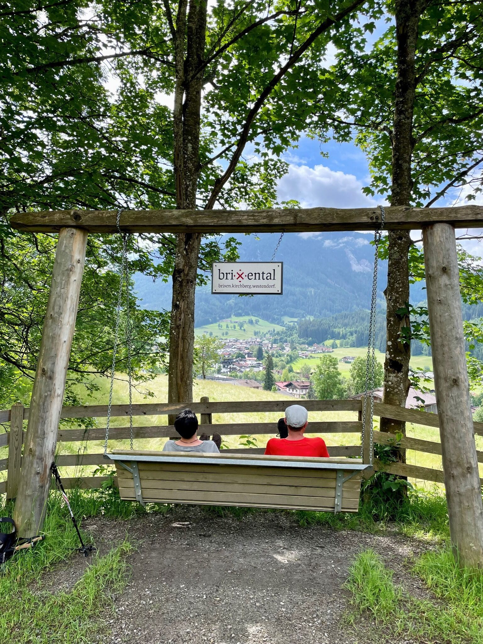
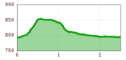
Open interactive mapOpen this POI on the interactive mapElevation profiledownloadHängebank Schneckgass.gpx
Koasatrail Etappe 4 Region St. Johann in Tirol - Oberndorf - Kirchdorf - Erpfendorf © Sportalpen Koasa Trail Stage 4Difficulty:mediumLength:20.6 kmDuration:7:35 hElevation uphill:923 mSee trailSee trail: Koasa Trail Stage 4
Koasatrail Etappe 3 Region St. Johann in Tirol - Oberndorf - Kirchdorf - Erpfendorf © Sportalpen Koasa Trail Stage 3Difficulty:mediumLength:19.9 kmDuration:7:10 hElevation uphill:730 mSee trailSee trail: Koasa Trail Stage 3
Koasatrail Etappe 5 Region St. Johann in Tirol - Oberndorf - Kirchdorf - Erpfendorf © Sportalpen Koasa Trail Stage 5Difficulty:mediumLength:14.0 kmDuration:6:45 hElevation uphill:935 mSee trailSee trail: Koasa Trail Stage 5
Koasatrail-Etappe 1 Gmailkapelle Region St. Johann in Tirol © Sportalpen Koasa Trail Stage 1Difficulty:mediumLength:16.9 kmDuration:6:45 hElevation uphill:937 mSee trailSee trail: Koasa Trail Stage 1
Ursulakreuz_Kaiserkrone_Etappe 5_Wilder Kaiser © TVB Wilder Kaiser/Mathäus Gartner Kaiserkrone - stage 5Difficulty:mediumLength:10.8 kmDuration:5:15 hElevation uphill:840 mSee trailSee trail: Kaiserkrone - stage 5
Walchsee_Stripsenkopf_Wilder Kaiser © TVB Wilder Kaiser/Mathäus Gartner Kaiserkrone - stage 4Difficulty:mediumLength:16.1 kmDuration:6:30 hElevation uphill:640 mSee trailSee trail: Kaiserkrone - stage 4
Lourdesgrotte - Kirchdorf Region St. Johann in Tirol © Region St. Johann in Tirol Einsiedelei Hermitage - Gmail Chapel - Lourdes GrottoDifficulty:mediumLength:6.3 kmDuration:2:30 hElevation uphill:325 mSee trailSee trail: Einsiedelei Hermitage - Gmail Chapel - Lourdes Grotto
Bergbahn Pillersee - Flecken - BuchensteinwandDifficulty:mediumLength:6.0 kmElevation uphill:596 mSee trailSee trail: Bergbahn Pillersee - Flecken - Buchensteinwand
Summit Hike to Lodron from Gasthof JägerhäuslDifficulty:mediumLength:20.0 kmDuration:8:30 hElevation uphill:1,125 mSee trailSee trail: Summit Hike to Lodron from Gasthof Jägerhäusl
Wildseeloderhaus © Toni Niederwieser WaiWi - from Waidring to the WildseeloderDifficulty:mediumLength:50.0 kmDuration:4 daysElevation uphill:3,200 mSee trailSee trail: WaiWi - from Waidring to the Wildseeloder
Koasatrail-Etappe2 Region St. Johann in Tirol Kirchdorf Oberndorf © Sportalpen Koasa Trail Stage 2Difficulty:mediumLength:11.8 kmDuration:7:15 hElevation uphill:1,078 mSee trailSee trail: Koasa Trail Stage 2
Wandern Bettlersteig Kaistertal Naturerlebnis Kaisergebirge © Thomas Laukat 2-Day High-Altitude Tour around Kaisertal - Stage 2Difficulty:mediumLength:12.1 kmDuration:5:30 hElevation uphill:700 mSee trailSee trail: 2-Day High-Altitude Tour around Kaisertal - Stage 2
Kaiserbachtal (c) Sportalpen (21).jpg © Sportalpen Alpine Outdoor GalleryDifficulty:easyLength:6.7 kmDuration:2:00 hElevation uphill:117 mSee trailSee trail: Alpine Outdoor Gallery
MG_St_Johann_0192.JPG © Mirja Geh Schnackler Adventure TrailDifficulty:easyLength:3.8 kmDuration:0:45 hElevation uphill:132 mSee trailSee trail: Schnackler Adventure Trail
Eifersbacher Wasserfall Region St. Johann in Tirol Wandern Sommer © Sportalpen Eifersbacher WasserfallDifficulty:mediumLength:5.9 kmDuration:2:30 hElevation uphill:241 mSee trailSee trail: Eifersbacher Wasserfall
Niederkaiser Region St. Johann in Tirol © Franz Gerdl Niederkaiser with waterfall SchleierwasserfallDifficulty:mediumLength:16.1 kmDuration:7:00 hElevation uphill:954 mSee trailSee trail: Niederkaiser with waterfall Schleierwasserfall
BiathlonpfadDifficulty:mediumLength:14.0 kmDuration:4:00 hElevation uphill:360 mSee trailSee trail: Biathlonpfad
The WiegalmDifficulty:mediumLength:10.5 kmDuration:4:45 hElevation uphill:680 mSee trailSee trail: The Wiegalm
Horn-Gipfel-Höhenweg auf der Kitzbüheler Seite © Mirja Geh Kitzbüheler Horn via Horn-Gipfel-HöhenwegDifficulty:mediumLength:5.0 kmDuration:3:00 hElevation uphill:455 mSee trailSee trail: Kitzbüheler Horn via Horn-Gipfel-Höhenweg
Angerer_Alm_Berglehen_53_St_Johann_Ausblick_Kaiser.JPG © TVB Kitzbüheler Alpen St. Johann in Tirol Angerer AlmDifficulty:mediumLength:5.7 kmDuration:2:45 hElevation uphill:652 mSee trailSee trail: Angerer Alm
Sonnenuntergang Wandern Herbst Möslalm Wörgl 2022@Region Hohe Salve - Mathäus Gartner (21).jpg © Mathäus Gartner Möslalmkogel via WörglDifficulty:mediumLength:10.3 kmDuration:3:30 hElevation uphill:580 mSee trailSee trail: Möslalmkogel via Wörgl
KAT-Walk2019@ErwinHaiden-5019 e1 mobilität logo.jpg © Erwin Haiden 1st stage KAT Walk KompaktDifficulty:mediumLength:14.2 kmDuration:7:15 hElevation uphill:1,212 mSee trailSee trail: 1st stage KAT Walk Kompakt
KAT Walk E 6 / E 5 © Erwin Haiden KAT Walk Alpine stage 6Difficulty:mediumLength:19.0 kmDuration:7:30 hElevation uphill:1,000 mSee trailSee trail: KAT Walk Alpine stage 6
KAT-Walk2019@ErwinHaiden-7287 e2 logo natur.jpg © Erwin Haiden KAT WALK COMPACTDifficulty:mediumLength:83.0 kmDuration:5 daysElevation uphill:5,462 mSee trailSee trail: KAT WALK COMPACT
Kitzbüheler_Alpen_KAT_Walk_2019@ErwinHaiden-7290.jpg © Erwin Haiden KAT Walk Compact stage 2: Primeval drama - From gentle grass mountains to special geological featuresDifficulty:mediumLength:13.5 kmDuration:7:00 hElevation uphill:1,000 mSee trailSee trail: KAT Walk Compact stage 2: Primeval drama - From gentle grass mountains to special geological features
Give feedback for a chance to win a special holiday experience!Click here for the surveyClick here for the survey