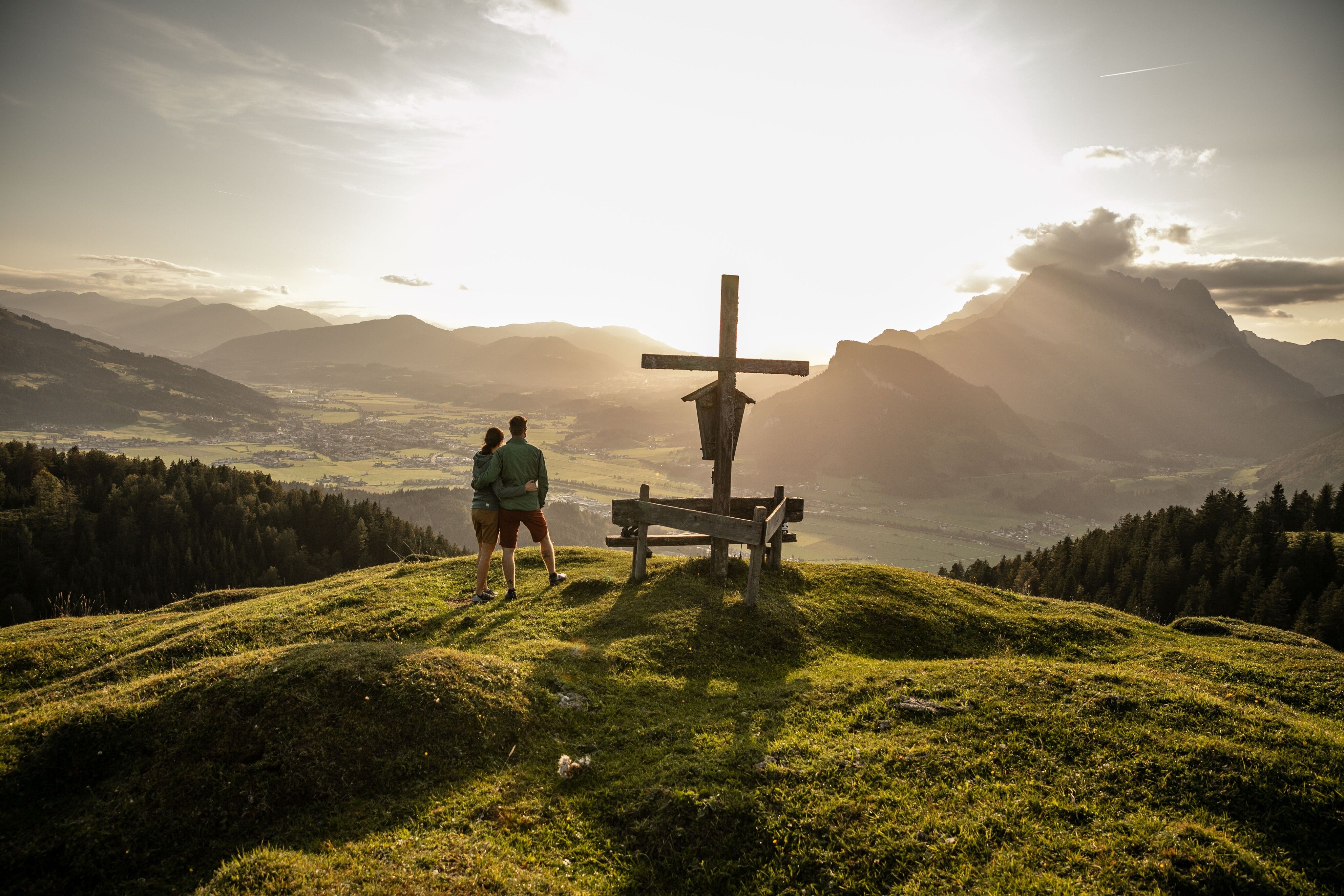
Mountain hikes Kirchberg at Kalkstein

Kirchdorf in Tirol / Lofer Stone Mountains
Difficulty ratings: medium
Route length: 24.7 km
Duration: 9:00 h

Variety-Packed Landscape, Alpine Inns – ranging from the Traditional to the Ultra-Contemporary - and an Idyllic Mountain Plateau.

Tour information

  • Requirement: medium
  • Length: 24.7 km
  • Duration: 9:00 h
  • Elevation uphill:1,083 hm
  • Elevation downhill:1,081 hm
Highest point1,672 m

Starting point

Erpfendorf - Parplatz Griesbachklamm

Finishing point

Erpfendorf - Parkplatz Griesbachklamm
  • Fitness level 3 / 6
  • Technique 2 / 6

Features

  • Circular route

Best time of year

  • January
  • February
  • March
  • April
  • May
  • June
  • July
  • August
  • September
  • October
  • November
  • December

Trail condition

gravel and rocky paths

Equipment

- outdoor clothing
- sturdy shoes
- Sufficient food and drinks
- First aid kit
- Mobile phone with full battery & charger
- Hiking map & guide literature
- GPS device or download the GPS data to your mobile phone if necessary
- Sun protection (sunglasses, sun cream, cap)
- Rain protection
- Cash
Source: Kitzbüheler Alpen Management GmbH

Description

Walk initially through the wild, romantic Griesbachklamm. At the end of the gorge, keep left to reach Breitaualmen. The path proceeds past lovely, old Alpine inns.  From the pretty chapel cross a steep path meanders through fields of mountain pine up to the Kirchberg (1678 m). Kirchberg is the highest elevation on
the Kalkstein and provides a wonderful panoramic view. Via a narrow, steep path, hike down towards Adlerspoint. Along a forest road you cross the peaceful mountain plateau. Descend either via the Huberalm or Angerlalm.

TIP: Bring snacks and drinks with you – there is only one refreshment stop option towards the end of the tour!


Nearby huts and mountain restaurants

Getting here

  • Arrival by public transport

    Postbus 4012 Exit: Erpfendorf Griesbachklamm
    Or conveniently with the free Okto hiking bus, which travels to hiking starting points in the St. Johann in Tirol region during the summer months.

    All information and bus and train times can be found here
    kitzalps.cc/mobile
     

  • Parking

    Coming from Kitzbühel/St. Johann in Tirol on the B178, drive towards Lofer. You will pass the village of Kirchdorf and shortly afterwards Erpfendorf. Look out for the signs indicating the exit on the right to the Griesbachklamm car park on Salzburger Straße.

    This will take you to the St. Johann in Tirol region:
    https://www.kitzbueheler-alpen.com/en/stjo/getting-here/holidays.html

     
    Chargeable parking lot Griesbachklamm

Weather

Today

partly Cloudy
12°C/0°C
80%7.7l5 km/h

Sat

light rain showers
8°C/1°C
75%2l5 km/h

Sun

light rain
11°C/0°C
80%6.7l5 km/h
Go to weather forecast

More tours in the surrounding area

  • Koasa Trail Stage 4

    Difficulty:medium
    Length:20.6 kmDuration:7:35 hElevation uphill:923 m
  • Koasa Trail Stage 3

    Difficulty:medium
    Length:19.9 kmDuration:7:10 hElevation uphill:730 m
  • Koasa Trail Stage 5

    Difficulty:medium
    Length:14.0 kmDuration:6:45 hElevation uphill:935 m
  • Koasa Trail Stage 1

    Difficulty:medium
    Length:16.9 kmDuration:6:45 hElevation uphill:937 m
  • Kaiserkrone - stage 5

    Difficulty:medium
    Length:10.8 kmDuration:5:15 hElevation uphill:840 m
  • Kaiserkrone - stage 4

    Difficulty:medium
    Length:16.1 kmDuration:6:30 hElevation uphill:640 m
  • Koasa Trail Stage 2

    Difficulty:medium
    Length:11.8 kmDuration:7:15 hElevation uphill:1,078 m
  • Alpine Outdoor Gallery

    Difficulty:easy
    Length:6.7 kmDuration:2:00 hElevation uphill:117 m
  • Eifersbacher Wasserfall

    Difficulty:medium
    Length:5.9 kmDuration:2:30 hElevation uphill:241 m
  • The Wiegalm

    Difficulty:medium
    Length:10.5 kmDuration:4:45 hElevation uphill:680 m
  • Angerer Alm

    Difficulty:medium
    Length:5.7 kmDuration:2:45 hElevation uphill:652 m
  • Möslalmkogel via Wörgl

    Difficulty:medium
    Length:10.3 kmDuration:3:30 hElevation uphill:580 m
  • 1st stage KAT Walk Kompakt

    Difficulty:medium
    Length:14.2 kmDuration:7:15 hElevation uphill:1,212 m
  • KAT Walk Alpine stage 6

    Difficulty:medium
    Length:19.0 kmDuration:7:30 hElevation uphill:1,000 m
  • KAT WALK COMPACT

    Difficulty:medium
    Length:83.0 kmDuration:5 daysElevation uphill:5,462 m
Newsletter

The mountain is calling? So does our newsletter!

In our monthly newsletter we reveal the best holiday tips for Tyrol.