Mountain hikes Maurach - Buchauer Alm - Maurach

Difficulty ratings: easy
Route length: 5.7 km
Duration: 2:00 h

Easy hike to the former Buchauer Alm. The ascent takes about one hour, mostly along a forest road with occasional views.

Tour information

  • Requirement: easy
  • Length: 5.7 km
  • Duration: 2:00 h
  • Elevation uphill:390 hm
  • Elevation downhill:390 hm
Highest point1,385 m

Starting point

Maurach, Talstation Rofanseilbahn

Finishing point

Maurach, Talstation Rofanseilbahn

Features

  • Suitable for families

Best time of year

  • January
  • February
  • March
  • April
  • May
  • June
  • July
  • August
  • September
  • October
  • November
  • December

Trail condition

forest road

Equipment

Sturdy boots (ankle-high hiking boots), weather appropriate clothing. Telescopic hiking poles are recommended.
Source: Achensee Tourismus

Description

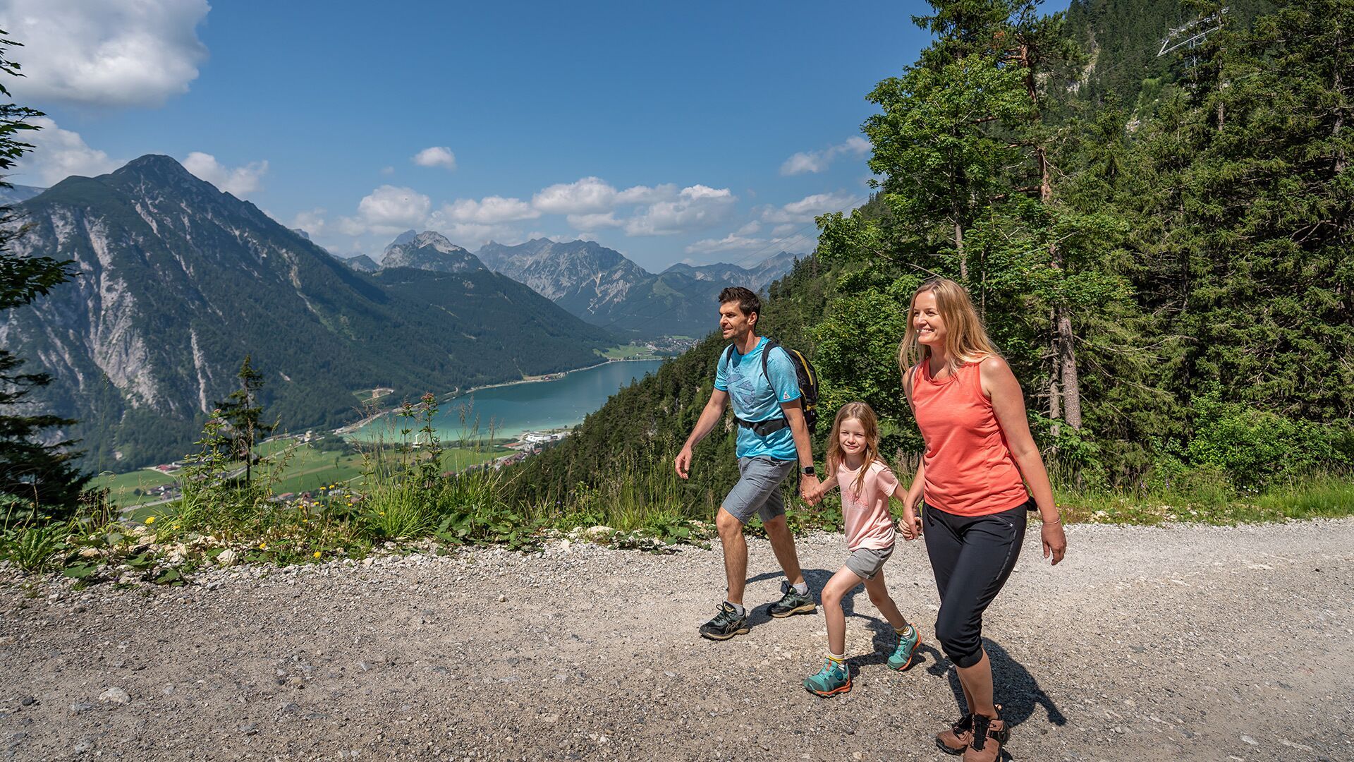
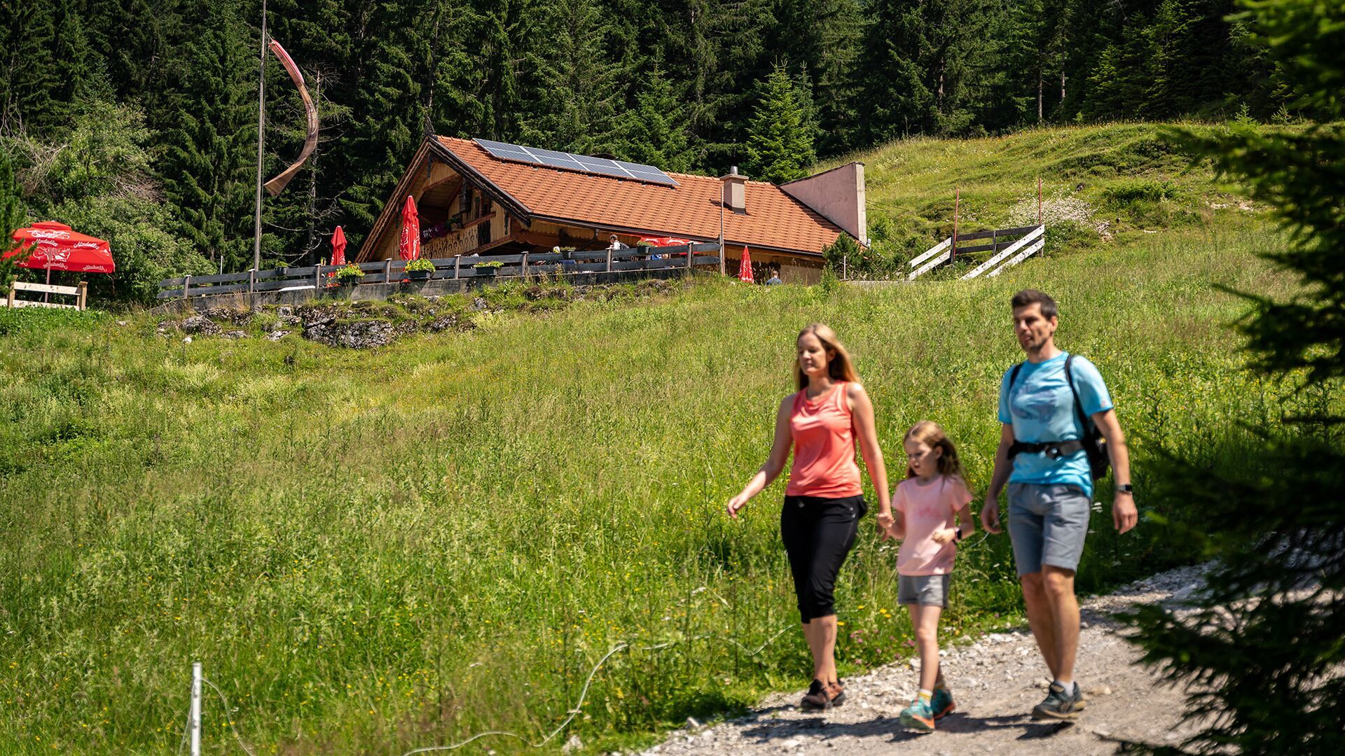
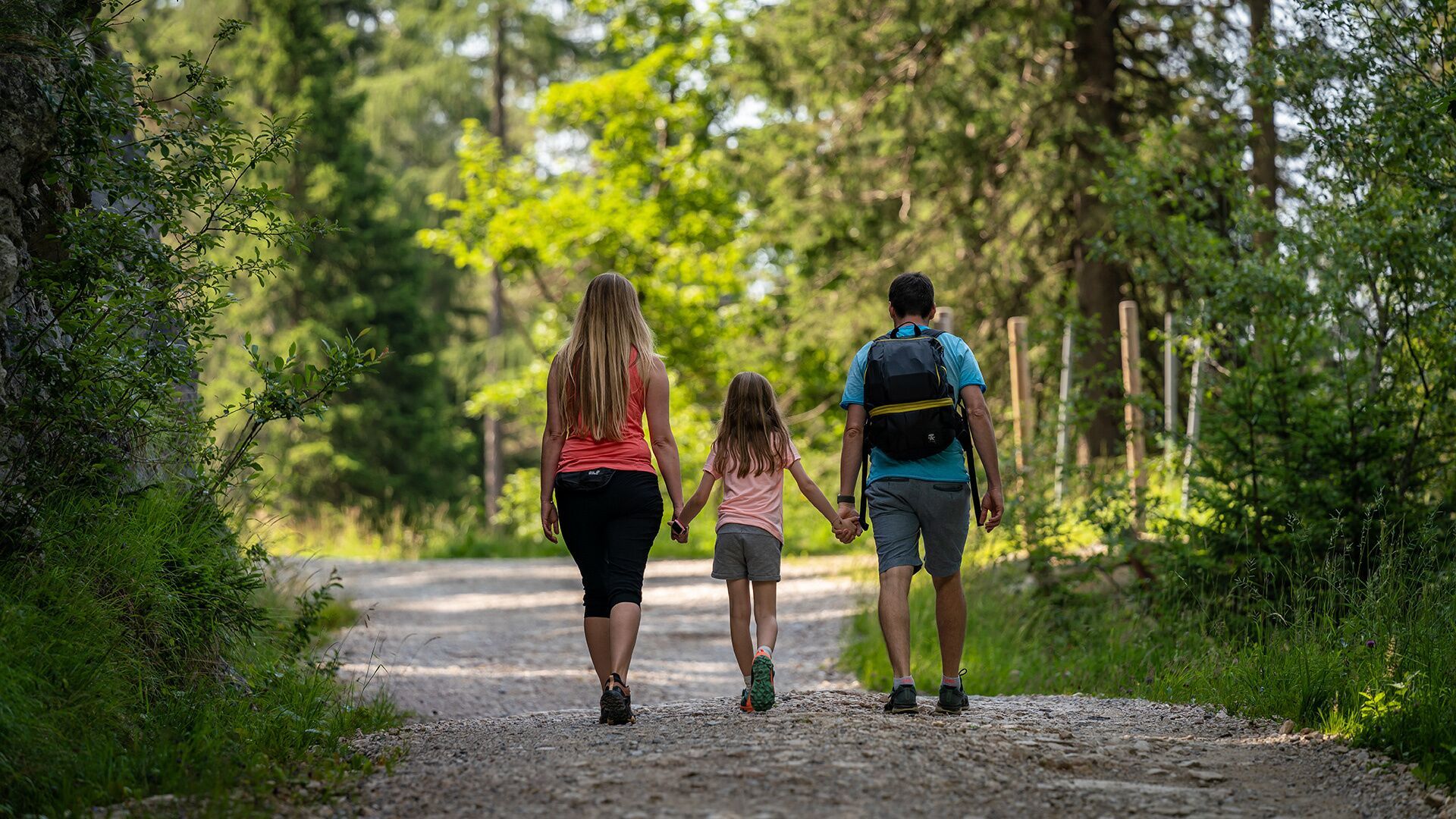
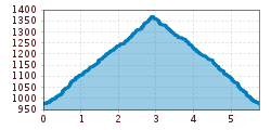
From the valley station of the Rofan cable car, follow the path past the hotel Naturhotel Alpenblick until you reach the wooden bridge. Continue along the forest road to the Buchauer Alm*) mountain hut (1,385 metres). The return is via the same route.

*) Sadly, the Buchauer Alm was destroyed in a tragic fire. It is unclear whether the hut will be rebuilt.

Nearby huts and mountain restaurants

  • Buchauer Alm

    Opening hours: closed
    Place: Maurach am Achensee
    : Alpine pasture / hut / mountain restaurant

Getting here

  • Arrival by public transport

    Take the regional bus to Maurach (line 8332, 4080 or 390) and get off at the "Maurach a. A. Rofan Seilbahn" stop. 

  • Parking

    Car park of the Rofan cable car no. 1 or 2 in Maurach  (paid parking)

More tours in the surrounding area

  • Wilder-Kaiser-Steig - Detour

    Difficulty: difficult
    Length: 33.0 km Duration: 16:49 h Elevation uphill: 2,311 m
  • 3-day Family Tour Alpbachtal

    Difficulty: easy
    Length: 18.3 km Duration: 7:00 h Elevation uphill: 998 m
  • Voldöpper Spitze Loop Hike

    Difficulty: medium
    Length: 12.9 km Duration: 5:00 h Elevation uphill: 988 m
  • Kundler Klamm

    Opening hours: closed
    Difficulty: easy
    Length: 6.4 km Duration: 2:00 h Elevation uphill: 116 m
  • 3-peak-tour Kienberg-Plessenberg-Heuberg

    Difficulty: medium
    Length: 8.6 km Duration: 4:30 h Elevation uphill: 779 m
  • Discovering the Tiefenbach Gorge Hike

    Opening hours: closed
    Difficulty: medium
    Length: 5.7 km Duration: 3:30 h Elevation uphill: 669 m
  • Loop tour Juppi Zauberwald

    Difficulty: easy
    Length: 2.5 km Duration: 1:00 h Elevation uphill: 93 m
  • Barrier-free path Lake Reintal

    Difficulty: easy
    Length: 6.5 km Duration: 1:45 h Elevation uphill: 15 m
  • Day 1: 4 days - 4 summits tour

    Difficulty: medium
    Length: 9.8 km Duration: 5:00 h Elevation uphill: 984 m
  • Kaiser Gorge - loop trail

    Opening hours: closed
    Difficulty: easy
    Length: 4.2 km Duration: 1:00 h Elevation uphill: 198 m
  • Farmkehralm 1.521 m

    Difficulty: medium
    Length: 9.3 km Duration: 3:30 h Elevation uphill: 506 m
  • Wiedersberger Horn Panorama Path

    Difficulty: easy
    Length: 4.1 km Duration: 1:30 h Elevation uphill: 195 m
  • Day 3: 4 days - 4 summits tour

    Difficulty: medium
    Length: 19.3 km Duration: 8:00 h Elevation uphill: 1,371 m
  • 4 days - 4 summits tour

    Difficulty: medium
    Length: 54.4 km Duration: 23:00 h Elevation uphill: 3,408 m
  • Ötztal Trek Stage 6

    Difficulty: difficult
    Length: 7.6 km Duration: 3:30 h Elevation uphill: 640 m
Newsletter

The mountain is calling? So does our newsletter!

In our monthly newsletter we reveal the best holiday tips for Tyrol.