Mountain hikes Roßkogel 1,948 m via Anderl's Hut

Brandenberg / Brandenberger Alpen (Rofan)
Difficulty ratings: medium
Route length: 17.1 km
Duration: 5:45 h

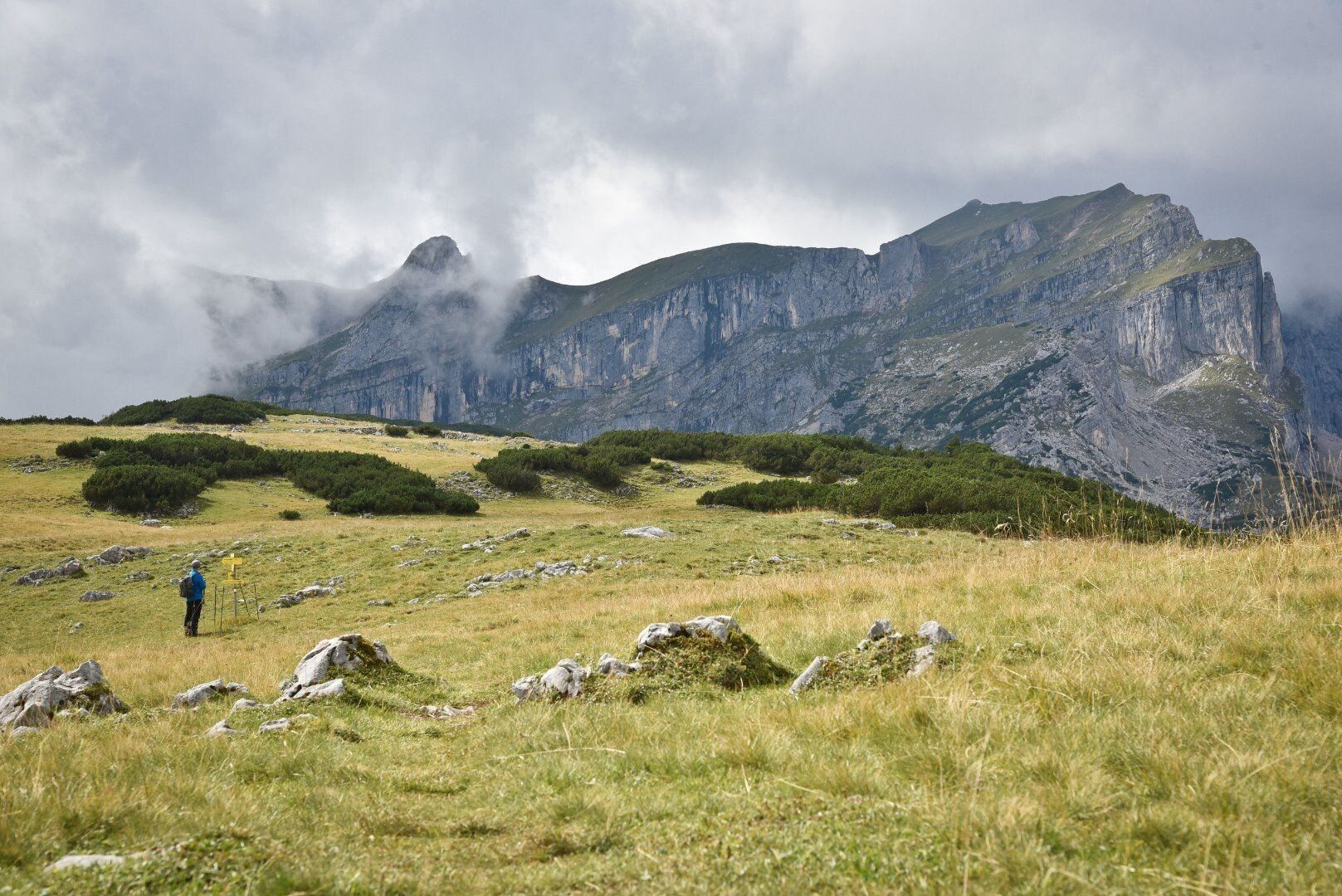
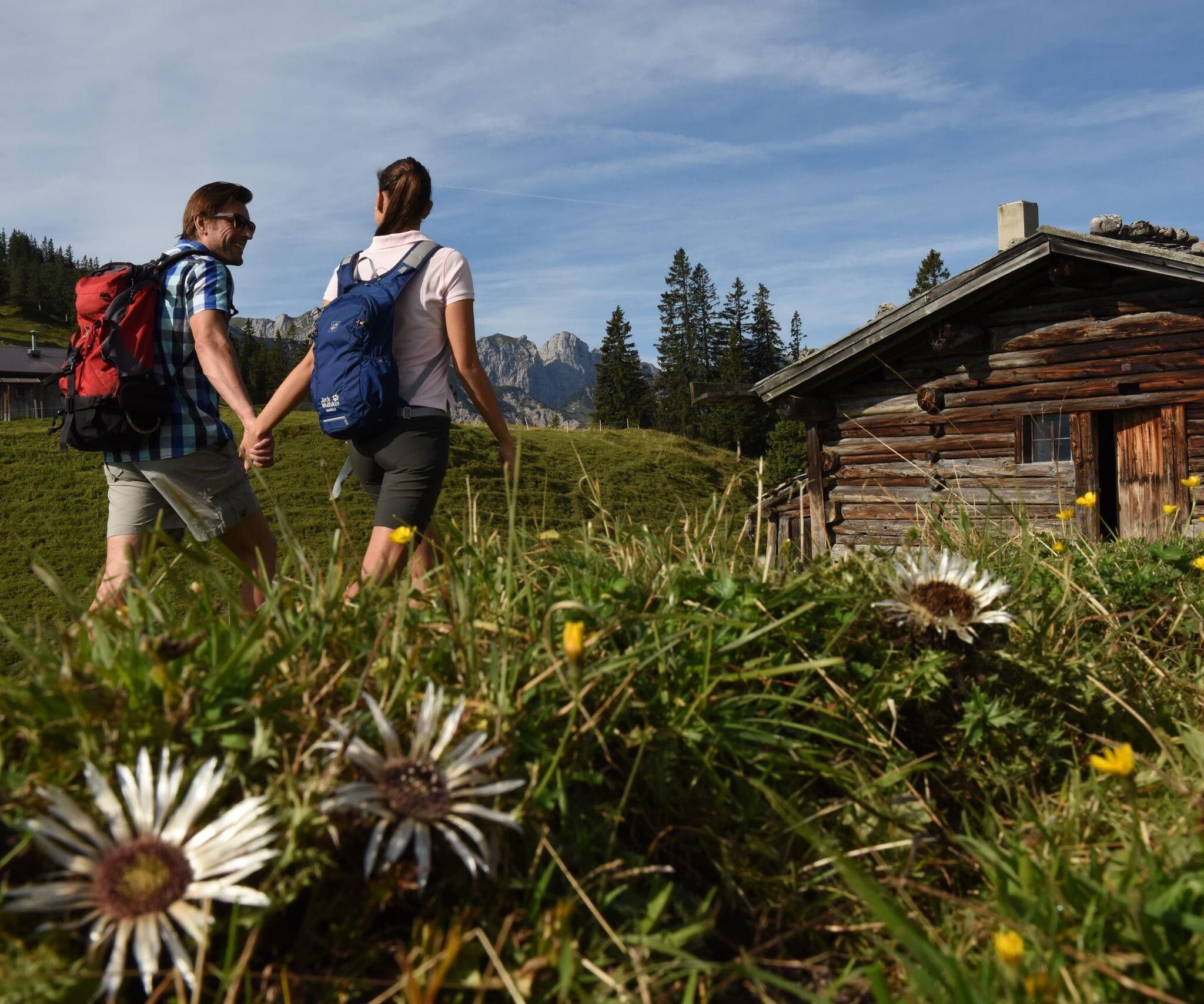
Summit ascent in the Rofan mountains via the Brandenberg alpine pasture area

Tour information

  • Requirement: medium
  • Length: 17.1 km
  • Duration: 5:45 h
  • Elevation uphill:848 hm
  • Elevation downhill:792 hm
Highest point1,948 m

Starting point

Brandenberg/Aschau/Wimm

Finishing point

Brandenberg/Aschau/Wimm
  • Fitness level 3 / 6

Best time of year

  • January
  • February
  • March
  • April
  • May
  • June
  • July
  • August
  • September
  • October
  • November
  • December

Equipment

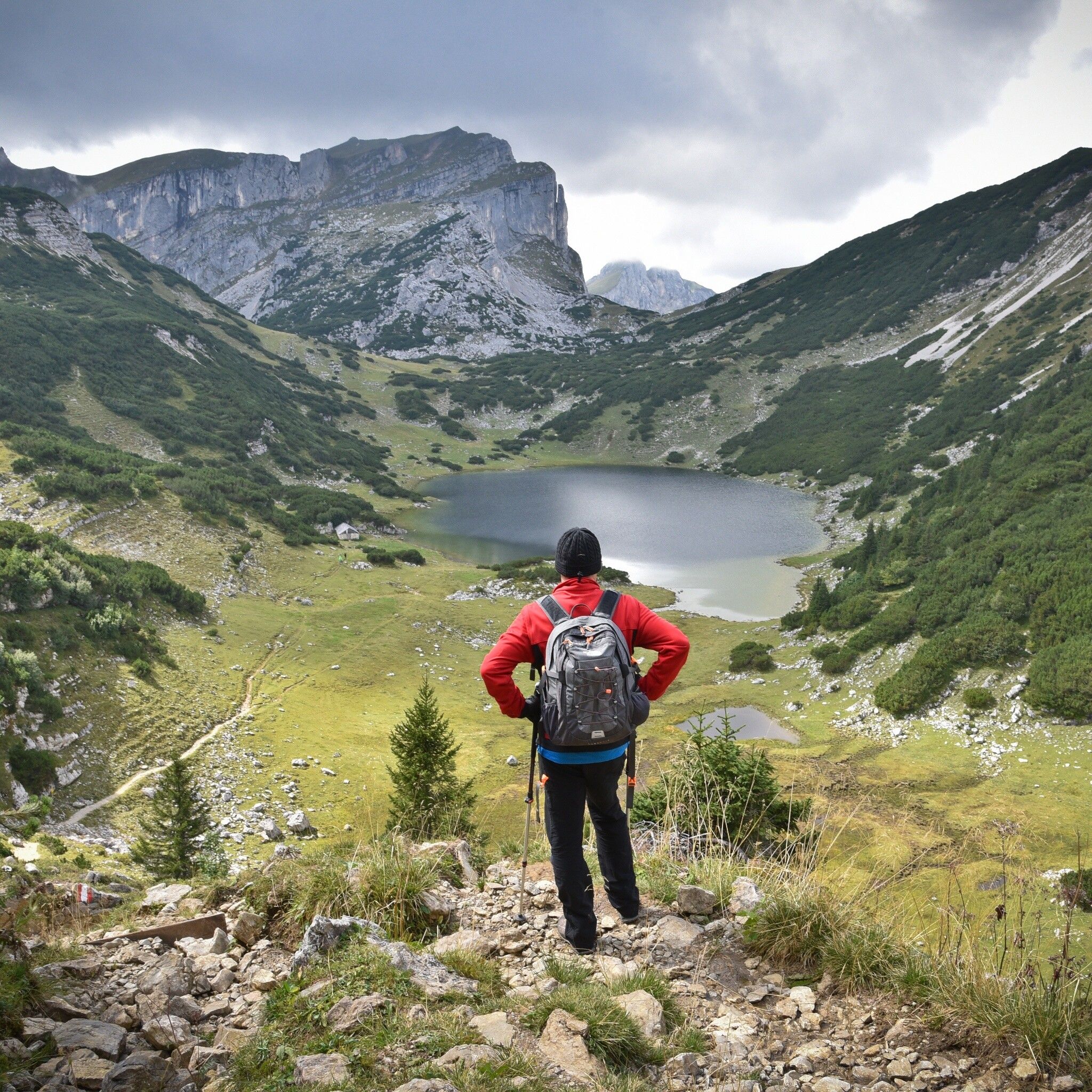
Sure-footedness is required when descending to the Berghaus Sonnwendjoch.

sturdy shoes, weatherproof clothing

Source: Alpbachtal Tourismus

Description

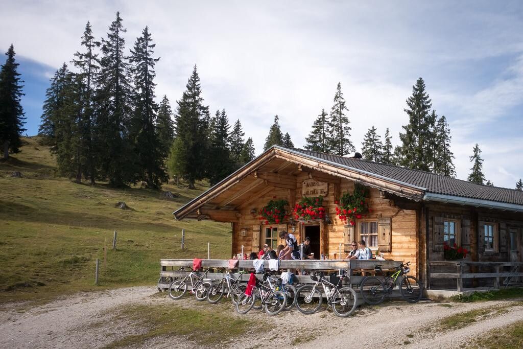
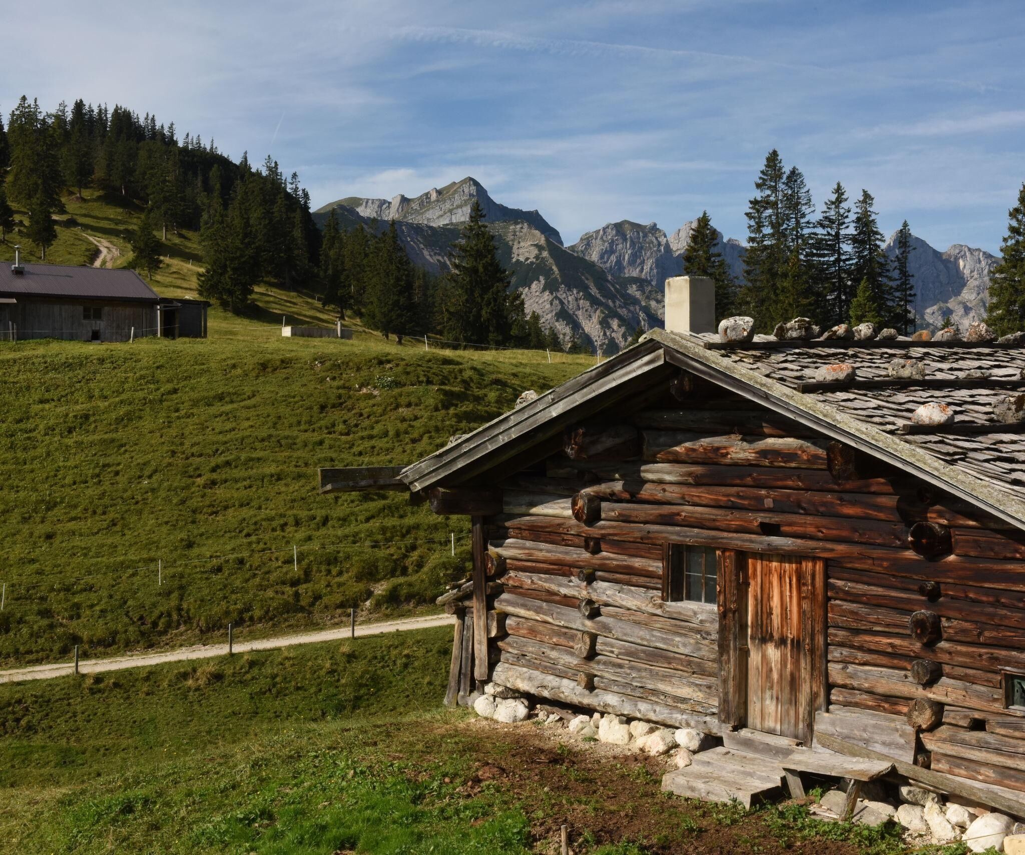
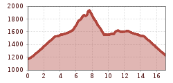
Drive by car from the district Aschau to the parking lot "Wimm". From here the hike partly leads over forest roads first over the Eilalm to "Anderl's Hut" and further over Labegg to the Kreuzein high pasture. Now a somewhat steeper ascent to the foot of the Roßkogel. At the crossing with the many yellow signs, turn left and climb a short ascent to the summit of Roßkogel (approx. 3 h). A sensational view over the Inn valley and the surrounding mountain ranges awaits you. After an extensive rest, a detour to the Zireiner See lake is recommended. Follow the signs at the summit. Descent to the crossroads and straight on approx. 45 min. to the lake. Return the same way! (Return approx. 3 h)

Or as a circular hike: From the summit head west down to the Berghaus Sonnwendjoch. From here further steeply down to the Hochalm, then slightly upwards and around the ridge over the "Hörndl" to the Kreuzeinalm, which you already know from your ascent. The rest of the way you hike back on the known ascent path to the starting point. (approx. 3 h from Roßkogel)


Nearby huts and mountain restaurants

Getting here

  • Arrival by public transport

    not possible by public transport

  • Parking

    Parking lot Wimm Brandenberg/Aschau

More tours in the surrounding area

  • Loop tour Juppi Zauberwald

    Difficulty: easy
    Length: 2.5 km Duration: 1:00 h Elevation uphill: 93 m
  • 3-day Family Tour Alpbachtal

    Difficulty: easy
    Length: 18.3 km Duration: 7:00 h Elevation uphill: 998 m
  • Voldöpper Spitze Loop Hike

    Difficulty: medium
    Length: 12.9 km Duration: 5:00 h Elevation uphill: 988 m
  • Kundler Klamm

    Opening hours: closed
    Difficulty: easy
    Length: 6.4 km Duration: 2:00 h Elevation uphill: 116 m
  • Farmkehralm 1.521 m

    Difficulty: medium
    Length: 9.3 km Duration: 3:30 h Elevation uphill: 506 m
  • Wiedersberger Horn Panorama Path

    Difficulty: easy
    Length: 4.1 km Duration: 1:30 h Elevation uphill: 195 m
  • Discovering the Tiefenbach Gorge Hike

    Opening hours: closed
    Difficulty: medium
    Length: 5.7 km Duration: 3:30 h Elevation uphill: 669 m
  • Kaiser Gorge - loop trail

    Opening hours: closed
    Difficulty: easy
    Length: 4.2 km Duration: 1:00 h Elevation uphill: 198 m
  • Barrier-free path Lake Reintal

    Difficulty: easy
    Length: 6.5 km Duration: 1:45 h Elevation uphill: 15 m
  • Day 1: 4 days - 4 summits tour

    Difficulty: medium
    Length: 9.8 km Duration: 5:00 h Elevation uphill: 984 m
  • 3-peak-tour Kienberg-Plessenberg-Heuberg

    Difficulty: medium
    Length: 8.6 km Duration: 4:30 h Elevation uphill: 779 m
  • Day 3: 4 days - 4 summits tour

    Difficulty: medium
    Length: 19.3 km Duration: 8:00 h Elevation uphill: 1,371 m
  • 4 days - 4 summits tour

    Difficulty: medium
    Length: 54.4 km Duration: 23:00 h Elevation uphill: 3,408 m
Newsletter

The mountain is calling? So does our newsletter!

In our monthly newsletter we reveal the best holiday tips for Tyrol.