
Mountain hikes Ulrichshorn (Seehorn) 2.155 m

St. Ulrich am Pillersee / Lofer Stone Mountains
Difficulty ratings: difficult
Route length: 4.2 km
Duration: 7:50 h

Ulrichshorn (Seehorn) 2.155 m

Tour information

  • Requirement: difficult
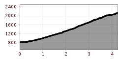
  • Length: 4.2 km
  • Duration: 7:50 h
  • Elevation uphill:1,320 hm
  • Elevation downhill:0 hm
Highest point2,155 m

Starting point

Car park at the sports ground in St. Ulrich a. P.

Finishing point

Ulrichshorn 2.155 m
  • Fitness level 6 / 6
  • Technique 6 / 6

Best time of year

  • January
  • February
  • March
  • April
  • May
  • June
  • July
  • August
  • September
  • October
  • November
  • December

Trail condition

Marked, steep path, rope safety devices in the upper area.

Equipment

sufficient food and water, no refreshment stop, no water point
Source: Kitzbüheler Alpen Management GmbH

Description

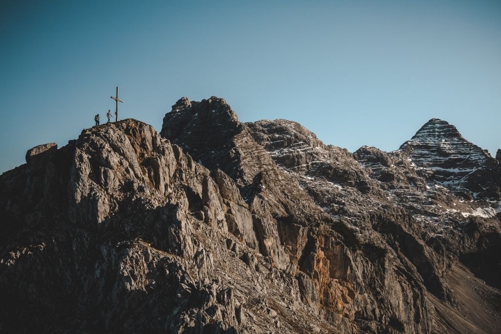
The ascent starts at the car park at the sports field in St. Ulrich am Pillersee. Cross the stream over the bridge and follow the gravel road straight ahead. At the foot of the Steinberge mountains, the strenuous, steep climb begins, leading through mixed forest for the first third. The forest terrain ends at the "Bräuplatte" halfway along the trail. The trail continues steeply through mountain pine terrain until shortly after the helipad, where you follow the trail in a south-easterly direction. Rope protections lead to the Heimkehrerkreuz and on to the summit of the Ulrichhorn. An impressive summit climb with breathtaking views down towards the Pillersee! 
Tour only for experienced mountaineers with surefootedness, no fear of heights and very good physical condition!
 

Getting here

  • Arrival by public transport

    By bus: free bus service from Ellmau / Kitzbühel / St. Johann i.T. / Lofer and within the PillerseeTal region. Bus stop St. Ulrich a.P. Gemeindeamt. Free of charge with guest card
  • Parking

    Car park sports ground
    Alternative: Pillersee car park (opposite)

Weather

Today

mainly clear
24°C/13°C
20%0l5 km/h

Fri

clear sky
29°C/13°C
50%0.8l10 km/h

Sat

light rain showers
22°C/13°C
70%4.2l10 km/h
Go to weather forecast

More tours in the surrounding area

  • Koasa Trail Stage 3

    Difficulty:medium
    Length:19.9 kmDuration:7:10 hElevation uphill:730 m
  • Koasa Trail Stage 5

    Difficulty:medium
    Length:14.0 kmDuration:6:45 hElevation uphill:935 m
  • Kaiserkrone - stage 5

    Difficulty:medium
    Length:10.8 kmDuration:5:15 hElevation uphill:840 m
  • Kaiserkrone - stage 4

    Difficulty:medium
    Length:16.1 kmDuration:6:30 hElevation uphill:640 m
  • Koasa Trail Stage 1

    Difficulty:medium
    Length:16.9 kmDuration:6:45 hElevation uphill:937 m
  • Koasa Trail Stage 4

    Difficulty:medium
    Length:20.6 kmDuration:7:35 hElevation uphill:923 m
  • Alpine Outdoor Gallery

    Difficulty:easy
    Length:6.7 kmDuration:2:00 hElevation uphill:117 m
  • The Wiegalm

    Difficulty:medium
    Length:10.5 kmDuration:4:45 hElevation uphill:680 m
  • Koasa Trail Stage 2

    Difficulty:medium
    Length:11.8 kmDuration:7:15 hElevation uphill:1,078 m
  • Angerer Alm

    Difficulty:medium
    Length:5.7 kmDuration:2:45 hElevation uphill:652 m
  • Adlerweg Day Tour

    Difficulty:medium
    Length:16.0 kmDuration:6:00 hElevation uphill:1,200 m
  • Möslalmkogel via Wörgl

    Difficulty:medium
    Length:10.3 kmDuration:3:30 hElevation uphill:580 m
  • Bichlachrunde

    Difficulty:easy
    Length:10.5 kmDuration:3:30 hElevation uphill:295 m
  • Eifersbacher Wasserfall

    Difficulty:medium
    Length:5.9 kmDuration:2:30 hElevation uphill:241 m
  • Brechhorn

    Difficulty:medium
    Length:11.8 kmDuration:5:00 hElevation uphill:600 m
  • Schafsiedel

    Difficulty:medium
    Length:15.6 kmDuration:7:00 hElevation uphill:1,280 m
Newsletter

The mountain is calling? So does our newsletter!

In our monthly newsletter we reveal the best holiday tips for Tyrol.
