Hut hike Valley hike to the Gamskogelhütte

Westendorf / Kitzbühel Alps
Difficulty ratings: easy
Route length: 28.5 km
Duration: 3:30 h

An easy walk into the heart of the Windau Valley!
Tour information

  • Requirement: easy
  • Length: 28.5 km
  • Duration: 3:30 h
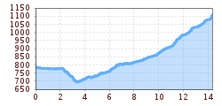
  • Elevation uphill:565 hm
  • Elevation downhill:561 hm
Highest point1,123 m

Starting point

Infobüro Westendorf

Finishing point

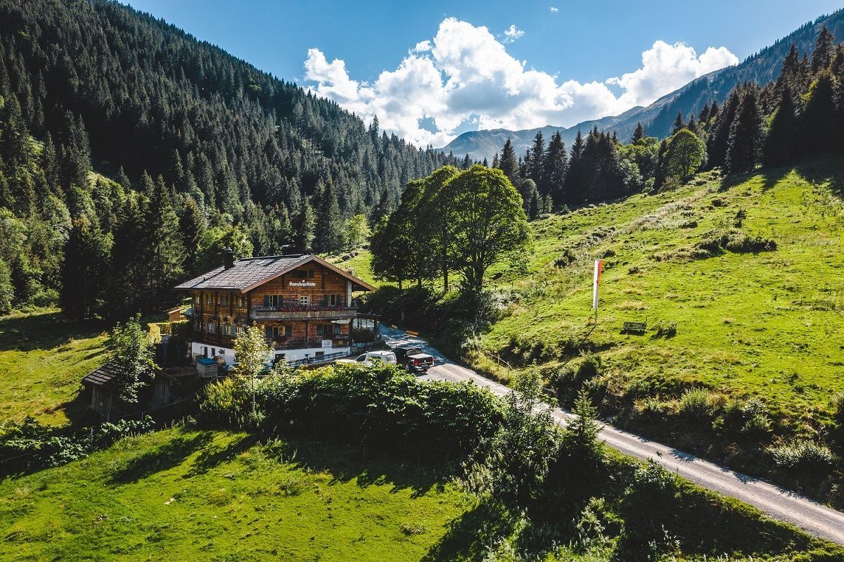
Gamskogelhütte
  • Fitness level 3 / 6
  • Technique 3 / 6

Features

  • suitable for pushchairs

Best time of year

  • January
  • February
  • March
  • April
  • May
  • June
  • July
  • August
  • September
  • October
  • November
  • December

Trail condition

gravel road, asphalt road

Equipment

hiking shoes, weather protection, food, drink, first aid kit
Source: Kitzbüheler Alpen Management GmbH

Description

An easy walk for all ages into the heart of the Windau Valley! The Windautal is a popular place for peace and tranquility, and hiding many treasures! You will pass pastures and woodland, experiencing the true joy of the mountain farm life. The Windauer Ache, a natural mountain river is also a big highlight- whether as a picnic spot or just to take a dip. Culture and traditions, mixed with culinary pleasures are also extremely important in this valley. The Gasthofs through the Windau (Lendwirt, Jägerhäusl, Gasthaus Steinberg and Gamskogelhütte) serve trout from the stream and game from the hills, as well as other regional specialities.
The route from the village centre takes you first to the Lendwirt then along the Windauer Ache to the Gasthaus Jägerhäusl. Another two kilometre stretch past fields and woods will take you to the Gasthaus Steinberg. Continuing straight on you will make the climb eventually reaching the Gamskogelhütte. There are places to park along the valley, making short variations of this hike possible.

Nearby huts and mountain restaurants

Getting here

Weather

Today

light rain showers
20°C/11°C
80%1.8l5 km/h

Tue

clear sky
25°C/9°C
0%0l5 km/h

Wed

light rain showers
23°C/10°C
90%34.5l5 km/h
Go to weather forecast

More tours in the surrounding area

  • Koasa Trail Stage 3

    Difficulty:medium
    Length:19.9 kmDuration:7:10 hElevation uphill:730 m
  • Koasa Trail Stage 5

    Difficulty:medium
    Length:14.0 kmDuration:6:45 hElevation uphill:935 m
  • Kaiserkrone - stage 5

    Difficulty:medium
    Length:10.8 kmDuration:5:15 hElevation uphill:840 m
  • Kaiserkrone - stage 4

    Difficulty:medium
    Length:16.1 kmDuration:6:30 hElevation uphill:640 m
  • Koasa Trail Stage 1

    Difficulty:medium
    Length:16.9 kmDuration:6:45 hElevation uphill:937 m
  • Koasa Trail Stage 4

    Difficulty:medium
    Length:20.6 kmDuration:7:35 hElevation uphill:923 m
  • Alpine Outdoor Gallery

    Difficulty:easy
    Length:6.7 kmDuration:2:00 hElevation uphill:117 m
  • The Wiegalm

    Difficulty:medium
    Length:10.5 kmDuration:4:45 hElevation uphill:680 m
  • Schafsiedel

    Difficulty:medium
    Length:15.6 kmDuration:7:00 hElevation uphill:1,280 m
  • Bichlachrunde

    Difficulty:easy
    Length:10.5 kmDuration:3:30 hElevation uphill:295 m
  • Angerer Alm

    Difficulty:medium
    Length:5.7 kmDuration:2:45 hElevation uphill:652 m
  • Koasa Trail Stage 2

    Difficulty:medium
    Length:11.8 kmDuration:7:15 hElevation uphill:1,078 m
  • Eifersbacher Wasserfall

    Difficulty:medium
    Length:5.9 kmDuration:2:30 hElevation uphill:241 m
  • Brechhorn

    Difficulty:medium
    Length:11.8 kmDuration:5:00 hElevation uphill:600 m
Newsletter

The mountain is calling? So does our newsletter!

In our monthly newsletter we reveal the best holiday tips for Tyrol.