Mountain hikes Wiesenweg to Ladis

closed
Fiss / Samnaungruppe
Difficulty ratings: easy
Route length: 3.2 km
Duration: 1:00 h

The Wiesenweg trail to Ladis runs flat and slightly downhill through an enchanting landscape of meadows and is the shortest trail between Fiss and Ladis.

Tour information

  • Requirement: easy
  • Length: 3.2 km
  • Duration: 1:00 h
  • Elevation uphill:231 hm
  • Elevation downhill:260 hm
Highest point1,432 m

Starting point

Josef chapel

Finishing point

Ladis

Features

  • suitable for pushchairs
Source: Serfaus-Fiss-Ladis

Description

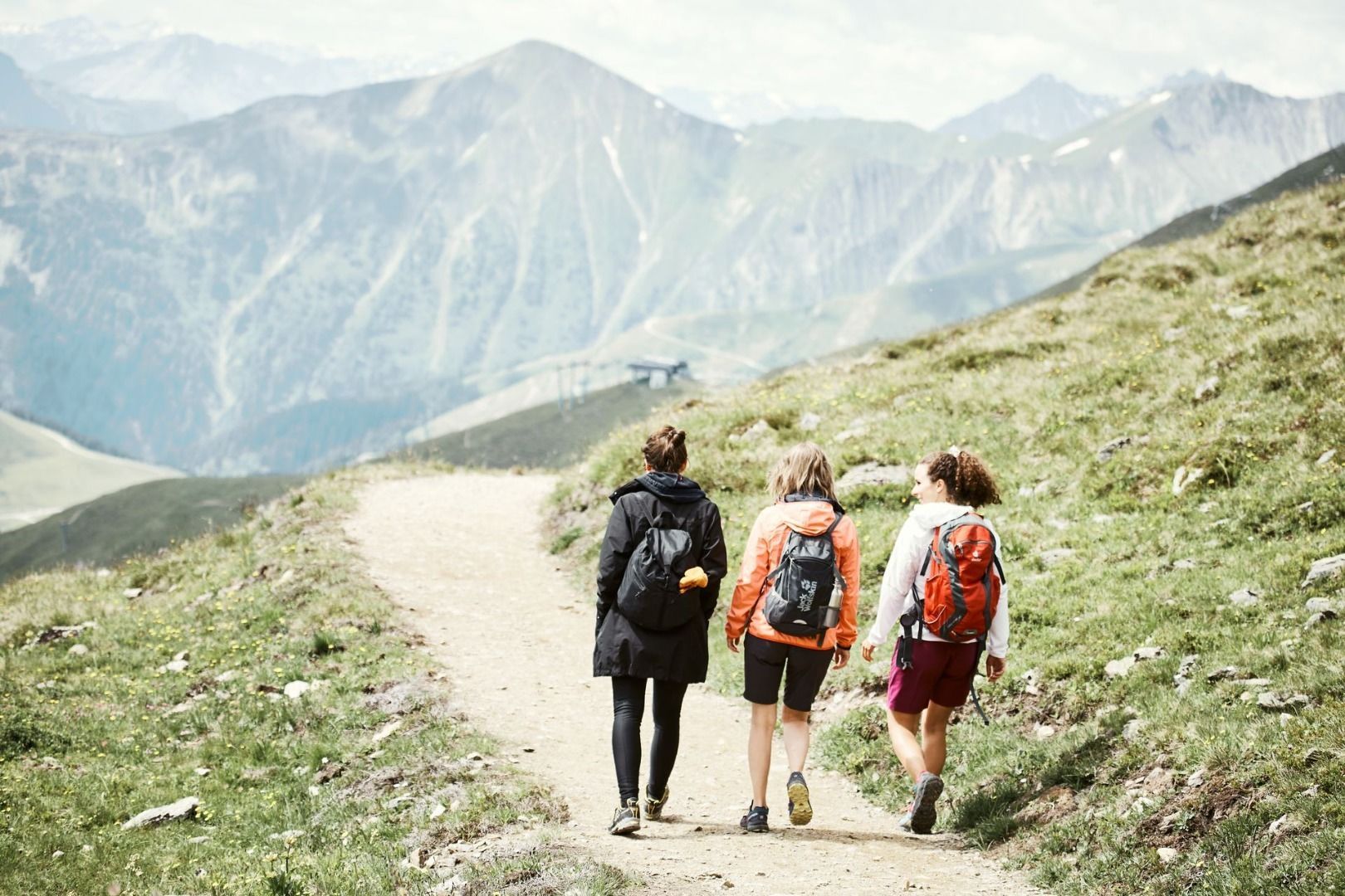
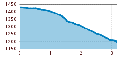
At the Josef Chapel (F001), take the left path and continue straight along the main road, walking through cultivated land that has been maintained by farmers for centuries. When you reach the last flat meadows, you will encounter a prominent fork in the trail (F003). Here, the left path leads to the connecting trail to the Langenweg (F004), which can also be followed to Ladis or towards Falterjöchl and Obladis (a slightly longer route). The right path descends more steeply past Urschbühel, heading directly towards Ladis (L002). For the return journey, you can take the cable car or the post or hiking bus.

Nearby huts and mountain restaurants

Getting here

  • Arrival by public transport

    Fiss can be easily reached with the hiking bus line 221, which runs between Serfaus, Fiss and Ladis. Please get off at the Fiss Mittelschule stop.
    If you are travelling from Ried, Prutz or Landeck, you can take the regular bus line 220.
     

More tours in the surrounding area

  • Wild Animals Trail

    Opening hours:closed
    Difficulty:easy
  • Marmot Trail

    Opening hours:closed
    Difficulty:easy
    Length:573 mDuration:0:20 hElevation uphill:12 m
  • Fiss to the Oberen Sattelkopf

    Opening hours:closed
    Difficulty:medium
    Length:5.6 kmDuration:3:00 hElevation uphill:1,079 m
  • Forscherpfad

    Opening hours:closed
    Difficulty:easy
    Length:3.4 kmDuration:1:30 hElevation uphill:219 m
  • Murmeltiersteig (Marmot alpine trail)

    Opening hours:closed
    Difficulty:medium
    Length:6.9 kmDuration:3:00 hElevation uphill:302 m
  • Six Senses trail

    Opening hours:closed
    Difficulty:easy
    Length:6.5 kmDuration:4:00 hElevation uphill:99 m
  • Six Senses trail

    Opening hours:open
    Difficulty:easy
    Length:5.7 kmDuration:4:00 h
Newsletter

The mountain is calling? So does our newsletter!

In our monthly newsletter we reveal the best holiday tips for Tyrol.