Mountain hikes Wilhelm-Oltrogge-Weg Hochoetz

Oetz / Stubaier Alpen
Difficulty ratings: difficult
Route length: 13.1 km
Duration: 8:30 h

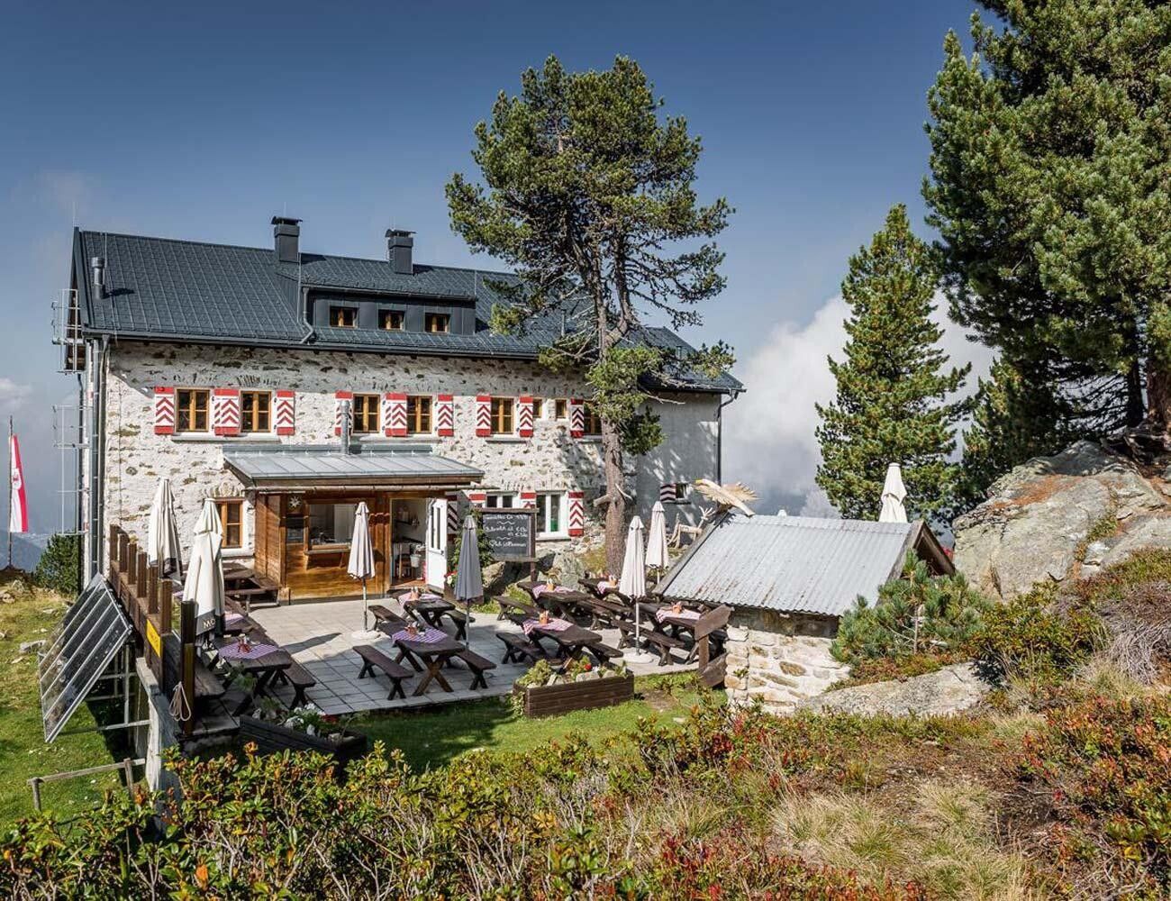
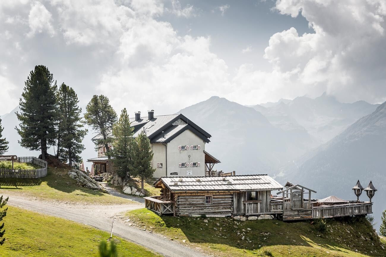
PANORAMARESTAURANT HOCHOETZ -> Bielefelder Hut -> Old Bielefelder Hut -> Wilhelm-Oltrogge-Weg -> SCHWEINFURTER HUT

Tour information

  • Requirement: difficult
  • Length: 13.1 km
  • Duration: 8:30 h
  • Elevation uphill:1,513 hm
  • Elevation downhill:1,492 hm
Highest point2,905 m

Starting point

Panorama restaurant Hochoetz

Finishing point

Schweinfurter Hut
  • Fitness level 5 / 6

Best time of year

  • January
  • February
  • March
  • April
  • May
  • June
  • July
  • August
  • September
  • October
  • November
  • December

Equipment

Suitable for those free from vertigo, sure-footed, and experienced alpine mountaineers; very good physical condition, alpine experience, and mountaineering equipment (see equipment section), sometimes alpine safety gear, and good weather conditions are recommended. Please check the current weather report at: www.oetztal.com/de/sommer.html Appropriate equipment such as breathable and weather-appropriate outdoor clothing, ankle-high hiking boots, wind, rain, and sun protection, a hat, and possibly gloves is required for all hikes and routes. Carrying a first aid kit, a mobile phone, and possibly a hiking map, as well as sufficient provisions for hikes without opportunities to stop for food, is necessary.
Source: Ötztal

Description

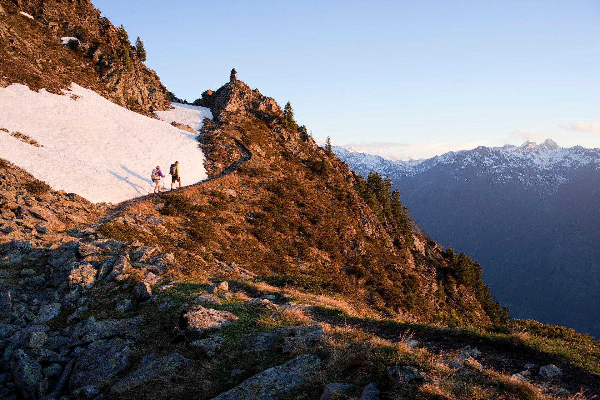
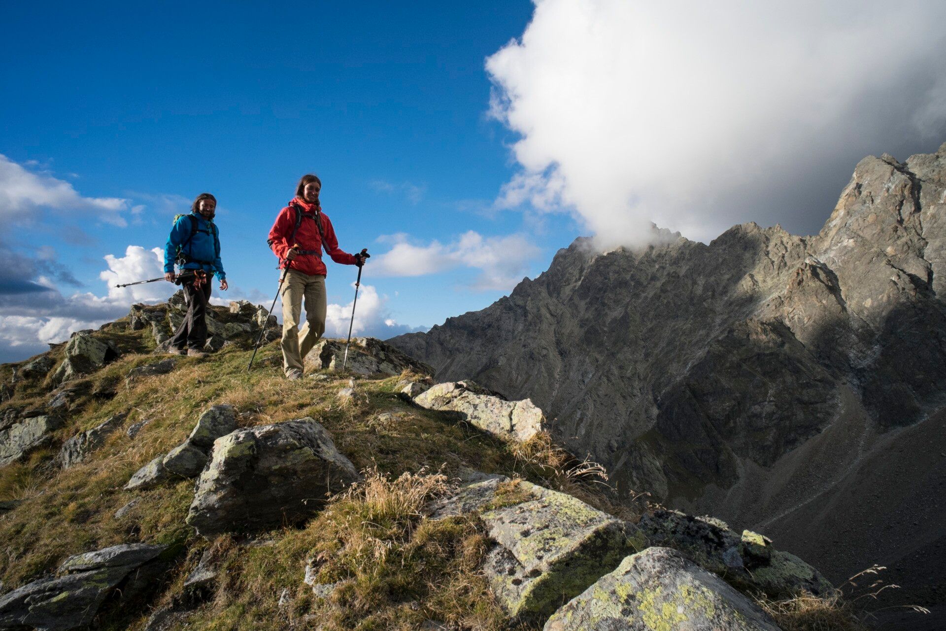
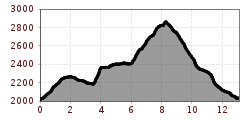
Ascent with the Acherkogelbahn or the Ochsengartengondelbahn. From the mountain station, you hike along the forest road ascending to the Bielefelder Hut. Above the hut follows a steep ascent to just below the summit of the Brunnenkopf. There the path gently ascends to the old Bielefelder Hut. The hut is derelict, but the panorama terrace can still be accessed. Above the hut is a small mountain lake. You pass the ruined alpine pasture and continue on the Wilhelm-Oltrogge-Weg over the Achplatte. The hiking trail is considered very challenging, and some parts are exposed.

You hike past the Hochreichkopf below. On the partly exposed path to the Hochreichscharte, you must pass a section with cable protection. Climbing equipment is not necessary. At the end, you descend to the Schweinfurter Hut.


Nearby huts and mountain restaurants

Getting here

  • Arrival by public transport

    Travel comfortably and safely by train to the Ötztal train station. The final stop and exit point is the ÖTZTAL station. Afterwards, you travel conveniently and quickly by public transport or local taxi companies through the entire valley to your desired destination. The current bus timetable is available at: http://fahrplan.vvt.at

  • Parking

    The following parking options are available:

    • Parking lot Acherkogelbahn (subject to fees)
    • Parking lot rafting entry point (at the end of Oetz on the right side) (subject to fees)
    • Central parking lot Oetz (subject to fees)
    • Overnight parking during multi-day routes: central parking lot Oetz. The ticket is available at the Oetz information office.

More tours in the surrounding area

Newsletter

The mountain is calling? So does our newsletter!

In our monthly newsletter we reveal the best holiday tips for Tyrol.