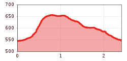
Putzatal-Walk Fügen

Fügen, Zillertal / Tuxer Alpen
Route length: 2.3 km

Short but challenging and diverse circuit above the centre of Fügen

Tour information

  • Length: 2.3 km
  • Elevation uphill:104 hm
  • Elevation downhill:104 hm
Highest point640 m

Starting point

Fügen / Zentrum

Finishing point

Fügen / Zentum
Source: Zillertal Tourismus GmbH

Description

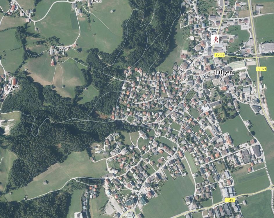
The short course initiallyruns from the town centre of Fügen on an uphill gradient into the Putzatal. Then the course follows a picturesque stream, crosses bridges and goes uphill to higher altitudes. The course then goes slightly downhill along a gravel road to the Marienberg church, which is one of the most beautiful round churches of Tyrol. By following the course between houses, one will reach the lit up Panoramaweg (Panorama Trail), which leads back to the starting point.
 

More tours in the surrounding area

  • Hochfügen - Kleiner Gilfert (2388m) Walk no. 27

    Difficulty: medium
    Length: 14.4 km Duration: 6:00 h Elevation uphill: 925 m
  • Hamberg (2095m) from the Gasthof Almluft (Trail No. 37)

    Difficulty: medium
    Length: 9.4 km Duration: 4:45 h Elevation uphill: 865 m
  • Nature Trail and Bird Nature Trail

    Difficulty: medium
    Length: 6.5 km Duration: 2:00 h Elevation uphill: 250 m
  • 471 Kaltenbach - Wedelhütte

    Difficulty: medium
    Length: 36.9 km Duration: 5:00 h Elevation uphill: 1,759 m
  • 401 | Zillertaler Höhenstraße

    Difficulty: difficult
    Length: 52.6 km Duration: 7:40 h Elevation uphill: 1,890 m
Newsletter

The mountain is calling? So does our newsletter!

In our monthly newsletter we reveal the best holiday tips for Tyrol.