Wednesday: Nature watch tour to the Feilkopf

Difficulty ratings: medium
Route length: 14.0 km
Duration: 5:00 h

Wednesday: Nature watch tour to the Feilkopf

Tour information

  • Requirement: medium
  • Length: 14.0 km
  • Duration: 5:00 h
  • Elevation uphill:590 hm
  • Elevation downhill:590 hm
Highest point1,562 m

Starting point

Pertisau, at the car park in front of the Langlaufstüberl in Pertisau

Finishing point

Pertisau, at the car park in front of the Langlaufstüberl in Pertisau

Features

  • Circular route
  • Suitable for families

Best time of year

  • January
  • February
  • March
  • April
  • May
  • June
  • July
  • August
  • September
  • October
  • November
  • December

Trail condition

Gravel and forest path

Equipment

For all tours, sturdy boots (ankle-high hiking boots) are essential. Please bring weather appropriate clothing. Telescopic hiking poles are recommended. All tours require sure-footedness and an adequate fitness level.

Description

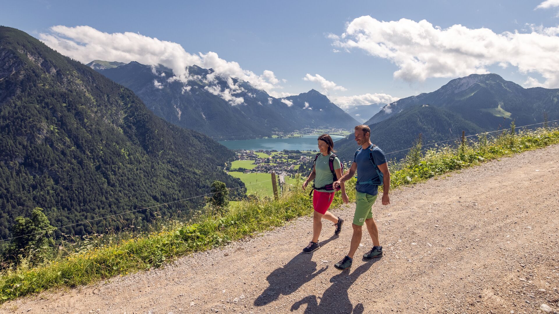
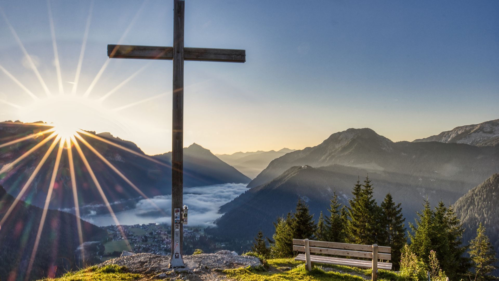
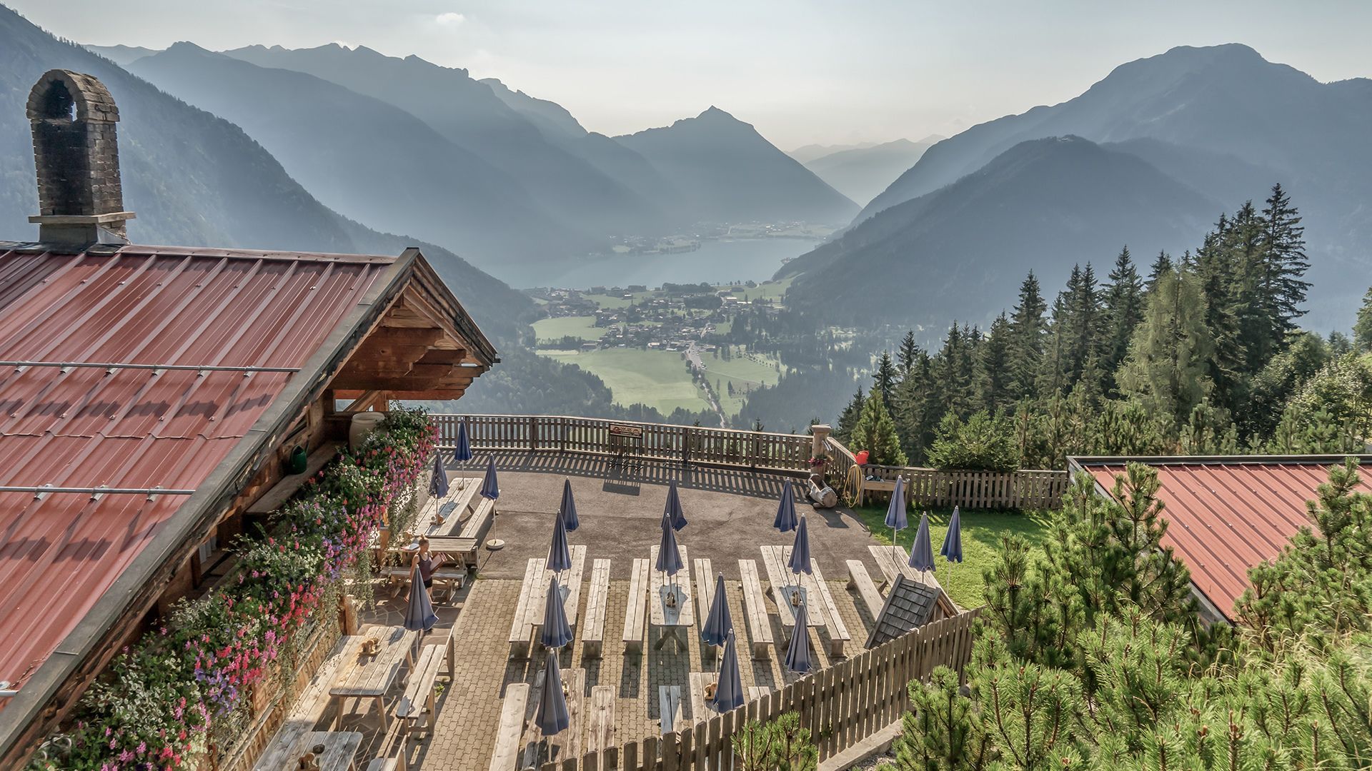
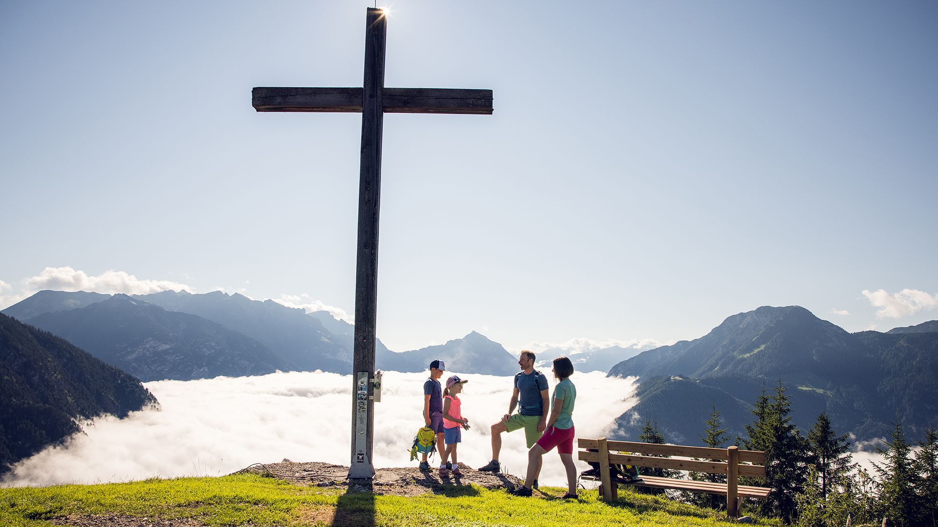
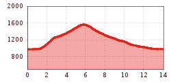
As part of the Achensee summer hiking programme, the Karwendel Nature Park rangers will take us on a discovery tour to the Feilkopf mountain (1,562 metres). Equipped with Swarovski binoculars, we will explore the alpine flora and fauna. The lowest panoramic mountain in the Achensee region offers spectacular views over the lake and the surrounding peaks. On our way back, we will stop for refreshments at the Feilalm.

View details.

Getting here

  • Arrival by public transport

    With the regional buses to Pertisau, exit bus stop: Pertisau Karwendeltäler

  • Parking

    Pertisau, car park Karwendeltäler (paid parking lot)

More tours in the surrounding area

  • “Moor & more” Rocky Way

    Difficulty: easy
    Length: 8.0 km Duration: 3:00 h Elevation uphill: 380 m
  • Brixenbachalm

    Difficulty: medium
    Length: 4.4 km Duration: 3:30 h Elevation uphill: 290 m
  • A1 - Seekirchl Loipe

    Opening hours: open
    Difficulty: easy
    Length: 3.0 km Elevation uphill: 19 m : Style: Skating, Classic
  • Oberau - Kragenjochkreuz

    Difficulty: medium
    Length: 7.9 km Duration: 3:00 h Elevation uphill: 513 m
  • Spitzstein Circuit

    Difficulty: difficult
    Length: 12.5 km Duration: 5:30 h Elevation uphill: 770 m
  • MTB Tour Söll - Hochsöll

    Difficulty: medium
    Length: 5.1 km Elevation uphill: 480 m
  • Hintere Goinger Halt summit tour

    Difficulty: difficult
    Length: 8.9 km Duration: 6:30 h Elevation uphill: 1,090 m
  • Kranzhorn Erl

    Difficulty: medium
    Length: 8.8 km Duration: 3:30 h Elevation uphill: 498 m
  • Schafsiedel

    Difficulty: medium
    Length: 15.6 km Duration: 6:45 h Elevation uphill: 1,280 m
  • 45 Gschnitztalradweg

    Difficulty: easy
    Length: 15.3 km Duration: 2:30 h Elevation uphill: 256 m
  • HB

    Opening hours: closed
    Difficulty: medium
    Length: 5.7 km Duration: 2:00 h Elevation uphill: 260 m
    See trail: HB
Newsletter

The mountain is calling? So does our newsletter!

In our monthly newsletter we reveal the best holiday tips for Tyrol.