Cycle tour Drauradweg

Difficulty ratings: easy
Route length: 63.0 km
Duration: 3:30 h

Easy trail conditions and many child-friendly excursion destinations make the Drau Cycle Path in East Tyrol an ideal family long-distance cycle tour.

Tour character

Beautiful, technically easy long-distance cycle tour through East Tyrol with ideal conditions for families. The Drau cycle path leads from Sillian on the Italian border through the Pustertal valley to Lienz and on to the Carinthian border. Along the way, on gently sloping asphalt and forest paths, there are numerous family-friendly excursion destinations and historically interesting sights. The Roman archaeological site of Aguntum lies at the end of the route.

Tour information

  • Requirement: easy
  • Length: 63.0 km
  • Duration: 3:30 h
  • Elevation uphill:50 hm
  • Elevation downhill:600 hm
Highest point1,230 m

Starting point

Toblach

Finishing point

Nikolsdorf
  • Fitness level 2 / 6
  • Technique 2 / 6

Best time of year

  • January
  • February
  • March
  • April
  • May
  • June
  • July
  • August
  • September
  • October
  • November
  • December

Trail condition

Asphalt

Description

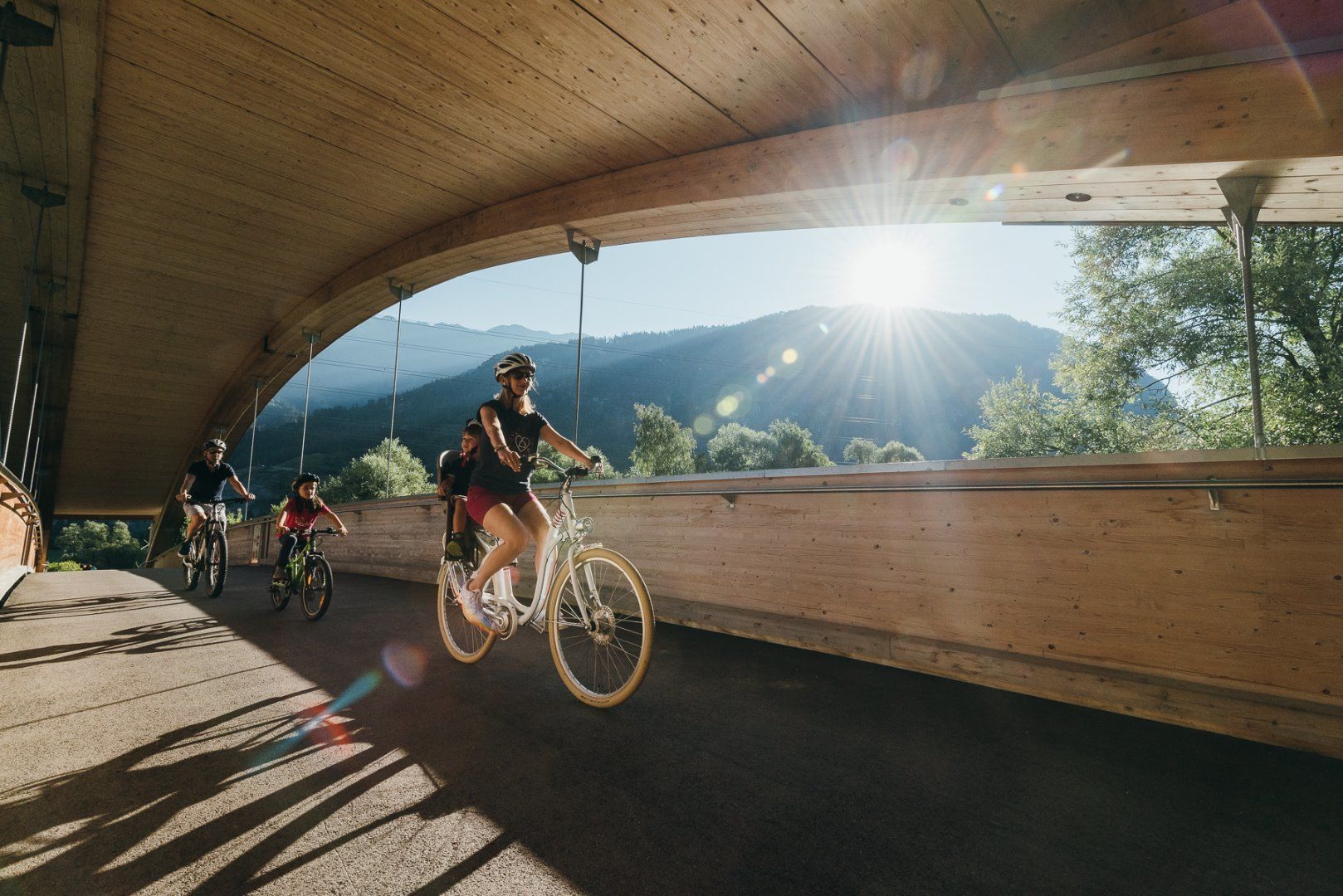
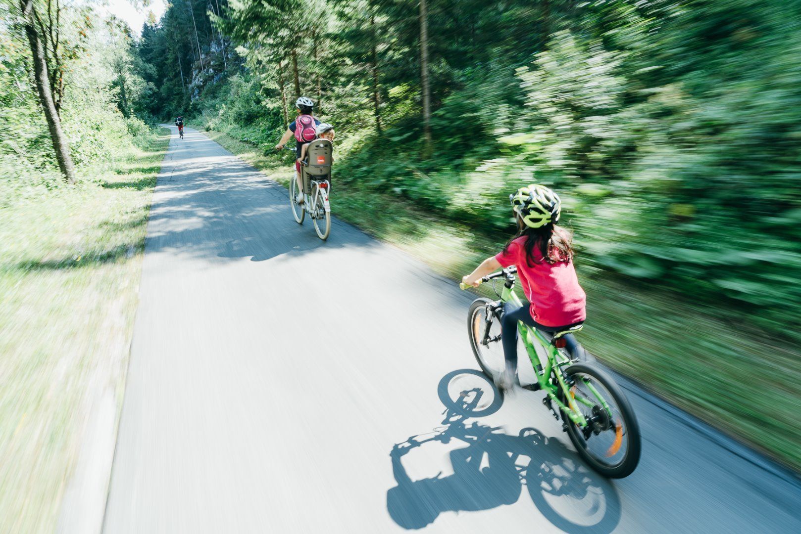
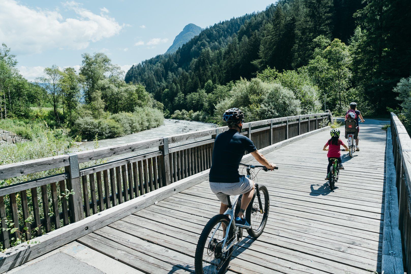
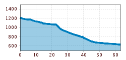
With around 510 kilometres of cycle paths, the Drau Cycle Path is one of the most beautiful cycle paths in Europe. The basis for this is not only the scenic delights, but also the many specialised hosts along the route. The cycle tour leads along a well-marked cycle path and is suitable for all types of bikes. The tour is recommended for families with children as well as novice cyclists. A beautiful, family-friendly cycle route on a gentle slope along the Drau river through the Pustertal valley, through the villages of Sillian and Abfaltersbach, with views of the Lienz Dolomites on the right, through the Galitzenklamm gorge to the district capital of Lienz, continuing along the beautiful Drau floodplain to the Carinthian border.

Nearby huts and mountain restaurants

Getting here

  • Arrival by public transport

    Take the train to Dobbiaco station.

  • Parking

    Dobbiaco train station.

More tours in the surrounding area

  • Bifang Tour

    Opening hours: closed
    Difficulty: easy
    Length: 10.4 km Duration: 1:00 h Elevation uphill: 320 m
  • Högtrail 7081

    Opening hours: open
    Difficulty: easy
    Length: 3.8 km
  • Lichte Trail 882

    Opening hours: closed
    Difficulty: difficult
    Length: 3.4 km Duration: 0:15 h Elevation uphill: 5 m
  • Alpbachtal Giro

    Difficulty: difficult
    Length: 117.4 km Duration: 5:45 h Elevation uphill: 2,250 m
  • Wilder Kaiser cycle route no. 14

    Difficulty: medium
    Length: 38.3 km Elevation uphill: 520 m
  • Komperdell Tour 761

    Opening hours: closed
    Difficulty: medium
    Length: 17.4 km Duration: 1:30 h Elevation uphill: 650 m
  • Plamort Trail

    Opening hours: closed
    Difficulty: Very easy
    Length: 2.5 km
  • 694 Amberger Hütte

    Opening hours: closed
    Difficulty: medium
    Length: 23.7 km Duration: 3:00 h Elevation uphill: 960 m
  • Supernatural

    Opening hours: open
    Difficulty: medium
    Length: 610 m
  • Bike Route Gaislach (644)

    Opening hours: closed
    Difficulty: medium
    Length: 18.7 km Duration: 3:04 h Elevation uphill: 835 m
  • Wildbachtrail

    Difficulty: difficult
    Length: 3.4 km Duration: 0:30 h Elevation uphill: 480 m
  • OD Trails

    Opening hours: closed
    Difficulty: medium
  • Bannwaldsee circuit

    Difficulty: medium
    Length: 94.5 km Duration: 3:45 h Elevation uphill: 877 m
Newsletter

The mountain is calling? So does our newsletter!

In our monthly newsletter we reveal the best holiday tips for Tyrol.