Ehrwald - Panorama path to Lermoos - return through the MoosDifficulty:easyLength:4.8 kmDuration:2:08 hElevation uphill:137 mSee trailSee trail: Ehrwald - Panorama path to Lermoos - return through the Moos
Hochalm Sommer Außenansicht © Hochalm Berwang circular hike AlmkopfDifficulty:easyLength:8.9 kmDuration:3:30 hElevation uphill:466 mSee trailSee trail: Berwang circular hike Almkopf
TVB Bike 147.jpg © Bergbahnen Langes/Klemens Koenig Blindsee TrailOpening hours:openDifficulty:difficultLength:8.2 kmDuration:1:00 hElevation uphill:109 mGo to biketourGo to biketour: Blindsee Trail
B23 Loipe Kelmen-Namlos - NamlosOpening hours:closedDifficulty:mediumLength:3.4 kmDuration:0:50 h:Style: Skating, ClassicGo to Cross-country skiing trailGo to Cross-country skiing trail: B23 Loipe Kelmen-Namlos - Namlos
A20 Moosloipe BerwangOpening hours:closedDifficulty:easyLength:2.6 kmDuration:0:30 h:Style: Skating, ClassicGo to Cross-country skiing trailGo to Cross-country skiing trail: A20 Moosloipe Berwang
A15 Moosloipe - Heiterwang am SeeOpening hours:closedDifficulty:easyLength:4.1 kmDuration:0:45 hElevation uphill:10 m:Style: Skating, ClassicGo to Cross-country skiing trailGo to Cross-country skiing trail: A15 Moosloipe - Heiterwang am See
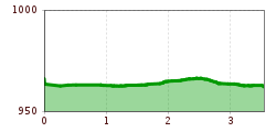
A3 Golf Rundloipe LermoosOpening hours:closedDifficulty:easyLength:3.8 kmDuration:1:00 hElevation uphill:8 m:Style: Skating, ClassicGo to Cross-country skiing trailGo to Cross-country skiing trail: A3 Golf Rundloipe Lermoos
Ehenbichler Alm mit Blick auf Abendspitze © LIGHTHOUSE | Stefan Mayr Fotografie Berwang - To the Sennalpe RaazDifficulty:mediumLength:16.6 kmDuration:3:30 hElevation uphill:768 mGo to biketourGo to biketour: Berwang - To the Sennalpe Raaz
©Robert Eder.jpg © Eder Robert Berwang - ThanellerDifficulty:mediumLength:4.9 kmDuration:3:30 hElevation uphill:982 mSee trailSee trail: Berwang - Thaneller
Lermoos - Moosles ForscherpfadOpening hours:openDifficulty:easyLength:2.7 kmDuration:1:00 hSee trailSee trail: Lermoos - Moosles Forscherpfad
IMG_20190716_162017.jpg © Nina Falger Berwang - Abendspitze & GaltjochDifficulty:mediumLength:5.8 kmDuration:6:00 hElevation uphill:991 mSee trailSee trail: Berwang - Abendspitze & Galtjoch
TVB bike 43.jpg © KLAUS LISTL Lichte Trail 882Opening hours:openDifficulty:difficultLength:3.4 kmDuration:0:15 hElevation uphill:5 mGo to biketourGo to biketour: Lichte Trail 882
Ehenbichler Alm © Robert Eder, Naturparkregion Reutte Winter walk to the Ehenbichler Alm hutDifficulty:difficultLength:6.5 kmDuration:4:00 hElevation uphill:640 mGo to winter hikeGo to winter hike: Winter walk to the Ehenbichler Alm hut
Tiroler Zugspitz Arena LoipeOpening hours:closedDifficulty:mediumLength:39.2 kmDuration:8:00 hElevation uphill:359 m:Style: Skating, ClassicGo to Cross-country skiing trailGo to Cross-country skiing trail: Tiroler Zugspitz Arena Loipe
TVB Bike 195.jpg © Nikola Radovic - NKLRDVC Photo Wetterstein Trail blue/easy - Blue BirdOpening hours:openDifficulty:easyLength:4.1 kmGo to biketourGo to biketour: Wetterstein Trail blue/easy - Blue Bird
TVB Bike 204.jpg © Nikola Radovic - NKLRDVC photo Wetterstein trail red - Fifty/FiftyOpening hours:openDifficulty:mediumLength:1.2 kmGo to biketourGo to biketour: Wetterstein trail red - Fifty/Fifty
Eagle trail stage 17 © Tirol Werbung/Dominik Gigler Eagle Walk Stage 17: Ehrwald - Lorea HütteDifficulty:mediumLength:19.0 kmDuration:5:30 hElevation uphill:1,170 mSee trailSee trail: Eagle Walk Stage 17: Ehrwald - Lorea Hütte
Give feedback for a chance to win a special holiday experience!Click here for the surveyClick here for the survey