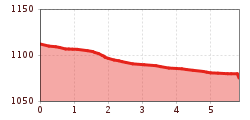
Open interactive mapOpen this POI on the interactive mapElevation profileFishing zone no. 9001 river Kleine Drau.gpx
Fundusfeiler - UmhausenDifficulty: difficult Length: 4.5 km Duration: 3:00 h Elevation uphill: 1,109 m See trailSee trail: Fundusfeiler - Umhausen
694 Amberger HütteOpening hours: open Difficulty: medium Length: 23.7 km Duration: 3:00 h Elevation uphill: 960 m Go to biketourGo to biketour: 694 Amberger Hütte
Seenplatte - Lake Nedersee - ObergurglDifficulty: medium Length: 9.6 km Duration: 5:00 h Elevation uphill: 740 m See trailSee trail: Seenplatte - Lake Nedersee - Obergurgl
Gampe ThayaDifficulty: medium Length: 2.6 km Duration: 1:45 h Elevation uphill: 623 m See trailSee trail: Gampe Thaya
Kitzbüheler Horn, Tour Nr. 4Length: 10.3 km Duration: 1:30 h Elevation uphill: 950 m Go to biketourGo to biketour: Kitzbüheler Horn, Tour Nr. 4
Circular hiking trail Horlachtal - NiederthaiOpening hours: closed Difficulty: easy Length: 6.9 km Duration: 2:00 h Elevation uphill: 233 m Go to winter hikeGo to winter hike: Circular hiking trail Horlachtal - Niederthai
Tauferberg Trail, ÖtztalOpening hours: closed Difficulty: difficult Length: 2.3 km Duration: 0:45 h Elevation uphill: 96 m : Style: Skating, Classic Go to Cross-country skiing trailGo to Cross-country skiing trail: Tauferberg Trail, Ötztal
KitzTrail Streif-liveDifficulty: medium Length: 7.7 km Duration: 3:00 h Elevation uphill: 76 m See trailSee trail: KitzTrail Streif-live
Saalkogel-Rauber-Laubkogel Nr. 87Difficulty: medium Length: 11.1 km Duration: 6:00 h Elevation uphill: 947 m See trailSee trail: Saalkogel-Rauber-Laubkogel Nr. 87
Ramolhaus - ObergurglDifficulty: difficult Length: 7.8 km Duration: 4:00 h Elevation uphill: 1,095 m See trailSee trail: Ramolhaus - Obergurgl
· Cross-country skiing on the sunny plateau in NiederthaiOpening hours: closed Difficulty: easy Length: 3.0 km Duration: 0:40 h Elevation uphill: 15 m : Style: Skating, Classic Go to Cross-country skiing trailGo to Cross-country skiing trail: · Cross-country skiing on the sunny plateau in Niederthai
WIDI Theme Trail - Glück auf! Die spannende Welt der BergmännerDifficulty: easy Length: 2.7 km Duration: 1:15 h Elevation uphill: 110 m See trailSee trail: WIDI Theme Trail - Glück auf! Die spannende Welt der Bergmänner
Höfe Trail stage 5: St. Lorenzen im Lesachtal - Liesing im LesachtalMore InformationMore Information: Höfe Trail stage 5: St. Lorenzen im Lesachtal - Liesing im Lesachtal
Gampe AlmDifficulty: medium Length: 2.7 km Duration: 2:00 h Elevation uphill: 623 m See trailSee trail: Gampe Alm
SupernaturalOpening hours: open Difficulty: medium Length: 610 m Go to biketourGo to biketour: Supernatural
01.2 Panoramic tour through IschglMore InformationMore Information: 01.2 Panoramic tour through Ischgl
Scenic nature site: GletscherblickMore InformationMore Information: Scenic nature site: Gletscherblick
Höfe Trail stage 4: Wacht/Untertilliach – St. Lorenzen im LesachtalMore InformationMore Information: Höfe Trail stage 4: Wacht/Untertilliach – St. Lorenzen im Lesachtal
Stage 6: Through the VerwallDifficulty: medium Length: 15.0 km Duration: 8:00 h Elevation uphill: 1,481 m See trailSee trail: Stage 6: Through the Verwall
Suspension bridge to Maria Locherboden pilgrimage churchDifficulty: medium Length: 8.5 km Duration: 3:00 h Elevation uphill: 370 m See trailSee trail: Suspension bridge to Maria Locherboden pilgrimage church
FigerhornDifficulty: difficult Length: 6.5 km Duration: 6:00 h Elevation uphill: 807 m See trailSee trail: Figerhorn
Along the Goetheweg trail to thePfeishütte mountain hutDifficulty: difficult Length: 5.2 km Duration: 5:00 h Elevation uphill: 344 m See trailSee trail: Along the Goetheweg trail to thePfeishütte mountain hut
Carnic altitude trail. Stage 4: Porzehütte – HochweißsteinhausMore InformationMore Information: Carnic altitude trail. Stage 4: Porzehütte – Hochweißsteinhaus
Nauders mountain trailDifficulty: medium Length: 18.0 km Duration: 7:00 h Elevation uphill: 407 m See trailSee trail: Nauders mountain trail
Kühtai - SulzkogelDifficulty: medium Length: 12.7 km Duration: 7:21 h Elevation uphill: 1,079 m See trailSee trail: Kühtai - Sulzkogel
Give feedback for a chance to win a special holiday experience!Click here for the surveyClick here for the survey

")


.jpg")


.jpg")
.jpg")

")
")

.jpg")

