Themed hikes WIDI Theme Trail - Glück auf! Die spannende Welt der Bergmänner

Oetz / Stubaier Alpen
Difficulty ratings: easy
Route length: 2.7 km
Duration: 1:15 h

With Kuno, the miner, on the way into the world of miners: He shows what is hidden in tunnels and caves, how a rope hoist works and lays the trail for further discoveries.

Tour character

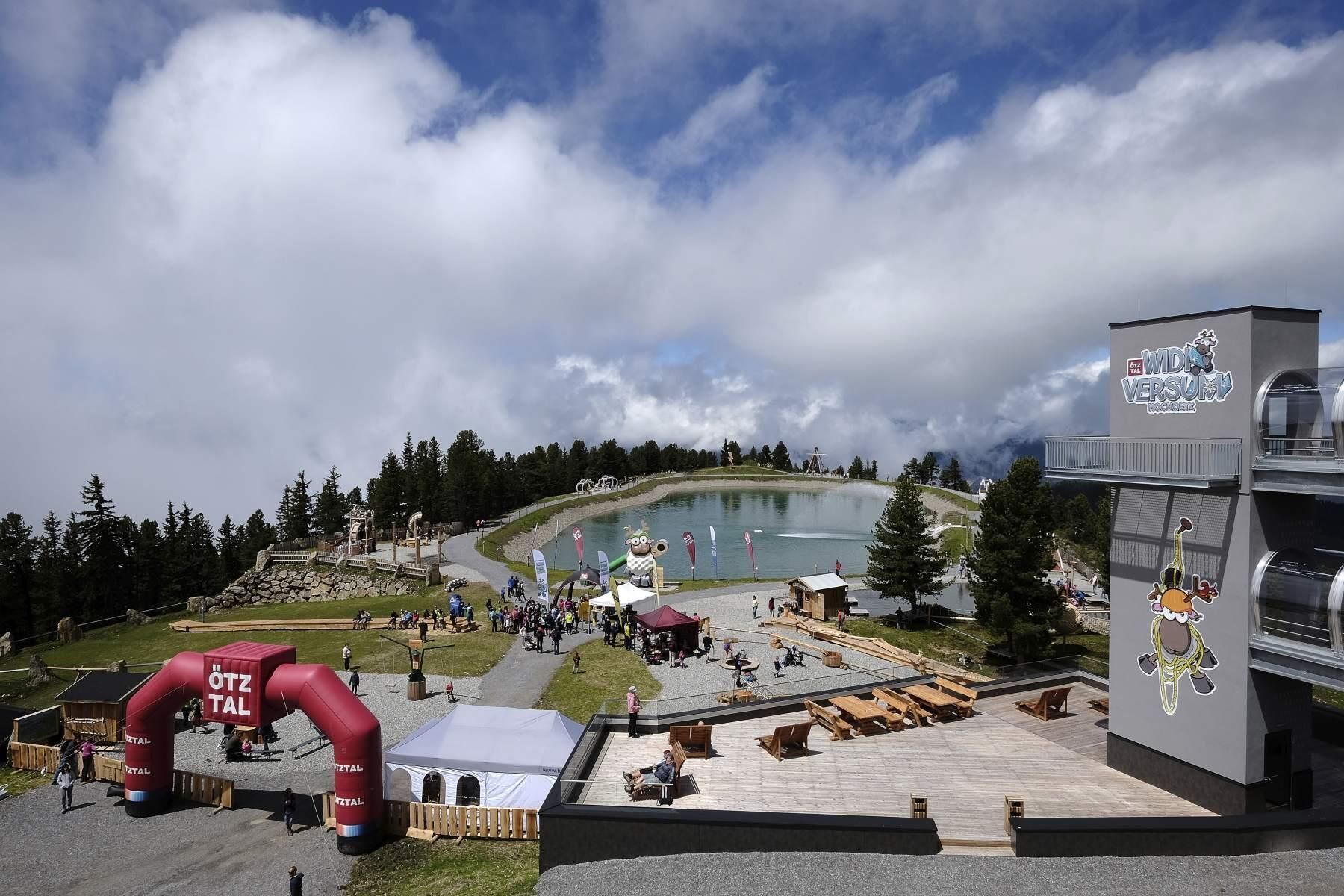
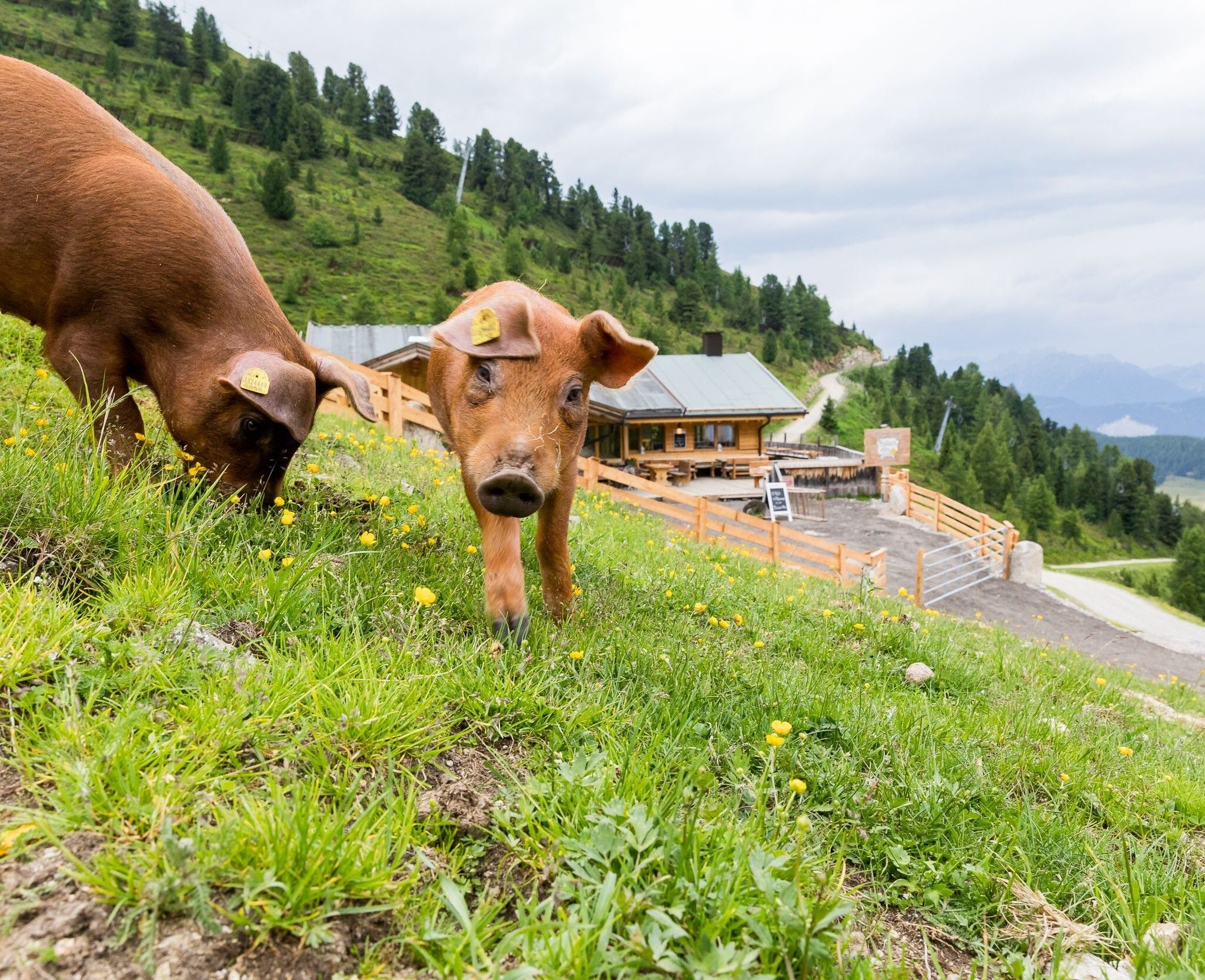
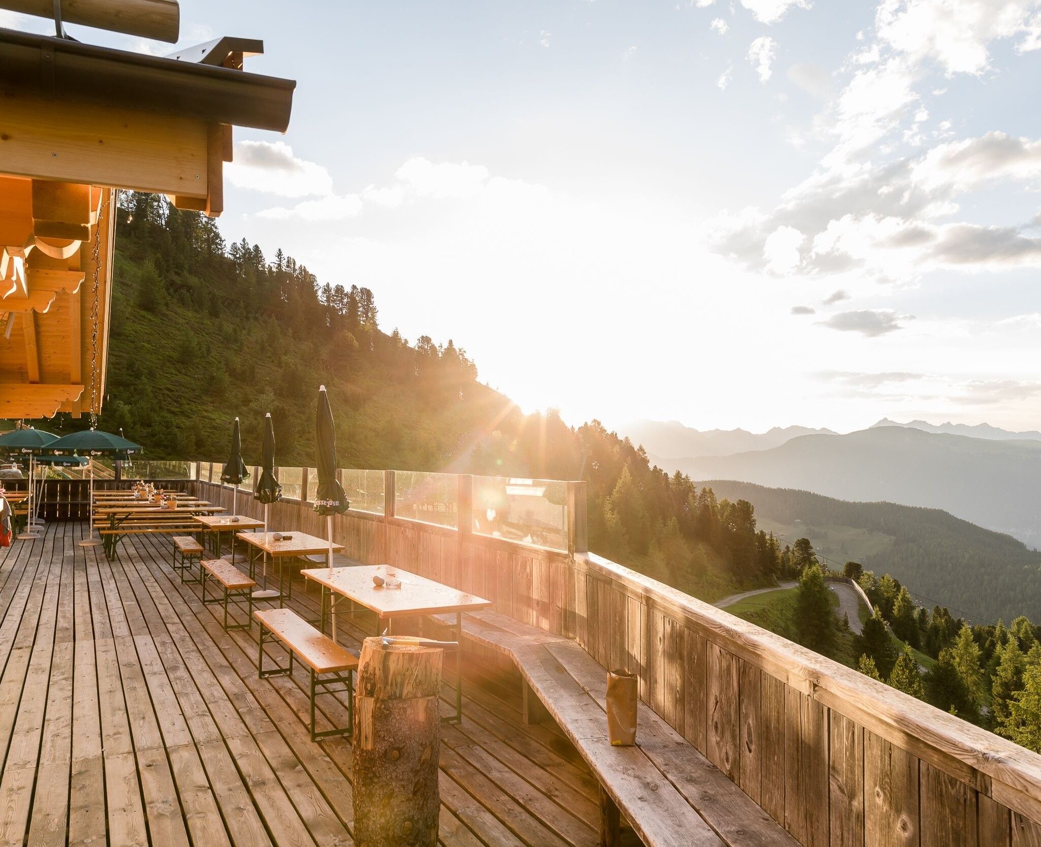
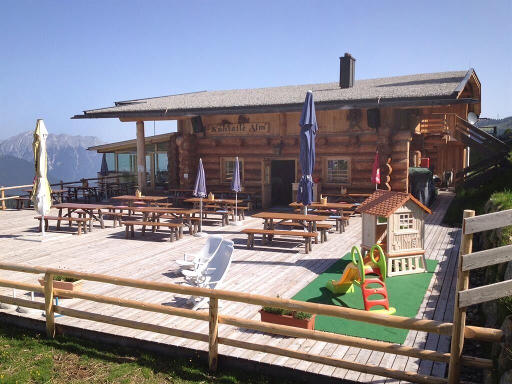
"Glück auf!" S0 is the greeting on the Oetz theme trail, where several child-friendly stations on the theme of mining are lined up along the 2.5-kilometre route: Kristallfelsen > Steinmühle > Kunos Stollen > Balbach Alm > Kunos Seilzug > Kühtaile Alm > Kristallwasser > Bergstation. The Balbach Alm and Kühtaile Alm are great places to stop for refreshments, and the ascent and descent is easy with the mountain railroad.

Tour information

  • Requirement: easy
  • Length: 2.7 km
  • Duration: 1:15 h
  • Elevation uphill:110 hm
  • Elevation downhill:110 hm
Highest point2,061 m

Starting point

Panorama Restaurant Hochoetz

Finishing point

Panorama Restaurant Hochoetz
  • Fitness level 2 / 6

Best time of year

  • January
  • February
  • March
  • April
  • May
  • June
  • July
  • August
  • September
  • October
  • November
  • December

Equipment

Intermediate mountain path; suitable for sure-footed and experienced hikers; good physical condition, mountain experience and mountaineering equipment (see under equipment) necessary. Please note the current weather report at: www.oetztal.com/en/summer.html Suitable equipment such as breathable and weather-appropriate outdoor clothing, ankle-high hiking boots, wind, rain and sun protection, hat, possibly gloves, is required for all hikes and routes. Carrying a first aid kit, a mobile phone and possibly a hiking map, as well as sufficient provisions for hikes without refreshment options, is necessary.
Source: Ötztal

Description

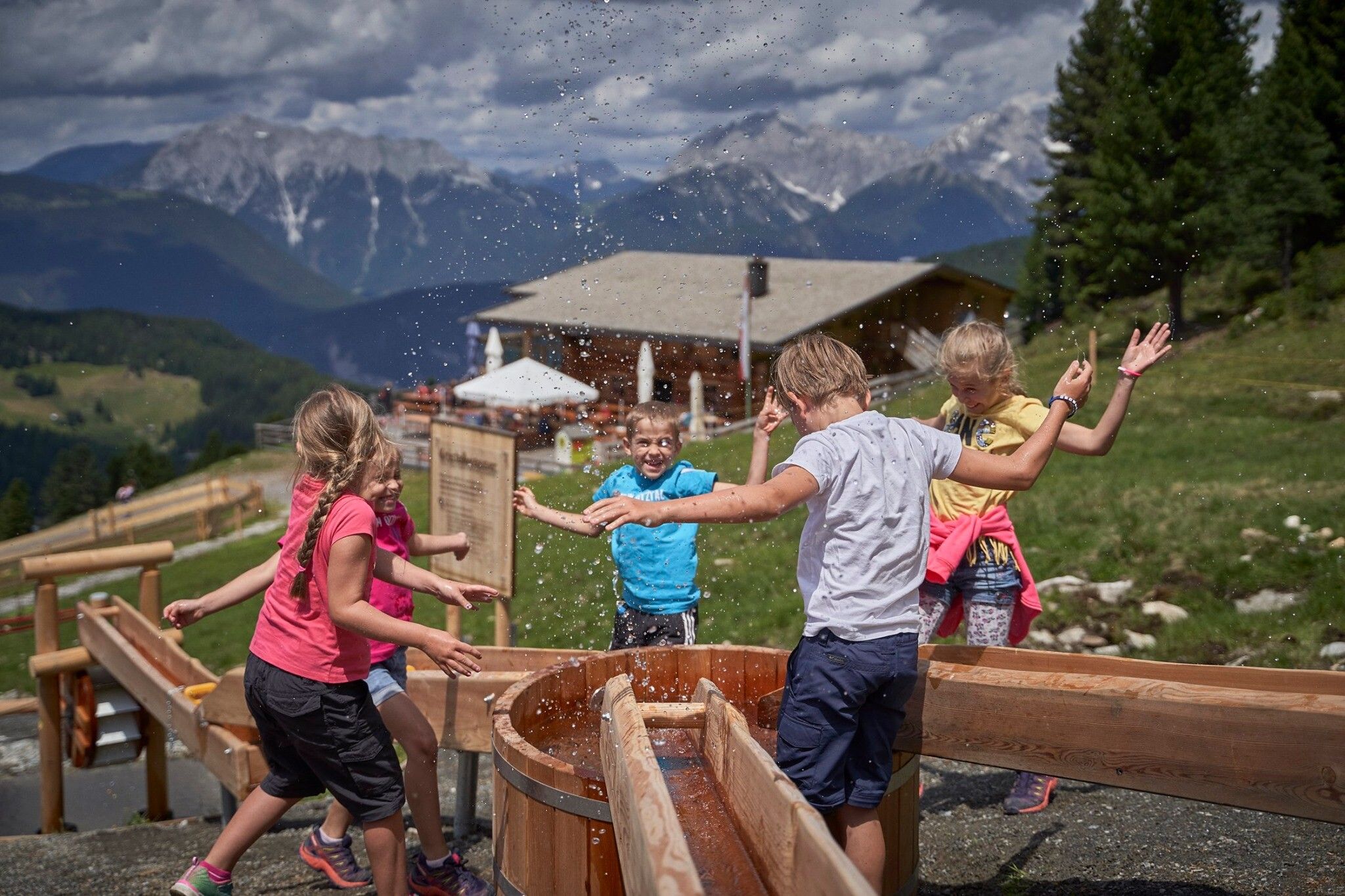
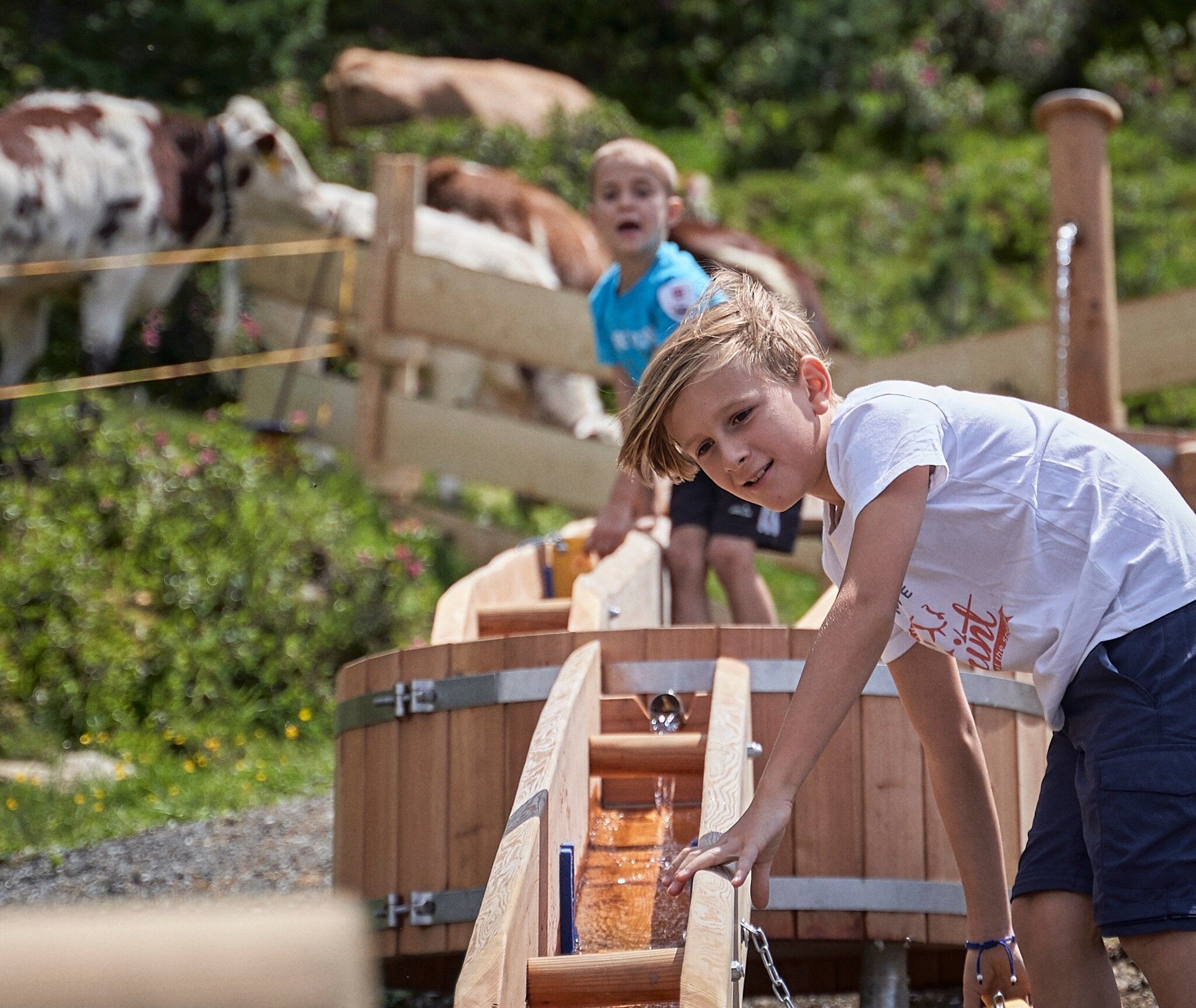
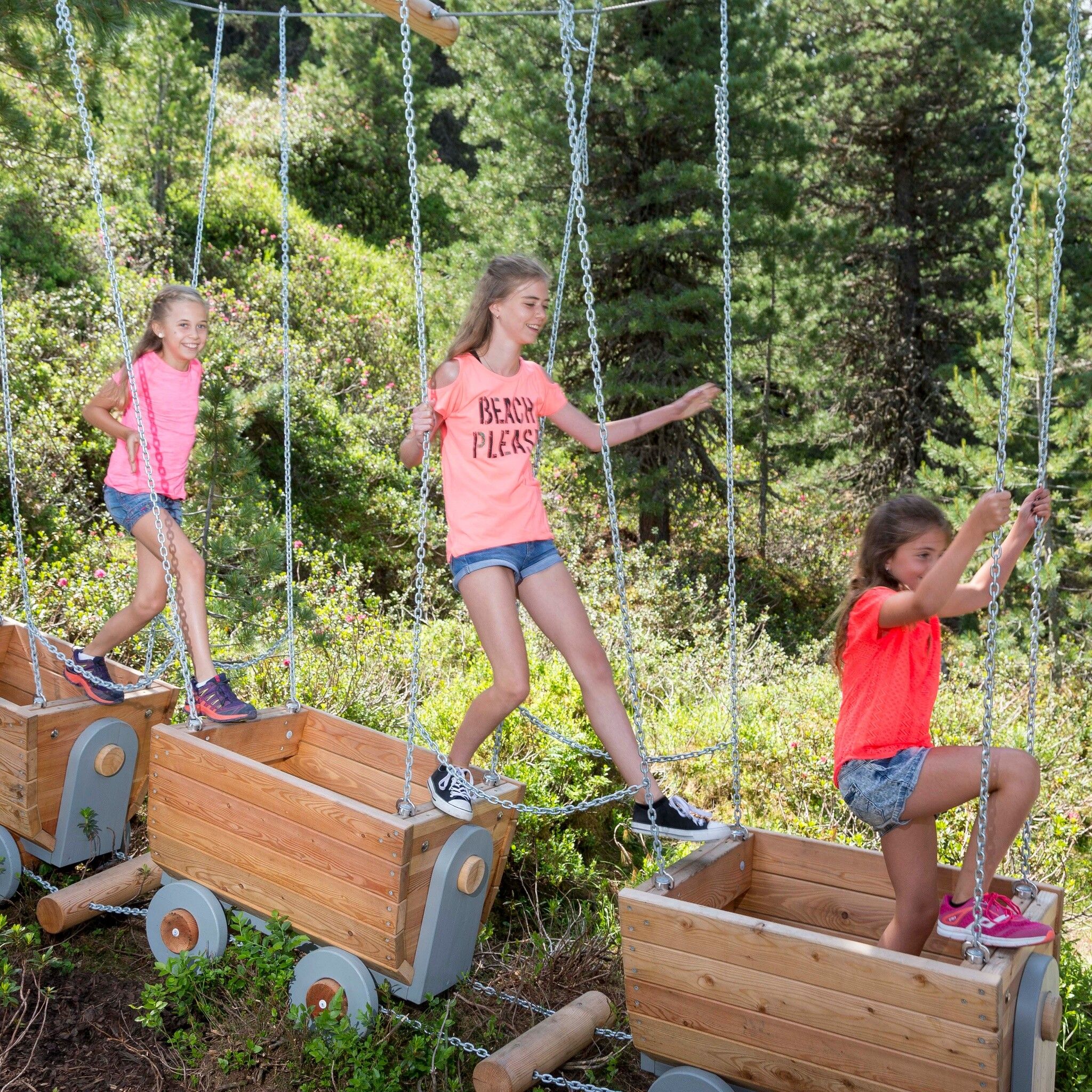
Here miner Kuno is the hero. Follow his tracks and learn everything about miners and mining. What is hidden in tunnels and caves? Where do the crystals come from? How does a pulley work? You will discover all this and much more along the way.

Length of the route: 2.5 km

Walking time: approx. 1 hour

Stations: Mountain station > Crystal rock > Stone mill > Kuno's tunnel > Balbach Alm – Kuno's pulley > Kühtaile Alm – Crystal water > Mountain station

Refreshments: Balbach Alm, Kühtaile Alm


Nearby huts and mountain restaurants

Getting here

  • Arrival by public transport

    Travel comfortably and safely by train to the Ötztal Train Station. The final stop and exit point is ÖTZTAL station. Afterwards, you can conveniently and quickly travel by public transport or local taxi companies through the entire valley to your desired destination! The current bus timetable is available at: http://fahrplan.vvt.at

  • Parking

    The following parking options are available:

    • Parking lot Acherkogelbahn (fee required)
    • Parking lot Rafting entry point (at the end of the village of Oetz on the right side) (fee required)
    • Central parking lot Oetz (fee required)
    • Overnight parking during multi-day tours: Central parking lot Oetz, the ticket is available at the Oetz information office.
    • Free parking in Ochsengarten when taking the Ochsengarten gondola - camping prohibited

More tours in the surrounding area

  • Ötztal Trek Stage 6

    Difficulty: difficult
    Length: 7.6 km Duration: 3:30 h Elevation uphill: 640 m
  • Ötztal Trek Stage 7

    Difficulty: difficult
    Length: 5.3 km Duration: 2:00 h Elevation uphill: 376 m
  • Ötztal Trek

    Length: 246.4 km Duration: 84:25 h Elevation uphill: 18,910 m
  • Ötztal Trek Stage 17

    Difficulty: difficult
    Length: 16.4 km Duration: 6:00 h Elevation uphill: 1,080 m
  • Ötztal Trek Stage 16

    Difficulty: difficult
    Length: 6.9 km Duration: 2:30 h Elevation uphill: 358 m
  • Winter hiking trail Rotes Wandl - No. 431

    Opening hours: closed
    Difficulty: easy
    Length: 1.5 km Duration: 0:45 h Elevation uphill: 52 m
  • Ötztal Trek Stage 21

    Difficulty: difficult
    Length: 9.4 km Duration: 4:30 h Elevation uphill: 1,270 m
  • Ötztal Trek Stage 4

    Difficulty: difficult
    Length: 8.9 km Duration: 4:00 h Elevation uphill: 802 m
  • Ötztal Trek Stage 3

    Difficulty: difficult
    Length: 10.4 km Duration: 4:00 h Elevation uphill: 842 m
  • Ötztal Trek Stage 10

    Difficulty: difficult
    Length: 11.1 km Duration: 4:30 h Elevation uphill: 1,476 m
  • Ötztal Trek Stage 8

    Difficulty: difficult
    Length: 9.3 km Duration: 3:30 h Elevation uphill: 274 m
  • Ötztal Trek Stage 20

    Opening hours: closed
    Difficulty: medium
    Length: 6.4 km Duration: 3:00 h Elevation uphill: 610 m
  • Ötztal Trek Stage 11

    Difficulty: difficult
    Length: 12.0 km Duration: 5:00 h Elevation uphill: 705 m
  • Ötztal Trek Stage 5

    Difficulty: difficult
    Length: 8.1 km Duration: 3:30 h Elevation uphill: 1,125 m
  • Ötztal Trek Stage 1

    Difficulty: medium
    Length: 18.6 km Duration: 6:30 h Elevation uphill: 1,561 m
  • Ötztal Trek Stage 14

    Difficulty: difficult
    Length: 6.3 km Duration: 3:00 h Elevation uphill: 1,004 m
  • Ötztal Trek Stage 12

    Difficulty: difficult
    Length: 4.8 km Duration: 2:00 h Elevation uphill: 592 m
  • Ötztaler Urweg

    Length: 189.1 km Duration: 72:19 h Elevation uphill: 9,428 m
  • Ötztal Trek Stage 22

    Difficulty: difficult
    Length: 21.5 km Duration: 8:00 h Elevation uphill: 647 m
  • Vent - Breslauer Hütte - Vernagthütte

    Difficulty: medium
    Length: 10.4 km Duration: 4:00 h Elevation uphill: 1,203 m
Newsletter

The mountain is calling? So does our newsletter!

In our monthly newsletter we reveal the best holiday tips for Tyrol.