Mountain hikes Berglsteiner See - Easy Learning Hiking Trail

Kramsach / Brandenberger Alpen (Rofan)
Difficulty ratings: easy
Route length: 4.3 km
Duration: 1:30 h

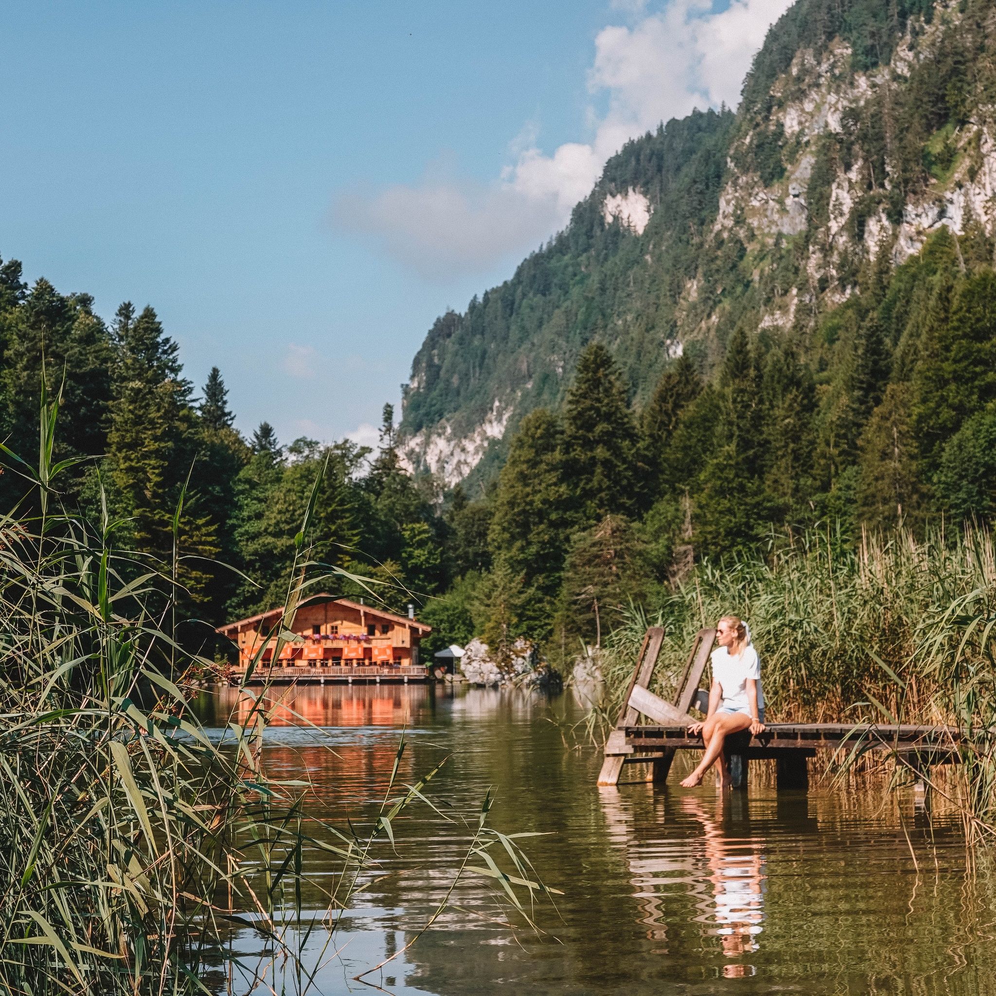
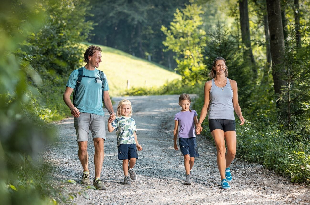
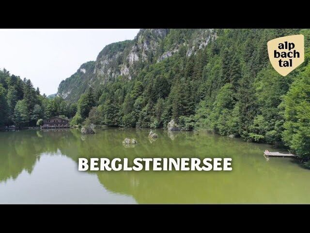
Hike for the whole family to the natural jewel Berglsteiner See from Kramsach

Tour information

  • Requirement: easy
  • Length: 4.3 km
  • Duration: 1:30 h
  • Elevation uphill:155 hm
  • Elevation downhill:155 hm
Highest point737 m

Starting point

Reintalersee/EAST parking lot, Kramsach

Finishing point

Reintalersee/EAST parking lot, Kramsach
  • Fitness level 2 / 6

Features

  • Circular route
  • Suitable for families
  • suitable for pushchairs

Best time of year

  • January
  • February
  • March
  • April
  • May
  • June
  • July
  • August
  • September
  • October
  • November
  • December

Equipment

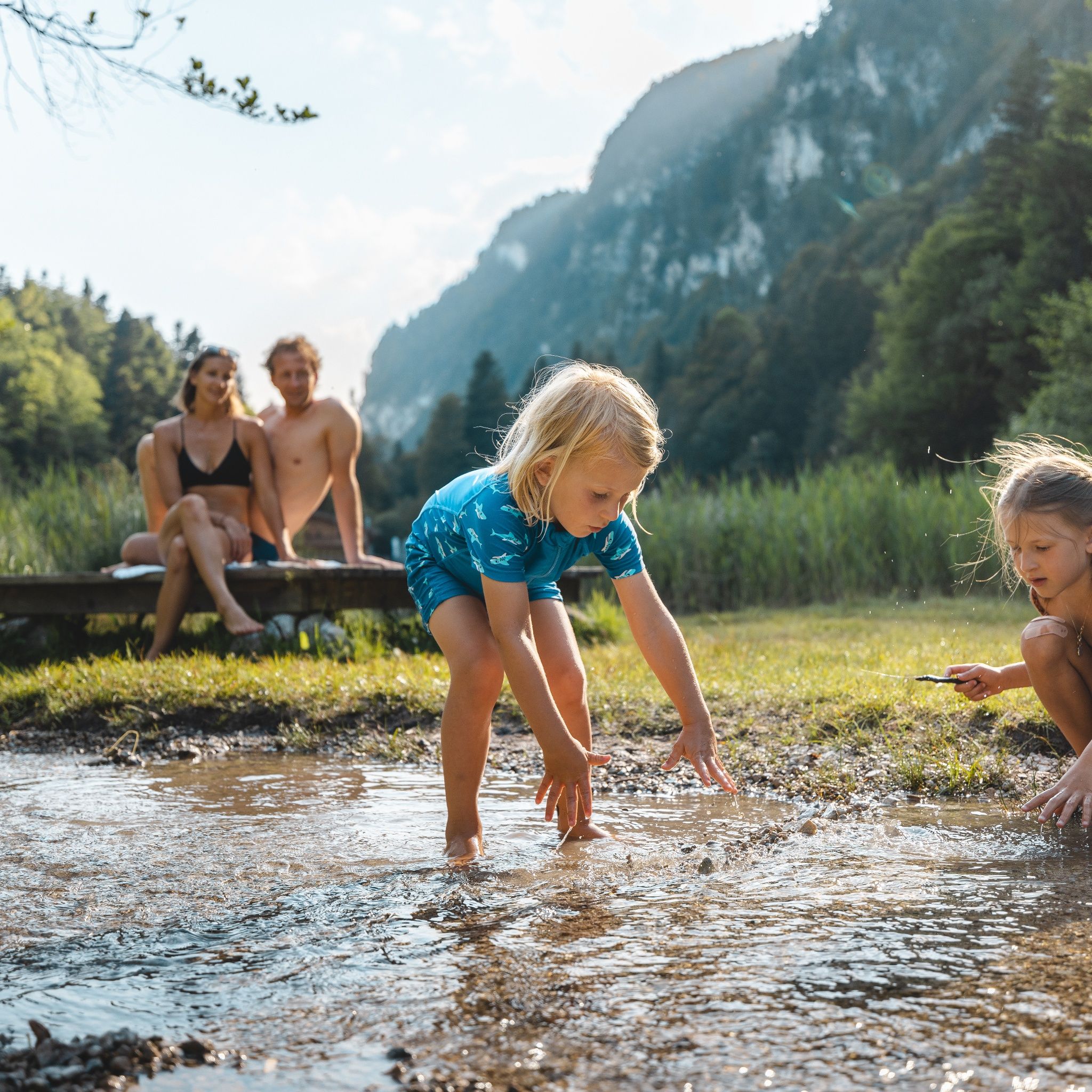
Up to Berglsteinersee it is a pram-friendly but somewhat steep forest road for strollers. A circumnavigation of the lake on the root-rich forest path is only partially recommended with a stroller.

Sturdy footwear

Source: Alpbachtal Tourismus

Description

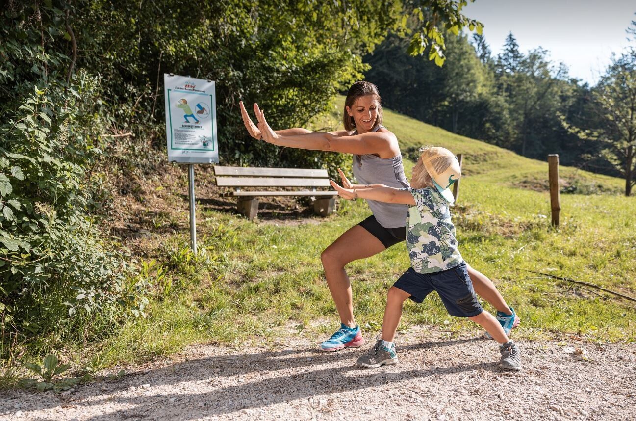
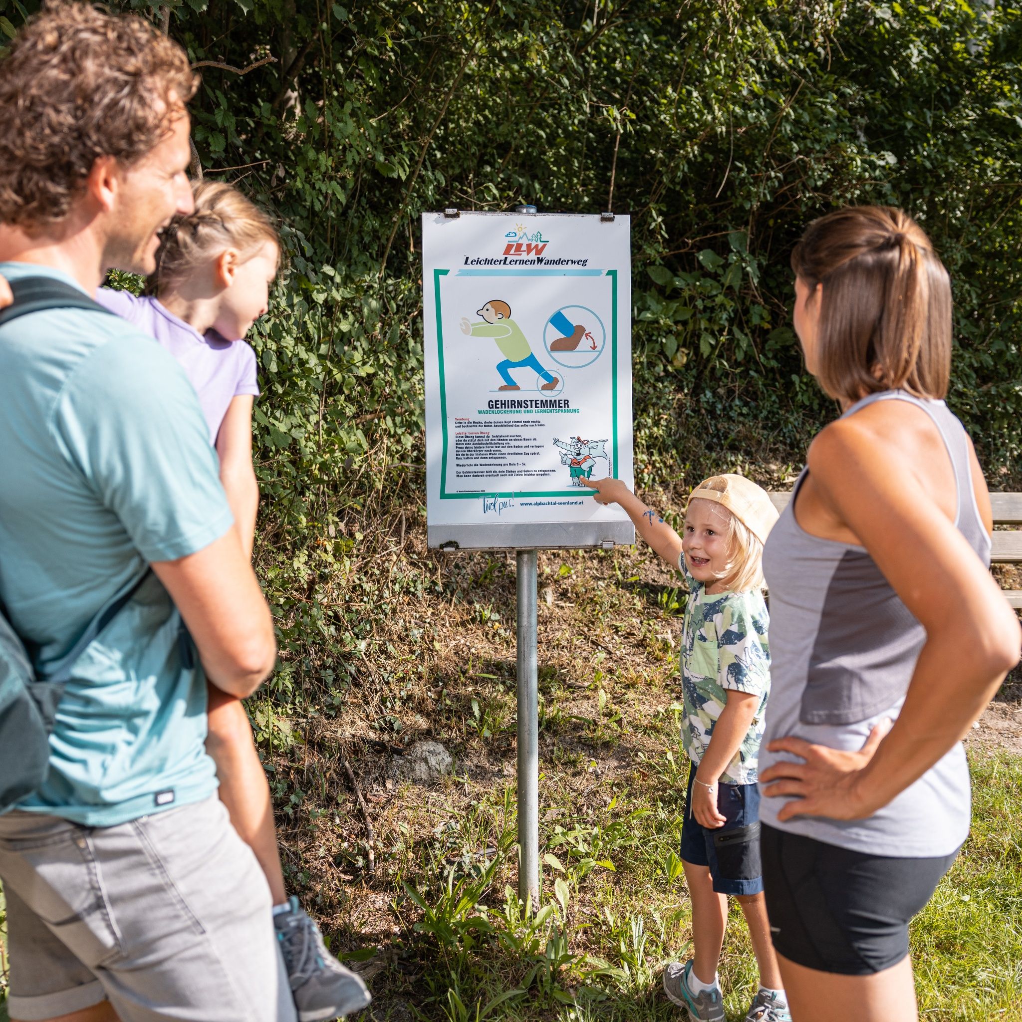
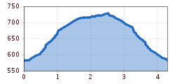
From the Reintalersee East parking lot (Regio bus stop Reintalersee Peninsula) pass the panoramic board and ascend the forest road to the "Natural jewel Berglsteiner See". Along the route, there are 12 exercise boards for the "Easy Learning Hiking Trail". These exercises improve learning and concentration skills (kinesiology). Information about the exercises and kinesiology at: www.bewegungswerkstatt.at by Herbert Handler

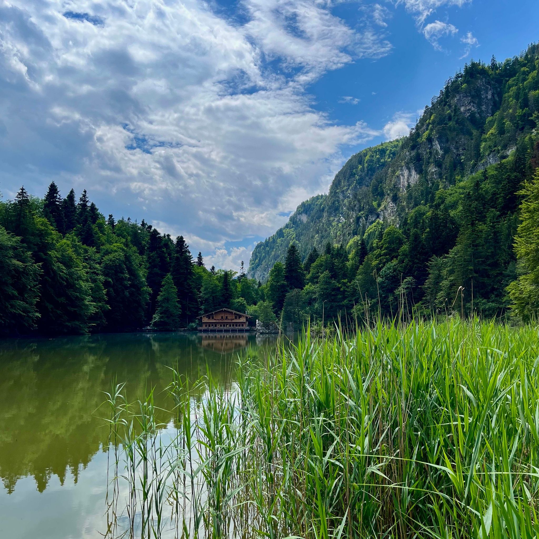
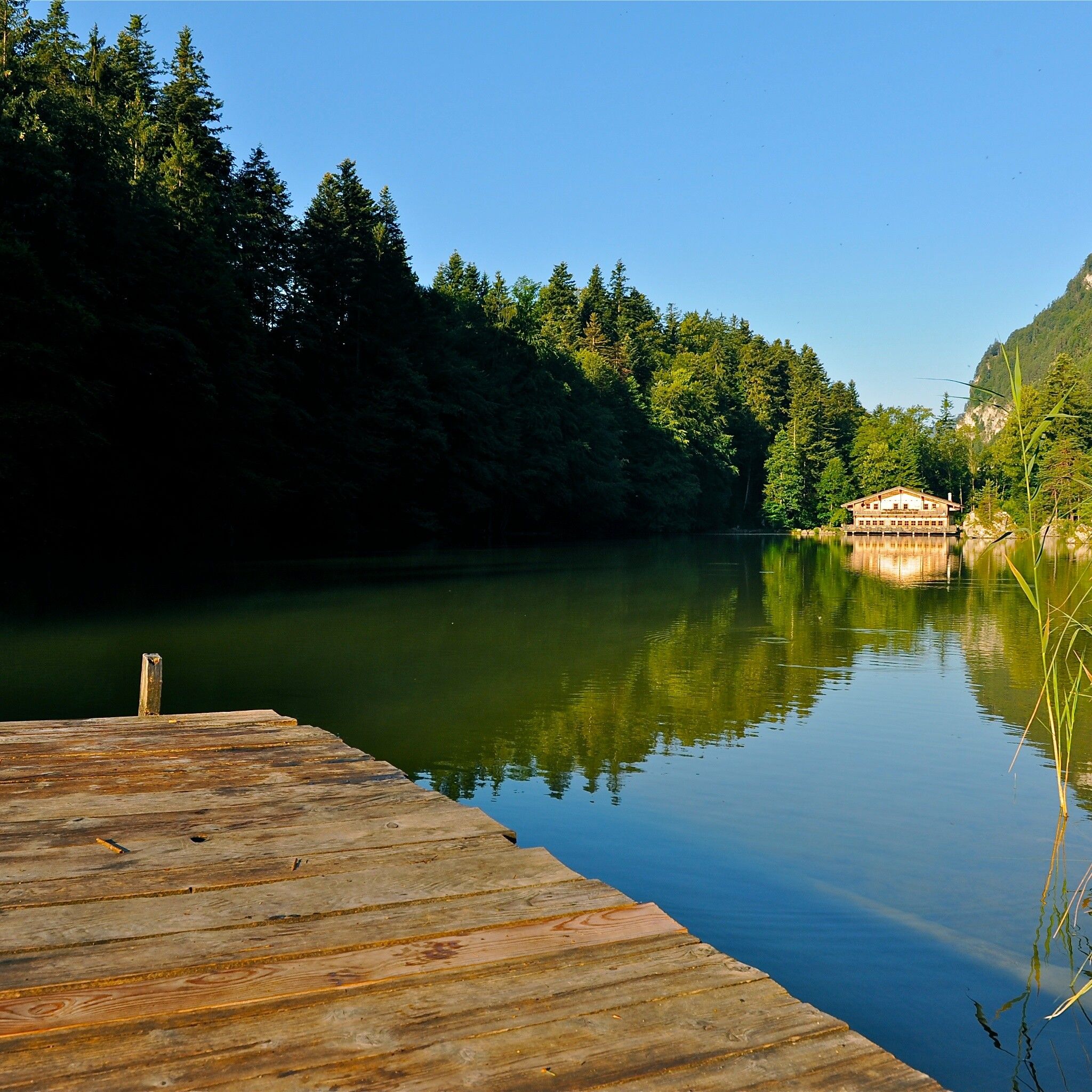
The legendary lake is nestled among deciduous forests in magnificent nature. A beautiful circular path with some rest options leads around the lake. The return route then leads back down the forest road to the starting point.

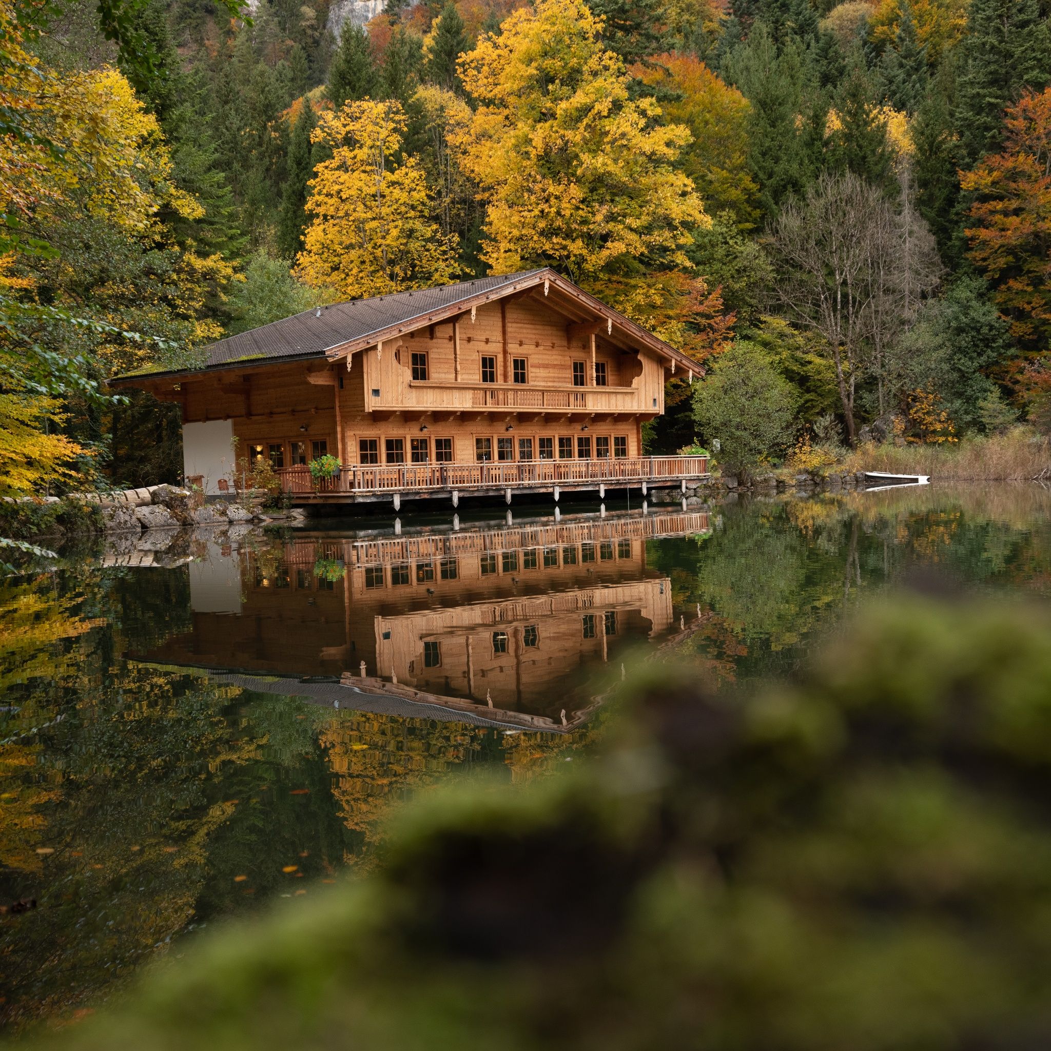
The Berglsteinersee 712er Lounge restaurant invites you to stop by. Further dining options are available directly at Reintalersee.


Nearby huts and mountain restaurants

Getting here

  • Arrival by public transport

    Line 621

    Stop Reintalersee Peninsula

    www.vvt.at

  • Parking

    Reintalersee East parking lot

More tours in the surrounding area

  • Voldöpper Spitze Loop Hike

    Difficulty: medium
    Length: 12.9 km Duration: 5:00 h Elevation uphill: 988 m
  • Barrier-free path Lake Reintal

    Difficulty: easy
    Length: 6.5 km Duration: 1:45 h Elevation uphill: 15 m
  • Kaiser Gorge - loop trail

    Opening hours: closed
    Difficulty: easy
    Length: 4.2 km Duration: 1:00 h Elevation uphill: 198 m
  • 3-day Family Tour Alpbachtal

    Difficulty: easy
    Length: 18.3 km Duration: 7:00 h Elevation uphill: 998 m
  • Loop tour Juppi Zauberwald

    Difficulty: easy
    Length: 2.5 km Duration: 1:00 h Elevation uphill: 93 m
  • Kundler Klamm

    Opening hours: closed
    Difficulty: easy
    Length: 6.4 km Duration: 2:00 h Elevation uphill: 116 m
  • Farmkehralm 1.521 m

    Difficulty: medium
    Length: 9.3 km Duration: 3:30 h Elevation uphill: 506 m
  • Wiedersberger Horn Panorama Path

    Difficulty: easy
    Length: 4.1 km Duration: 1:30 h Elevation uphill: 195 m
  • Day 1: 4 days - 4 summits tour

    Difficulty: medium
    Length: 9.8 km Duration: 5:00 h Elevation uphill: 984 m
  • 3-peak-tour Kienberg-Plessenberg-Heuberg

    Difficulty: medium
    Length: 8.6 km Duration: 4:30 h Elevation uphill: 779 m
  • Day 3: 4 days - 4 summits tour

    Difficulty: medium
    Length: 19.3 km Duration: 8:00 h Elevation uphill: 1,371 m
  • 4 days - 4 summits tour

    Difficulty: medium
    Length: 54.4 km Duration: 23:00 h Elevation uphill: 3,408 m
  • Discovering the Tiefenbach Gorge Hike

    Opening hours: closed
    Difficulty: medium
    Length: 5.7 km Duration: 3:30 h Elevation uphill: 669 m
Newsletter

The mountain is calling? So does our newsletter!

In our monthly newsletter we reveal the best holiday tips for Tyrol.