Mountain hikes Bergstation Rofan Seilbahn - Rotspitz - Streichkopf - Hochiss - Bergstation Rofan Seilbahn

Difficulty ratings: difficult
Route length: 7.5 km
Duration: 4:00 h

Challenging circular hike along the ridge of the Dalfazer Wände, crossing three peaks: Rotspitz, Streichkopf, and Hochiss. This tour promises views that will stay with you forever.

Tour information

  • Requirement: difficult
  • Length: 7.5 km
  • Duration: 4:00 h
  • Elevation uphill:665 hm
  • Elevation downhill:665 hm
Highest point2,299 m

Starting point

Maurach, top station Rofan cable car

Finishing point

Maurach, top station Rofan cable car
  • Fitness level 4 / 6
  • Technique 5 / 6

Features

  • Circular route

Best time of year

  • January
  • February
  • March
  • April
  • May
  • June
  • July
  • August
  • September
  • October
  • November
  • December

Trail condition

hiking trail, steep trail which is secured with a steel cable

Equipment

Sturdy boots (ankle-high hiking boots), weather appropriate clothing. Telescopic hiking poles are recommended.
Source: Achensee Tourismus

Description

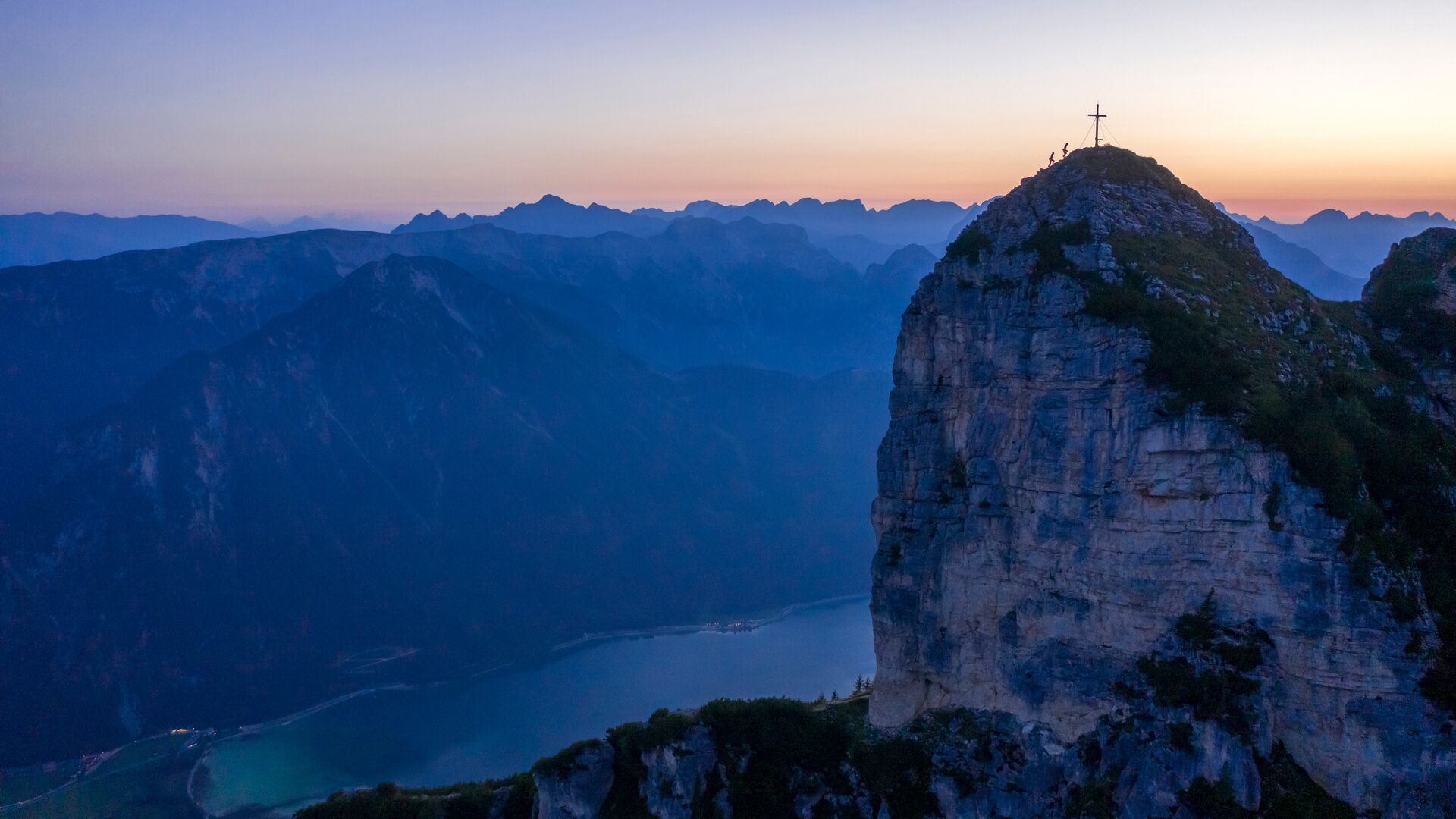
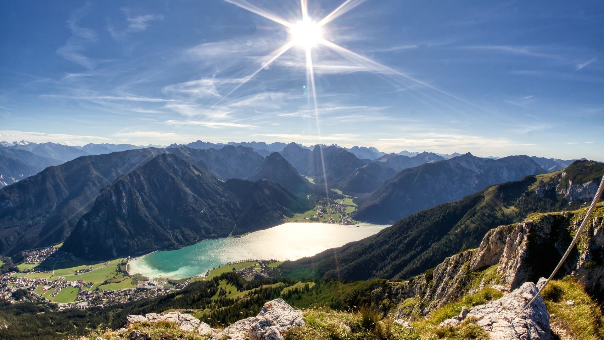
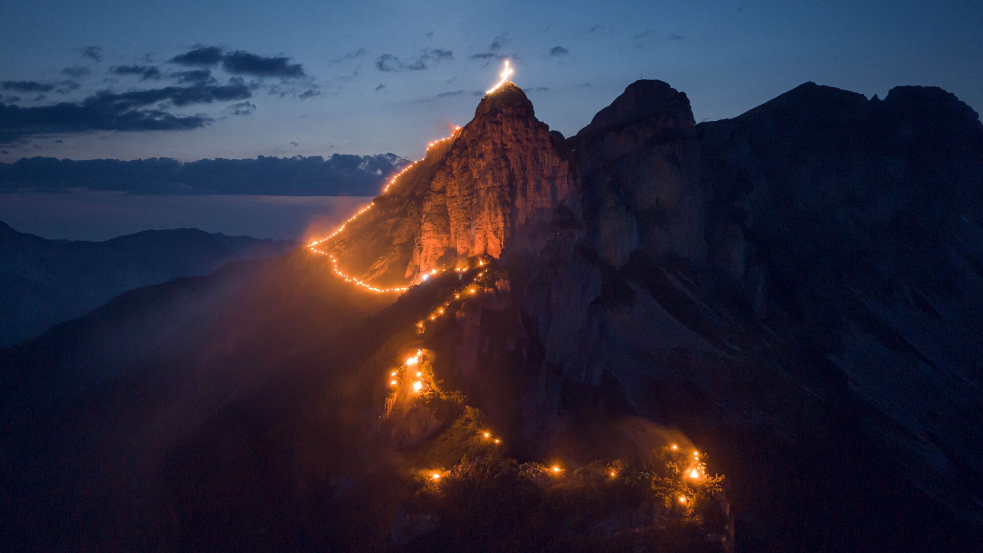
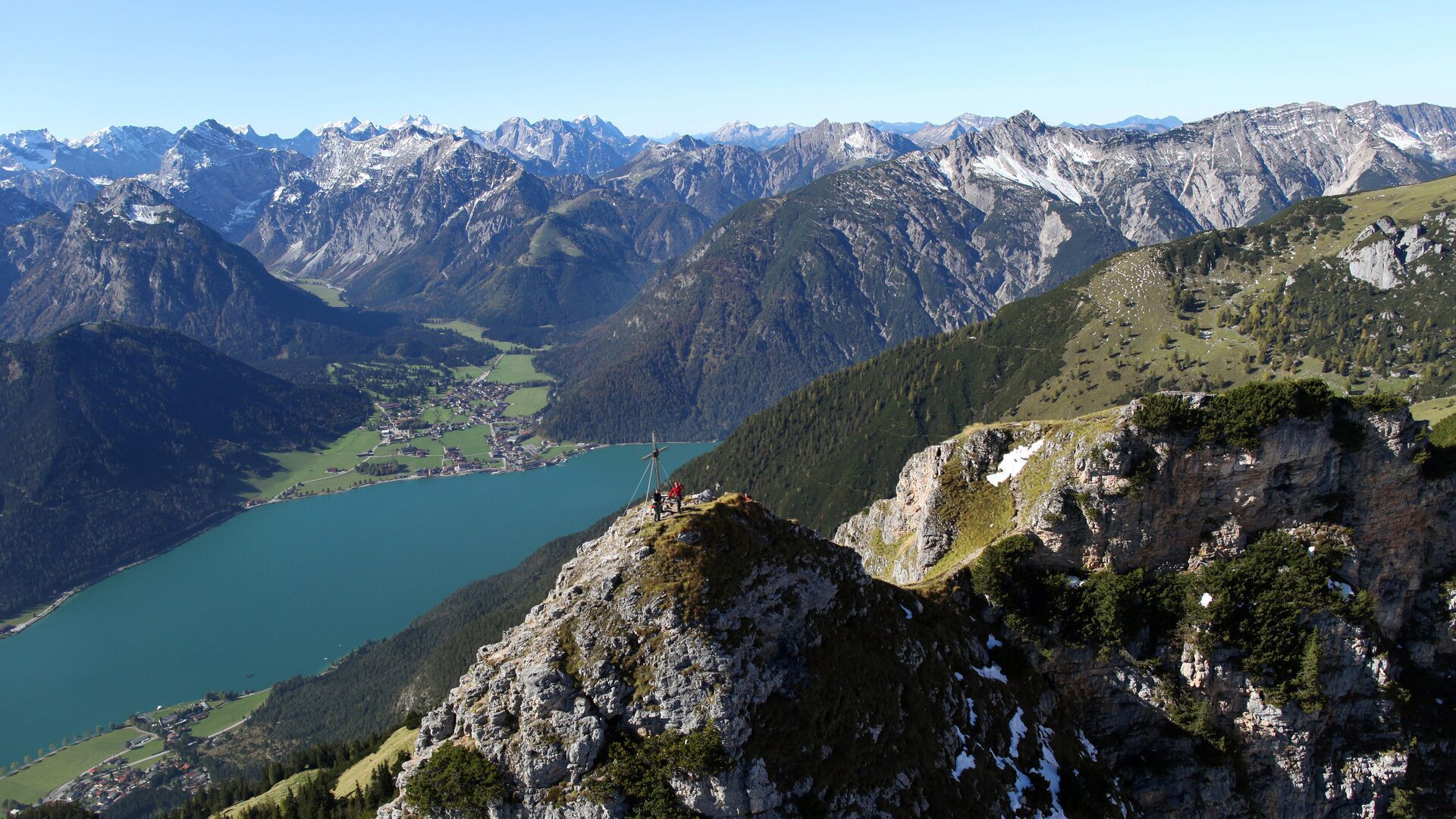
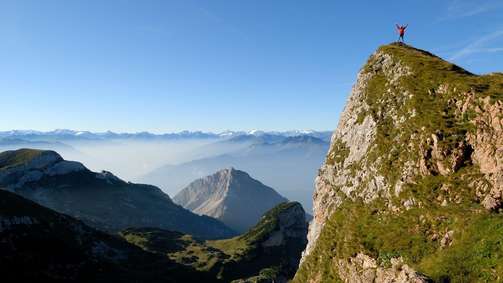
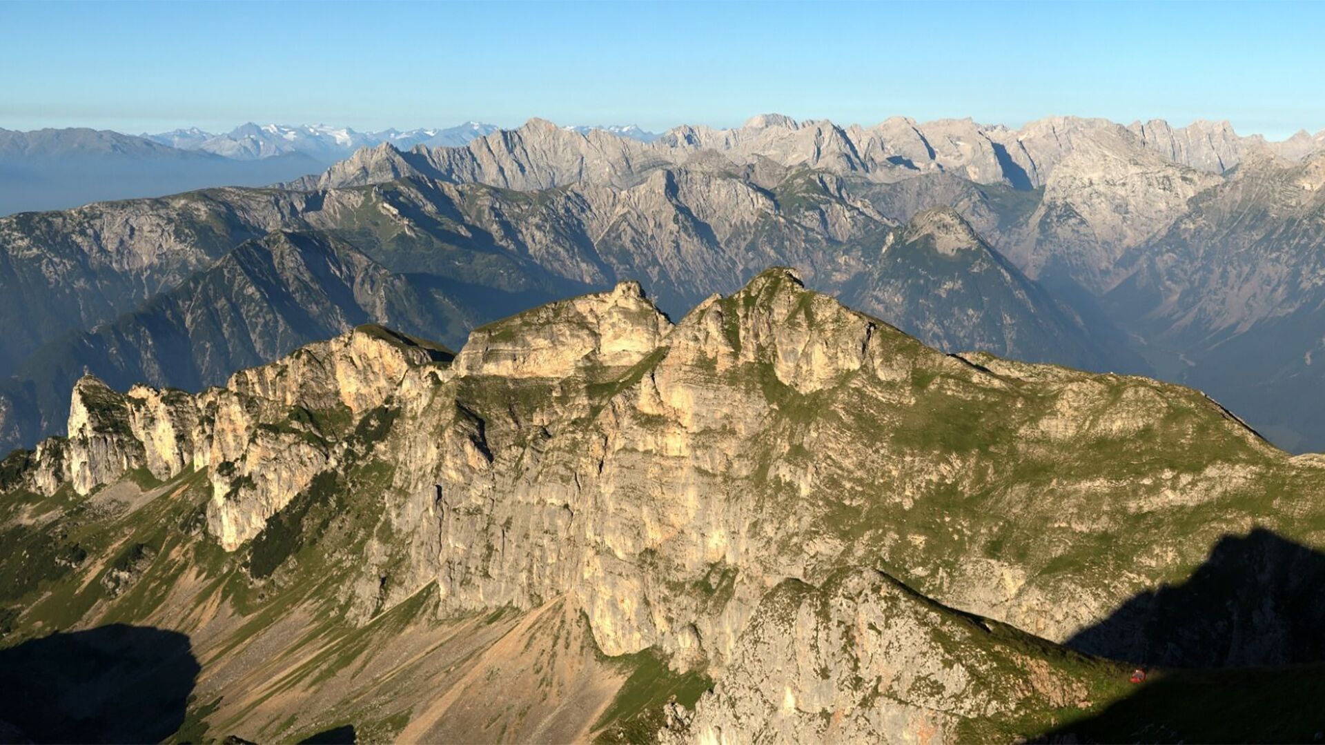
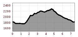
From the top station of the Rofan cable car, walk in the direction of the Dalfaz Alm. About halfway to the mountain hut, a signposted trail branches off to the Rotspitz. After a short detour to the summit of the Rotspitz (2,067 metres), follow the trail on the crest of the Dalfaz walls along the ridge. From the Streichkopf (2.243 metres), the trail leads via the Rote Kamml (secured with ropes) to the summit of the Hochiss (2,299 metres). From here, take the direct route back to the Rofan cable car. 

Nearby huts and mountain restaurants

  • Almstüberl

    Opening hours:Today closed
    Place:Maurach am Achensee
    :Alpine pasture / hut / mountain restaurant
  • Berggasthof Rofan

    Opening hours:Today closed
    Place:Maurach am Achensee
    :Alpine pasture / hut / mountain restaurant
  • Erfurter Hütte

    Opening hours:Today closed
    Place:Maurach am Achensee
    :Alpine pasture / hut / mountain restaurant
  • Mauritzalm

    Opening hours:Today closed
    Place:Maurach am Achensee
    :Alpine pasture / hut / mountain restaurant:Breakfast

Getting here

  • Arrival by public transport

    Take the regional bus to Maurach (line 8332, 4080 or 390) and get off at the "Maurach a. A. Rofan Seilbahn" stop. 

  • Parking

    Car park Rofan Seilbahn 1 or 2 (paid parking; Rofan cable car passengers receive a refund at the ticket office).

More tours in the surrounding area

  • Ötztal Trek Stage 2

    Difficulty:difficult
    Length:10.7 kmDuration:4:00 hElevation uphill:926 m
  • Ötztal Trek Stage 9

    Difficulty:difficult
    Length:12.8 kmDuration:6:00 hElevation uphill:1,623 m
  • Ötztal Trek Stage 10

    Difficulty:difficult
    Length:11.1 kmDuration:4:30 hElevation uphill:1,476 m
  • Ötztal Trek Stage 7

    Difficulty:difficult
    Length:5.3 kmDuration:2:00 hElevation uphill:376 m
  • Ötztal Trek

    Length:246.4 kmDuration:84:25 hElevation uphill:18,910 m
  • Ötztal Trek Stage 16

    Difficulty:difficult
    Length:6.9 kmDuration:2:30 hElevation uphill:358 m
  • Ötztal Trek Stage 19

    Difficulty:difficult
    Length:11.0 kmDuration:5:00 hElevation uphill:1,246 m
  • Ötztal Trek Stage 6

    Difficulty:difficult
    Length:7.6 kmDuration:3:30 hElevation uphill:640 m
  • Ötztal Trek Stage 3

    Difficulty:difficult
    Length:10.4 kmDuration:4:00 hElevation uphill:842 m
  • 3-day hut tour Wilder Kaiser

    Difficulty:difficult
    Length:24.6 kmDuration:14:00 hElevation uphill:2,060 m
  • Ötztal Trek Stage 1

    Difficulty:medium
    Length:18.6 kmDuration:6:30 hElevation uphill:1,561 m
  • Ötztal Trek Stage 17

    Difficulty:difficult
    Length:16.4 kmDuration:6:00 hElevation uphill:1,080 m
  • Ötztal Trek Stage 14

    Difficulty:difficult
    Length:6.3 kmDuration:3:00 hElevation uphill:1,004 m
  • Sunnenseit'n Weg: Round tour

    Difficulty:medium
    Length:8.2 kmDuration:3:00 hElevation uphill:400 m
  • Ötztal Trek Stage 4

    Difficulty:difficult
    Length:8.9 kmDuration:4:00 hElevation uphill:802 m
  • Ötztal Trek Stage 8

    Difficulty:difficult
    Length:9.3 kmDuration:3:30 hElevation uphill:274 m
  • Ötztal Trek Stage 15

    Difficulty:difficult
    Length:6.5 kmDuration:2:30 hElevation uphill:332 m
  • Ötztal Trek Stage 20

    Opening hours:closed
    Difficulty:medium
    Length:6.4 kmDuration:3:00 hElevation uphill:610 m
  • Ötztal Trek Stage 18

    Difficulty:difficult
    Length:9.5 kmDuration:9:30 hElevation uphill:979 m
Newsletter

The mountain is calling? So does our newsletter!

In our monthly newsletter we reveal the best holiday tips for Tyrol.