Hut hike Brixlegg to Hechahof

Brixlegg / Kitzbüheler Alpen
Difficulty ratings: easy
Route length: 4.2 km
Duration: 1:30 h

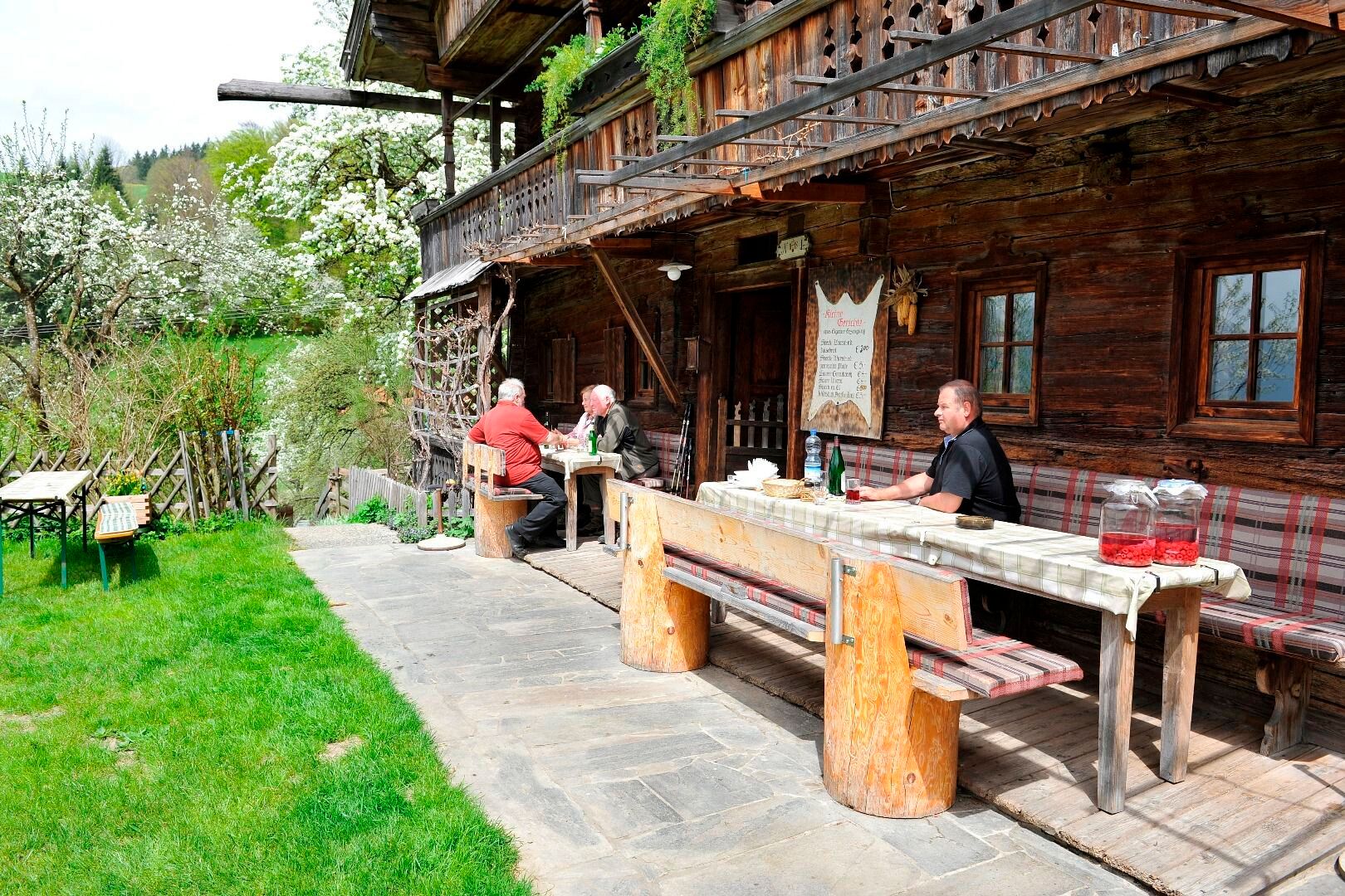
Short hike with a great stop for food and drink

Tour information

  • Requirement: easy
  • Length: 4.2 km
  • Duration: 1:30 h
  • Elevation uphill:121 hm
  • Elevation downhill:121 hm
Highest point772 m

Starting point

Bad Mehrn, Brixlegg

Finishing point

Bad Mehrn, Brixlegg
  • Fitness level 1 / 6

Best time of year

  • January
  • February
  • March
  • April
  • May
  • June
  • July
  • August
  • September
  • October
  • November
  • December

Equipment

Increased caution is necessary along the street!

Weather-appropriate clothing, good footwear

Source: Alpbachtal

Description

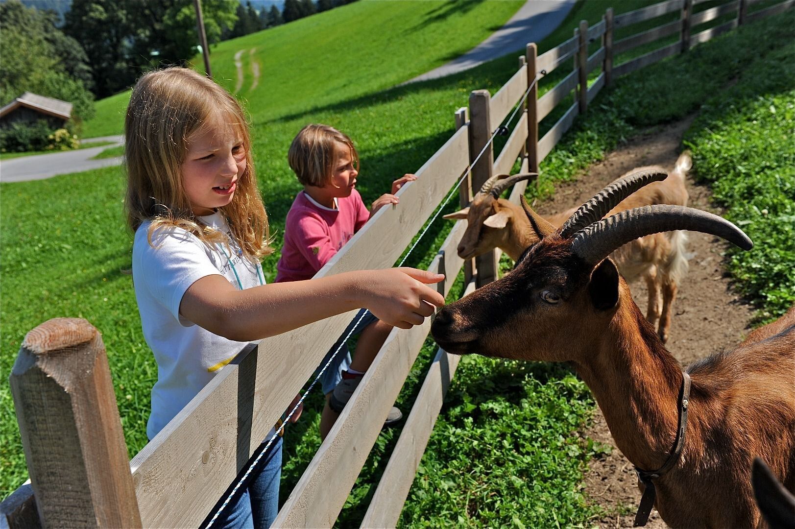
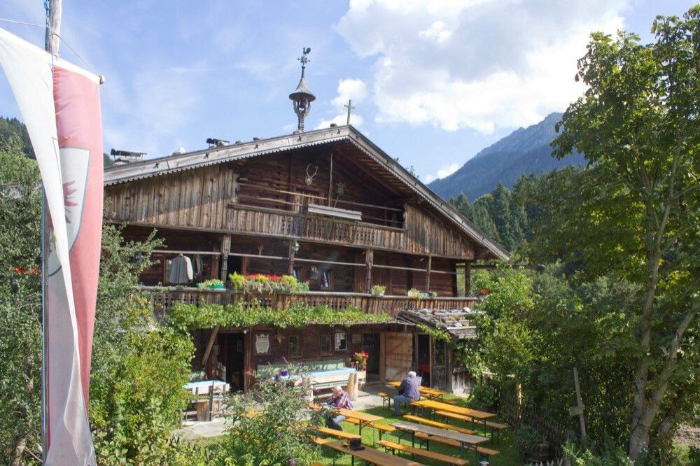
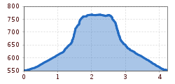
The route starts at the parish church in Mehrn - there are parking options opposite the bridge. After a short visit to the church, follow the street through Mehrn to the shooting range. Now follow the signs through the forest. A beautiful, shady path quickly leads upwards to the forest road, continue straight ahead here, a short stretch slightly downhill, then over a small creek the last 100 m to the Hechahof. Children can look forward to small animals to pet and a playground. Return via the same route.


Getting here

  • Arrival by public transport

    www.vvt.at Bus 620 stop Brixlegg Mühlbichlsiedlung

  • Parking

    Parking lot in front of the bridge in Brixlegg Mehrn (opposite the parish church)

More tours in the surrounding area

  • Day 1: 4 days - 4 summits tour

    Difficulty: medium
    Length: 9.8 km Duration: 5:00 h Elevation uphill: 984 m
  • Day 3: 4 days - 4 summits tour

    Difficulty: medium
    Length: 19.3 km Duration: 8:00 h Elevation uphill: 1,371 m
  • 3-peak-tour Kienberg-Plessenberg-Heuberg

    Difficulty: medium
    Length: 8.6 km Duration: 4:30 h Elevation uphill: 779 m
  • 4 days - 4 summits tour

    Difficulty: medium
    Length: 54.4 km Duration: 23:00 h Elevation uphill: 3,408 m
  • Voldöpper Spitze Loop Hike

    Difficulty: medium
    Length: 12.9 km Duration: 5:00 h Elevation uphill: 988 m
  • Loop tour Juppi Zauberwald

    Difficulty: easy
    Length: 2.5 km Duration: 1:00 h Elevation uphill: 93 m
  • Farmkehralm 1.521 m

    Difficulty: medium
    Length: 9.3 km Duration: 3:30 h Elevation uphill: 506 m
  • Barrier-free path Lake Reintal

    Difficulty: easy
    Length: 6.5 km Duration: 1:45 h Elevation uphill: 15 m
  • Kaiser Gorge - loop trail

    Opening hours: closed
    Difficulty: easy
    Length: 4.2 km Duration: 1:00 h Elevation uphill: 198 m
  • 3-day Family Tour Alpbachtal

    Difficulty: easy
    Length: 18.3 km Duration: 7:00 h Elevation uphill: 998 m
  • Kundler Klamm

    Opening hours: closed
    Difficulty: easy
    Length: 6.4 km Duration: 2:00 h Elevation uphill: 116 m
  • Wiedersberger Horn Panorama Path

    Difficulty: easy
    Length: 4.1 km Duration: 1:30 h Elevation uphill: 195 m
  • Discovering the Tiefenbach Gorge Hike

    Opening hours: closed
    Difficulty: medium
    Length: 5.7 km Duration: 3:30 h Elevation uphill: 669 m
Newsletter

The mountain is calling? So does our newsletter!

In our monthly newsletter we reveal the best holiday tips for Tyrol.