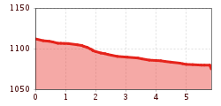
Open interactive mapOpen this POI on the interactive mapElevation profileFishing zone no. 9001 river Kleine Drau.gpx
The Wildschönau High TrailDifficulty:mediumLength:14.8 kmDuration:6:30 hElevation uphill:760 mSee trailSee trail: The Wildschönau High Trail
Summit hike: Ginzling Schlegeis reservoir - Schönbichler HornDifficulty:difficultLength:20.7 kmDuration:9:30 hElevation uphill:1,350 mSee trailSee trail: Summit hike: Ginzling Schlegeis reservoir - Schönbichler Horn
Wildschönau Oberau Achentalalm © Wildschönau Tourismus Oberau - KragenjochkreuzDifficulty:mediumLength:7.9 kmDuration:3:00 hElevation uphill:513 mSee trailSee trail: Oberau - Kragenjochkreuz
web-wilder-kaiser-mountain-tours-summit-photos-behind-goinger-halt-herbst2022-stefan-leitner-6©stefanleitner © Stefan Leitner Hintere Goinger Halt summit tourDifficulty:difficultLength:9.3 kmDuration:6:30 hElevation uphill:1,090 mSee trailSee trail: Hintere Goinger Halt summit tour
Sonnenaufgang am ersten Wildalmsee in der Kelchsau © Christina Ehammer SchafsiedelDifficulty:mediumLength:15.6 kmDuration:6:45 hElevation uphill:1,280 mSee trailSee trail: Schafsiedel
BichlachrundeDifficulty:easyLength:10.5 kmDuration:3:30 hElevation uphill:295 mSee trailSee trail: Bichlachrunde
Griesbachklamm Gorge - Alpine LoopDifficulty:mediumLength:10.2 kmDuration:4:00 hElevation uphill:480 mSee trailSee trail: Griesbachklamm Gorge - Alpine Loop
Museum Galerie Schloss Landeck_010 © Huber Roman Tiroler BurgenwegDifficulty:mediumLength:63.0 kmDuration:25:00 hElevation uphill:2,228 mSee trailSee trail: Tiroler Burgenweg
Ellmau_Biedringer Platte_Winterwanderung_Wilder Kaiser © TVB Wilder Kaiser/Maria Luise Handl Winter walking Biedringer PlatteOpening hours:closedLength:12.7 kmDuration:5:30 hElevation uphill:470 mGo to winter hikeGo to winter hike: Winter walking Biedringer Platte
Scheffau_Kaiser-Hochalm_Wilder Kaiser © TVB Wilder Kaiser/Stefan Leitner Hochalm hikeDifficulty:mediumLength:19.6 kmDuration:7:00 hElevation uphill:1,140 mSee trailSee trail: Hochalm hike
Wallfahrtsweg Kauns (1.050 m) - Kaltenbrunn (1.287 m)Opening hours:openDifficulty:easyLength:9.2 kmDuration:3:30 hElevation uphill:290 mSee trailSee trail: Wallfahrtsweg Kauns (1.050 m) - Kaltenbrunn (1.287 m)
Blick vom Juifen ins Karwendel © Achensee Tourismus Achenkirch - Falkenmoosalm - Großzemmalm - Juifen - AchenkirchDifficulty:mediumLength:20.5 kmDuration:7:30 hElevation uphill:1,120 mSee trailSee trail: Achenkirch - Falkenmoosalm - Großzemmalm - Juifen - Achenkirch
Eagle trail stage 6 © Tirol Werbung/Jens Schwarz Eagle Walk Stage 06: Pinegg - Steinberg am RofanDifficulty:mediumLength:17.8 kmDuration:7:00 hElevation uphill:1,016 mSee trailSee trail: Eagle Walk Stage 06: Pinegg - Steinberg am Rofan
Eagle trail stage 5 © Tirol Werbung/Jens Schwarz Eagle Walk Stage 05: Gasthof Buchacker - PineggDifficulty:difficultLength:18.0 kmDuration:6:00 hElevation uphill:980 mSee trailSee trail: Eagle Walk Stage 05: Gasthof Buchacker - Pinegg
Eagle trail stage 10 © Tirol Werbung/Benjamin Fuchs Eagle Walk Stage 10: Falken Hut - Karwendelhaus LodgeDifficulty:mediumLength:9.0 kmDuration:3:30 hElevation uphill:440 mSee trailSee trail: Eagle Walk Stage 10: Falken Hut - Karwendelhaus Lodge
Eagle trail stage 17 © Tirol Werbung/Dominik Gigler Eagle Walk Stage 17: Ehrwald - Lorea HütteDifficulty:mediumLength:19.0 kmDuration:5:30 hElevation uphill:1,170 mSee trailSee trail: Eagle Walk Stage 17: Ehrwald - Lorea Hütte
Eagle trail stage 24 © Tirol Werbung/Christian Klingler Eagle Walk Stage 24: Kaiserjochhaus - St. Christoph am ArlbergDifficulty:difficultLength:17.5 kmDuration:8:20 hElevation uphill:1,225 mSee trailSee trail: Eagle Walk Stage 24: Kaiserjochhaus - St. Christoph am Arlberg
East Tyrol, Prägraten, Großvenediger, Johannishütte_Tirol Werbung_Huang Long-Nong_Prägraten am Großvenediger.jpg © Huang Long-Nong Eagle Walk Stage O1: Ströden - Johannis HütteDifficulty:mediumLength:13.0 kmDuration:6:30 hElevation uphill:1,430 mSee trailSee trail: Eagle Walk Stage O1: Ströden - Johannis Hütte
Eagle Trail stage O5: Badener Hütte © Badener Hütte Eagle Walk Stage O4: Bonn-Matreier Hütte - Badener HütteDifficulty:difficultLength:10.0 kmDuration:5:00 hElevation uphill:800 mSee trailSee trail: Eagle Walk Stage O4: Bonn-Matreier Hütte - Badener Hütte
Ein Pärchen freut sich über den Gipfelsieg und genießt den Blick von der Rofanspitze auf die umliegende Berglandschaft. © Achensee Tourismus Bergstation Rofan Seilbahn - Rofanspitze - Bergstation Rofan SeilbahnDifficulty:mediumLength:7.1 kmDuration:3:30 hElevation uphill:485 mSee trailSee trail: Bergstation Rofan Seilbahn - Rofanspitze - Bergstation Rofan Seilbahn
Long-distance hike: Berliner Höhenweg (Zillertal Runde)Difficulty:difficultLength:71.0 kmDuration:35:00 hElevation uphill:5,300 mSee trailSee trail: Long-distance hike: Berliner Höhenweg (Zillertal Runde)
Die AlpenüberquerungDifficulty:difficultLength:116.5 kmDuration:37:30 hElevation uphill:3,850 mSee trailSee trail: Die Alpenüberquerung
Kaisergebirge near Ellmau-Going, Klammlsteig to Gruttenhuette, Adlerweg stage 02_Tirol Werbung_Schwarz Jens_Ellmau.jpg © Schwarz Jens Eagle Walk Stage 02: Gaudeamushütte - KaindlhütteDifficulty:mediumLength:15.1 kmDuration:6:30 hElevation uphill:888 mSee trailSee trail: Eagle Walk Stage 02: Gaudeamushütte - Kaindlhütte
Eagle trail stage 9 © Tirol Werbung/Dominik Gigler Eagle Walk Stage 09: Lamsenjoch Hut - Falken HutDifficulty:mediumLength:12.5 kmDuration:6:00 hElevation uphill:810 mSee trailSee trail: Eagle Walk Stage 09: Lamsenjoch Hut - Falken Hut
Eagle trail stage 12 © Tirol Werbung/Hans Herbig Eagle Walk Stage 12: Hallerangerhaus - InnsbruckDifficulty:difficultLength:13.0 kmDuration:5:30 hElevation uphill:1,150 mSee trailSee trail: Eagle Walk Stage 12: Hallerangerhaus - Innsbruck
Give feedback for a chance to win a special holiday experience!Click here for the surveyClick here for the survey
.jpg")


.jpg")


")
.JPG")


