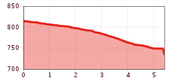
Open interactive mapOpen this POI on the interactive mapElevation profileFishing zone no. 9030 river Kleine Drau.gpx
prosseggklamm-matrei-2024-c-peter-maier72_TVB Osttirol_Peter Maier_Matrei in Osttirol.jpg © Peter Maier Circular Hike Proßeggklamm - Hinteregg - Matrei i. O.Difficulty:mediumLength:12.4 kmDuration:5:20 hElevation uphill:722 mSee trailSee trail: Circular Hike Proßeggklamm - Hinteregg - Matrei i. O.
Adlerweg © Lechtal Tourismus Lechtaler Höhenweg: 6th stage: Württemberger Haus-Steinseehütte-Hanauer HütteDifficulty:difficultLength:9.5 kmDuration:5:15 hElevation uphill:713 mSee trailSee trail: Lechtaler Höhenweg: 6th stage: Württemberger Haus-Steinseehütte-Hanauer Hütte
Leutkircher-Hütte © Lechtal Tourismus Lechtaler Höhenweg 1st stage: Stuttgarter Hütte-Leutkircher HütteDifficulty:difficultLength:7.7 kmDuration:3:15 hElevation uphill:429 mSee trailSee trail: Lechtaler Höhenweg 1st stage: Stuttgarter Hütte-Leutkircher Hütte
Wildtierweg Fuchs.jpg © © Serfaus-Fiss-Ladis Marketing GmbH Wild Animals TrailOpening hours:openDifficulty:easySee trailSee trail: Wild Animals Trail
Leutkircher-Hütte © Lechtal Tourismus Lechtaler Höhenweg 1st stage: Stuttgarter Hütte-Leutkircher HütteDifficulty:difficultLength:6.6 kmDuration:3:15 hElevation uphill:469 mSee trailSee trail: Lechtaler Höhenweg 1st stage: Stuttgarter Hütte-Leutkircher Hütte
©-TVB-Tiroler-Oberland-Kaunertal-Michael-Veit-Klima-Führer-2018-Talwanderweg-Vergötschen-Platz-2018 © Michael Veit Talwanderweg KaunertalDifficulty:easyDuration:2:30 hElevation uphill:295 mSee trailSee trail: Talwanderweg Kaunertal
Gallruth Stollenwanderung_Daniel Zangerl.jpg © Daniel Zangerl Kaunerberger WasserwegDifficulty:mediumLength:15.2 kmDuration:6:00 hElevation uphill:935 mSee trailSee trail: Kaunerberger Wasserweg
Namlos suspension bridge © Außerhofer Hanspeter Namlos - FallerscheinDifficulty:easyLength:3.8 kmElevation uphill:37 mSee trailSee trail: Namlos - Fallerschein
Kundl GorgeOpening hours:openDifficulty:easyLength:6.5 kmDuration:3:00 hElevation uphill:10 mSee trailSee trail: Kundl Gorge
Wildschönau Niederau Auenweg Sommer © Wildschönau Tourismus Auenweg NiederauDifficulty:easyLength:1.0 kmDuration:0:30 hElevation uphill:31 mGo to winter hikeGo to winter hike: Auenweg Niederau
Blick nach Vorderhornbach © Lechtal Tourismus Stanzach - Baichlstein - high trail to VorderhornbachDifficulty:mediumLength:10.0 kmDuration:3:10 hElevation uphill:288 mSee trailSee trail: Stanzach - Baichlstein - high trail to Vorderhornbach
Kaiserjochhaus © Lechtal Tourismus Lechtaler Höhenweg: 3. Etappe Kasierjochhaus-Ansbacher HütteDifficulty:difficultLength:6.9 kmDuration:4:45 hElevation uphill:745 mSee trailSee trail: Lechtaler Höhenweg: 3. Etappe Kasierjochhaus-Ansbacher Hütte
Kaiserjochhaus © Lechtal Tourismus Lechtaler Höhenweg: 3. Etappe Kasierjochhaus-Ansbacher HütteDifficulty:difficultLength:7.8 kmDuration:4:45 hElevation uphill:855 mSee trailSee trail: Lechtaler Höhenweg: 3. Etappe Kasierjochhaus-Ansbacher Hütte
Lech bei Forchach. © Lechtal Tourismus Stanzach - Over the suspension bridgeDifficulty:easyLength:12.8 kmDuration:3:15 hElevation uphill:38 mSee trailSee trail: Stanzach - Over the suspension bridge
Kaiserjochhaus © Lechtal Tourismus Lechtaler Höhenweg: 3. Etappe Kasierjochhaus-Ansbacher HütteDifficulty:difficultLength:7.9 kmDuration:4:15 hElevation uphill:518 mSee trailSee trail: Lechtaler Höhenweg: 3. Etappe Kasierjochhaus-Ansbacher Hütte
Kaiserjochhaus © Lechtal Tourismus Lechtaler Höhenweg: 3. Etappe Kasierjochhaus-Ansbacher HütteDifficulty:difficultLength:11.2 kmDuration:6:45 hElevation uphill:1,037 mSee trailSee trail: Lechtaler Höhenweg: 3. Etappe Kasierjochhaus-Ansbacher Hütte
sonnenaufgangstour-boesesweibele-sommer2020-c-attic-film-gmbh © Attic Film GmbH Böses WeibeleDifficulty:easyLength:10.0 kmDuration:4:00 hElevation uphill:545 mSee trailSee trail: Böses Weibele
Breitegg tourDifficulty:mediumLength:11.0 kmDuration:5:00 hElevation uphill:680 mSee trailSee trail: Breitegg tour
The WiegalmDifficulty:mediumLength:10.5 kmDuration:4:45 hElevation uphill:680 mSee trailSee trail: The Wiegalm
Winter walk Schwarzer See, NaudersDifficulty:easyLength:10.5 kmDuration:3:30 hElevation uphill:255 mGo to winter hikeGo to winter hike: Winter walk Schwarzer See, Nauders
Evening winter hike Kleinmutzkopf, NaudersDifficulty:easyLength:6.0 kmDuration:2:00 hElevation uphill:70 mGo to winter hikeGo to winter hike: Evening winter hike Kleinmutzkopf, Nauders
Wandern Bettlersteig Kaistertal Naturerlebnis Kaisergebirge © Thomas Laukat Kaiserlift Tourentipp 5: From Brentenjoch into the Kaiser ValleyDifficulty:difficultLength:17.6 kmElevation uphill:425 mSee trailSee trail: Kaiserlift Tourentipp 5: From Brentenjoch into the Kaiser Valley
GenießerRundWeg am Ahorn © Christian Lorenz Circular & themed hike: "GenießerRundWeg" at Mount AhornDifficulty:easyLength:2.0 kmDuration:0:45 hElevation uphill:70 mSee trailSee trail: Circular & themed hike: "GenießerRundWeg" at Mount Ahorn
Muttereralm - Saile (Nockspitze)Difficulty:difficultLength:7.5 kmDuration:4:00 hElevation uphill:789 mSee trailSee trail: Muttereralm - Saile (Nockspitze)
Arzler Alm 1 © TVB Pitztal/Chris Walch Arzler Alm – TiefentalalmDifficulty:mediumLength:11.3 kmDuration:5:00 hElevation uphill:1,000 mSee trailSee trail: Arzler Alm – Tiefentalalm
Give feedback for a chance to win a special holiday experience!Click here for the surveyClick here for the survey


.jpg")


.jpg")

.jpg")
.jpg")


.jpg")

