Mountain hikes G'sundheitsbründlweg

Difficulty ratings: easy
Route length: 4.2 km
Duration: 1:15 h

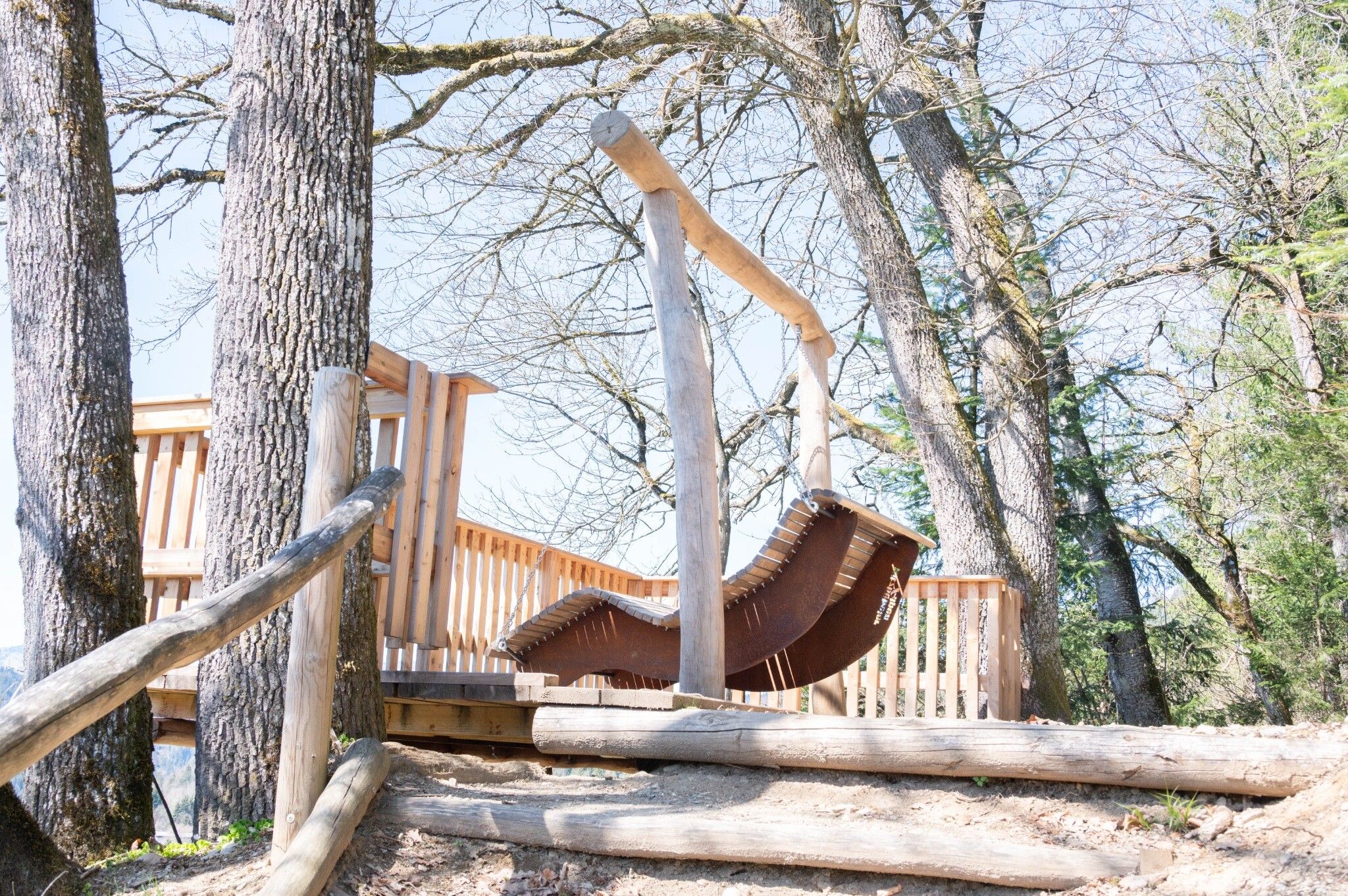
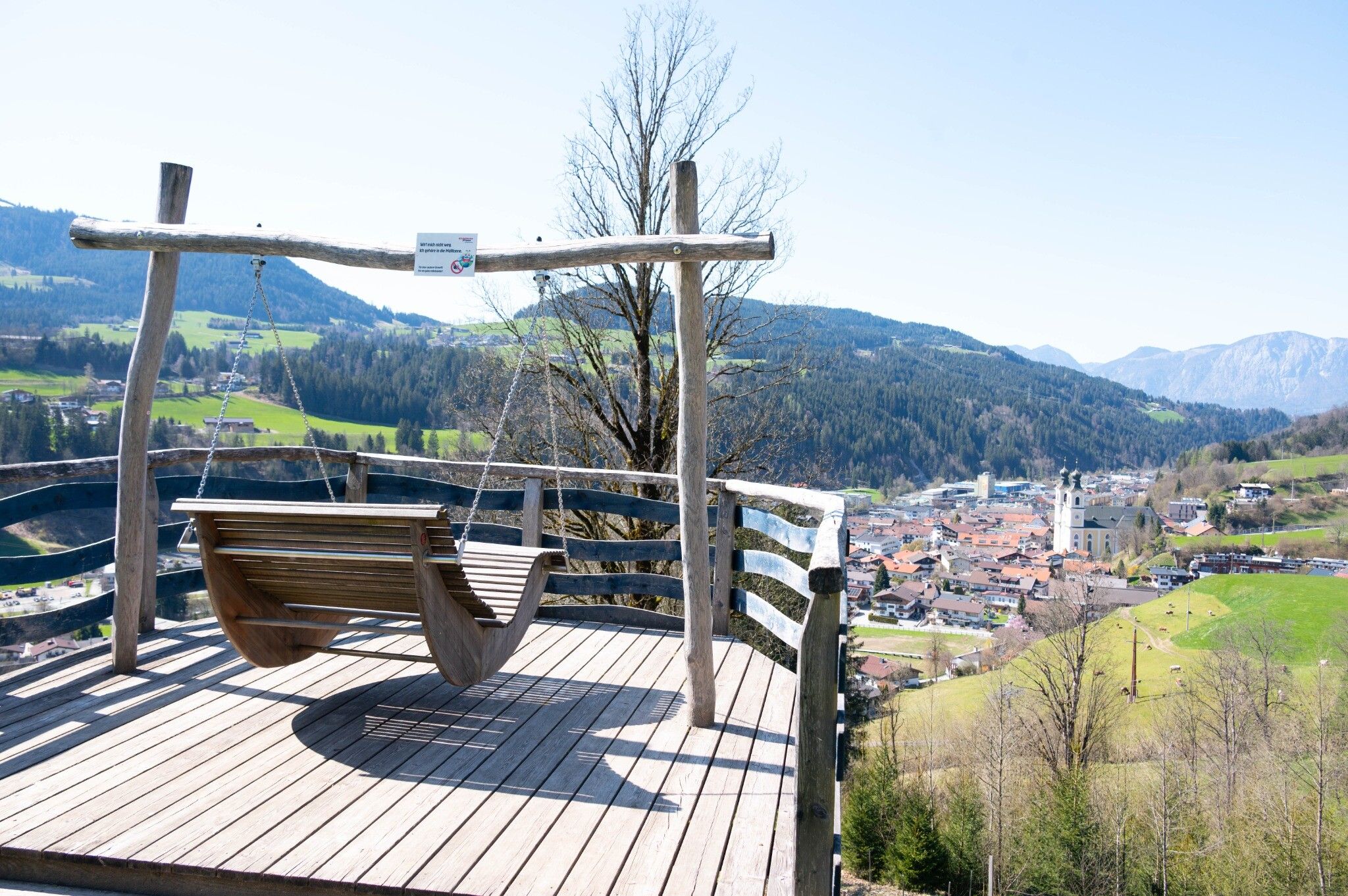
A sporty round with many special features awaits you.

Tour information

  • Requirement: easy
  • Length: 4.2 km
  • Duration: 1:15 h
  • Elevation uphill:190 hm
  • Elevation downhill:190 hm
Highest point770 m

Starting point

Tourist information office Hopfgarten

Finishing point

Tourist information office Hopfgarten
  • Fitness level 1 / 6
  • Technique 1 / 6

Features

  • Circular route
  • Suitable for families

Best time of year

  • January
  • February
  • March
  • April
  • May
  • June
  • July
  • August
  • September
  • October
  • November
  • December

Trail condition

Asphalt, forest trail, hiking path

Equipment

Outdoor clothing, sturdy shoes


Description

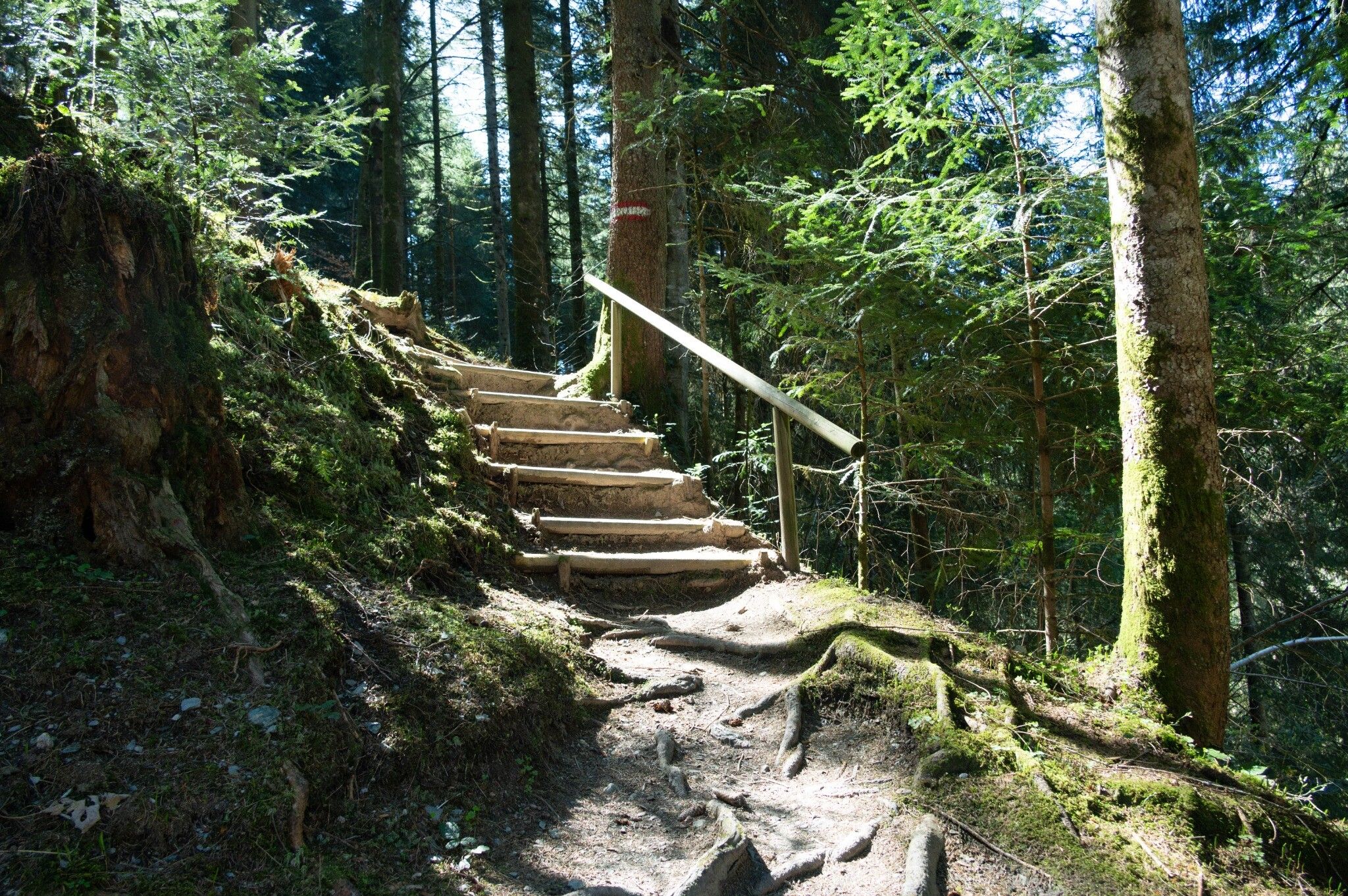
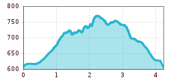
The starting point of this hike is the information office in Hopfgarten. Pass the Familotel and the Högerhof farm and follow the signs no. 4 in the direction of the market centre. A narrow path with a slight ascent takes you past a plateau. This is also where you will find the first exercise station. Through the forest, past the stream, over the steeper steps you reach the centrepiece of the G'sundheitsbürndlweg - the fountain with crystal-clear mountain water that gives the trail its name.
Passing the Högerhof farm, you return to the starting point, the Hopfgarten information centre.

Nearby huts and mountain restaurants

Getting here

  • Arrival by public transport

    bus: Hopfgarten Berglift 
    train: Hopfgarten Berglift

    Guest card of the region = train ticket from Wörgl to Hochfilzen + bus ticket from Mariastein to Kitzbühel included

    More detailed information: www.hohe-salve.com/mobility
     

  • Parking

    Car park P3 Wasserfeld 
    Car psrk P1 extension

More tours in the surrounding area

  • Wilder-Kaiser-Steig - Detour

    Difficulty: difficult
    Length: 33.0 km Duration: 16:49 h Elevation uphill: 2,311 m
  • 3-day Family Tour Alpbachtal

    Difficulty: easy
    Length: 18.3 km Duration: 7:00 h Elevation uphill: 998 m
  • Kundler Klamm

    Opening hours: closed
    Difficulty: easy
    Length: 6.4 km Duration: 2:00 h Elevation uphill: 116 m
  • 3-peak-tour Kienberg-Plessenberg-Heuberg

    Difficulty: medium
    Length: 8.6 km Duration: 4:30 h Elevation uphill: 779 m
  • Kaiser Gorge - loop trail

    Opening hours: closed
    Difficulty: easy
    Length: 4.2 km Duration: 1:00 h Elevation uphill: 198 m
  • Voldöpper Spitze Loop Hike

    Difficulty: medium
    Length: 12.9 km Duration: 5:00 h Elevation uphill: 988 m
  • Loop tour Juppi Zauberwald

    Difficulty: easy
    Length: 2.5 km Duration: 1:00 h Elevation uphill: 93 m
  • Farmkehralm 1.521 m

    Difficulty: medium
    Length: 9.3 km Duration: 3:30 h Elevation uphill: 506 m
  • Barrier-free path Lake Reintal

    Difficulty: easy
    Length: 6.5 km Duration: 1:45 h Elevation uphill: 15 m
  • Day 1: 4 days - 4 summits tour

    Difficulty: medium
    Length: 9.8 km Duration: 5:00 h Elevation uphill: 984 m
  • Day 3: 4 days - 4 summits tour

    Difficulty: medium
    Length: 19.3 km Duration: 8:00 h Elevation uphill: 1,371 m
  • Wiedersberger Horn Panorama Path

    Difficulty: easy
    Length: 4.1 km Duration: 1:30 h Elevation uphill: 195 m
  • 4 days - 4 summits tour

    Difficulty: medium
    Length: 54.4 km Duration: 23:00 h Elevation uphill: 3,408 m
  • Discovering the Tiefenbach Gorge Hike

    Opening hours: closed
    Difficulty: medium
    Length: 5.7 km Duration: 3:30 h Elevation uphill: 669 m
Newsletter

The mountain is calling? So does our newsletter!

In our monthly newsletter we reveal the best holiday tips for Tyrol.