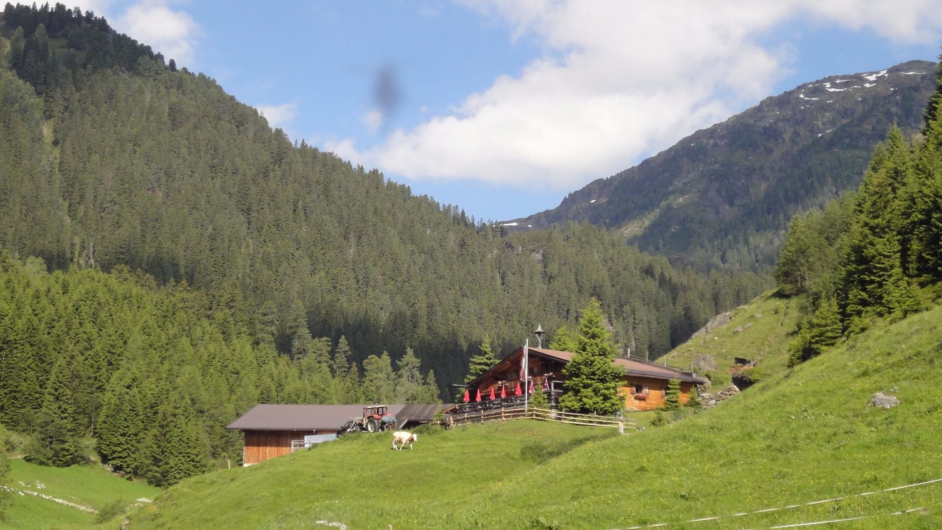
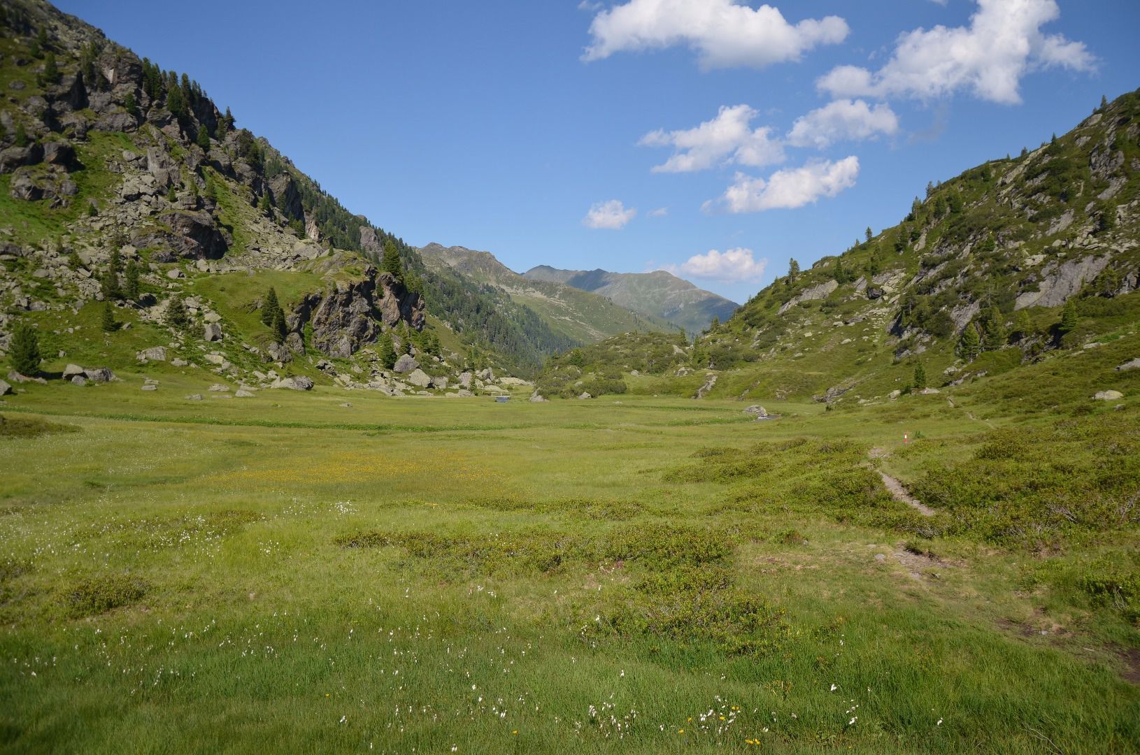
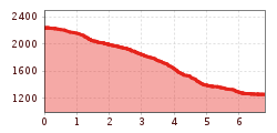
Open interactive mapOpen this POI on the interactive mapElevation profileDownloadKönigsleiten - Fußalm - Krummbach - Gerlos.gpx
Elbigenalp Gibler AlmDifficulty:easyLength:1.4 kmElevation uphill:153 mSee trailSee trail: Elbigenalp Gibler Alm
neuer-wanderweg-im-stilluptal-foto-stefan-absenger © Archiv TVB Mayrhofen Themed hike: Stilluptal "Wasserfallweg"Difficulty:easyLength:15.3 kmDuration:5:00 hElevation uphill:325 mSee trailSee trail: Themed hike: Stilluptal "Wasserfallweg"
Hoch oben an der Rastkogelhütte © Archiv TVB Mayrhofen Circuit & summit hike: Schwendberg (Jausenstation Melchboden) Arbiskopf, Rauhenkopf and KreuzjochDifficulty:mediumLength:8.6 kmDuration:3:30 hElevation uphill:450 mSee trailSee trail: Circuit & summit hike: Schwendberg (Jausenstation Melchboden) Arbiskopf, Rauhenkopf and Kreuzjoch
Blick nach Vorderhornbach © Lechtal Tourismus Stanzach - Baichlstein - high trail to VorderhornbachDifficulty:mediumLength:10.0 kmDuration:3:10 hElevation uphill:271 mSee trailSee trail: Stanzach - Baichlstein - high trail to Vorderhornbach
Wildschönau Auffach Schatzberg Familienwanderung.jpg © Wildschönau Tourismus Johannes Sautner Rechte Skijuwel und Wildschönau Schatzberg and Joel SpitzeDifficulty:mediumLength:7.3 kmDuration:3:00 hElevation uphill:400 mSee trailSee trail: Schatzberg and Joel Spitze
Feldberg, Stripsenjoch, Kaiserbachtal, Region St. Johann in Tirol, Kirchdorf © Mirja Geh Kaiserbachtal - Feldberg - StripsenjochDifficulty:mediumLength:21.0 kmDuration:9:00 hElevation uphill:1,170 mSee trailSee trail: Kaiserbachtal - Feldberg - Stripsenjoch
©-TVB-Tiroler-Oberland-Daniel-Zangerl-Winterwandern-Pfundser-Tschey-2019 (23).jpg © danielzangerl Pfundser Tschey winter hiking trailOpening hours:closedDifficulty:easyLength:5.1 kmDuration:1:39 hElevation uphill:120 mGo to winter hikeGo to winter hike: Pfundser Tschey winter hiking trail
Tschirgant Karr+Âster Kreuz_IMG_8349.jpg © @imst-tourismus Auf den Tschirgant über die BergwachthütteDifficulty:mediumLength:14.0 kmDuration:6:30 hElevation uphill:1,300 mSee trailSee trail: Auf den Tschirgant über die Bergwachthütte
Muttekopf (No. 621)Difficulty:mediumLength:9.2 kmDuration:6:00 hElevation uphill:966 mSee trailSee trail: Muttekopf (No. 621)
Lech bei Forchach. © Lechtal Tourismus Stanzach - Over the suspension bridgeDifficulty:easyLength:12.8 kmDuration:3:15 hElevation uphill:42 mSee trailSee trail: Stanzach - Over the suspension bridge
Kaiserjochhaus © Lechtal Tourismus Lechtaler Höhenweg: 3. Etappe Kasierjochhaus-Ansbacher HütteDifficulty:difficultLength:7.9 kmDuration:4:15 hElevation uphill:511 mSee trailSee trail: Lechtaler Höhenweg: 3. Etappe Kasierjochhaus-Ansbacher Hütte
Kaiserjochhaus © Lechtal Tourismus Lechtaler Höhenweg: 3. Etappe Kasierjochhaus-Ansbacher HütteDifficulty:difficultLength:11.3 kmDuration:6:45 hElevation uphill:1,010 mSee trailSee trail: Lechtaler Höhenweg: 3. Etappe Kasierjochhaus-Ansbacher Hütte
Kundl GorgeDifficulty:easyLength:6.5 kmDuration:3:00 hElevation uphill:10 mSee trailSee trail: Kundl Gorge
Blick vom Juifen ins Karwendel © Achensee Tourismus Achenkirch - Falkenmoosalm - Großzemmalm - Juifen - AchenkirchDifficulty:mediumLength:20.5 kmDuration:7:30 hElevation uphill:1,120 mSee trailSee trail: Achenkirch - Falkenmoosalm - Großzemmalm - Juifen - Achenkirch
Kaiserjochhaus © Lechtal Tourismus Lechtaler Höhenweg: 3. Etappe Kasierjochhaus-Ansbacher HütteDifficulty:difficultLength:6.9 kmDuration:4:45 hElevation uphill:768 mSee trailSee trail: Lechtaler Höhenweg: 3. Etappe Kasierjochhaus-Ansbacher Hütte
Wildschönau Niederau Auenweg Sommer © Wildschönau Tourismus Auenweg NiederauDifficulty:easyLength:1.0 kmDuration:0:30 hElevation uphill:31 mGo to winter hikeGo to winter hike: Auenweg Niederau
Hängebrücke Namlos © Außerhofer Hanspeter Namlos - FallerscheinDifficulty:easyLength:3.8 kmElevation uphill:119 mSee trailSee trail: Namlos - Fallerschein
©-TVB-Tiroler-Oberland-Kaunertal-Daniel-Zangerl-Aifneralm-2016-(19).jpg © Daniel Zangerl Rolli-Wanderung Aifner AlmDifficulty:mediumLength:6.0 kmDuration:2:30 hElevation uphill:460 mSee trailSee trail: Rolli-Wanderung Aifner Alm
©-TVB-Tiroler-Oberland-Kaunertal-Daniel-Zangerl-2016-Nassereinalm-(5).jpg © Daniel Zangerl Rolli-Wanderung NassereinalmDifficulty:mediumLength:5.5 kmDuration:1:45 hElevation uphill:269 mSee trailSee trail: Rolli-Wanderung Nassereinalm
Going_Ausblick vom Baumgartenköpfl_Wilder Kaiser © TVB Wilder Kaiser/Thomas Hennerbichler Tauernblick panorama circular hiking routeDifficulty:mediumLength:13.6 kmDuration:6:00 hElevation uphill:980 mSee trailSee trail: Tauernblick panorama circular hiking route
Winterwandern in der Naturparkregion Reutte © Peter Neusser Hike to the Ehrenberg castle ruinsDifficulty:mediumLength:5.1 kmDuration:1:45 hElevation uphill:237 mGo to winter hikeGo to winter hike: Hike to the Ehrenberg castle ruins
Aussicht vom Panormaweg © Tim Salow Winter walk at Hüttegg am WeerbergDifficulty:easyLength:8.0 kmDuration:2:50 hElevation uphill:315 mSee trailSee trail: Winter walk at Hüttegg am Weerberg
Hike to the Small AhornbodenDifficulty:mediumLength:26.8 kmDuration:10:40 hElevation uphill:1,395 mSee trailSee trail: Hike to the Small Ahornboden
Durch die Wolfsklamm © ichmachefotos.com Along the Wild Waters through the WolfsklammDifficulty:mediumLength:6.8 kmDuration:3:00 hElevation uphill:440 mSee trailSee trail: Along the Wild Waters through the Wolfsklamm
Breitegg tourDifficulty:mediumLength:11.0 kmDuration:5:00 hElevation uphill:680 mSee trailSee trail: Breitegg tour
Give feedback for a chance to win a special holiday experience!Click here for the surveyClick here for the survey


.jpg")


.jpg")


.jpg")
.jpg")


")

.jpg")
