Mountain hikes Path of the Senses (Weg der Sinne)

Virgen in Osttirol / Venediger Group
Difficulty ratings: easy
Route length: 3.6 km
Duration: 1:30 h

Path of the Senses (Weg der Sinne)

Tour information

  • Requirement: easy
  • Length: 3.6 km
  • Duration: 1:30 h
  • Elevation uphill:149 hm
  • Elevation downhill:149 hm
Highest point1,188 m

Starting point

Tourist information Virgen

Finishing point

Tourist information Virgen
  • Fitness level 3 / 6
  • Technique 2 / 6

Features

  • Circular route
  • Suitable for families
  • suitable for pushchairs

Best time of year

  • January
  • February
  • March
  • April
  • May
  • June
  • July
  • August
  • September
  • October
  • November
  • December

Trail condition

gravel
Source: TVB Osttirol

Description

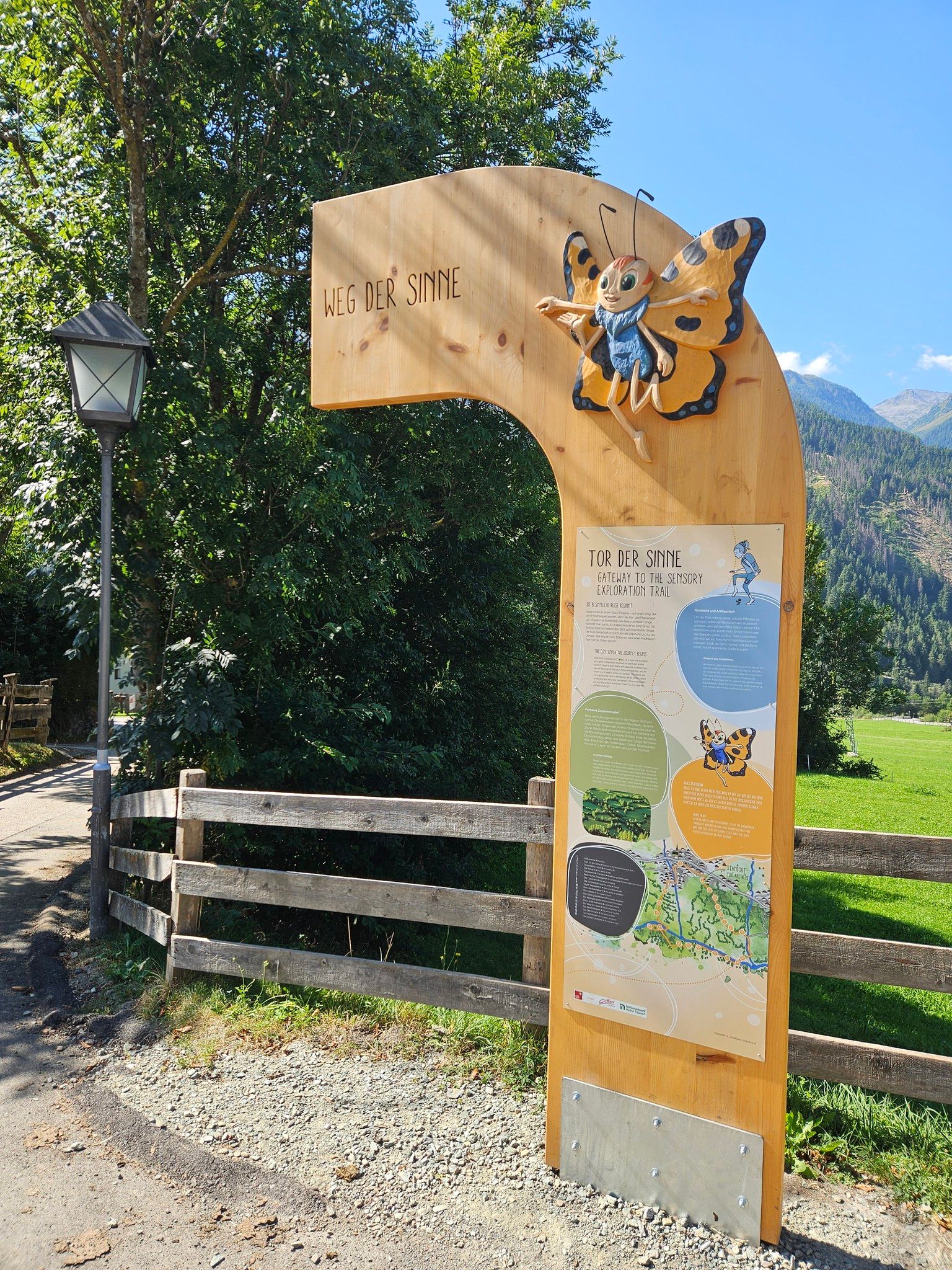
Since summer 2025, visitors can look forward to a completely redesigned adventure trail in the picturesque fields of Virgen. In the heart of the Hohe Tauern National Park, the new “Path of the Senses” invites visitors to experience nature interactively and with all their senses. Whether families, hiking enthusiasts, or nature lovers—there is something for everyone here. The trail combines playful learning, mindful perception of nature, and relaxing moments to create a special destination.

19 interactive experience stations
→ Activate your senses: sight, hearing, smell, touch
→ Exciting topics: meaning of life, balance, and water cycle

Water playground and landscape cinema
→ Playful learning about the power and cycle of water
→ Breathtaking nature images in the open-air cinema with a regional focus

“Isi” – the butterfly as an animal nature guide
→ A lovingly designed companion for children – with adventure stories and exciting discoveries
→ Join Isi on an exciting puzzle journey with the sensory explorer passport. 

You can collect your reward from the tourist information office in Virgen or Matrei i. O

Herbal cuisine in a traditional “Schupfe” hut
→ Sustainability meets regionality: experience local herbs with all your senses

Nearby huts and mountain restaurants

Getting here

  • Arrival by public transport

    Bus stop Virgen Church

More tours in the surrounding area

  • Lasörling altitude trail

    Difficulty:medium
    Length:57.0 kmDuration:25:00 hElevation uphill:3,740 m
  • Venediger altitude trail

    Difficulty:difficult
    Length:55.5 kmDuration:27:00 hElevation uphill:3,915 m
  • Figerhorn

    Difficulty:difficult
    Length:6.5 kmDuration:6:00 hElevation uphill:807 m
  • Theme path "Virgen crossroads"

    Difficulty:easy
    Length:3.2 kmDuration:1:00 hElevation uphill:104 m
  • Muhs panorama trail

    Difficulty:medium
    Length:15.2 kmDuration:6:00 hElevation uphill:1,090 m
  • Hike to the Venedigerhaus Innergschlöß

    Difficulty:easy
    Length:8.6 kmDuration:2:30 hElevation uphill:184 m
  • Hike to Kalser Tauernhaus

    Difficulty:medium
    Length:12.2 kmDuration:4:00 hElevation uphill:244 m
  • Hiking tour to Neue Sajathütte 2.600m

    Difficulty:medium
    Length:10.3 kmDuration:6:50 hElevation uphill:1,086 m
  • Hiking tour to Zupalsee Hütte 2.350m

    Difficulty:medium
    Length:14.9 kmDuration:8:30 hElevation uphill:1,261 m
  • Badener Hütte

    Difficulty:difficult
    Length:23.2 kmDuration:12:00 hElevation uphill:1,754 m
  • Hiking tour to St. Pöltner Hütte and 3 lakes

    Difficulty:difficult
    Length:14.8 kmDuration:7:40 hElevation uphill:1,119 m
  • Hike to Neuen Reichenberger Hütte

    Difficulty:medium
    Length:18.2 kmDuration:9:00 hElevation uphill:1,252 m
  • Hiking tour to Lasörlinghütte 2.350m

    Difficulty:medium
    Length:14.6 kmDuration:7:50 hElevation uphill:1,135 m
  • Lucknerhaus - Stüdlhütte

    Difficulty:medium
    Length:9.3 kmDuration:4:30 hElevation uphill:862 m
  • Rollitour with Swiss Trac

    Difficulty:easy
    Length:3.2 kmDuration:1:30 hElevation uphill:135 m
  • Lasörling 3.098m

    Difficulty:difficult
    Length:22.0 kmDuration:12:00 hElevation uphill:1,940 m
  • Circular walk church St. Nikolaus

    Difficulty:easy
    Length:5.4 kmDuration:1:39 hElevation uphill:150 m
  • Rotenkogel

    Difficulty:difficult
    Length:3.9 kmDuration:3:00 hElevation uphill:383 m
  • Glacier trail Innergschlöss/Schlatenkees

    Difficulty:medium
    Length:9.4 kmDuration:4:50 hElevation uphill:680 m
Newsletter

The mountain is calling? So does our newsletter!

In our monthly newsletter we reveal the best holiday tips for Tyrol.