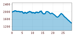
Open interactive mapOpen this POI on the interactive mapElevation profileDownloadPustertaler Almweg.gpx
Hochsteinhütte © Bernhard Assmair Hochsteinhütte 2.023mOpening hours:Open todayPlace:Lienz:Alpine pasture / hut / mountain restaurantsee restaurant detailssee restaurant details: Hochsteinhütte 2.023m
Wandern am Penken © Christian Lorenz Themed hike: Mayrhofen "PanoramaRundWeg" at Mount PenkenDifficulty:easyLength:4.4 kmDuration:1:45 hElevation uphill:195 mSee trailSee trail: Themed hike: Mayrhofen "PanoramaRundWeg" at Mount Penken
Benni-Raich-Brücke_0518_001.jpg © TVB Pitztal/Chris Walch Arzl - Benni-Raich-Bridge - WaldDifficulty:easyLength:1.8 kmDuration:0:40 hElevation uphill:120 mSee trailSee trail: Arzl - Benni-Raich-Bridge - Wald
Arzler Alm 1 © TVB Pitztal/Chris Walch Arzler Alm – TiefentalalmDifficulty:mediumLength:11.3 kmDuration:5:00 hElevation uphill:1,000 mSee trailSee trail: Arzler Alm – Tiefentalalm
Going_Ausblick vom Baumgartenköpfl_Wilder Kaiser © TVB Wilder Kaiser/Thomas Hennerbichler Tauernblick panorama circular hiking routeDifficulty:mediumLength:13.6 kmDuration:6:00 hElevation uphill:980 mSee trailSee trail: Tauernblick panorama circular hiking route
Circular Hike at the KellerjochDifficulty:mediumLength:7.7 kmDuration:4:30 hElevation uphill:585 mSee trailSee trail: Circular Hike at the Kellerjoch
Frauenseestube Luftbild © Robert Eder Winter Hike to Lake Frauensee from LechaschauDifficulty:easyLength:7.2 kmDuration:2:30 hElevation uphill:122 mGo to winter hikeGo to winter hike: Winter Hike to Lake Frauensee from Lechaschau
Durch die Wolfsklamm © ichmachefotos.com Along the Wild Waters through the WolfsklammDifficulty:mediumLength:6.8 kmDuration:3:00 hElevation uphill:440 mSee trailSee trail: Along the Wild Waters through the Wolfsklamm
Breitegg tourDifficulty:mediumLength:11.0 kmDuration:5:00 hElevation uphill:680 mSee trailSee trail: Breitegg tour
©-TVB-Tiroler-Oberland-Kaunertal-Daniel-Zangerl-2016-Gepatschhaus-(3).jpg © Daniel Zangerl Rolli-Wanderung GepatschhausLength:8.5 kmDuration:1:45 hElevation uphill:156 mSee trailSee trail: Rolli-Wanderung Gepatschhaus
©-TVB-Tiroler-Oberland-Kaunertal-Daniel-Zangerl-Aifneralm-2016-(19).jpg © Daniel Zangerl Rolli-Wanderung Aifner AlmDifficulty:mediumLength:6.0 kmDuration:2:30 hElevation uphill:460 mSee trailSee trail: Rolli-Wanderung Aifner Alm
©-TVB-Tiroler-Oberland-Kaunertal-Daniel-Zangerl-Falkaunsalm-2016-(6).jpg © Daniel Zangerl Rolli-Wanderung FalkaunsalmDifficulty:mediumLength:4.5 kmDuration:1:45 hElevation uphill:392 mSee trailSee trail: Rolli-Wanderung Falkaunsalm
©-TVB-Tiroler-Oberland-Kaunertal-Daniel-Zangerl-2016-Nassereinalm-(5).jpg © Daniel Zangerl Rolli-Wanderung NassereinalmDifficulty:mediumLength:5.5 kmDuration:1:45 hElevation uphill:269 mSee trailSee trail: Rolli-Wanderung Nassereinalm
Pfad zur Dürrenberg Alm © Rene Paulweber Koflerjoch summit hikeDifficulty:difficultLength:9.3 kmDuration:4:45 hElevation uphill:933 mSee trailSee trail: Koflerjoch summit hike
Ehenbichler Alm © Robert Eder, Naturparkregion Reutte Winter walk to the Ehenbichler Alm hutDifficulty:difficultLength:6.5 kmDuration:4:00 hElevation uphill:640 mGo to winter hikeGo to winter hike: Winter walk to the Ehenbichler Alm hut
Vilser Alm im Winter © Robert Eder Winter walk to the Vilser Alm hutDifficulty:mediumLength:6.6 kmDuration:2:30 hElevation uphill:348 mGo to winter hikeGo to winter hike: Winter walk to the Vilser Alm hut
Winterwandern in der Naturparkregion Reutte © Peter Neusser Hike to the Ehrenberg castle ruinsDifficulty:mediumLength:5.1 kmDuration:1:45 hElevation uphill:237 mGo to winter hikeGo to winter hike: Hike to the Ehrenberg castle ruins
Aussicht vom Panormaweg © Tim Salow Winter walk at Hüttegg am WeerbergDifficulty:easyLength:8.0 kmDuration:2:50 hElevation uphill:315 mSee trailSee trail: Winter walk at Hüttegg am Weerberg
Wanderung zur Binsalm © ichmachefotos.com Uo to the die Binsalm Alp in the KarwendelDifficulty:easyLength:6.2 kmDuration:2:15 hElevation uphill:289 mSee trailSee trail: Uo to the die Binsalm Alp in the Karwendel
Hike to the Small AhornbodenDifficulty:mediumLength:26.8 kmDuration:10:40 hElevation uphill:1,395 mSee trailSee trail: Hike to the Small Ahornboden
Kaiserlift Tour tip 1: Berghaus Aschenbrenner und Duxer AlmDifficulty:easyLength:4.9 kmElevation uphill:35 mSee trailSee trail: Kaiserlift Tour tip 1: Berghaus Aschenbrenner und Duxer Alm
©-TVB-Tiroler-Oberland-Kaunertal-Daniel-Zangerl-Piller-Moor-Familie-2014-(28).jpg © Daniel Zangerl Rolli-Wanderung Piller MoorDifficulty:easyLength:2.0 kmSee trailSee trail: Rolli-Wanderung Piller Moor
sommer-steinbockmarsch-foto-dominic-ebenbichler © Archiv TVB Mayrhofen Stage of the Berliner Höhenweg (Zillertal Runde): Berliner Hütte - Greizer HütteDifficulty:difficultLength:10.2 kmDuration:6:30 hElevation uphill:1,200 mSee trailSee trail: Stage of the Berliner Höhenweg (Zillertal Runde): Berliner Hütte - Greizer Hütte
Stage of the Berliner Höhenweg (Zillertal Runde): Greizer Hütte - Kasseler HütteDifficulty:difficultLength:9.8 kmDuration:6:00 hElevation uphill:650 mSee trailSee trail: Stage of the Berliner Höhenweg (Zillertal Runde): Greizer Hütte - Kasseler Hütte
Großer MutzkopfDifficulty:easyLength:10.3 kmDuration:4:00 hElevation uphill:507 mSee trailSee trail: Großer Mutzkopf
Winter- und Schneeschuhwandern (c) Mirja Geh (26).jpg © Mirja Geh At the foot of Fleischbank and TotenkirchlDifficulty:easyLength:9.3 kmDuration:3:00 hElevation uphill:250 mGo to winter hikeGo to winter hike: At the foot of Fleischbank and Totenkirchl
Give feedback for a chance to win a special holiday experience!Click here for the surveyClick here for the survey


")


.jpg")
.jpg")
.jpg")
.jpg")
.jpg")


")
")
.jpg")


.jpg")
 Mirja Geh (26).jpg")
