Schattseit - Runde in Brixen

Brixen im Thale / Kitzbühel Alps
Difficulty ratings: easy
Route length: 8.0 km
Duration: 2:30 h

Perfect for hot summer days!

Tour information

  • Requirement: easy
  • Length: 8.0 km
  • Duration: 2:30 h
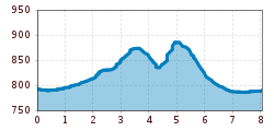
  • Elevation uphill:200 hm
  • Elevation downhill:200 hm
Highest point930 m

Starting point

Center Brixen im Thale

Finishing point

Center Brixen im Thale
  • Fitness level 2 / 6
  • Technique 2 / 6

Features

  • Circular route
  • Suitable for families

Best time of year

  • January
  • February
  • March
  • April
  • May
  • June
  • July
  • August
  • September
  • October
  • November
  • December

Trail condition

Asphalt, gravel road, hiking trail

Equipment

hiking shoes, weather protection, drink, first aid kit
Source: Kitzbüheler Alpen Management GmbH

Description

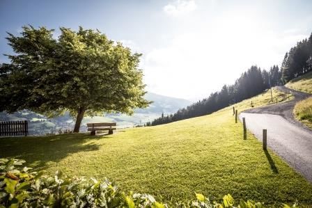
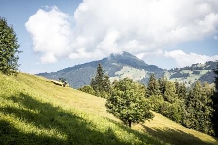
This hike starts in the centre of Brixen im Thale and leads directly to the Winkel district, after crossing the Brixenbach stream we follow the beautifully laid out forest path towards Achenberg, continue to the Hof district and reach the Erlensee lake, which is ideal for fishing, where we can also enjoy refreshments on the beautiful terrace of the Fischerstadl before returning to the starting point 5 minutes away.

Nearby huts and mountain restaurants

Getting here

  • Parking

    Take the B170 from Wörgl or Kitzbühel as far as Brixen im Thale.
    center Brixen im Thale
    Bergbahn Hochbrixen

Weather

Today

partly Cloudy
11°C/-1°C
85%8.8l5 km/h

Sat

light rain showers
8°C/0°C
75%2.4l5 km/h

Sun

light rain
11°C/0°C
80%6.7l5 km/h
Go to weather forecast

More tours in the surrounding area

  • Koasa Trail Stage 4

    Difficulty:medium
    Length:20.6 kmDuration:7:35 hElevation uphill:923 m
  • Koasa Trail Stage 3

    Difficulty:medium
    Length:19.9 kmDuration:7:10 hElevation uphill:730 m
  • Koasa Trail Stage 5

    Difficulty:medium
    Length:14.0 kmDuration:6:45 hElevation uphill:935 m
  • Koasa Trail Stage 1

    Difficulty:medium
    Length:16.9 kmDuration:6:45 hElevation uphill:937 m
  • Kaiserkrone - stage 5

    Difficulty:medium
    Length:10.8 kmDuration:5:15 hElevation uphill:840 m
  • Kaiserkrone - stage 4

    Difficulty:medium
    Length:16.1 kmDuration:6:30 hElevation uphill:640 m
  • Alpine Outdoor Gallery

    Difficulty:easy
    Length:6.7 kmDuration:2:00 hElevation uphill:117 m
  • Angerer Alm

    Difficulty:medium
    Length:5.7 kmDuration:2:45 hElevation uphill:652 m
  • Koasa Trail Stage 2

    Difficulty:medium
    Length:11.8 kmDuration:7:15 hElevation uphill:1,078 m
  • The Wiegalm

    Difficulty:medium
    Length:10.5 kmDuration:4:45 hElevation uphill:680 m
  • Teufelsgasse - "Devil's Lane"

    Difficulty:medium
    Length:7.6 kmDuration:3:00 hElevation uphill:343 m
  • Bichlachrunde

    Difficulty:easy
    Length:10.5 kmDuration:3:30 hElevation uphill:295 m
  • Schafsiedel

    Difficulty:medium
    Length:15.6 kmDuration:7:00 hElevation uphill:1,280 m
  • Möslalmkogel via Wörgl

    Difficulty:medium
    Length:10.3 kmDuration:3:30 hElevation uphill:580 m
Newsletter

The mountain is calling? So does our newsletter!

In our monthly newsletter we reveal the best holiday tips for Tyrol.