
Difficulty:easy
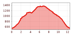
Length:6.8 kmDuration:2:30 hElevation uphill:297 m
Schlitters - Larchkopf - Schrofenmarterl - Schlitters (Trail Nr. 15)
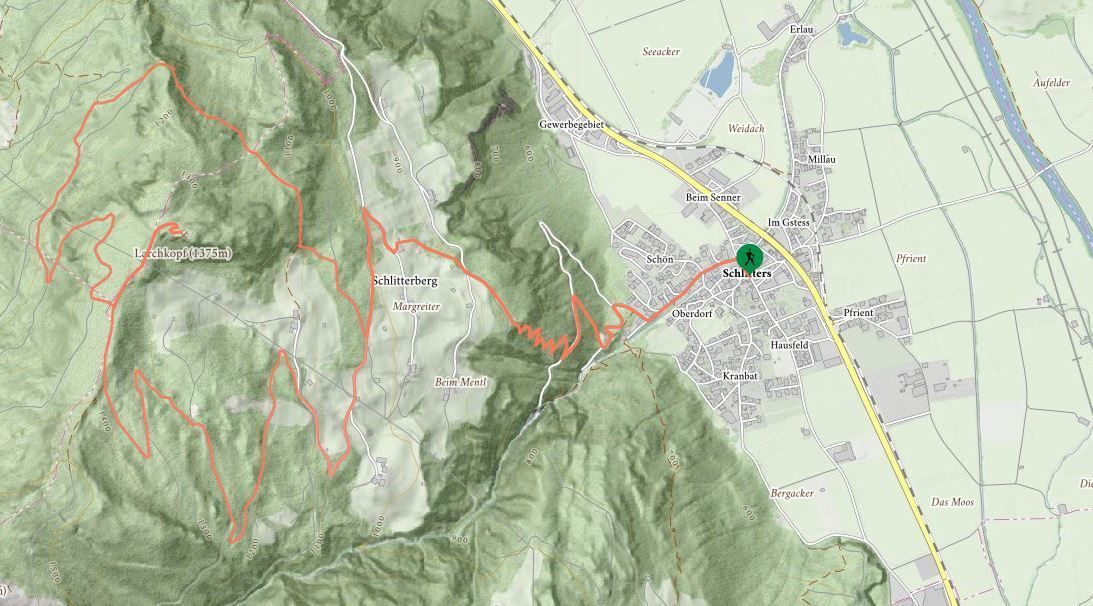
Cross the bridge after the Municipal office and turn off left uphill – walk past the Gasthof Jäger through Schlitters. As the village ends, turn right onto the hiking trail in the direction of Larchkopf – along a forest path to start with – and then through forests and meadows until the crossroads for Maria Brettfall/Larchkopf - keep left and follow the trail until it merges with the Öxltalweg trail. From here on uphill, walking on the road first and then along a forest trail until Larchkopf (lookout point). Follow the route from there heading downhill and along a forest trail until you reach the junction and head towards the Schrofenmarterl wayside cross. The hiking trail (with some exposed sections) leads past the Schrofenmarterl (shrine) and back to the Öxltalweg trail. The same trail leads back from here to Schlitters.
Stop off possibilities: restaurants in Schlitters


")
.jpg")

.jpg")


.jpg")
.jpg")

")


")
.jpg")
.jpg")

