
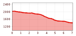
Difficulty:medium
Length:3.7 kmDuration:0:20 h
A cosy end to the Lasörling Höhenweg
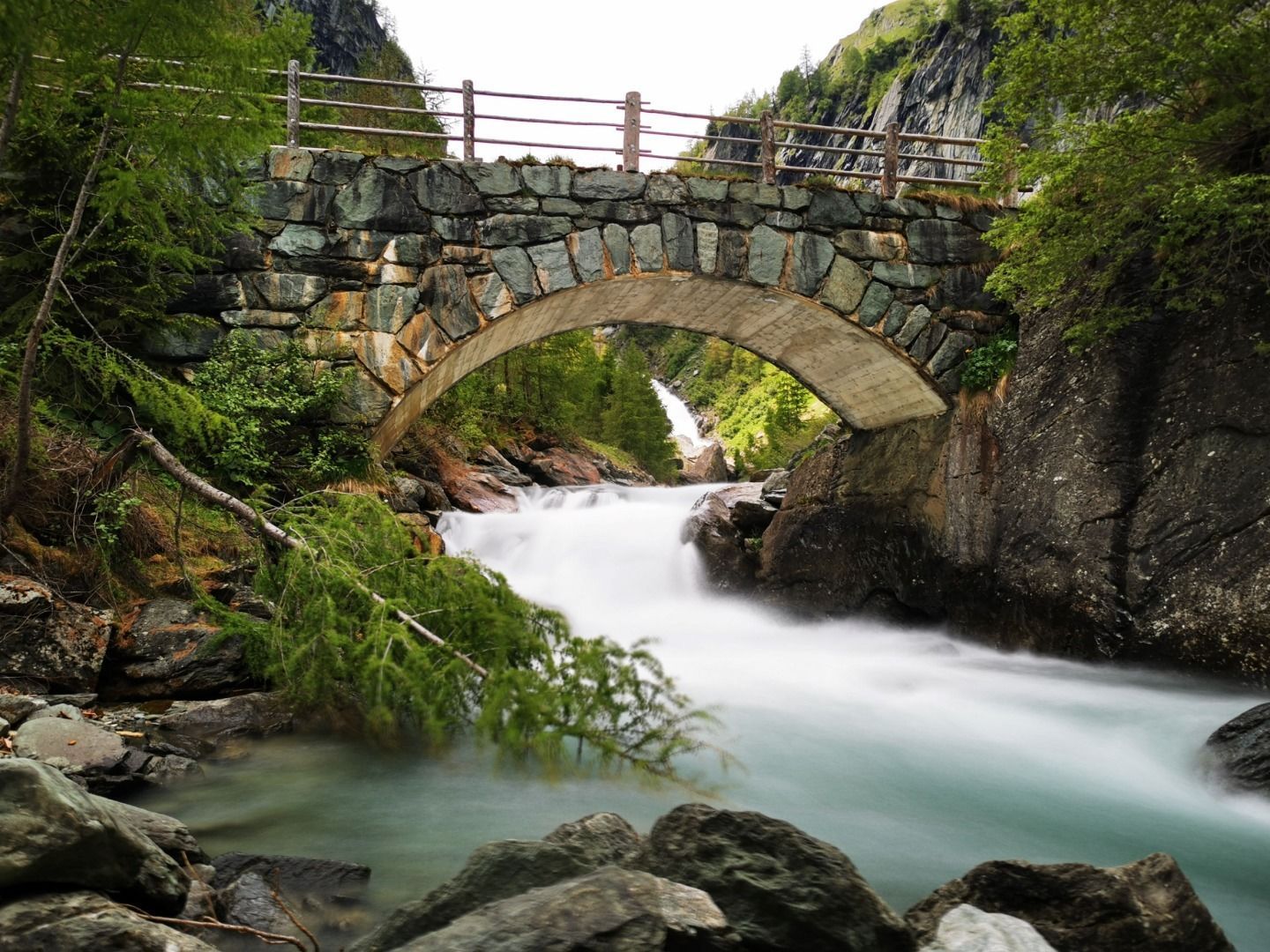
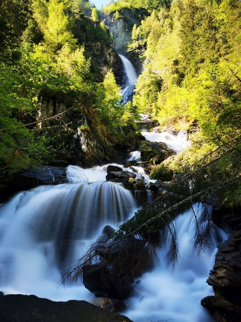
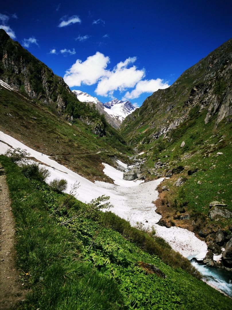
The last stage of the Lasörling Höhenweg leads from the Clara Hütte along trail no. 911, a narrow path, first to the Rötspitze viewpoint. The constant, powerful rumble of the Umbalbach accompanies you along the entire length. After the turnoff to the Wiesbauerspitze (Mullwitzkogel), the roar of the stream becomes increasingly wild and flows into the Upper Umbal Falls. The natural power trail at the Lower Umbal Falls scores with many viewing platforms and information boards. Here you can feel the largest waterfalls in Osttirol up close.
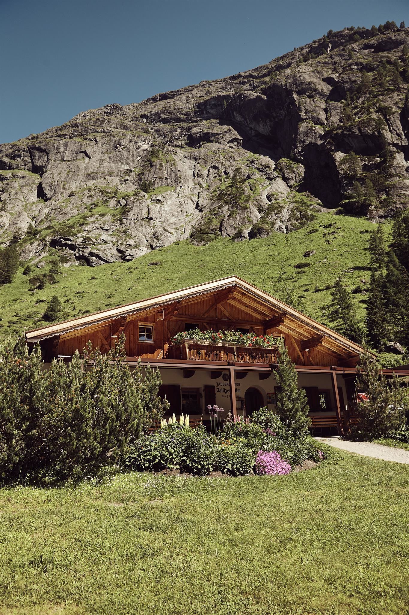
The Islitzeralm at the foot of the waterfalls is a worthwhile place to stop for refreshments. From here it is a 20-minute walk to the car park in Ströden, the end point of the Lasörling Höhenweg.


")


www.bergpixel.de")


