Hut hike Hike to the Venedigerhaus Innergschlöß

Matrei in Osttirol / Venediger Group
Difficulty ratings: easy
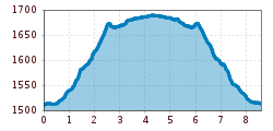
Route length: 8.6 km
Duration: 2:30 h

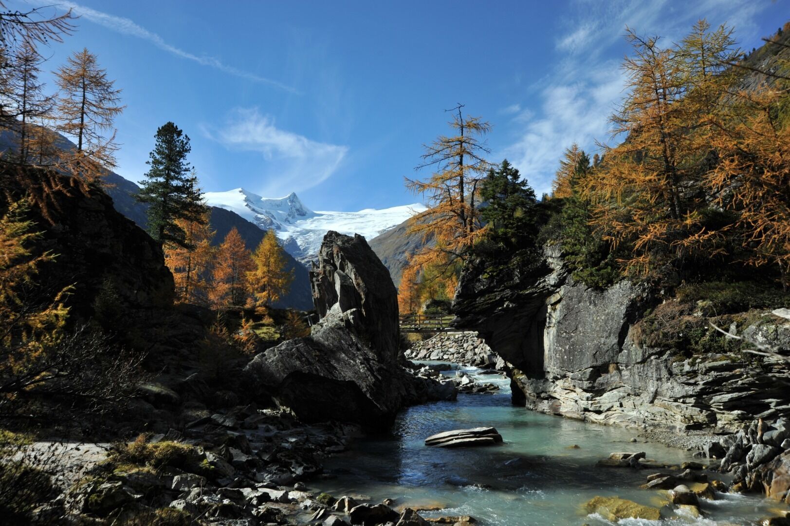
As is well known, nature often shows off in Tyrol - but here, especially in spring, it makes such an effort that you wish you lived in East Tyrol. The Gschlößtal valley with its glaciers, alpine villages and mountain streams is just that beautiful.

Tour character

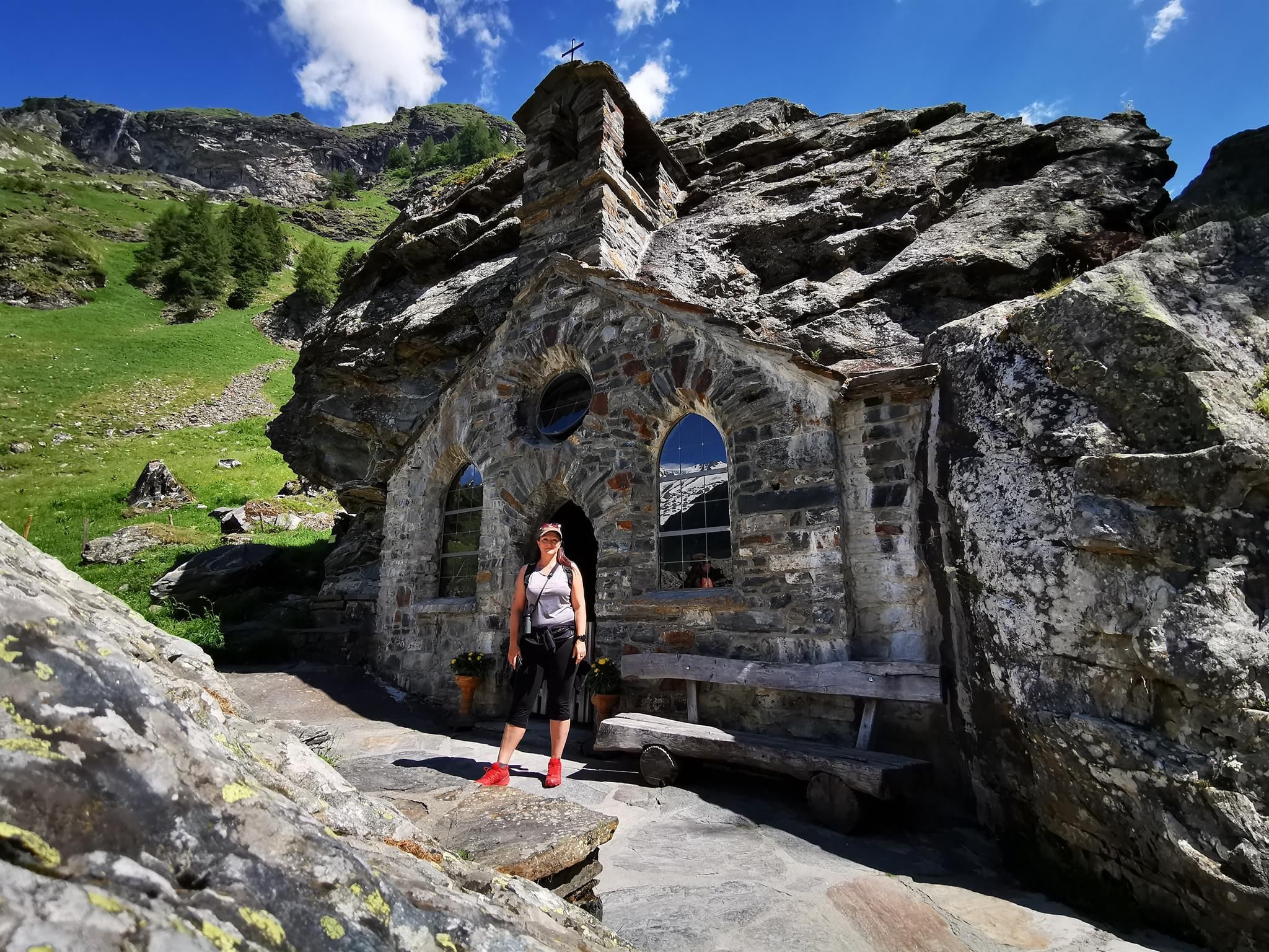
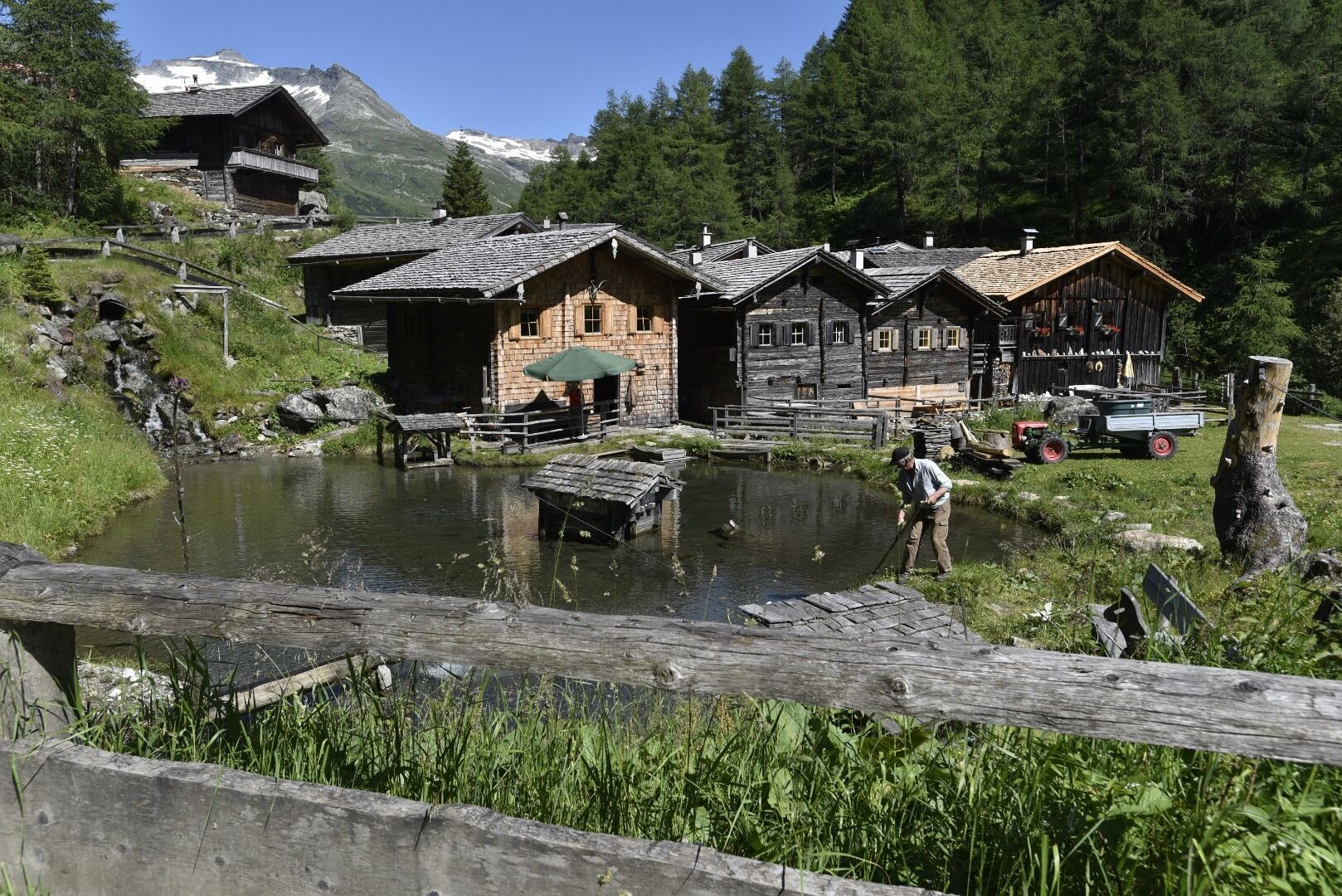
A very sunny, easy hike with gentle gradients that is suitable for all fitness and age levels and can also be done as a circular hike in late spring. You comfortably pass the famous rock chapel and an old alpine village, while the Frauenbrunnen fountain with its healing water offers refreshment along the way. In spring, the hike is known for its blooming crocus meadows, provided you can avert your gaze from the impressive glacier world of the Großvenediger. The Gschlösstal can be easily reached by public transport (Matreier Tauernhaus bus stop). Refreshments are usually available here and in the Venedigerhaus from Whitsun onwards, but it is advisable to contact the businesses before starting the hike at the start of the season.
Tour information

  • Requirement: easy
  • Length: 8.6 km
  • Duration: 2:30 h
  • Elevation uphill:184 hm
  • Elevation downhill:184 hm
Highest point1,691 m

Starting point

Alpengasthof Matreier Tauernhaus 1.512m

Finishing point

Alpengasthof Matreier Tauernhaus 1.512m
  • Fitness level 1 / 6
  • Technique 1 / 6

Features

  • Suitable for families
  • suitable for pushchairs

Best time of year

  • January
  • February
  • March
  • April
  • May
  • June
  • July
  • August
  • September
  • October
  • November
  • December

Trail condition

Gravel

Equipment

Basic equipmentformountainhikingincludessturdy hiking bootswith a goodtread, a 30-35 literbackpack, and functionalclothingbased on thelayeringprinciple, includingsufficient spare clothes. Essential itemsare rain, cold, and sunprotection, adequatefluids and food, aswellas a first-aid kit and a charged mobile phone. A mapor a GPS devicesupportsorientation. 

The informationservesas a guideline and does not claimtobe exhaustive. Equipment mustalwaysbeadaptedtothe planned route, weatherconditions, season, naturalhazards, environmental influences, and personal needs. 

Source: TVB Osttirol

Description

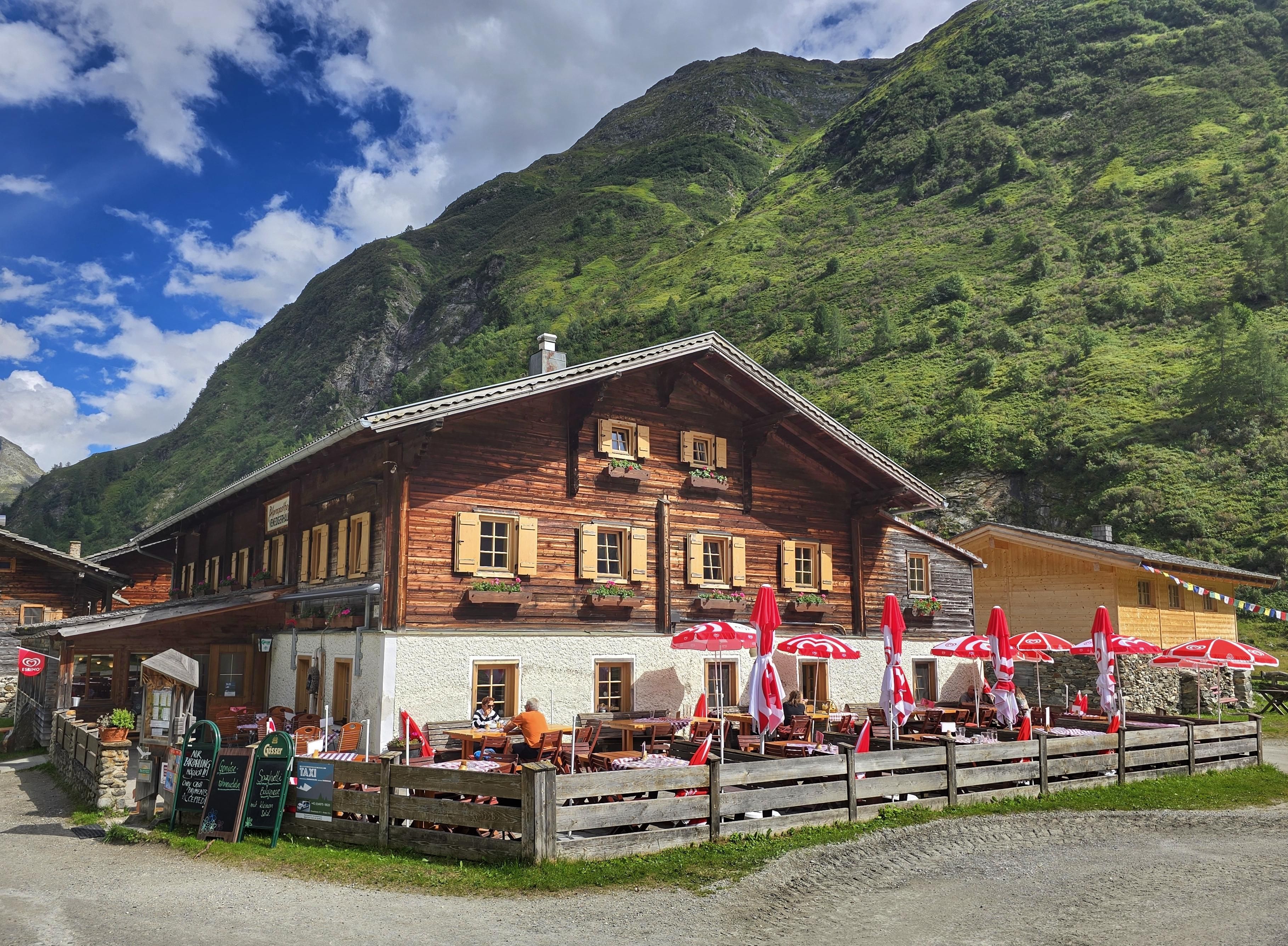
This leisurely hike starts at the Matreier Tauernhaus (1.511 m) and leads along a driveway, first slightly uphill past the alpine pastures Wohlgemutalmen up to the Berghaus Außergschlöß (1.680 m). 
From the Berghaus Außergschlöß, the hike continues along the wild stream Gschlößbach without any major ascents towards the Venedigerhaus Innergschlöß (1.689 m). On the way from the Berghaus Außergschlöß to the Venedigerhaus Innergschlöß you can find the so-called Felsenkapelle (rock chapel).


The hike can also be done with a pushchair.
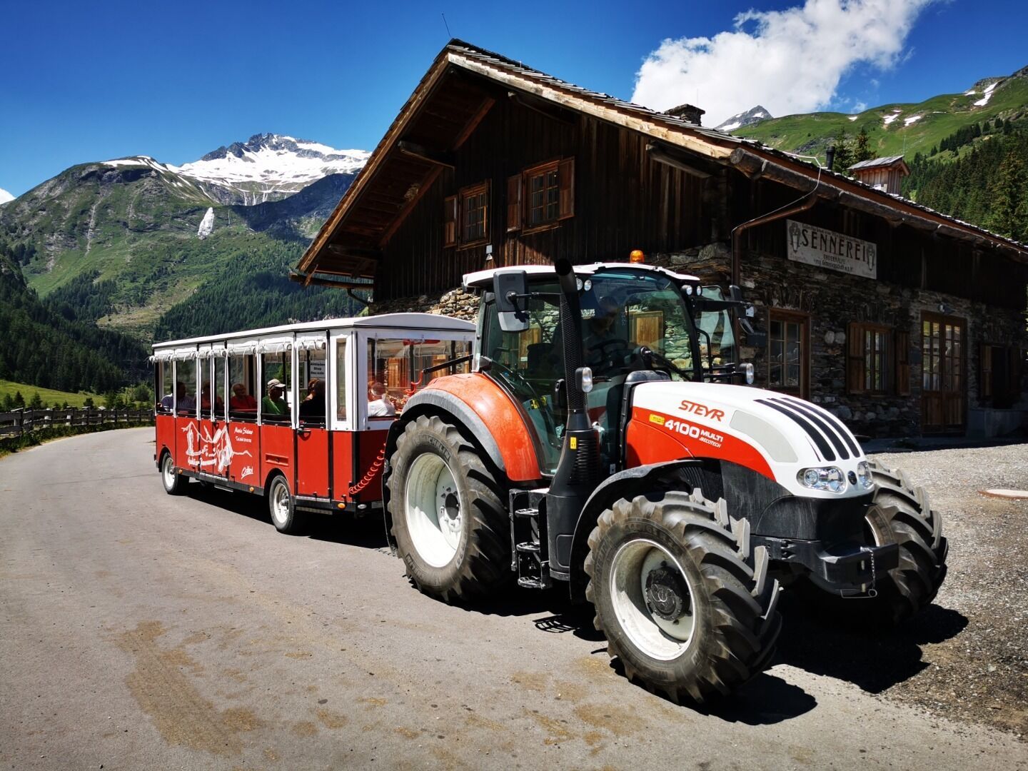
Alternatively you can also get to the hut by Taxi or "local train" Gschlösser Panoramazug.

Nearby huts and mountain restaurants

Getting here

  • Arrival by public transport

    Bus stop Matreier Tauernhaus

  • Parking

    From Matrei in Osttirol take the street Felbertauernstraße. Follow the road for 16 km and turn left 2 km before the south portal of the tunnel Felbertauerntunnel towards Matreier Tauernhaus.
    Car park Matreier Tauernhaus

Weather

Today

clear sky
20°C/5°C
25%0l0 km/h

Mon

partly Cloudy
19°C/7°C
30%1.5l0 km/h

Tue

clear sky
19°C/6°C
5%0.2l0 km/h
Go to weather forecast

More tours in the surrounding area

  • Muhs panorama trail

    Difficulty:medium
    Length:15.2 kmDuration:6:00 hElevation uphill:1,090 m
  • Herz-Ass Villgratental

    Difficulty:medium
    Length:75.6 kmDuration:34:00 hElevation uphill:5,703 m
  • Theme path "Virgen crossroads"

    Difficulty:easy
    Length:3.2 kmDuration:1:00 hElevation uphill:104 m
  • Figerhorn

    Difficulty:difficult
    Length:6.6 kmDuration:6:00 hElevation uphill:811 m
  • Böses Weibele

    Difficulty:easy
    Length:10.0 kmDuration:4:00 hElevation uphill:545 m
  • Badener Hütte

    Difficulty:difficult
    Length:23.2 kmDuration:12:00 hElevation uphill:1,754 m
  • Lucknerhaus - Stüdlhütte

    Difficulty:medium
    Length:9.3 kmDuration:4:30 hElevation uphill:862 m
  • Hiking tour to St. Pöltner Hütte and 3 lakes

    Difficulty:difficult
    Length:14.8 kmDuration:7:40 hElevation uphill:1,119 m
  • Hike to Kalser Tauernhaus

    Difficulty:medium
    Length:12.2 kmDuration:4:00 hElevation uphill:244 m
  • Hiking tour to Neue Sajathütte 2.600m

    Difficulty:medium
    Length:10.3 kmDuration:6:50 hElevation uphill:1,086 m
  • Hike to Neuen Reichenberger Hütte

    Difficulty:medium
    Length:18.2 kmDuration:9:00 hElevation uphill:1,252 m
  • Hiking tour to Lasörlinghütte 2.350m

    Difficulty:medium
    Length:14.6 kmDuration:7:50 hElevation uphill:1,135 m
  • Hiking tour to Zupalsee Hütte 2.350m

    Difficulty:medium
    Length:14.9 kmDuration:8:30 hElevation uphill:1,261 m
  • Glödis via ferrata route

    Opening hours:open
    Difficulty:B
    Duration:1:00 hDuration:4:00 hElevation difference:230 m
  • Children's mile Golzentipp

    Difficulty:easy
    Length:3.7 kmDuration:2:00 hElevation uphill:140 m
Newsletter

The mountain is calling? So does our newsletter!

In our monthly newsletter we reveal the best holiday tips for Tyrol.