Hut hike Hiking tour to Neue Sajathütte 2.600m

Prägraten am Großvenediger / Venediger Group
Difficulty ratings: medium
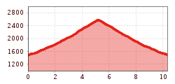
Route length: 10.3 km
Duration: 6:50 h

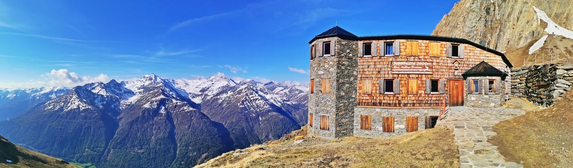
Stone and shingles - in terms of color, the Sajathütte hardly stands out from the rocks. But with its striking oriel towers, the imposing mountain castle cannot be overlooked and greets hikers from afar.

Tour character

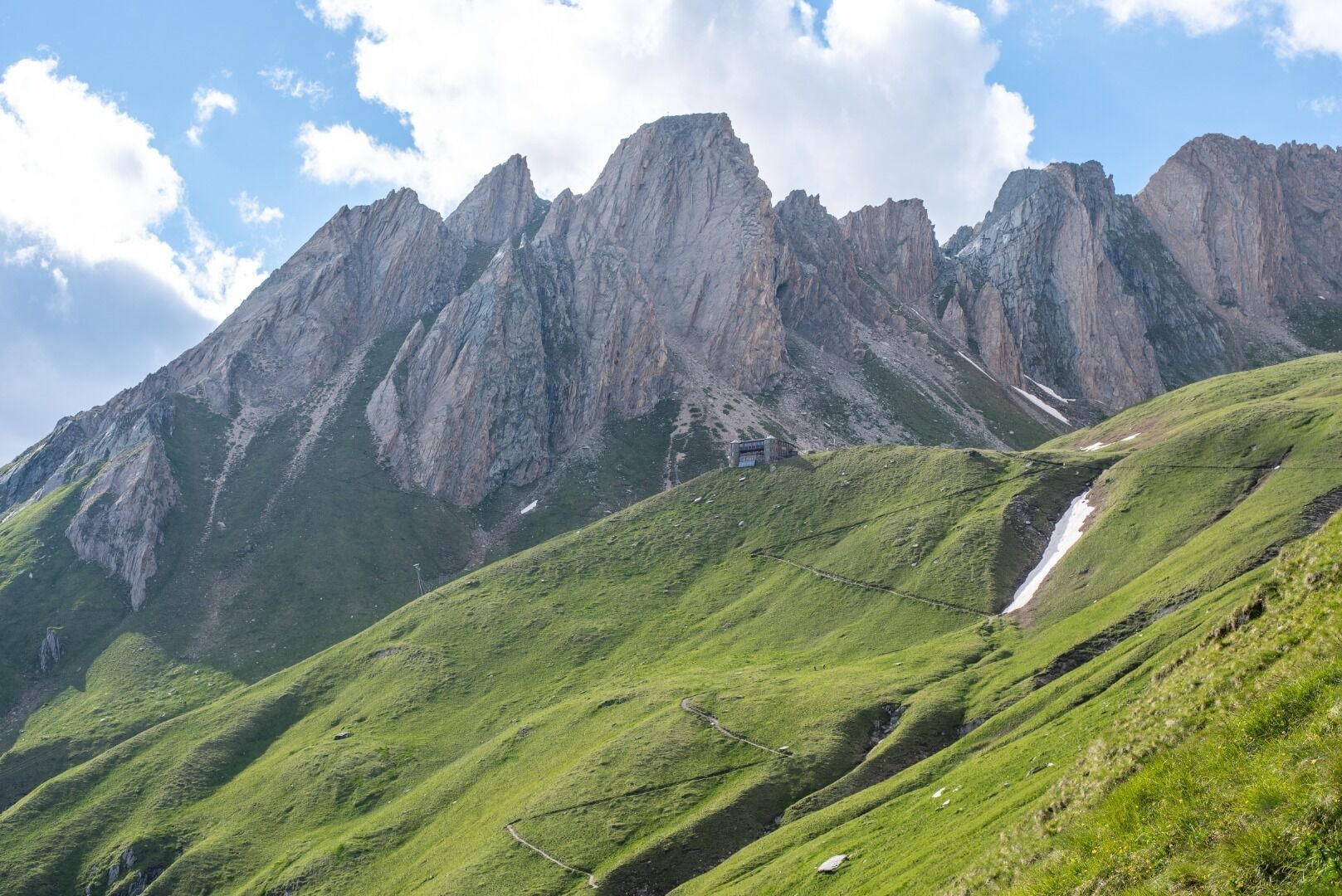
Main ascent: on moderately difficult paths and climbs from the hamlet of Bichl via the Blumenweg to the Sajathütte in 3.5 hours. More comfortable option: by car or hut cab to the Bodenalm parking lot, from there ascent through part of the Timmeltal valley. You will pass the "Fenster", one of the most beautiful viewpoints in the Virgental Valley. The view from the Sajathütte also opens a window into fascinating mountain worlds, including views of the Venediger and Lasörling groups.
Tour information

  • Requirement: medium
  • Length: 10.3 km
  • Duration: 6:50 h
  • Elevation uphill:1,086 hm
  • Elevation downhill:1,086 hm
Highest point2,600 m

Starting point

Car park Sajat-/Stabanthütte 1.490m

Finishing point

Car park Sajat-/Stabanthütte 1.490m
  • Fitness level 4 / 6
  • Technique 3 / 6

Best time of year

  • January
  • February
  • March
  • April
  • May
  • June
  • July
  • August
  • September
  • October
  • November
  • December

Equipment

Basic equipmentformountainhikingincludessturdy hiking bootswith a goodtread, a 30-35 literbackpack, and functionalclothingbased on thelayeringprinciple, includingsufficient spare clothes. Essential itemsare rain, cold, and sunprotection, adequatefluids and food, aswellas a first-aid kit and a charged mobile phone. A mapor a GPS devicesupportsorientation. 

The informationservesas a guideline and does not claimtobe exhaustive. Equipment mustalwaysbeadaptedtothe planned route, weatherconditions, season, naturalhazards, environmental influences, and personal needs. 

Source: TVB Osttirol

Description

This moderately difficult hike begins at the Sajat-/Stabanthütte car park. First, you alternate between hiking trails and roads until they fork. At the fork, take the steeper path to the right. The trail leads briefly through the forest and then across meadows up to the Neue Sajathütte.

Nearby huts and mountain restaurants

Getting here

  • Arrival by public transport

    Bus stop Prägraten a.G. Gemeindeamt

  • Parking

    Follow the street L24 Virgentalstraße and turn right immediately after the tourist information office Prägraten a.G. Drive up to "Sankt Andrä" and follow this road to the district Bichl. Drive past the apartement house "Innerkratzerhof" and when the road branches off, continue left to reach the parking place Sajat/Stabanhütte.

    Car park Bichl (Stabant/Sajathütte hiking car park)

More tours in the surrounding area

  • Lasörling altitude trail

    Difficulty:medium
    Length:55.4 kmDuration:25:00 hElevation uphill:3,718 m
  • Venediger altitude trail

    Difficulty:difficult
    Length:55.5 kmDuration:27:00 hElevation uphill:3,975 m
  • Theme path "Virgen crossroads"

    Difficulty:easy
    Length:3.2 kmDuration:1:00 hElevation uphill:104 m
  • Figerhorn

    Difficulty:difficult
    Length:6.6 kmDuration:6:00 hElevation uphill:811 m
  • Böses Weibele

    Difficulty:medium
    Length:13.6 kmDuration:6:30 hElevation uphill:965 m
  • Herz-Ass Villgratental

    Difficulty:medium
    Length:75.6 kmDuration:34:00 hElevation uphill:5,703 m
  • Muhs panorama trail

    Difficulty:medium
    Length:15.2 kmDuration:6:00 hElevation uphill:1,090 m
  • Glödis via ferrata route

    Opening hours:open
    Difficulty:BExposition:SE
    Duration:1:00 hDuration:4:00 hElevation difference:230 m
  • Hike to the Venedigerhaus Innergschlöß

    Difficulty:easy
    Length:8.6 kmDuration:2:30 hElevation uphill:184 m
  • Böses Weibl

    Difficulty:difficult
    Length:14.1 kmDuration:8:00 hElevation uphill:1,193 m
  • Children's mile Golzentipp

    Difficulty:easy
    Length:3.7 kmDuration:2:00 hElevation uphill:140 m
  • Lasörling 3.098m

    Difficulty:difficult
    Length:22.0 kmDuration:12:00 hElevation uphill:1,940 m
  • Circular walk church St. Nikolaus

    Difficulty:easy
    Length:5.4 kmDuration:1:39 hElevation uphill:150 m
  • Badener Hütte

    Difficulty:difficult
    Length:23.2 kmDuration:12:00 hElevation uphill:1,754 m
  • Hiking tour to St. Pöltner Hütte and 3 lakes

    Difficulty:difficult
    Length:14.8 kmDuration:7:40 hElevation uphill:1,119 m
  • Trail Virgentaler Sonnseitenweg

    Difficulty:medium
    Length:41.9 kmDuration:1 dayElevation uphill:2,641 m
  • Lucknerhaus - Stüdlhütte

    Difficulty:medium
    Length:9.3 kmDuration:4:30 hElevation uphill:862 m
Newsletter

The mountain is calling? So does our newsletter!

In our monthly newsletter we reveal the best holiday tips for Tyrol.