Reiten

Sölden / Ötztaler Alpen
Difficulty ratings: easy
Route length: 140 m
Duration: 1:00 h

REITHALLE OBERGURGL 

Tour information

  • Requirement: easy
  • Length: 140 m
  • Duration: 1:00 h
  • Elevation uphill:4 hm
  • Elevation downhill:4 hm
Highest point1,900 m

Starting point

REITHALLE OBERGURGL | Hotel Edelweiss & Gurgl

Finishing point

REITHALLE OBERGURGL | Hotel Edelweiss & Gurgl
  • Fitness level 1 / 6
  • Technique 1 / 6

Best time of year

  • January
  • February
  • March
  • April
  • May
  • June
  • July
  • August
  • September
  • October
  • November
  • December
Source: Ötztal

Description

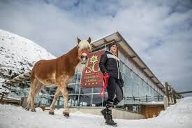
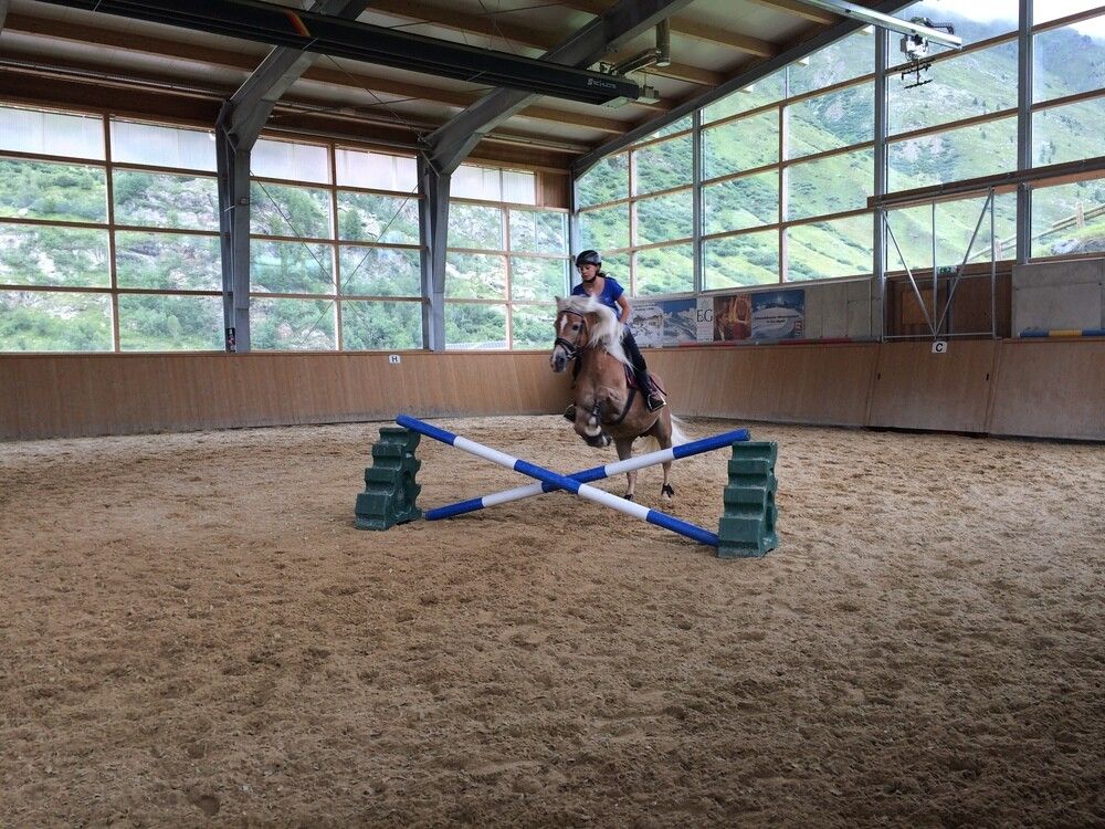
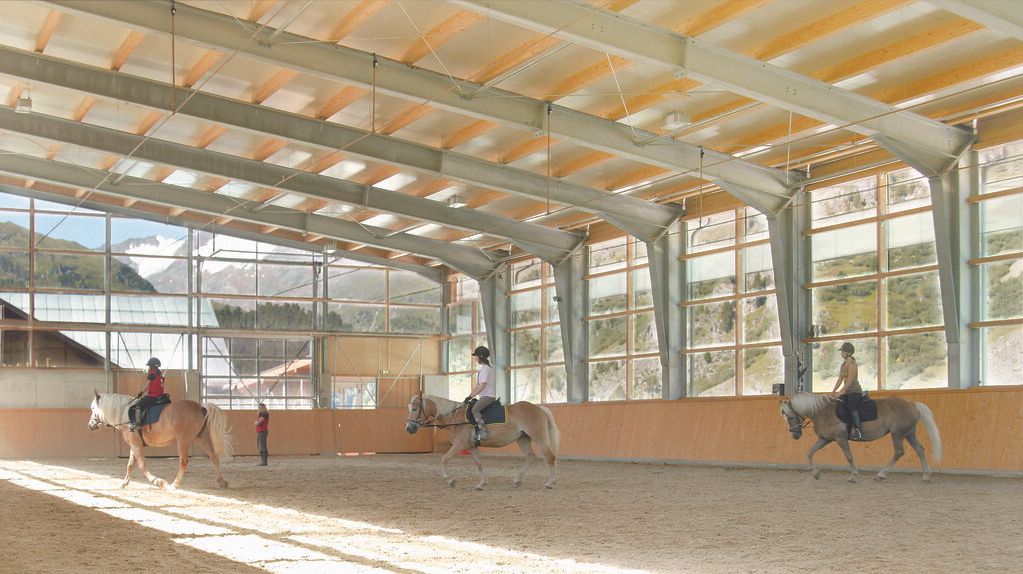
Unter strahlend blauem Himmel mit Blick auf die Ötztaler Bergwelt durch die alpine Natur galoppieren. Mitunter Unterricht an der Longe, Gruppen-&Springunterricht, Ausritte, private Reitstunden. 

Nearby huts and mountain restaurants

Getting here

  • Arrival by public transport

    Reisen Sie mit der Bahn komfortabel und sicher zur Bahnhof-Station Ötztal. Endstation bzw. Ausstiegspunkt ist der Bahnhof ÖTZTAL. Anschließend fahren Sie bequem und schnell mit dem öffentlichen Linienverkehr oder den örtlichen Taxiunternehmen durch das gesamte Tal zu Ihrem Wunschziel! Den aktuellen Busfahrplan gibt’s unter: http://fahrplan.vvt.at

  • Parking

    In Gurgl stehen folgende Parkmöglichkeiten zur Verfügung:

    • Parkgarage Dorfzentrum Obergurgl (vor der Kirche rechts runter), kostenpflichtig | € 2,00 pro Stunde
    • Parkgarage Ortseingang – Talstation Festkoglbahn, kostenpflichtig | € 6,00 pro Tag
    • Parkplatz Hochgurglbahn Talstation, kostenfrei – Nachtparkverbot
    • Parkplatz Top Mountain Crosspoint, kostenfrei
    • Parkplatz Hochgurgl, kostenfrei (sehr kleiner Parkplatz)

More tours in the surrounding area

  • Ötztal Trek Stage 17

    Difficulty: difficult
    Length: 16.4 km Duration: 6:00 h Elevation uphill: 1,080 m
  • Ötztal Trek Stage 16

    Difficulty: difficult
    Length: 6.9 km Duration: 2:30 h Elevation uphill: 358 m
  • Fernar Trail (6041)

    Difficulty: difficult
    Length: 6.0 km Duration: 0:49 h Elevation uphill: 18 m
  • Ötztal Trek Stage 21

    Difficulty: difficult
    Length: 9.4 km Duration: 4:30 h Elevation uphill: 1,270 m
  • Ötztal Trek Stage 4

    Difficulty: difficult
    Length: 8.9 km Duration: 4:00 h Elevation uphill: 802 m
  • Ötztal Trek Stage 8

    Difficulty: difficult
    Length: 9.3 km Duration: 3:30 h Elevation uphill: 274 m
  • Ötztal Trek Stage 1

    Difficulty: medium
    Length: 18.6 km Duration: 6:30 h Elevation uphill: 1,561 m
  • Ötztal Trek Stage 14

    Difficulty: difficult
    Length: 6.3 km Duration: 3:00 h Elevation uphill: 1,004 m
  • Ötztal Trek Stage 12

    Difficulty: difficult
    Length: 4.8 km Duration: 2:00 h Elevation uphill: 592 m
  • Ötztal Trek Stage 11

    Difficulty: difficult
    Length: 12.0 km Duration: 5:00 h Elevation uphill: 705 m
  • Vent - Breslauer Hütte - Vernagthütte

    Difficulty: medium
    Length: 10.4 km Duration: 4:00 h Elevation uphill: 1,203 m
  • Ötztal Cycle Trail (11)

    Opening hours: closed
    Difficulty: medium
    Length: 60.2 km Duration: 6:00 h Elevation uphill: 915 m
  • Mutsbühl

    Difficulty: medium
    Length: 4.5 km Duration: 1:30 h Elevation uphill: 470 m
  • Mountain peak Rosskopf

    Difficulty: medium
    Length: 2.0 km Duration: 2:00 h Elevation uphill: 379 m
  • Loop trail Stuibenfall Umhausen

    Opening hours: open
    Difficulty: easy
    Length: 9.2 km Duration: 4:00 h Elevation uphill: 608 m
Newsletter

The mountain is calling? So does our newsletter!

In our monthly newsletter we reveal the best holiday tips for Tyrol.