
Opening hours:Open today
Place:Umhausen
:Alpine pasture / hut / mountain restaurant
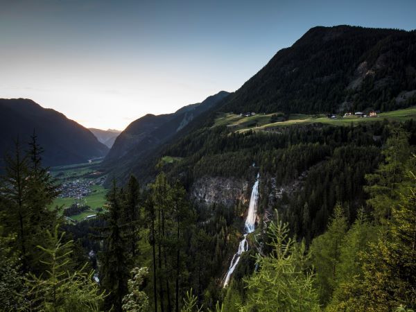
UMHAUSEN -> car park Bischoffsplatz -> Waldcafé Stuböbele -> Gasthof STUIBENFALL

Easy hiking trail; suitable for beginners and walking
Please note the current weather report
Appropriate equipment such as breathable and weather-appropriate outdoor clothing, ankle-high hiking boots, wind, rain, and sun protection, hat, possibly gloves, is required for all hikes and routes. Carrying a first aid kit, a mobile phone, and possibly a hiking map, as well as sufficient provisions for hikes without the option to stop for food, is necessary.
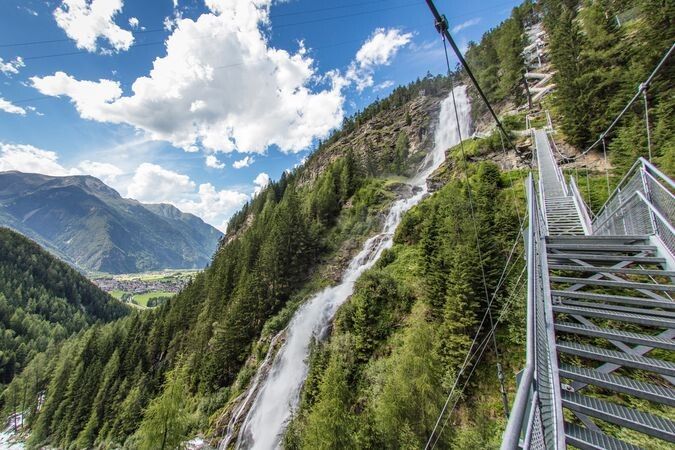
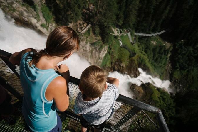
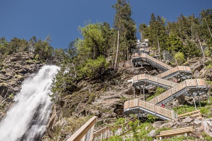
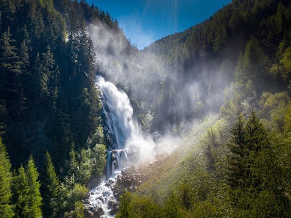
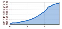
From the Bischoffsplatz parking lot in Umhausen, the wide hiking path leads past the Ötzi Village, raptor park and Stuböbele forest café to the foot of the Stuibenfall. The hike from the parking lot to the foot of the Stuibenfall (gravel area with benches) takes approximately 30-40 minutes and is well suited for families as well as with strollers/buggies. From the gravel area, you then continue over a narrow hiking trail to a path and step construction (approx. 700 steps & an 80 meter long, exposed suspension bridge), passing viewing platforms and roaring masses of water to the highest point of the waterfall, a fixed suspension bridge. There you cross the natural spectacle, experience fantastic views into the depths and reach the last platform, which at dizzy heights rounds off the Stuibenfall experience in its full uniqueness. From there, it is about a 20-minute walk to the Stuibenfall guesthouse.
Have you already tried our new discovery trail?
Debris flows, flood disasters, and water for agriculture. The Horlachbach moves not only water masses but also the history of the valley.
More information can be found here.
Travel comfortably and safely by train to the Ötztal train station. The final stop or exit point is the ÖTZTAL station. Afterwards, you travel conveniently and quickly with public transport or local taxi companies through the entire valley to your desired destination! The current bus schedule can be found at: http://fahrplan.vvt.at
In Umhausen, the following parking options are available:


