
Opening hours:Today closed
Place:Vent
:Restaurant
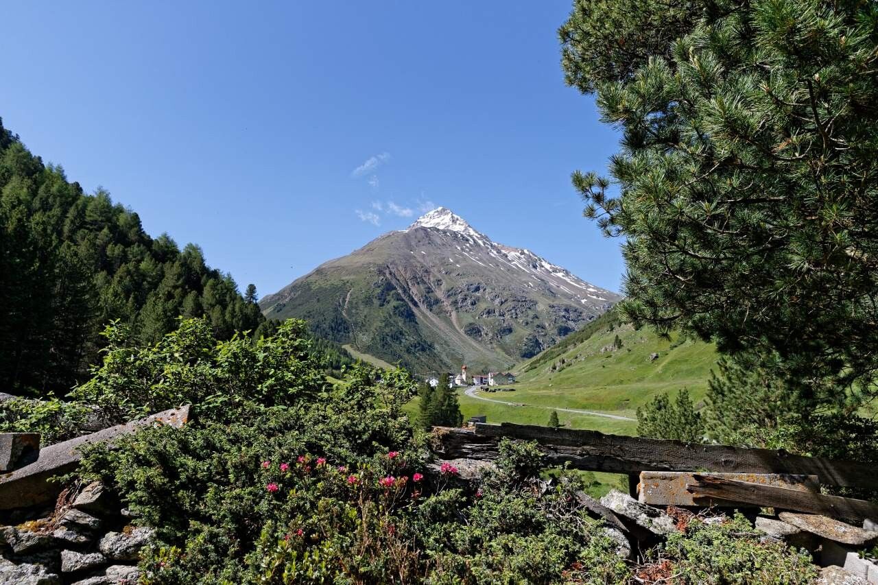
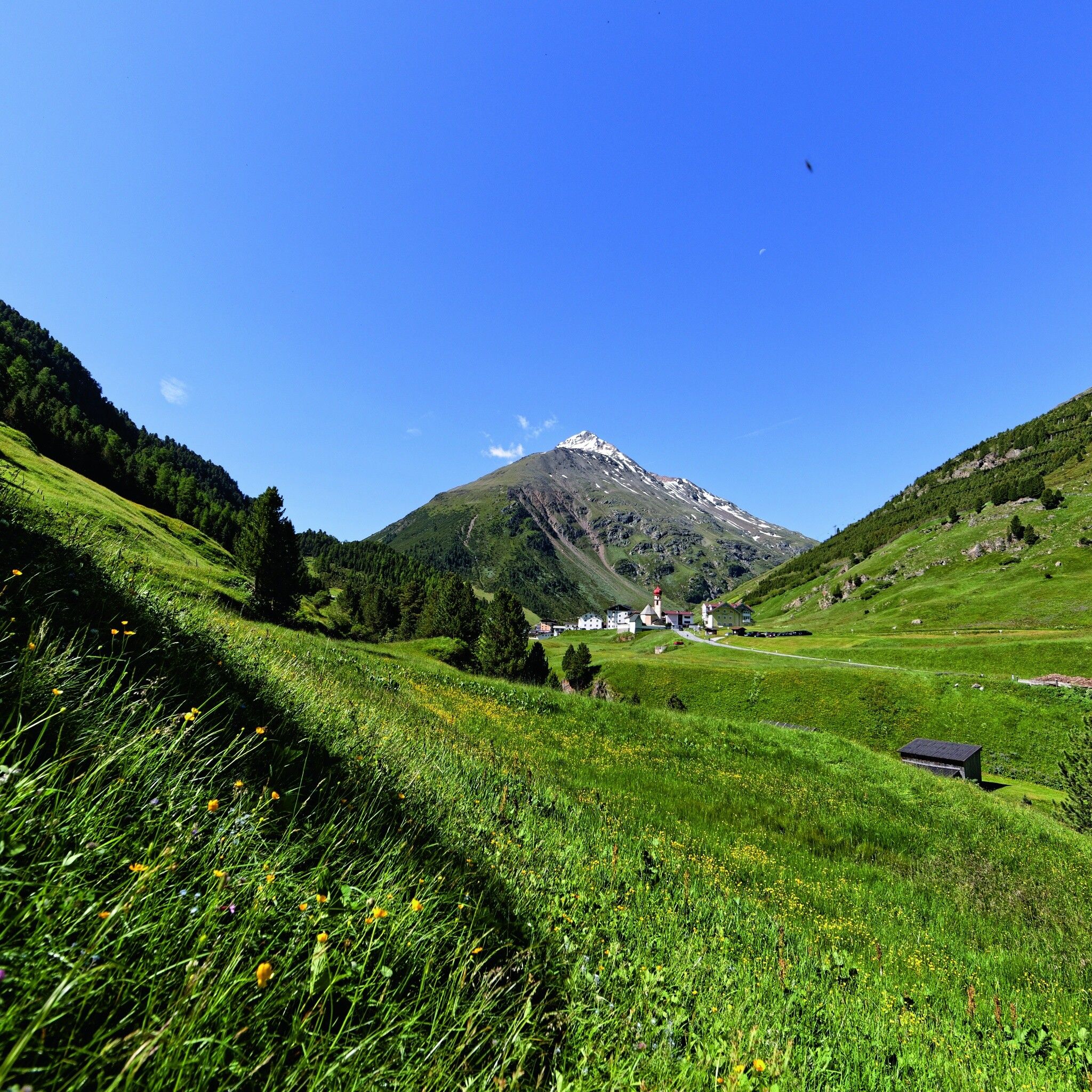
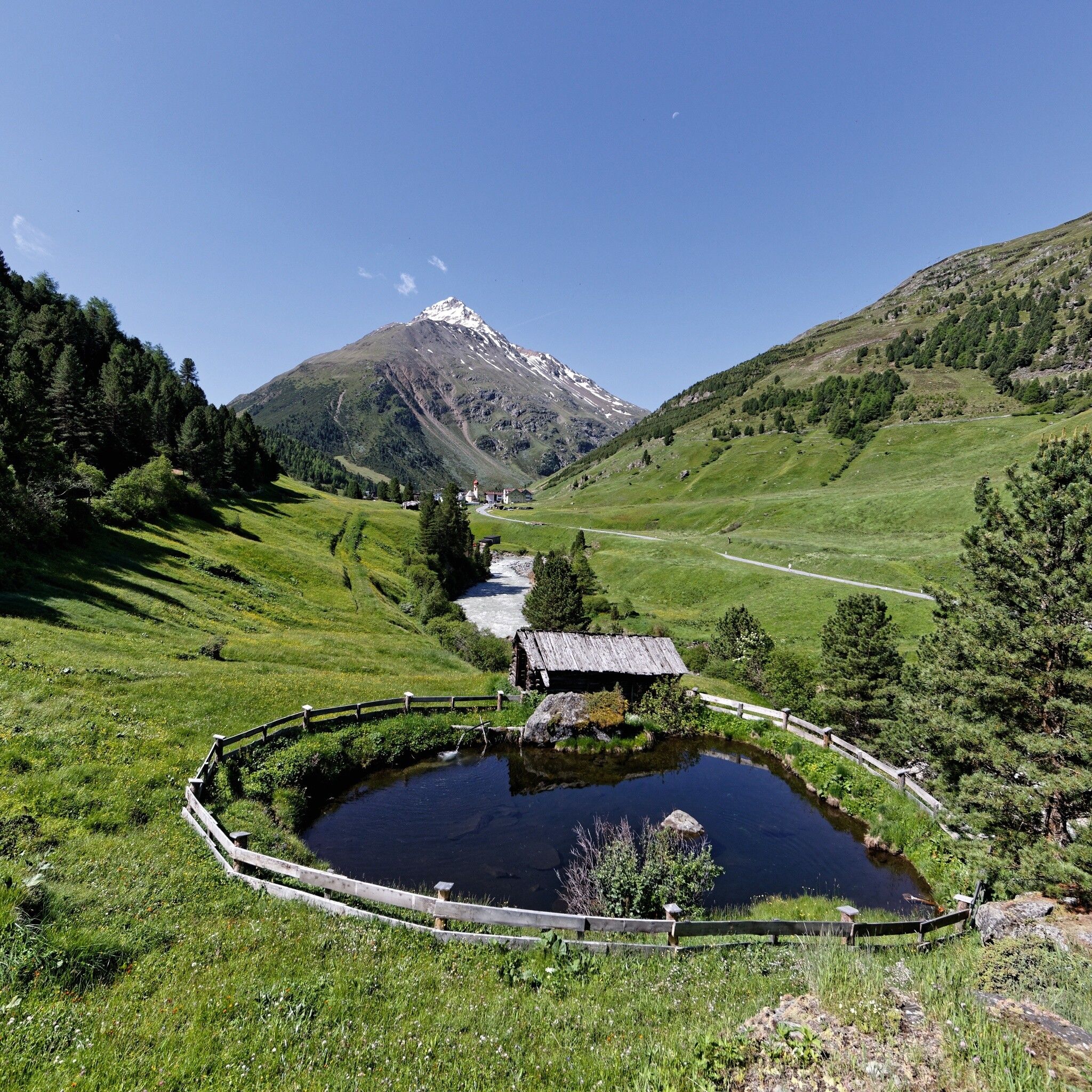
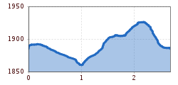
VENT -> AROUND VENT -> VENT
Wearing hiking equipment such as breathable and weather-appropriate outdoor clothing, ankle-high hiking boots, wind, rain and sun protection, hat and possibly gloves is recommended! It is also important to bring sufficient food and a first aid kit, a mobile phone and possibly a hiking map.
On a wide path past the Gampenlift, along the edge of the forest to the bridge over the Venterache. Return either along the road or above the meadows.
Travel comfortably and safely by train to the Ötztal train station. The final stop or exit point is the ÖTZTAL station. Then travel conveniently and quickly by public transport or local taxi companies through the entire valley to your desired destination! The current bus schedule is available at: http://fahrplan.vvt.at
In the mountaineering village of Vent the following parking options are available.
- In summer in front of the village (parking meter, coins or EC card only) and at the valley station of the chairlift (at the cash desk of the mountain railways)
- In winter only at the valley station of the chairlift
Cost: € 6.00 per day/car


")
