
Difficulty:medium
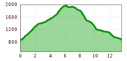
Length:8.2 kmDuration:3:00 hElevation uphill:400 m
Short description:We start in Hinterstein and walk over Zipfelsalpe, Bschießer, and Ponten to Willersalpe and back to the Hinterstein Valley.Quality of experience: *****Recommended season:JuneJulyAugustSeptemberOctoberProperties:LoopScenicRefreshment stops availableCultural/historical valueGeological highlightsBotanical highlightsFaunistic highlightsSummit route
Description:
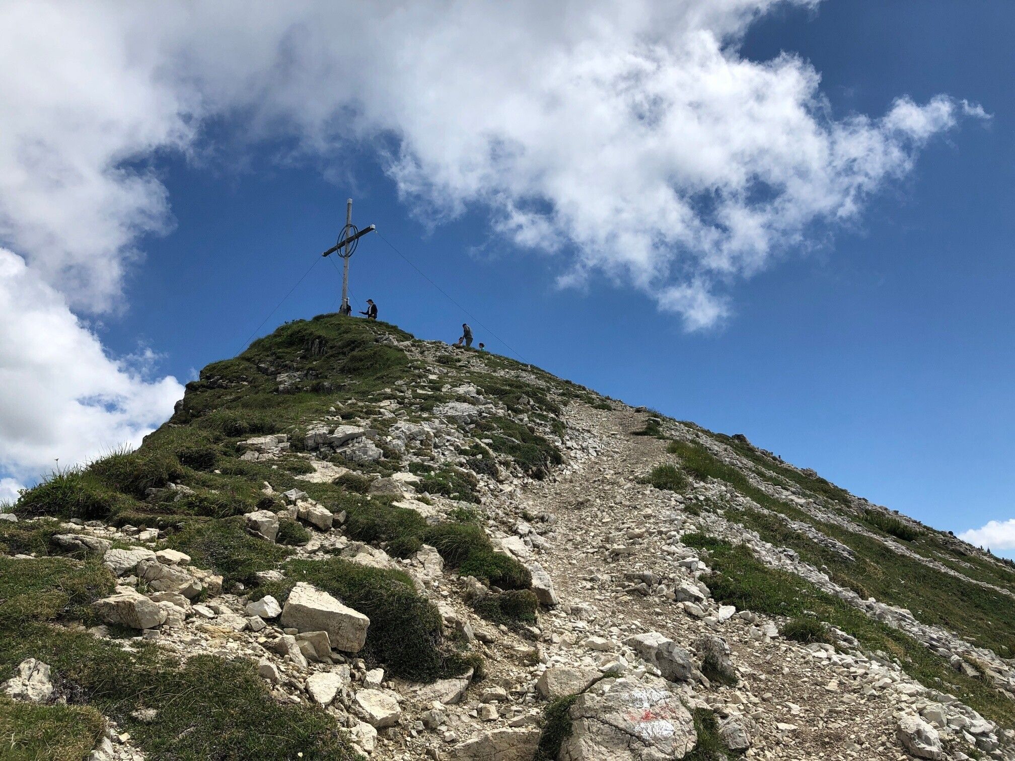
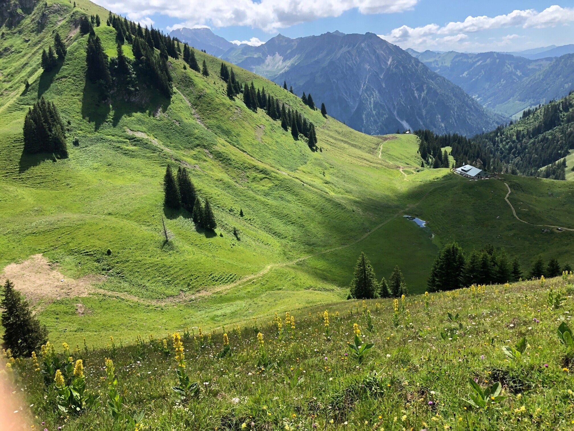
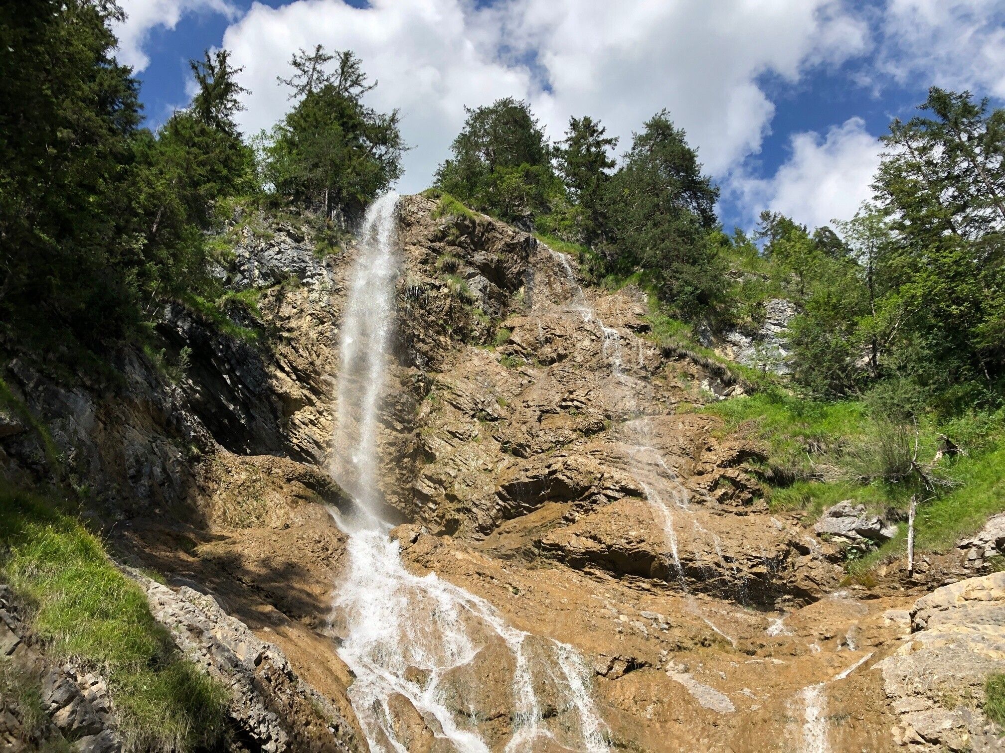
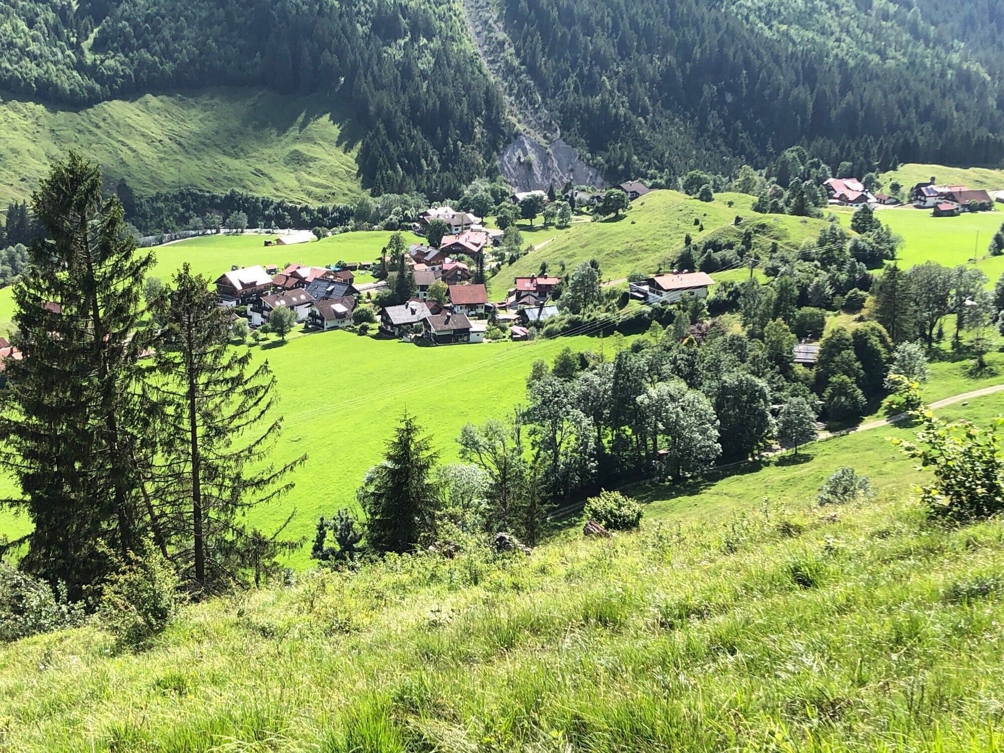
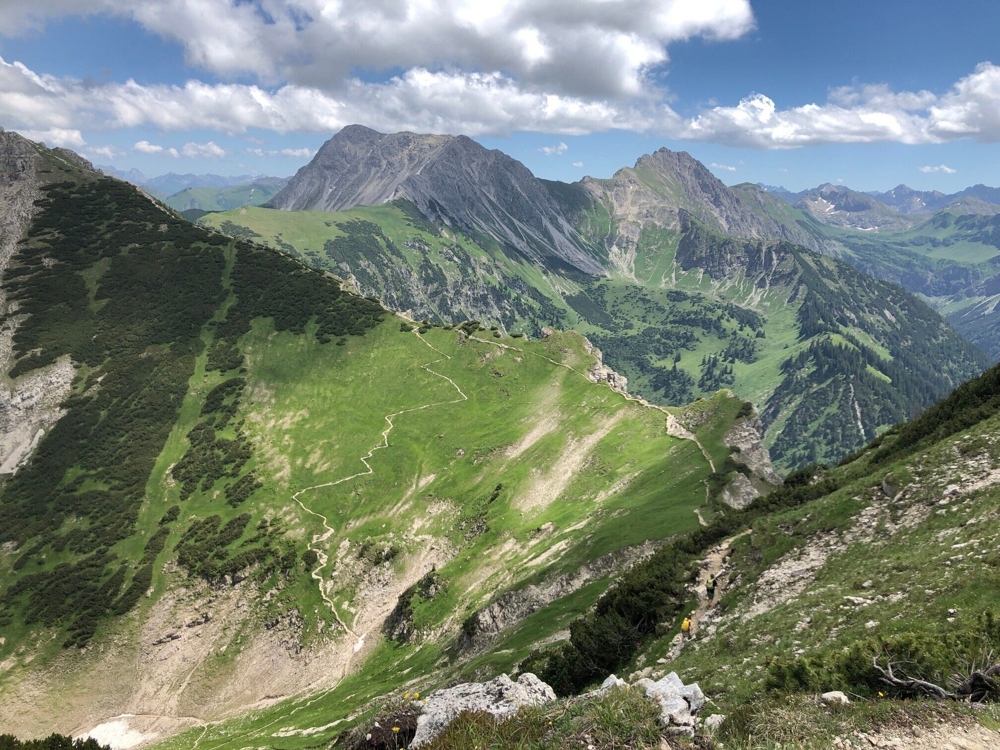
We start at the parking lot "Auf der Höh" in Hinterstein and walk above the village (entry to the path at the "Green Hat"!) to the Naturbad Prinze Gumpe and further up to the Zipfelsfälle. We steadily walk downhill over many switchbacks to Zipfelsalpe, where we still have just under 500 meters of altitude to the summit of Bschießer (1999 m). By the way: In Austria, the Bschießer is called Bscheisser! We walk over the magnificent ridge path to Ponten with its summit cross on the exposed forepeak – and finally below the rocks on the Border Crosser Path up to Zirleseck. From there, we hike down to Willersalpe, where a rest area with catering awaits us after most of the tour. Then we continue downhill via Wildfräuleinsteig back to Hinterstein.Directions:
Hinterstein, parking lot on the Höh - Naturbad Prinze Gumpe - Zipfelsfälle - Zipfelsalpe - Bschießer - Ponten - Zirleseck - Willersalpe - Wildfräuleinstein - Hinterstein, parking lot on the HöhTip:
Summit snack at BschießerSafety guidelines:
Sure-footedness and a head for heights are necessary, especially at the Ponten summit


